Lee is now a Tropical Depression and is poised to cause some severe storm damage-primarily flooding with some isolated tornadoes.
If you are in the path of this storm be aware. It's still moving pretty slowly but the worst stuff is happening in advance of the circulation center.
Update 7pm CDT new tornado warnings out, for counties in Virginia and North Carolina.
More below the squiggle.
The tornado watch areas also need to be aware of "bowing structures", aka straight line winds.
If you're in a watch or warning area, you probably already know it-click here for the Storm Prediction Center's existing watches.
Earlier
Lee has lost his focus a bit:
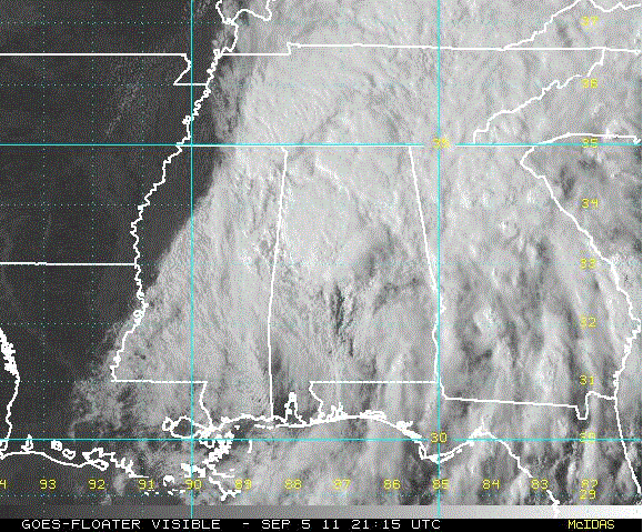
from the most recent NHS Advisory: LEE IS NOW
EXTRATROPICAL AFTER MERGING WITH A FRONTAL ZONE WITH COOL AND DRY
AIR INFILTRATING THE CIRCULATION CENTER FROM THE NORTH AND WEST.
THE EXTRATROPICAL LOW CENTER IS EXPECTED TO TURN TOWARDS THE
NORTHEAST...BRINGING THE CENTER INTO CENTRAL ALABAMA BY MONDAY
NIGHT AND REACHING THE CAROLINAS BY MID DAY TUESDAY. TROPICAL
MOISTURE ASSOCIATED WITH THE REMNANTS OF LEE WILL CONTINUE TO
INTERACT WITH THE FRONTAL ZONE...AND EXTREMELY HEAVY RAIN IS
EXPECTED TO FALL IN LOCATIONS WELL IN ADVANCE OF THE CIRCULATION
CENTER.
MAXIMUM SUSTAINED WINDS ARE NEAR 35 MPH...55 KM/H...WITH HIGHER
GUSTS.
Here is the current wunderground map (yes, I've clipped Texas out. Wouldn't it be nice to send all of this a few hundred miles southwest??):
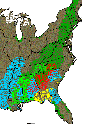
Color guide:
Dark green flash flood watch
Light green flash flood warning
Light blue high wind advisory
Red outline is a tornado watch area
Yellow outline is a severe thunderstorm watch area
Any solid color blocks are tornado (red) or severe thunderstorm (yellow) warnings
TOR:CON levels are not very nice, frankly. Yesterday the Georgia levels were 5 and that was the highest level listed:
Forecast for Monday, September 5
AL central - 7
AL northeast - 5
AL south - 6 to 7
FL panhandle - 6
GA north half - 7
GA south half - 6
MS extreme southeast - 4
NC west - 5
SC northwest - 5
Other areas - less than 2
Forecast for Tuesday, September 6
FL northeast - 4
GA east-central - 5
GA southeast - 4
NC west, central - 6
NC east - 4
SC west, central - 6
SC east - 4
VA south - 4
Other areas - less than 2
If you are in the path of these watch or warning areas please stay aware-some of these tornadoes are spinning up with very little notice. No they aren't monsters, but F0s and F1s are enough to hurt you.
Stay safe out there!
