Cartography is the science and art of map making. Maps provide us with a record of our knowledge of the world around us. This includes physical features, such as mountains, lakes, and rivers, as well as social and cultural features such as national boundaries, towns, and cities. The collection of old maps at the Columbia River Maritime Museum provides us with some insights into the history of the exploration of the Columbia River and the Pacific Coast.
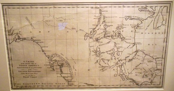
The Chart of the Interior Part of North America shown was published in 1790. It is from a book by John Meares, Voyages Made in the Years 1788 and 1789 from China to the North West Coast of America. Meares was a former lieutenant in the British navy and a controversial figure whose claims of discovery sometimes lacked credibility.
In the late eighteenth century, explorers were still seeking the mythical Northwest Passage which would make trade between Europe and Asia easier. Many geographers at this time insisted that such a passage had to exist. By placing river drainages too far west, Meares lent credence to the idea of a Northwest Passage through the river and lake system.
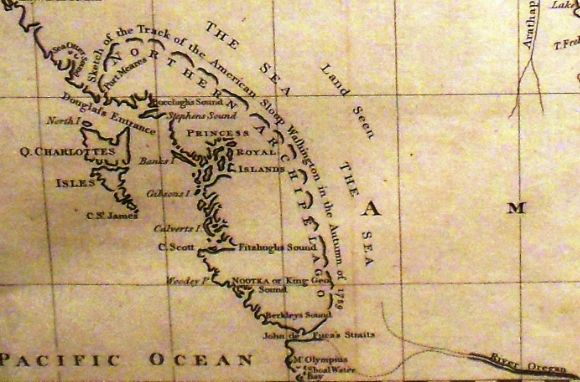
Meares’ map also shows an inland sea indicated by the track of the American sloop Lady Washington. However, the captain of the ship denied ever making such a voyage. Meares, however, did make a detailed survey of the coast and was the first to chart the Strait of Juan de Fuca and to show the Queen Charlotte Islands as two main land-masses instead of one.
Meares also shows the River Oregon (the Columbia?) flowing into Puget Sound.
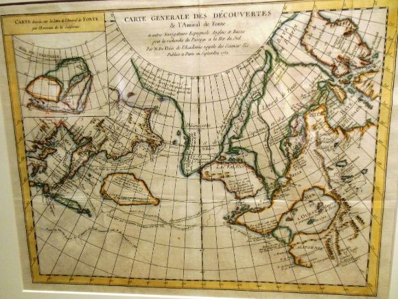
Cartographers often incorporate information into their maps which is false. In 1708, a British magazine published an account of a voyage into the North Pacific led by Bartholemew de Fonte. The story was some rather imaginative fiction, but nevertheless de Fonte’s “discoveries” were incorporated into the depiction of the Pacific Coast shown above. The map shown above by Joseph-Nicolas d’Isle was published in 1752.
During much of the seventeenth century, European cartographers depicted California as an island (see above). In 1681, Father Eusebio Kino, a Jesuit missionary who had been trained in mathematics and cartography, began his work in the American Southwest (Arizona) and Sonora, Mexico. He made at least 50 expeditions through the area and in 1695 he published a map showing California as an island. Between 1698 and 1701, he made nine trips from Arizona in an attempt to find a land route to the missions in Baja California. In 1698 he climbed the mountain he named Santa Clara and peered north into the Colorado River estuary.
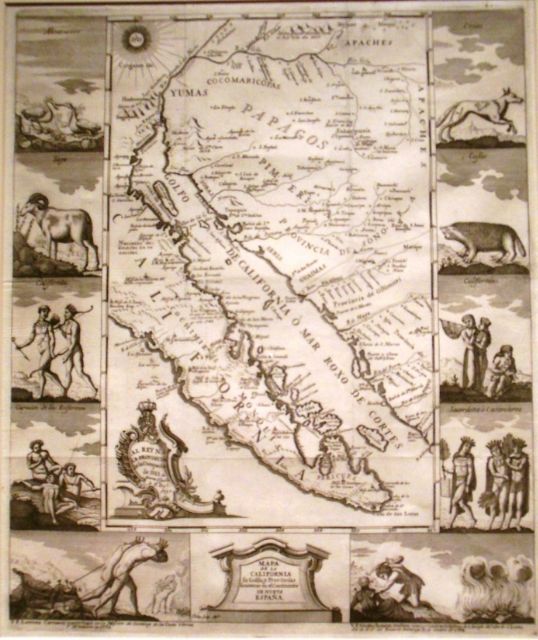
In 1701, he reported that the Sea of Cortez (Gulf of California) was closed and thus California was a peninsula, not an island. This was revolutionary news to the Europeans and the map shown above was published in 1705.
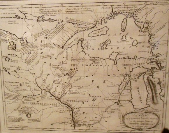
In 1766, Jonathon Carver was hired to find an overland route to the Pacific. He never reached the Pacific, but he managed to cover 7,000 miles, mapping North America and providing information on Indian life. This map, published in 1788, is from his book Travels through the Interior Parts of North America in the Years 1766, 1767, and 1768. In it he indicates “Heads of Origan” which is considered the first use of the word “Oregon” in print and demonstrates it association with the River of the West (later known as the Columbia River). This is seen as a potential route to the Pacific Ocean.
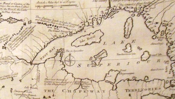
As can be seen in some of the detail shown above, his maps provide information about some of the Indian nations, such as that of the Chippewa (also known as Ojibwa).
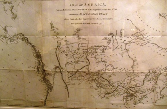
Working for the North West Company, Alexander Mackenzie became the first European to cross North America. The map shown above, from his 1801 book Travels from Montreal, shows his track from Montreal to Fort Chipewyan to the Pacific Coast in 1792. Mackenzie’s first attempt in 1789 took him north to the Arctic Ocean. In 1793, he set out in a 26-foot birchbark canoe with a small band of Chippewa Indians and a large dog. About 20 miles outside of the present day Bella Coola, British Columbia he inscribed on a rock: “Alex Mackenzie from Canada by land 22nd July 1793.” While the route he discovered was not commercially viable, his report inspired Thomas Jefferson to send an expedition overland to the Pacific and John Jacob Astor to establish trading posts along the Columbia River.
