A river of lava at night, and steam by day. That's what we see on the live cameras, when the view isn't blocked by a storm. It's tantalizingly close to being able to tell what's going on without actually being able to.
Wouldn't it be great to have a better idea? Where is the lava and what is it doing? How is the river responded? Has Surtur, Guardian of the firey realm of Múspell, given up his efforts to break free to wage war against the Æsir?
Join us below the fold!
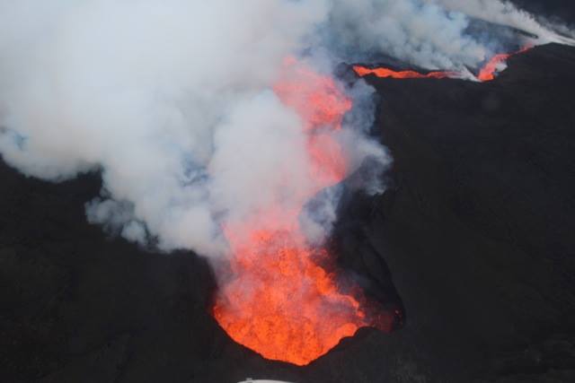
Let's start at the source: Baugur.
(Credit: S. Riishús)
Why not just say "start at the volcanic vents" (plural) or "start at the lava fountains"? Simple: because there is only one vent, and there are reportedly no more large fountains - just some roiling.
(Credit: S. Riishús)
The entire eruption has consolidated into a large lava lake from which the lava quickly pours.
(Credit: S. Riishús)
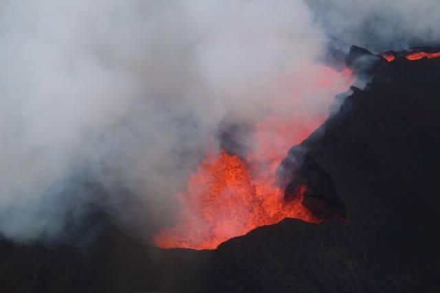
This is a normal part of the evolution of such an eruption, and total activity reportedly remains high. The river of lava then flows downhill, where "downhill" is in large part defined by what "hills" it's created previously:
(Credit: S. Riishús)
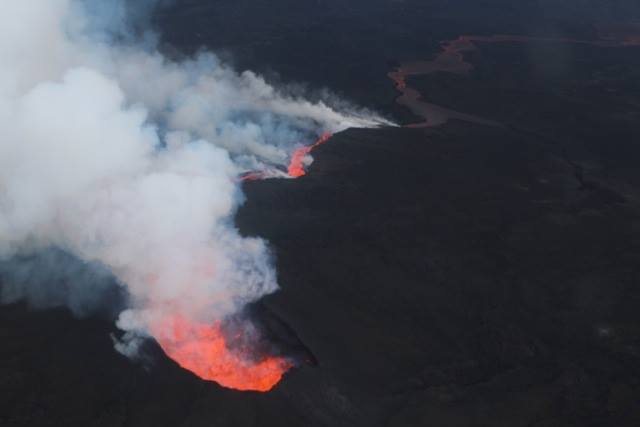
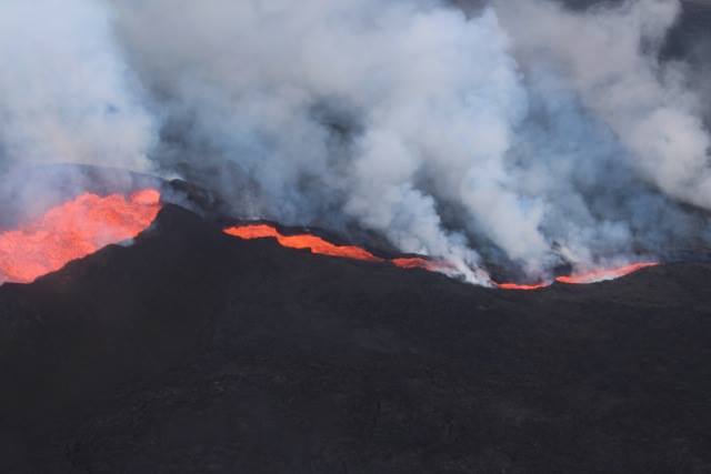
At this point in time, the easiest route was for it to first flow off of the lava flow to the south side:
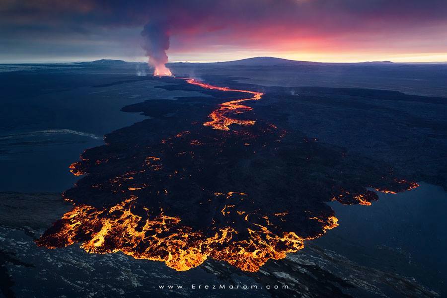
(Credit: Erez Marom)
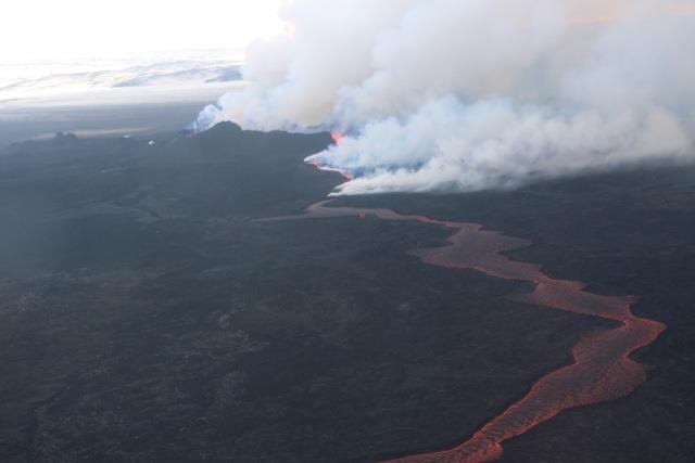
That picture is from two days ago. But now we're getting pictures in from yesterday's interactions with the river. So let's take a closer look at that.
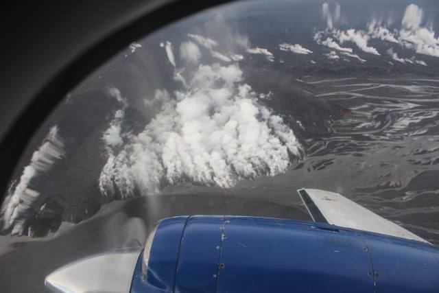
(Credit: S. Riishús)

(Credit: S. Riishús)
Whoa that's narrow! More on that in just a second. First, we need context. Just what are we looking at here? Well, Jarðvísindastofnun gave us a map from yesterday:
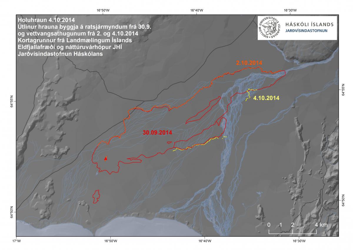
(Credit: Jarðvísindastofnun)
Unfortuantely, most of that is still "Here Be Dragons" territory. But I can do better, based on these pictures, also from yesterday.
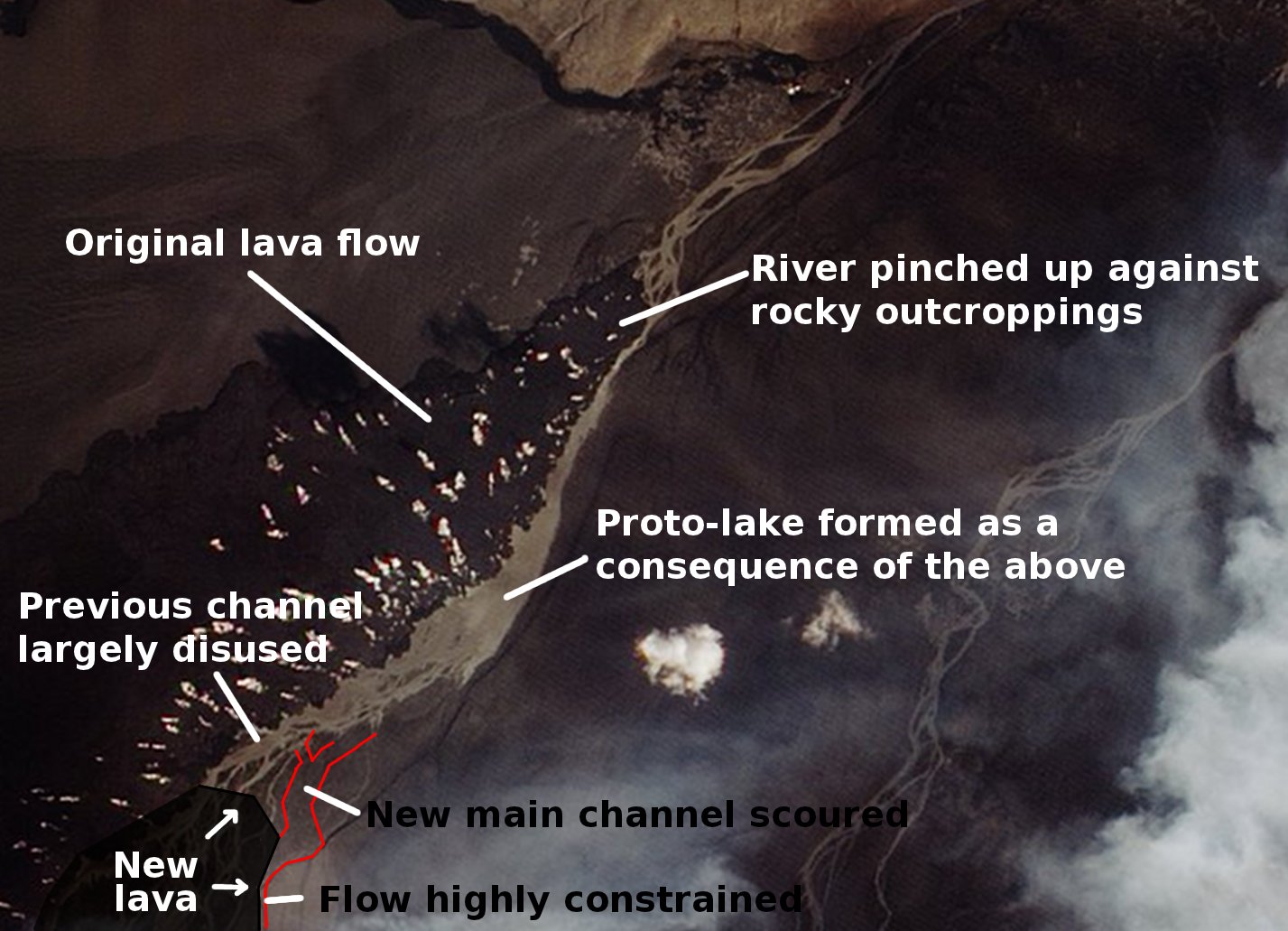
(Credit: Me being an obsessive nerd)
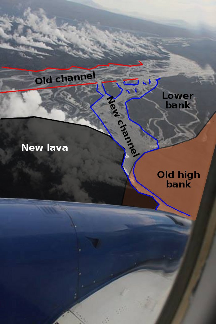
(Credit: An overheating laptop and more patience than I thought I had)
That's some significant changes to the river, beyond the fact that flow rates are down due to winter! But let's take a closer look at it, in particular how narrow it was. Come on, everybody, all at once:
"How Narrow Was It?!"
It was this narrow!
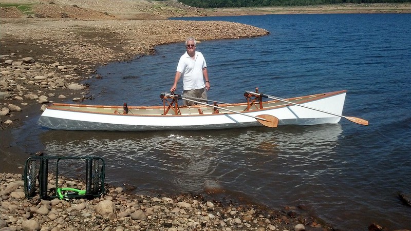
(Credit: Nick)
A channel five meters - the length of a rowboat, or a good pole vault - was all that separated the lava from the south bank. Keep in mind that this is a river that even during this low-flow rate period still has a higher flow rate than the Thames.
What does that say about how deep the river was and how fast the water was moving? NERDING OUT TIME!
(By the way, Icelandic actually has a verb for "to nerd out" - "nördast". Love that!)
--------
The standard way to tie together the various parameters related to a river is known as Manning formula. Given a riverbank perimeter P, a cross section A, a slope of S, and a constant n based on what the water is flowing over, the velocity V is approximately:
V = (A/P)^(2/3) * S^(1/2) / n
For our purposes, we'll assume that the lava goes straight down of height H and the riverbed angles up from the bottom to the surface on the other side at a constant slope. Thus we fill out our parameters:
A = (5 * H) / 2 = 2,5 * H
P = H + sqrt(H^2 + 25)
S = 1 / 150 (Flæður at this point drops about one meter for every 150 meters of run)
n = 0,03 (typical for a sandy riverbank)
We also can relate the area A to the velocity V via the flow rate of around 80 cubic meters per second. Since:
80 = A * V
Then
80 = 2,5 * H * V
V = 32 / H
We thus get:
32 / H = ((2,5 * H) / (H + sqrt(H^2 + 25)))^(2/3) * 2,72166
6.383 = (H ^ (5/3)) / (H + sqrt(H^2 + 25))^(2/3)
H = 10,493 m
V = 3,05 m/s
--------
So what does that say? Well, it says that for everything to balance, the water in this narrow channel would have to be an incredible 10 meters deep (height of an adult giraffe standing on the head of another adult giraffe), but due to side friction, it'd only move at 11 kmph / 6,8 mph.
How realistic is this scenario? Well, of course, the riverbed would be more complex than this shape. But more importantly, it's unlikely that such a narrow channel so deep would form with the lava as such a steep vertical wall. Rather, what you would get is water backing up behind where the lava hit the river, thus reducing the flow rate.
But of course, as water builds up height, you build up hydraulic head (pressure). Which means scouring power. And at this point, the river is just flowing atop loose sand and dust so one would expect with time that would scour out a wider channel - and that it has.
In fact, as you can see in the above maps, it not only scoured out a wider channel in the constrained point, but also downstream as the water raced away. That sediment will in turn be deposited where the river calms down, such as in the braided channels or the "lake" downstream, raising their height.
What did the lava flow do today and how much further is it going to advance? That I cannot answer. Stay tuned. :)
In the seismic front, there were a large number of quakes.... in Öxarfirði, far to the north:
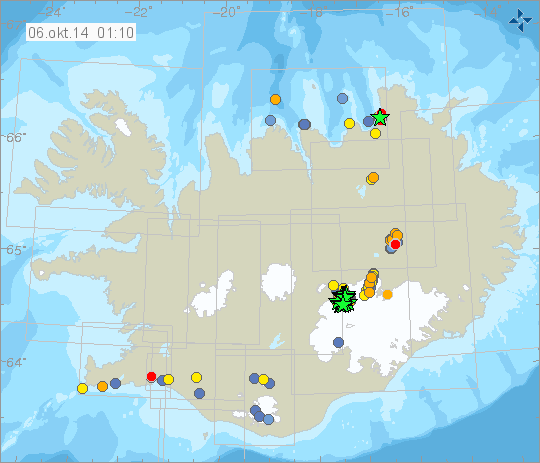
It is not believed to be connected with Bárðarbunga. She's got her own quakes going on:
Remember back when we were told that a quake of a magnitude around 5.0 would likely set off a caldera eruption? Oh, those were the days...
Hey, guess what? More gas forecasts for the capital region tomorrow, yeeaaaayyyy... :Þ
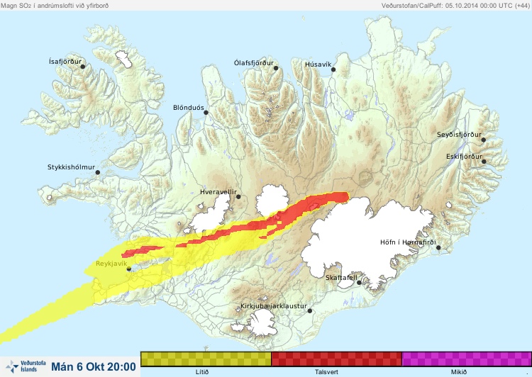
This is one of those times that I'm glad the forecasts are so inaccurate. :Þ Right now the plume is blowing to the north.
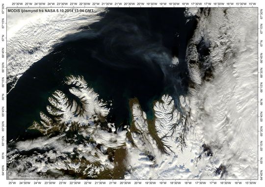
(Credit: NASA)
But hey... remember back in the day that the arctic wasn't full of SO2?
Yeah, those were the days :Þ
Hi, Alaska.
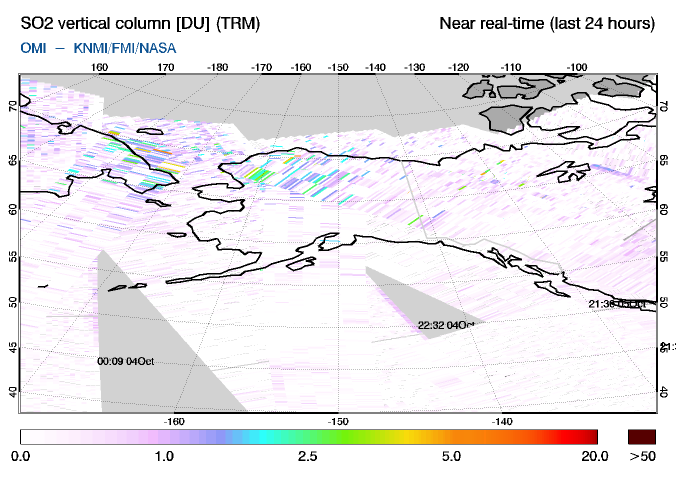
Don't freak out - we don't know whether there's anything on the ground, it could be all in the upper atmosphere. And even if it is on the ground, I doubt it's at a level that would do more than cause a statistical blip on mortality rates. I do however have concerns about the long term effect on plants. I've sent the EPA an inquiry as to whether there's any publically-accessible SO2 meters in the area; we'll see if they get back to me.
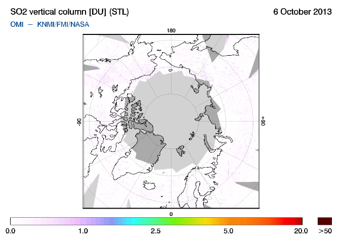
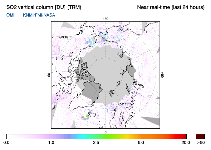
(By the way, in anyone is curious as to why GOME-2 and OMI SO2 maps don't always look the same? I asked about this a while back, and the response was that they use different measuring techniques, and so they have different sensitivities to SO2 under different conditions, such as altitude.)
Okay, that's all - just a few more pics :)
(Credit: S. Riishús)
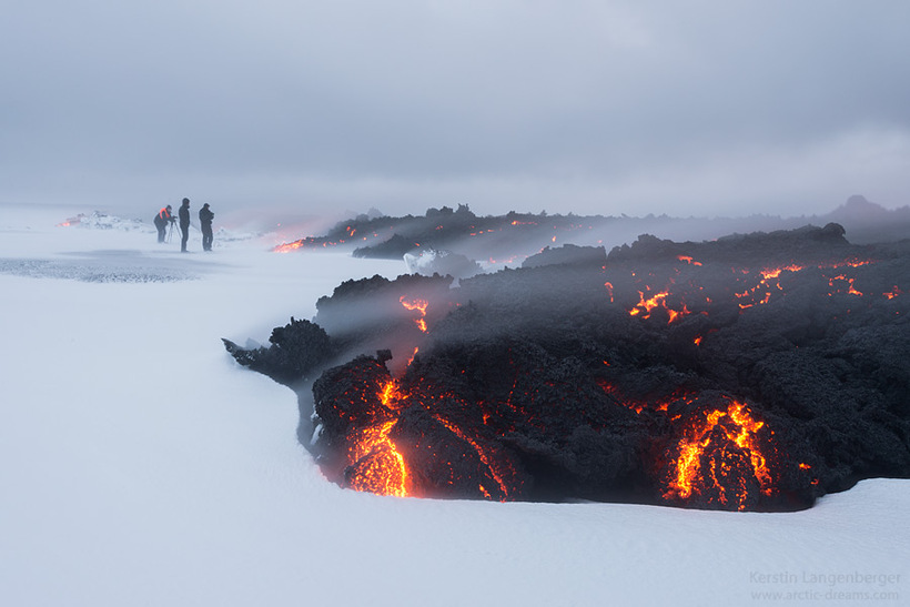
(Credit: Kersen Langenberger)
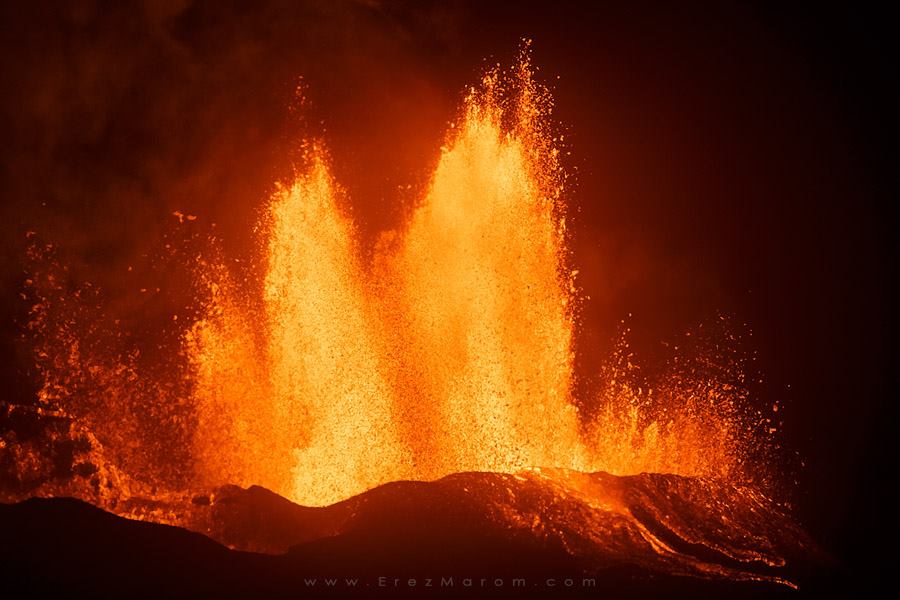
(Credit: Erez Marom - pic from a few days back)
Update, 23:00: No update tonight.
Update, 22:15: The info I was planning to use in tonight's article isn't here yet... so sorry everyone, one more delay :(
