You all felt it on the East Coast, shaking windows and hanging lights; moving top floors a few inches in each direction....
The USGS provides some rather interesting data. Originally listed as being <.1 kilometer, that correlates to 316.8 ft. The data has sensed been revised to stand at this writing, at 6 km, or 3 miles and 1281.6 yds,,, Only once before did this area experience a quake.
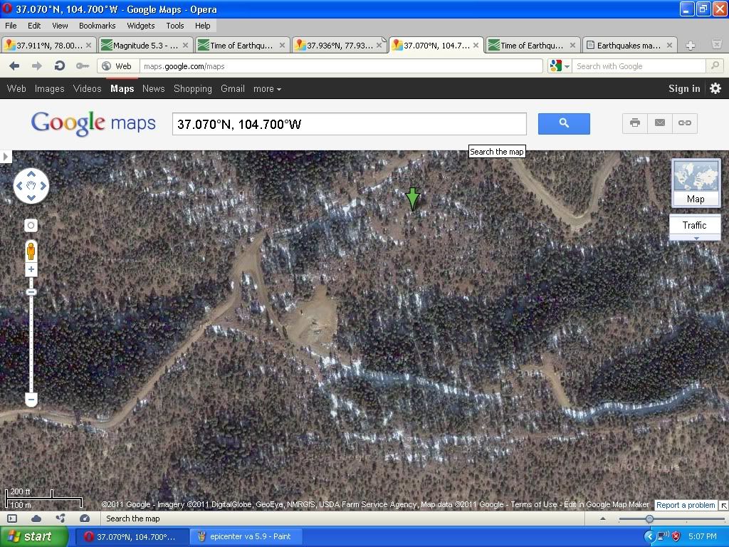
A quick satellite look at the epicenter shows an area crisscrossed with drilling roads and well sites.
What is at stake is the natural gas buried under the Marcellus Shale. This shale is impermeable and trapped the methane gas decomposing underneath. Most old wells went down to the shale level and stopped. Since 2009, new technology uses wastewater and high pressure to fracture that shale layer. Once fractured, the gas can escape upwards.....
Now, imagine filling up an old bathtub with sand... then going to sleep on it.... It would be quite comfortable... Now suppose your significant other brings in a garden hose, turns it on and leaves it. At first the water goes into the sand. Eventually the water gets too much, that the sand/water mix can no longer hold up your weight, and you go splat, to the bottom of the tub.
That is what happens to whole layers of rock when this process is applied. All the layers of rock on top, suddenly drop several feet. Whoomp...
This whoomp covered the whole east coast....
Two years ago, a team fracking (fracturing the shale layer) in central WV, caused a tremor felt outside of Pittsburgh, PA... In the past year, West Virginia, a state that has never had seismic activity, is suddenly being shaken with 2.2 to 3.4tremors...
This video gives you some insight into the problems that come with fracking. And this industry video shows the protections that are in place when frakking is involved. Take note of how the drill sites are set up.
Officials in WV, usually company operators themselves have dismissed any connection between the new technology being developed across their state, and all the new earthquakes that have come out of nowhereduring the same time.
The same occurrence took place in Arkansas. Fracking and novel earthquakes. And not just on this continent, but a 3 mile deep well drilled near Basil, Switzerland caused a 3.4 earthquake in that geologically tame region, so the well was shut down. (Unlike WV, neither Switzerland or Arkansas receive 75% of their income from energy) Out of Memphis, Steve Horton, an earthquake specialist at the University of Memphis and hydrologic technician with the U.S. Geological Survey notes: "Ninety percent of these earthquakes that have happened since 2009 have been within 6 kilometers of these salt water disposal wells,"
Likewise, ever since the West Virginia Oil and Gas Commission forced the disposal companies to cut back on their injection rate and pressure, the professor said, the earthquakes there seem to have dissipated. (Recently WV put emergency rules in place that require operators to file water management plans when using saltwater for fracking. The emergency rules require operators to file water management plans when using more than 210,000 gallons, citing the source and anticipated volume of withdrawals, as well as measures to protect aquatic life. The companies also must list their "anticipated additives" and say how they plan to dispose of wastewater.
Arkansas went one step further. They place a moratorium on fracking to see if there was a correlation between the two. The data was implicating, but not totally conclusive. In ten days preceeding the moratorium, Arkansas experienced 100 quakes with it's largest quake in 35 years at 4.7. In the following six months, 60 quakes occurred and only one was over a 3. Most were between 1.2 and 2.8. After shocks.
Just two Virginia counties away, permits to frack have already been sought in Rockingham County by a Carrizo Marcellus, LLC, a Texas company.
And as any driller in Central Virginia knows, there is a wide belt of phyllite bedrock that extends across central Virginia through eastern Albemarle and western Louisa counties. This is a very soft rock that does not have the ability to hold open fractures under the confining pressures that exist beneath the surface. As a result, groundwater is scarce, and successful wells are difficult to construct.
Compare this map with this satellite photo and see how the area of phyllite bedrock matches the area that is too poor a quality to farm and remains forested for that reason....
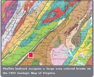
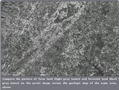 Courtesy of caggiotech.com
Below is a Google Map shot where the green arrow pinpoints the coordinates of the August 23rd epicenter, 5 miles south of Mineral, VA.
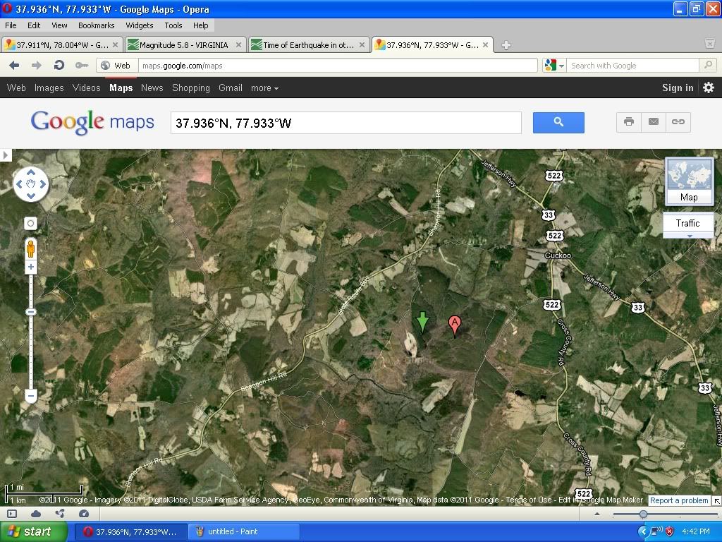
Next is a shot of the homestead on whose property the quake was centered (remember originally it was only 300 feet below the surface.)
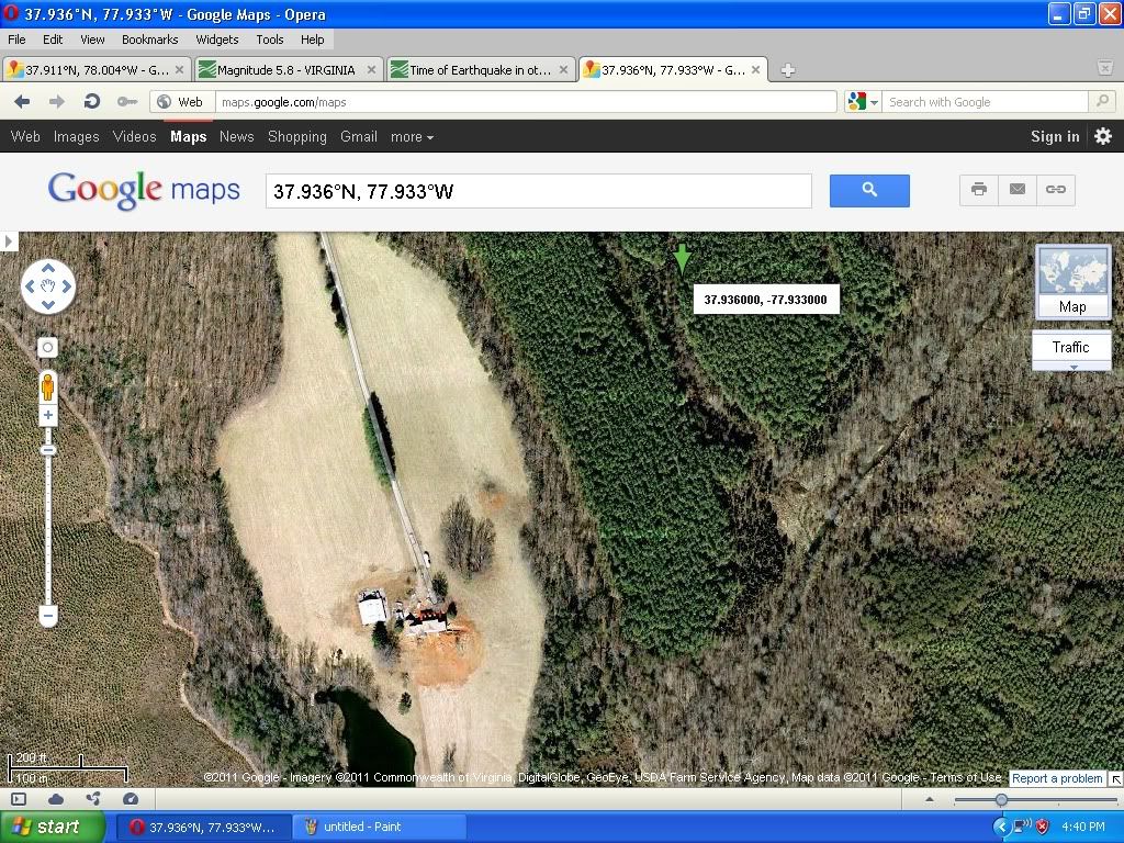
Seeing some interesting uncharacteristic activity, here is the closeup of that picture above. Use the zoom function or your own computer to let you zoom in closer.
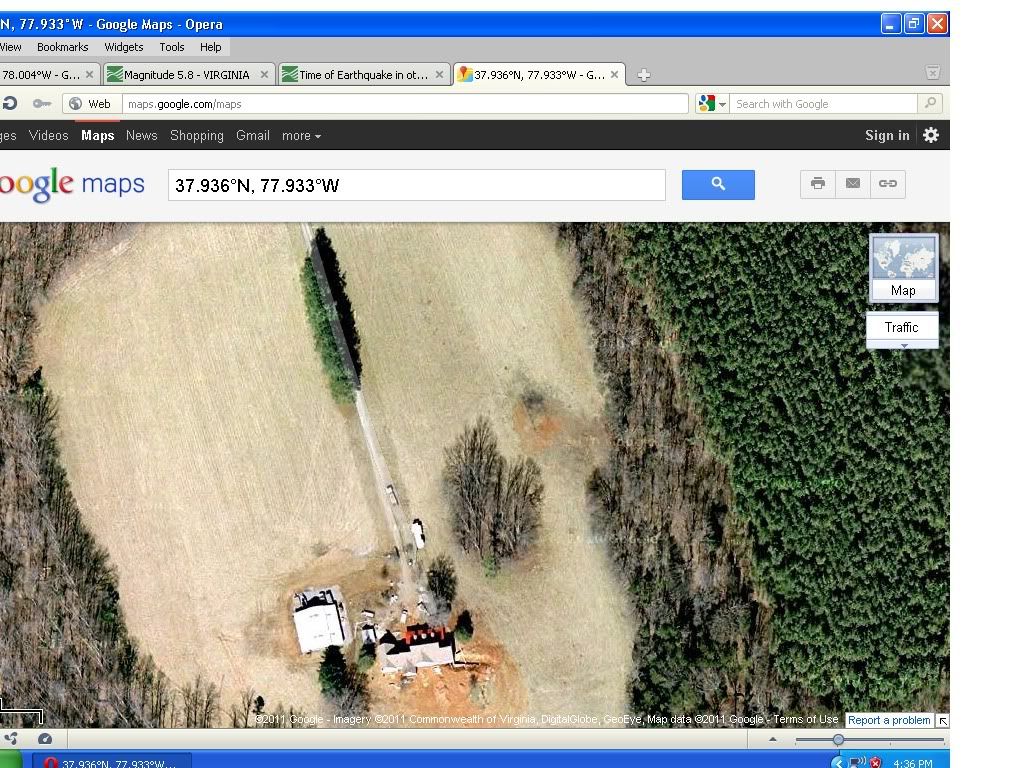
These structures are different from any other buildings in the area. There also are a lot of heavy equipment on the property.
And notice the surrounding soil is a different color.
Looking northeast of the green arrow on the top of the three images, one sees, across the expanse of forest, what looks like a new road, bright white the ends in a circle.
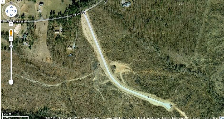
On that circle are several pieces of equipment. Remember the video that depicts the white covering of a well site, as well as berm appearing on the north side? It looks eerily similar.
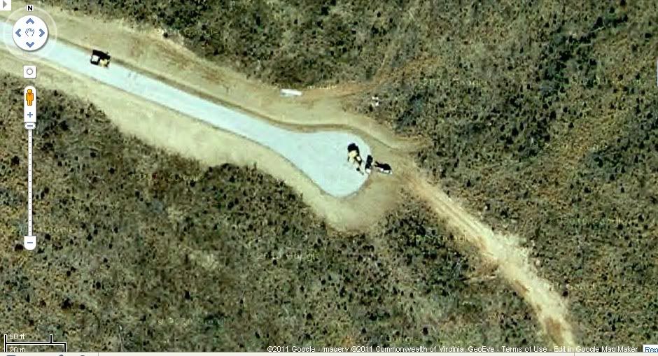
At the end of the circle, one can see tracks continuing over the area, quite possibly to wildcat drill sites. And what is peculiar, is that the road shows up brilliantly on the satellite, but on the map version of Google Maps, it does not... (Maps are updated faster than the satellite photos.) Whereas the driveway into the previous owners property is mapped out,this one is not.
It's all rather interesting, and needs further proof. To arrive whether it is definitely a possibility of having a man-made quake scare the crap out of the entire east coast, but as they say in a courtroom, there is the preponderance of evidence that it is so.....
Review:
Quakes happened across the world in stable areas far from faults, once fracking is done.
As soon as fracking is done with less pressure, or discontinued, the quakes stop. Despite the practice occurring in several different geographical and geological areas.
Satellite photos show drilling activity near the epicenter of the August 23rd quake.
Surprisingly, no permit was filed with the Department of Virgina Mining Bureau, or Louisa County for this activity.
Every driller knows that Louisa County, is permeated with a very soft shale that shatters extremely easily.
And unbeknown to most of you, another quake occurred almost simultaneously, in southern Colorado near the New Mexican Border, at very similar latitude in an area also crisscrossed by mining roads and drilling activity.... A 5.8 at 1:46 EDT... Ours was a 5.8 at 1:51....
