The rise in exiting Ukrainians is exponential but even with the projected four million refugees there will be a much more extended conflict as most of the pre-positioned Russian forces are now within the borders of Ukraine. The major cities are still resisting and aid comes in from other countries. OSINT has helped keep perspective on a situation that remains fluid. The US rejected Ukraine's appeal for a no-fly zone, saying the move could lead the US into war with Russia. Despite that news, Ukrainian aircraft losses are being matched by Poland transferring MiGs, and other countries providing munitions.
Here’s an example of how open source information OSINT works.
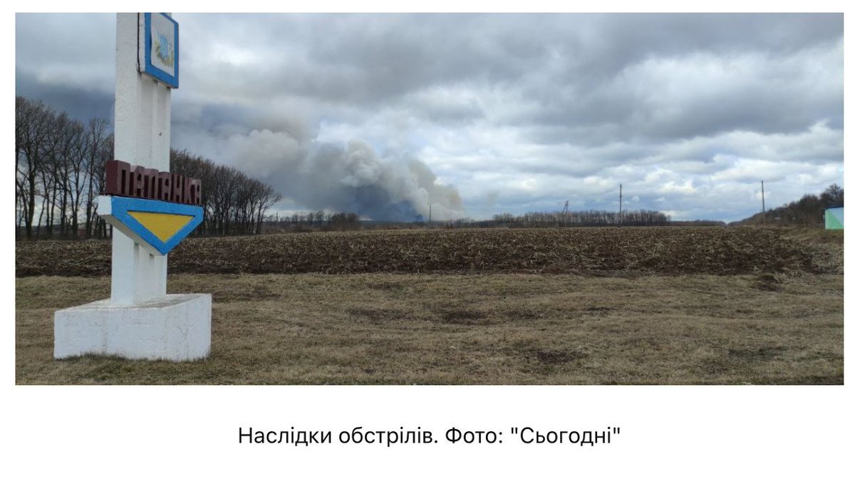
First, the where: determining the exact filming location, otherwise known as geolocation. The initial uploads of the video on Telegram and Twitter suggested this happened in the Cherkasy Oblast, so that's a good first place to start looking.
That's exactly what
@john_marquee did. Given that the explosion appears so large, he toggled on the “ammunition storage” filter, resulting in only six tagged locations in the Cherkasy Oblast.
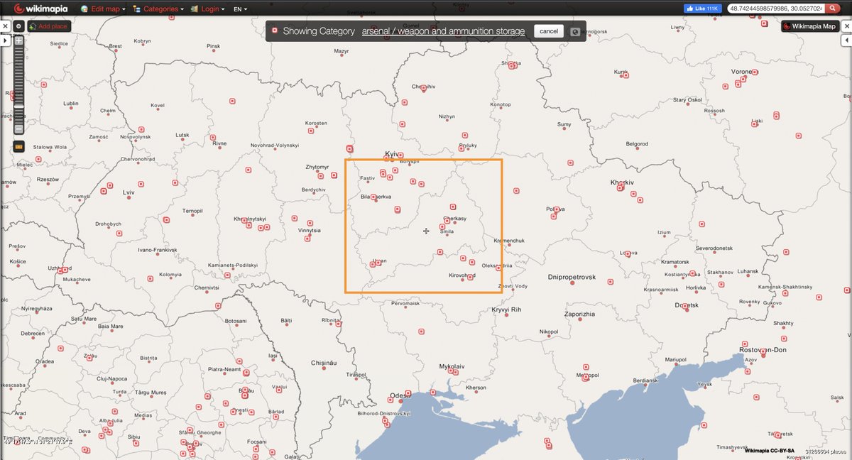
In the area around the second Wikimapia-tagged ammunition depot he looked at, he found a match: the junction, the trees, even the shape of an apparent bus stop lit up by the explosion.
Now that the exact location of the videographer is known, the approximate location on of the explosion can be established as well. And that is one of those locations tagged as a “ammunitions depot” on Wikimapia.
A location specifically labelled as “222nd Central Artillery Ammunition Base” on Wikimapia.
But, similar to Wikipedia, Wikimapia is based on user input — the labels are not necessarily factual (but often are).
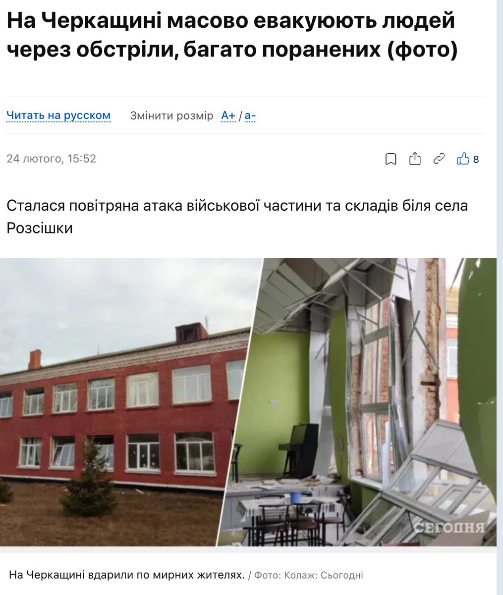
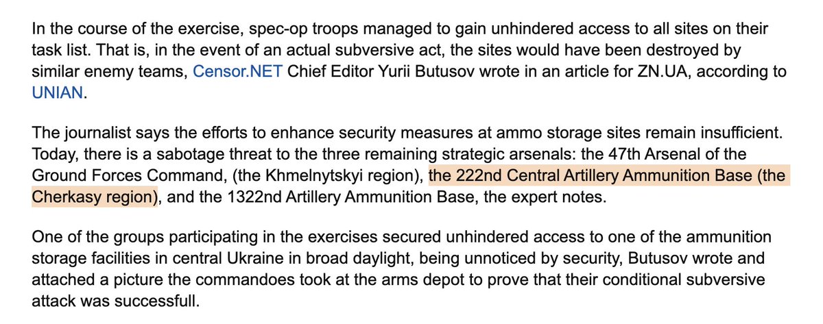
@Rebel44CZ did some corroboration and found a news article that mentions a 222nd Central Artillery Ammunition Base in the Cherkasy Oblast.
censor.net/en/news/309253…
With the where (48.7421, 30.1018) and what (likely an exploding ammo depot) known,
@AuroraIntel wanted to know the when too — because why would so many cars still be out if there would be a curfew, they thought? They turned to satellite imagery to answer the when question.
And satellite imagery, courtesy of @sentinel_hub, shows that something — likely an explosion — happened between Feb. 21 and Feb. 26. Satellite imagery is not collected every day, and sometimes it's cloudy too, hence a time period and not an exact day.
But besides optical data, some. satellites can collect other information too, like thermal anomalies. NASA's active-fire data picked up a big hot spot at the ammo depot in question on Feb. 24 — the day Russia invaded Ukraine.
In words of my satellite-savvy colleague
@ckoettl, “Active-fire data doesn't provide the cause of a fire, so one must exercise caution in interpreting it, especially when researching violence.” In other words: we can't say anything about why it happened, or how.
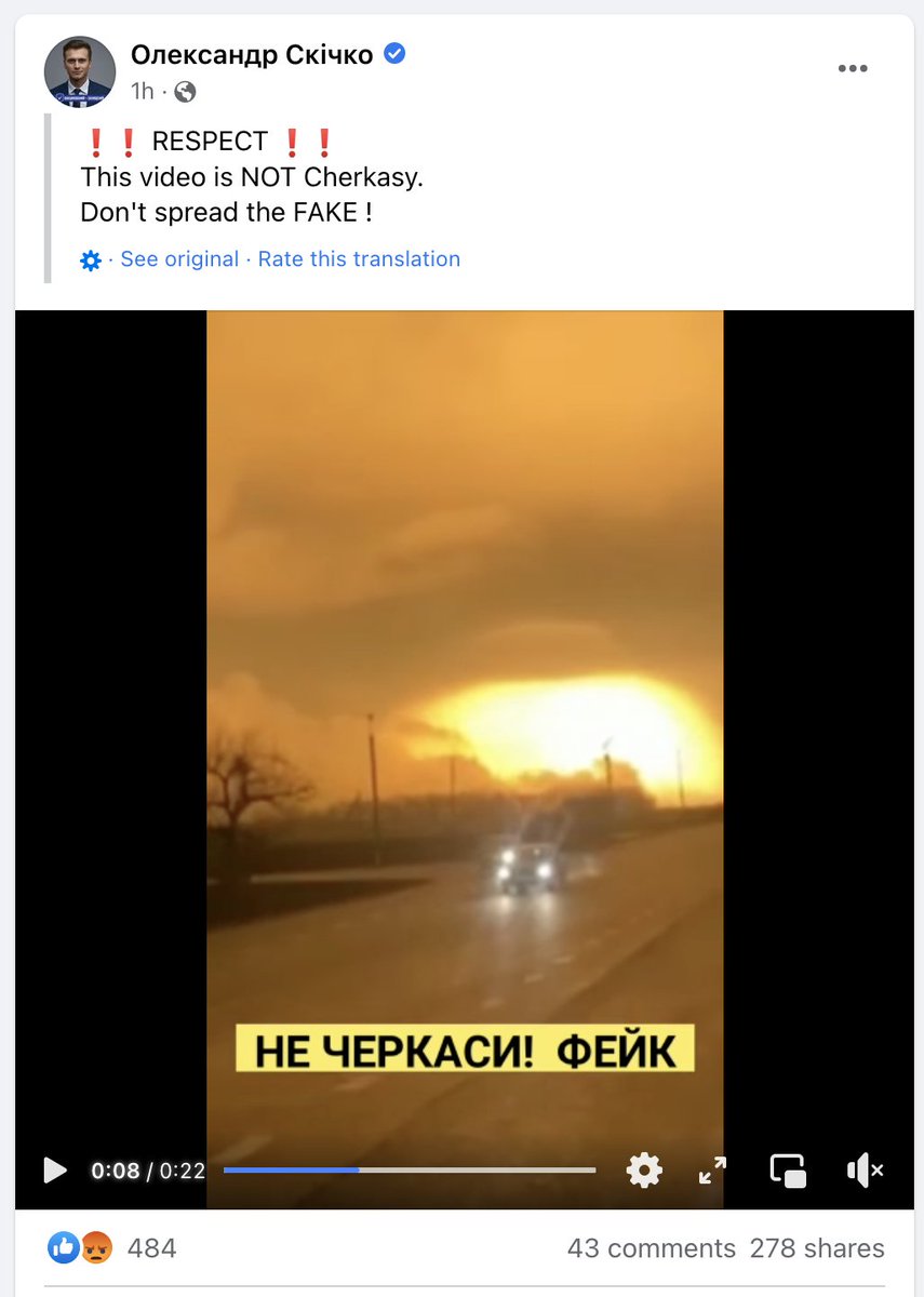
Oleksandr Skichko, the governor of Cherkasy Oblast, said on Facebook that the video is a fake. While it shows it may not have happened today but on Feb. 24, all the info outlined above strongly suggests a big explosion did happen in the Cherkasy Oblast.
Good question. Tweet mentioned “Cherkasy” so I searched for that in Cyrillic (Черка́си) on Telegram, where videos are often uploaded before they end up on Twitter.
There's roughly 10 seconds between seeing the explosion and hearing it. That bit of information is also useful for corroboration, as you can calculate the distance between the videographer and the explosion (and it matches).
(Someone else mentioned a local media report yesterday to in the comments, but can't find it back. Thanks anyway! Another good reason to always support local media, anywhere in the world.. they usually know it first.)
Another satellite data source to corroborate the Feb. 24 ammo depot explosion: Sentinel-2's short-wave infrared (SWIR) band appears to have captured it too. Striking image. Thanks @WED_explorer and @kosmi64833127 for flagging and processing.
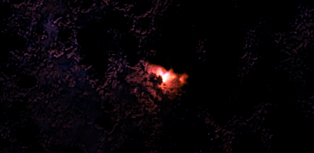
GIF of the above.
• • •