A few days ago, we here in the southern Rockies were treated to an abundant snowfall over the course of 24 hours. Prior to that snowstorm we had been experiencing warm temps & limited snow--but that was corrected with a foot of snow in the City of Durango & 2 feet of fresh powder up on the peaks & mountain passes.
I thoroughly enjoy snowshoeing, but you knew that, right? I suspect that is at least partially because I enjoy hiking. Being outdoors, being surrounded by nature, seeing things few if any other humans get to see--all enjoyable to me. Snowshoeing allows me to go hiking even in the Winter!
I occasionally get pushback: "Ooo, it's so cold" or "I hate the cold!". I'm here to tell you that while I would never argue that being outside when it is 10 degrees is warm--it isn't cold either. First off, yes, I'll grant you that it is cold when you first start. But the amount of exertion required--especially at high elevation--will cause you to feel warm quickly. If you aren't at least a little cold when you first begin you'll be sweating up a storm after 10-15 minutes. I often break a sweat due to the exertion, even at well below freezing temperatures...and who could argue they're cold when they're sweating?
Also, here in the southern San Juan Mountains, we are lucky to live in a very dry climate. That means the relative humidity is often quite low, and causes the low temps to "feel" warm. Add in our abundant sunshine & snowshoeing at less than 20 degrees is certainly not uncomfortable... Since we are at or above 7000' elevation, the sun here is either pleasingly warm or brutally harsh. That would depend on your perspective...
But back to the snowshoe adventure earlier this week. It began to snow in earnest last Monday and the storm lasted until Tuesday evening. The temps were relatively warm at 7000', near freezing in fact. The warm temps combined with our pleasant/harsh sunshine was causing a tiny bit of melting, turning roadways into a slushy mix of snow & water. So I knew if I wanted to 'shoe through fresh, dry, granular snow, I'd need to go up in elevation. Nearly always, as one ascends in elevation, the temperature drops. There is a 'formula' to determine the temp. drop per 1000' in elevation gained but I have found it unreliable. Generally I assume that as I go from my hut at 7000' to Molas Pass / Andrew's Lake at 11k', the temp will drop ~10-12 degrees. Usually that is fairly accurate but certainly not always--and looking up provides no clue as to what the Jetstream is doing...
Enough verbal rambling. I promised a photo heavy diary, so let's get to it. I'll just quickly add that it was 28 degrees & foggy when I left my hut. I live to the southeast of Durango, and my snowshoe haunts are to the north of town. So let's start with the drive to town, okay?
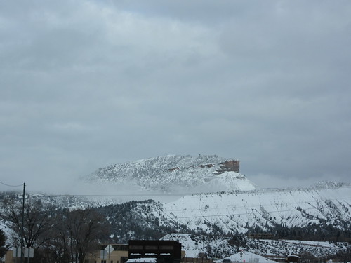
Perrins Peak, Durango's landmark that can be seen from most parts of town
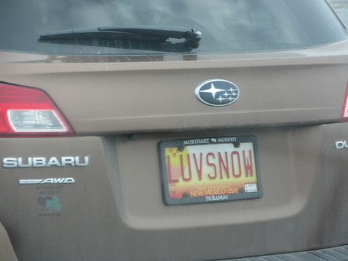
Me too! Me too! Wait--New Mexico? I thought we were in Colorado. (we are, but NM is very, very close)
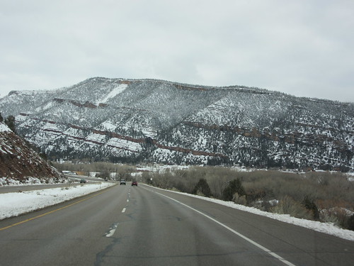
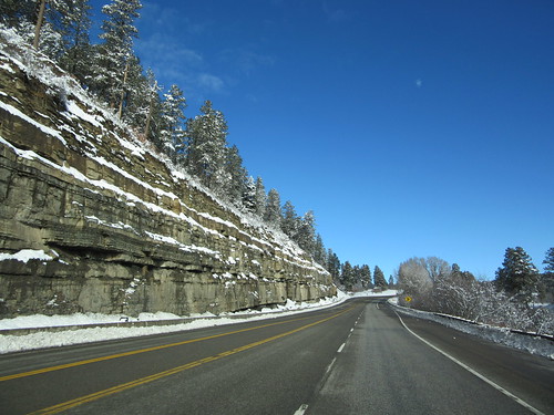
Once you're through town(on Highway 550), you proceed up the Hermosa Valley. The valley is demarcated by the Hermosa Cliffs on either side. Check 'em out:
The Hermosa Valley is relatively flat but it isn't long before you begin to gain elevation. And remember--I said it was warm-ish, so the roads were already clear of snow less than 24 hrs after the snow stopped falling.
Approaching Dalton Ranch, a golfing/dining/living 'resort'.
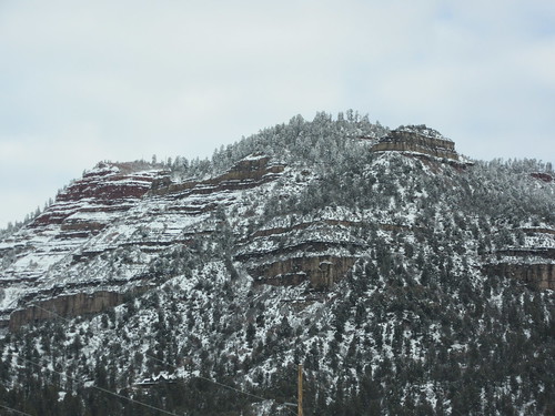
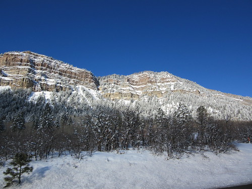
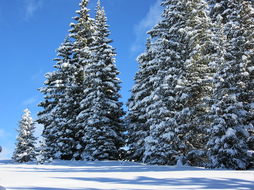
For most folks, Dalton Ranch is the northern tip of Durango, and you're entering "THE Mountains" once you're past it. In a few miles, you come to a small burg known as Needles. It's named for the Needle Mountains, and they are quite noticeable. If not for their towering over you, then for their beauty:
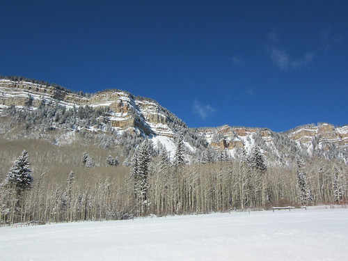
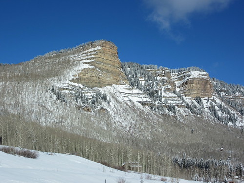
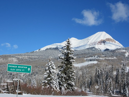
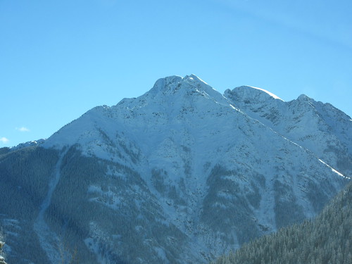
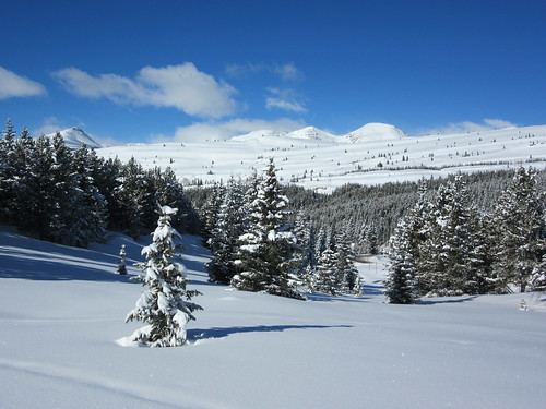
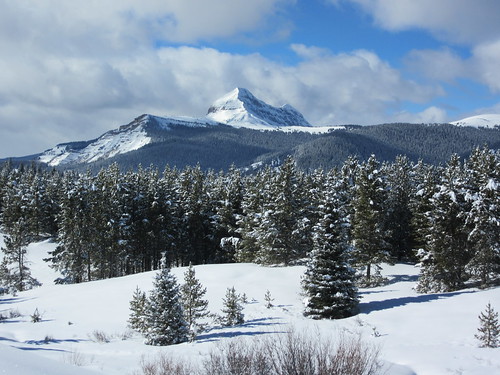
Once through the hamlet of Needles you continue gaining elevation, and go past our 'Home Slope', Durango Mountain Resort. It was known as 'Purgatory' Ski Area until a few years ago. Then they decided it would be more family-friendly to be known as DMR, so they changed the name. NO ONE here calls it DMR. It'll always be Purgatory or Purgy to us locals... After our 'home slope', you'll see our 'home peak', Engineer Mountain. At nearly 13,000', it is the tallest peak nearest to town. Here's the view of it from the south--we'll be snowshoeing on the north of it, so there'll be other pics of the reverse side later...
The road(Hwy 550) becomes quite steep, as well as twisty & turn-y. One never knows what is waiting around the next bend--an ice patch, an avalanche, or...
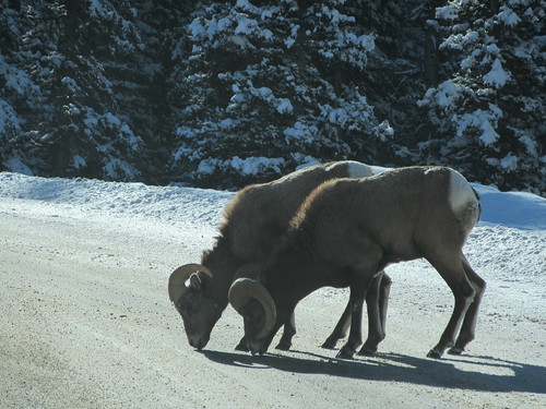
Bighorn Sheep, enjoying a little road salt.
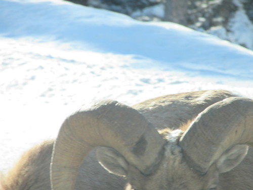
I like this pic of their horns. They look as strong & used as they really are in this pic. Well, I think so:
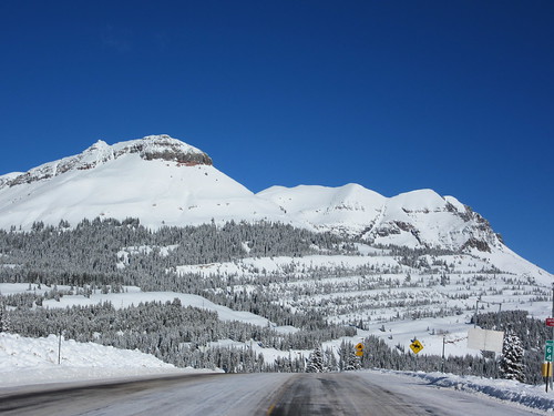
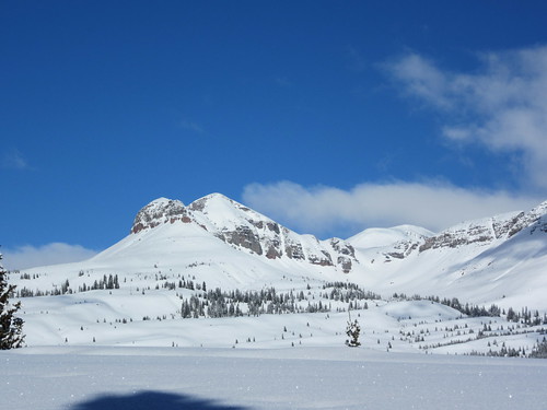
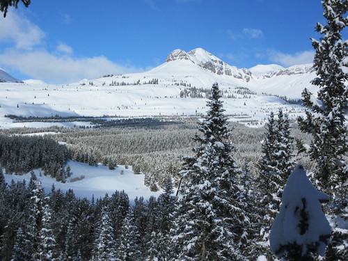
We're nearing the first Pass we'll cross--Coalbank Pass. As you pass over it at 10,600', you can't help but notice a sub-peak of Engineer Mtn to the west:
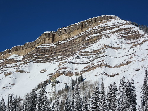
Man, that is a lot of mountain and a lot of snow! It's known as Twilight Peak.
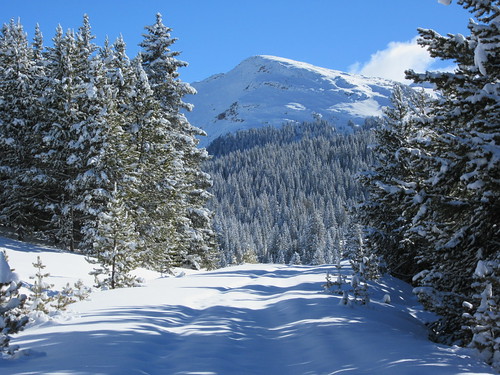
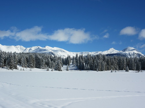
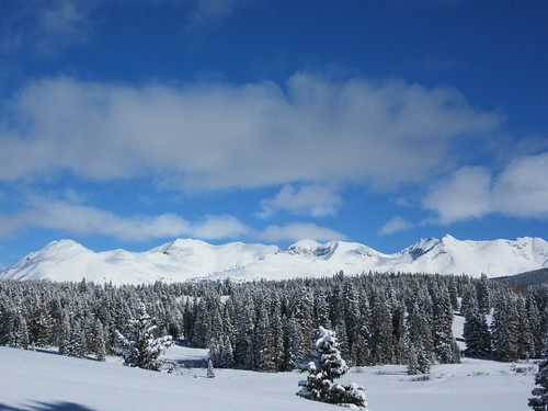
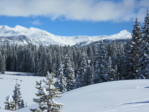
In a few more miles, we arrive at Molas Pass. I think it's beautiful...
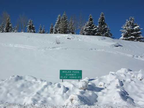
But really--the view to the north is much, much better. The two above pics are taken from the same spot: first one facing west, second one facing north.
Finally, we've reached our snowshoeing spot. Let's get our shoes on & go. *Just a pause to say my dogs, Fletcher & lil Chris, know the route up there & get progressively more excited as we approach. They explode out of the truck when I throw the door open for them, as excited as any pups get when they're about to have fun... They've been conditioned to play in the snow over the last few months, so they are able to enjoy running through deep snow without getting cold or a paw injury. It's important to remember that they have spent months acclimating to the conditions, just like me. It would be abusive to expect them to go from 80 degree temps to frolicking in snow. But it has been getting progressively colder on our hikes, then there was a little ice to walk on, then...snow. Then deep snow...they LOVE romping in snow. Love, love, love it!
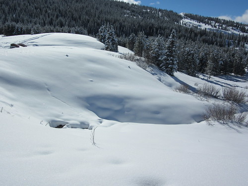
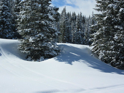
So here we are, north of Andrew's lake, south of Molas Pass. After parking we commence 'shoein across the hills around the lake until the lake comes into view. The snowshoe trail you see here is roughly 4' of packed snow. The trail--or ditch-looking part--is sitting ON 4' of snow, and the sides of that trail are about 18" of fresh powder from the most recent storm.
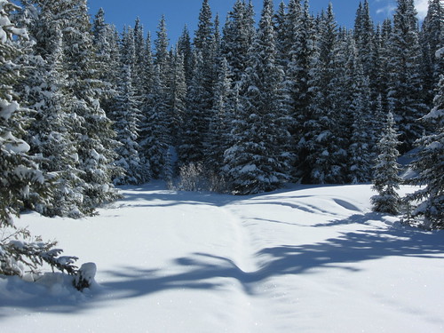
Two things to point out in the below pic: First, you are able to see the trail I made a week previous on the lower left corner. It looked like the above pic a week ago, but the last storm filled in the trail--which means I'll be breaking open the trail again. Breaking a new trail or re-breaking an old one is much, much more difficult than walking solely on packed snow. MUCH more difficult! Also, notice the shadows? That's because the sun is shining so brightly. The temp was 18 but trust me: it was plenty warm huffin & puffin through the snow at 11k'.
Walking up the road that leads to Andrew's Lake:
And at the lake area:
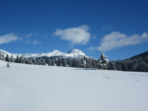
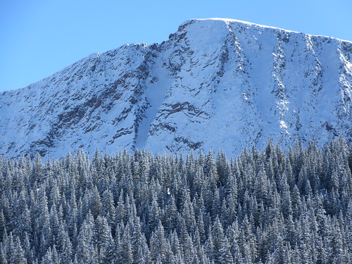
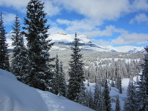
Here's the 'back side' of Engineer Mountain peak. Remember when we saw it before? this is looking at it from the opposite side--looking south:
Andrew's Lake--it's a lake, so there must be fishing, right? Right! Ever heard "The worst day fishing is better than the best day working"? Well, YMMV:
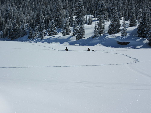
That looks fun. **not intended to be a factual statement
The next couple pics are taken in the hills behind those fishing dudes. It may not look steep, but trust me--it is UP!
I'm pretty sure this is Snowdon Peak
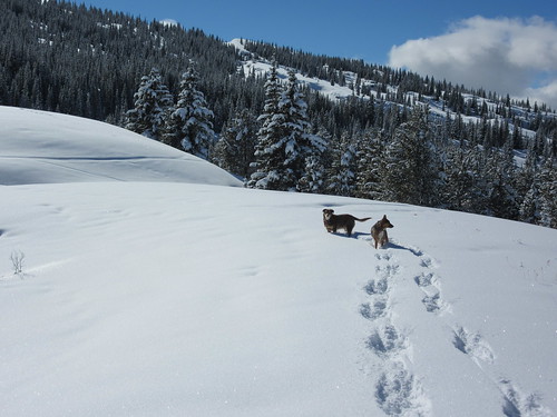
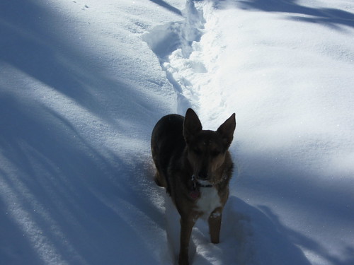
Fletch & lil Chris
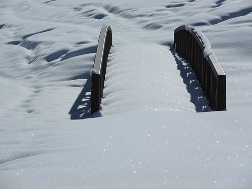
There is a bridge across the spillway from Andrew's Lake. I think it's a very cool thing that you, Mr. and/or Mrs. Taxpayer, have provided for us. I always take pics of the bridge. Always. And it looks a lil different each time.
This is looking east, across Andrew's. Yeah--that's a lake in the Rockies, at 11,000' in January. You can see the tracks the fishermen made as they crossed the lake to get to their fishing holes...
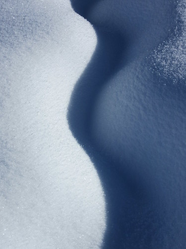
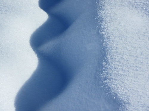
How about some artsy pics? Okay. Artsy snow pics coming right up:
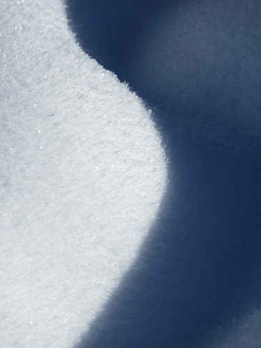
Oh, how I love you Andrew's Lake!
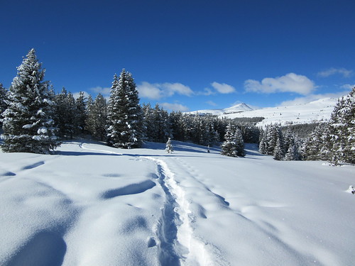
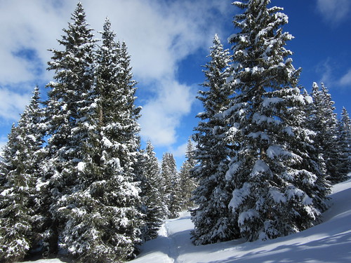
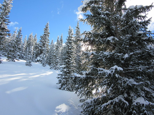
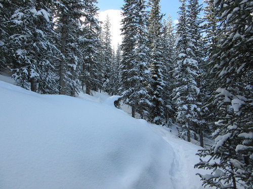
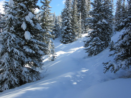
Let's head up, towards Snowdon Peak(and on further, towards Crater Lake). The snow here in this area is deeper, the hills steeper, and we're into the trees... Few, if any, people get to see this place in the Winter. Consider yourself as I do: privileged to be here:
That is a lot of snow. I don't care where you're from, that is a lot of snow!
Nobody is nearby, that's for sure
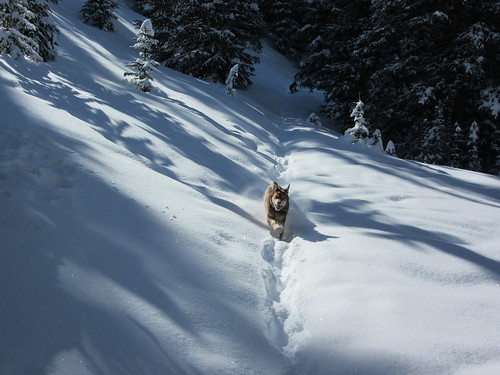
This may not look all that steep but believe me when I say you probably couldn't even get here, much less go up this hill. But Fletchie did, and now he's charging back down towards me:
Chris says "Are you coming with us, Dad?"

Through the trees--"The Fella was here"
Big shadows, Engineer lurking in the background

Dogs in snow. Oh yes.
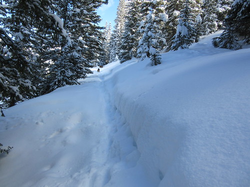
Looking at a switchback. Maybe you can see the trail the dogs made in the bottom right. The trail then cuts back, goes around that snow-covered pine tree, and goes on upward, leaving the frame to the upper left...
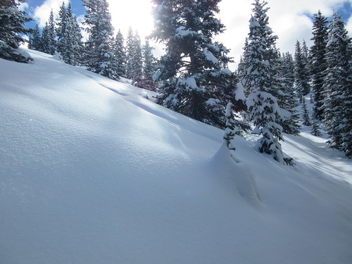
Deep stuff! Steep stuff!
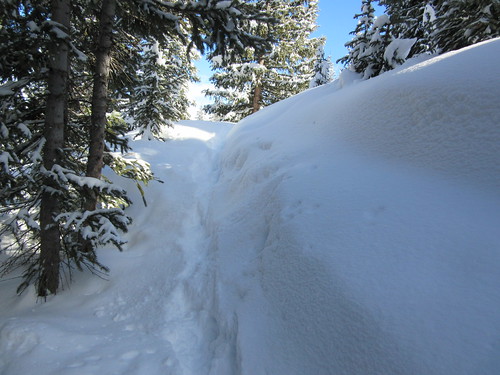
This 'traverse' is really f'n steep going forward. We're traversing the hill because it is way too steep to attempt a frontal attack. You can see the slope also going down towards the left... that is at perhaps a 50-60 degree angle--Avalanches happen at this angle.
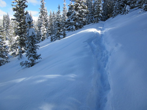
THAT'S the real deal kids
Here, look to your left:
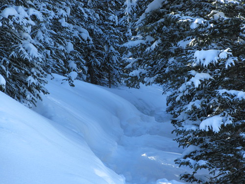
Really deep & through the trees
No one has been here for a while...
Way up there. Thanks for breaking a trail, doggies:

Looking back at our tracks
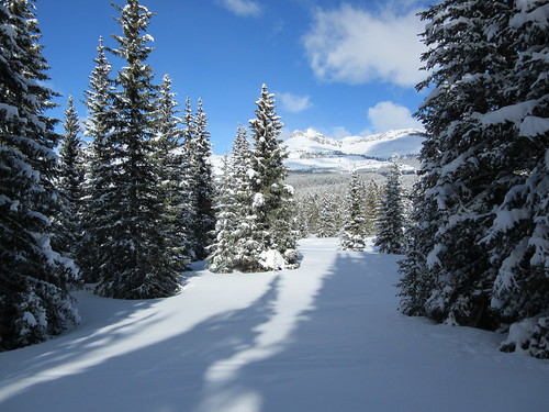
Awww yeah! This is why we come here. Deep, deep snow high in the Rockies--untouched by humans.
And hey--it's mostly downhill all the way back to the truck.
So...that's a day spent snowshoeing with the Fella. I live for days like this. I wait all year for days like this. This is what I like...
I hope you had an enjoyable time seeing a place few if any other people on earth ever get to see.
I'll close by giving a pictorial shout out to my two best friends. They always accompany me when snowshoeing. They're excellent 'shoein buddies, never complaining. I love them even more than snow. Some say they're 'rescue dogs', that I rescued them from the shelter. But I know better--I know who rescued whom...
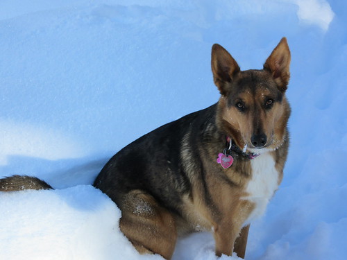
Lil Chris
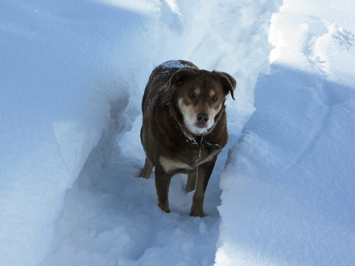
My main man, Fletch
Okay, see ya out on the hill, next time!

