A new atmospheric circulation pattern called the "Arctic rapid change pattern" or the "Arctic dipole" has emerged in the past several years according to Dr. Jeff Masters.
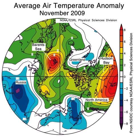
The dramatic loss of Arctic sea ice in recent years has created a fundamental new change in the atmospheric circulation in the Northern Hemisphere that has sped up sea ice loss and is affecting fall and winter weather across most of the Northern Hemisphere, according to several recent studies. Arctic sea ice loss peaks in September and October, exposing a large area of open water that heats the air above it. This extra heat has helped drive September - November air temperatures in the Arctic to 1°C (1.8°F) or more above average over about half of the depth of the lower atmosphere.
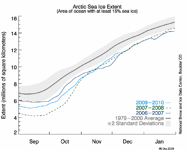
Arctic sea ice levels are presently at record low levels for the time of year, tied with the levels seen in early December 2006 and 2007.
By FishOutofWater
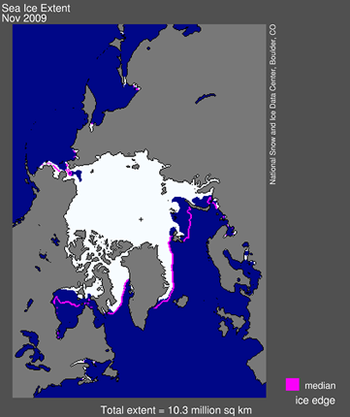
A large area of open water has appeared in the Barents sea where there was ice cover in previous decades.
By FishOutofWater
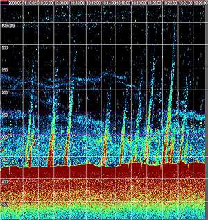
The open water in the Barents sea is allowing large amounts of heat to be transferred from the warm water to the atmosphere.
By FishOutofWater
Dr. Jeff Masters summarizes the radical change in the Arctic ocean-atmosphere circulation. A month ago I discussed how October's weather was changed by heating from the warm open water. Dr Masters discusses how the Arctic circulation has changed over the past several years and how it has affected weather this fall.
A new atmospheric pattern emerges: the Arctic Dipole
In a 2008 article titled, Recent radical shifts of atmospheric circulations and rapid changes in Arctic climate system Zhang et al. show that the extreme loss of Arctic sea ice since 2001 has been accompanied by a radical shift of the Arctic atmospheric circulation patterns, into a new mode they call the Arctic Rapid change Pattern. The new atmospheric circulation pattern has also been recognized by other researchers, who refer to it as the Arctic Dipole (Richter-Menge et al., 2009). The old atmospheric patterns that controlled Arctic weather--the North Atlantic Oscillation (NAO) and Arctic Oscillation (AO), which featured air flow that tended to circle the pole, now alternate with the new Arctic Dipole pattern. The Arctic Dipole pattern features anomalous high pressure on the North American side of the Arctic, and low pressure on the Eurasian side. This results in winds blowing more from south to north, increasing transport of heat into the central Arctic Ocean. The Arctic Dipole pattern occurred in all summer months of 2007 and helped support the record 2007 summer reduction in sea ice extent (Overland et al., 2008). Fall 2008 through spring 2009 featured the old AO pattern. The new Arctic Dipole pattern re-appeared in June - July 2009, but the old AO pattern dominated in August - September, resulting in greater sea ice extent than in 2007 and 2008. The Arctic Dipole pattern was active again in October, inactive in November, and is reasserting itself this December. As a result, Arctic sea ice reached a new record minimum for a 10-day period in early November, increased above record lows during late November and early December, and appears poised again to reach a new record minimum later this December.
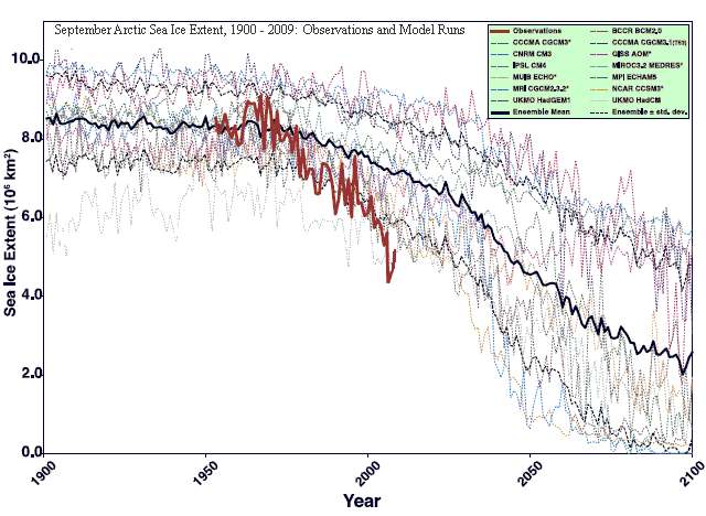
The coupled interaction of the exposed warm ocean with the atmosphere is causing the Arctic sea ice to melt much faster than models predicted. The models predicted slower melting because they missed the radical change in atmospheric circulation caused by melting.
By FishOutofWater
The rapid warming of the Arctic is beginning to cause an additional feedback loop to begin - the release of methane by the melting of methane-ice in the Arctic ocean.
Global climate models do not incorporate the Arctic climate warming - methane feedback loop. The flow of warm Atlantic ocean water into the Arctic, intensified by the loss of sea ice may trigger this loop. The IPCC may have significantly underestimated the rate and intensity of Arctic warming.
