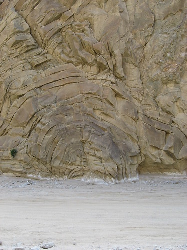
Orogeny (Orogeny), now of broader meaning, used to refer to the formation of mountains. Erosion is a process by which the earth's crust, including its mountains are weathered and reduced. Split mountain is a special place where these two sets of forces have combined to produce an illuminating and glorious result; a result such that one can drive up a dry wash, enjoying the full light of day right to the very heart of the mountain, the anticline. (Anticline)
Place a sheet of paper on a flat surface with the long axis oriented roughly east to west. If you now push westward on the eastern margin and eastward on the western edge, you approximate a common orogenic process. The center should bow upward, as would the earth's crust, and if you push until the paper is folded together in the middle, that would represent the anticline. If you duplicate this process with a stack of sheets of paper, each representing a huge number of crustal layers, you get a better visualization of the mountain formation process and the anticline. For a better visualization of the anticline -
Bear in mind that you are looking at rock.
The Anza-Borrego Desert State Park (ABDSP) lies within California's Colorado Desert (Colorado Desert) Split mountain lies just outside of or on the edge of the park, and it is at the park interpretive center and facilities relating to the park that you will find the best information on split mountain. This entire area was under water, off and on, for millions upon millions of years. As a result, it slowly grew upward as sediments were laid down day after day and century after century.
The area is also an ancient boundary between tectonic plates and suffered dislocations and disturbances of many kinds as a result. There came a point in time when the crust surface rose a bit above the water across a broad area, but there were still lakes and drainages and streams and rivers, one of which began to erode the newly exposed surface. This process was, of course, creating a canyon, but for one minor detail.
As the water eroded a channel for itself, the tectonic plates were slowly moving, folding the crust upward just as if it were a sheet of paper. By coincidence (or the connivance of the tricksters, Raven and Coyote) the rate of uplift generally matched the rate of erosion. There is perhaps something of a "canyon", but it is measured from the mountain peak to the desert floor, and is visible only by looking upward from the level plain, because the water didn't dig out a channel in the crust, but instead cut a notch through the mountain.
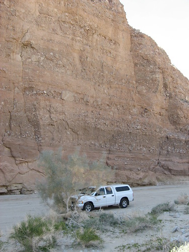
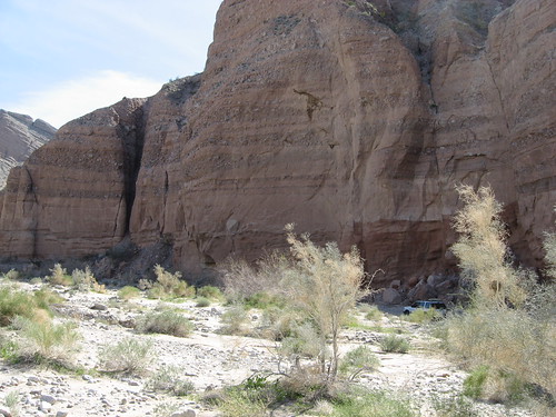
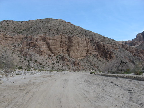
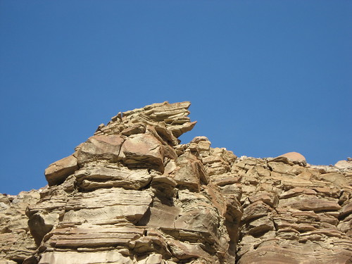
Split Mountain Road, originating at the "town" of Ocotillo Wells runs to a gypsum mine. At first paved, it degrades to gravel, and at the point where the pavement stops, a wide dry wash meanders off to the right. If one turns off of the road and takes drives up the wash, one approaches the Fish Creek Mountains and then, enters them. Outlying foothills can be discerned in that the strata tilt upward for a while, and then back downward.
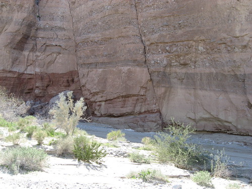
Strata going up,
some faulting confusing the strata's downward tendencies,
and more faulting
The wash meanders, as water will, among through and between the foothills
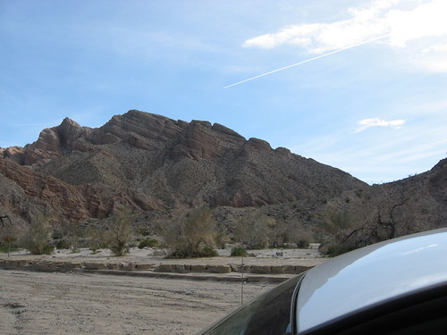
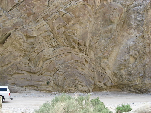
until it finds its way to the anticline.
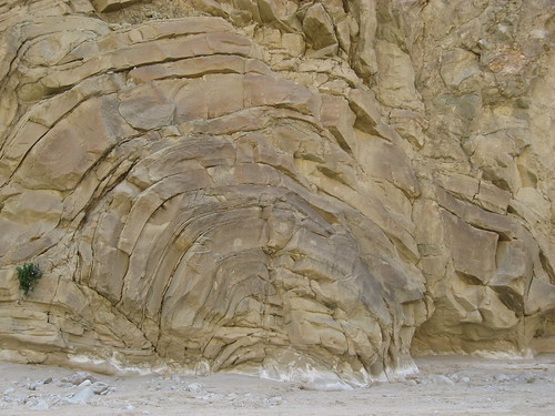
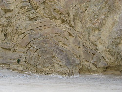
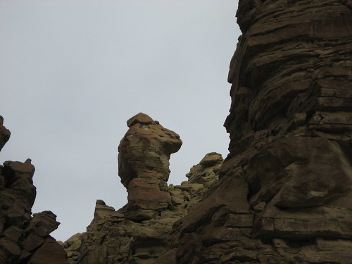
Unlike the paper model, it isn't uniform at all.
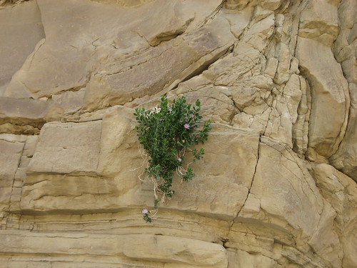
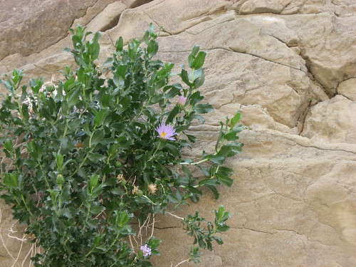
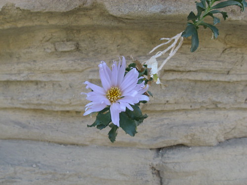
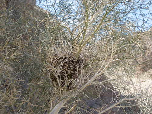
Yet this convoluted, bent and tortured rock supports life:
Including birds' nests.
All throughout, the non-uniform folding is matched by non-uniform erosion.
Edited to add close up of flower near anticline - it was there in the original draft.
Update: Iy you are more of a snow oriented person, RLMiller just put up a diary on Yellowstone Hike On!

