Although it isn't home repair/improvement related, I'm using this venue to show what I've been working on since being elected Majordomo of our village acequia (irrigation ditch). A farming community needs water, of course, and this community has been farming off the waters of the Pecos River since the acequia was dug by hand in 1835.
Politics at its most local, almost 50 shareholders (parciantes) self-govern the distribution of irrigation water through elected officers (3 Commissioners and the Majordomo) and this governance is recognized and preserved by New Mexico State Law and granted the status of an incorporated local government. These bodies date back to the earliest Hispanic settlements here, starting in 1598. The rights of these communities to their water were recognized and preserved by the Treaty of Guadalupe-Hidalgo in 1848, wherein Mexico ceded the American Southwest to the United States after the Mexican-American War.
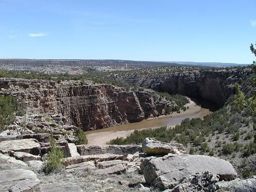
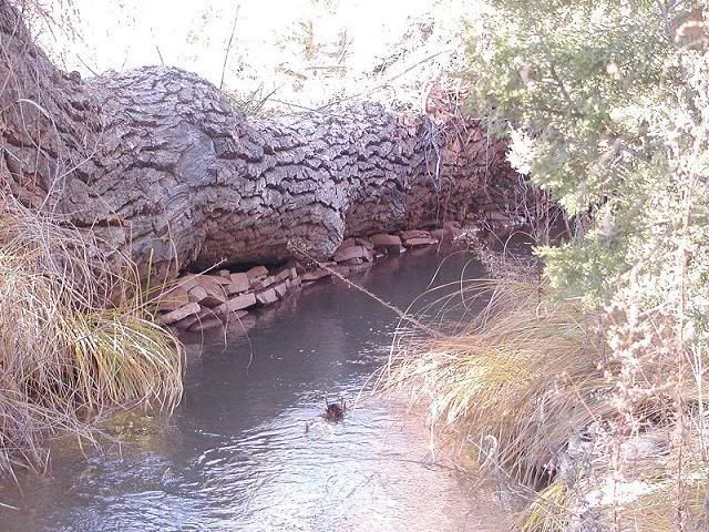
There is vast history here, but it all starts with a river, in this case, the Pecos River, seen here just upstream of the dam,
and here emerging from the deep and roadless canyon at the diversion dam (presa) that starts the acequia:
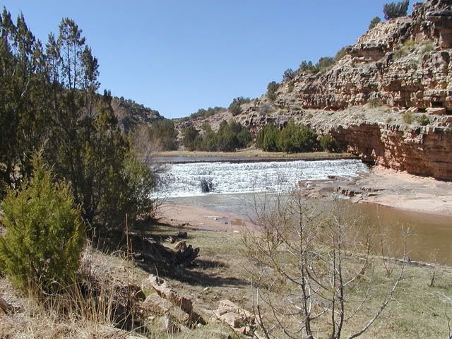
The presa was built of huge stones quarried from the canyon walls. As can be seen, the layers of sedimentary stone, primarily sandstone, are even and regular, and large blocks have been stacked up nearly 20 feet high. In the center of the dam can be seen the last gap in the dam. As the stones were placed from the outside in towards the center, the river was diverted through that opening (while running low, of course) until completed and the final gap closed.
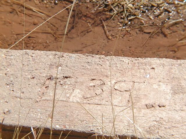
I don't exactly when this huge stone-laying was done, but we do know that in 1939, a WPA project built what is the present form we can see here.
and the locals came out to celebrate the completion:
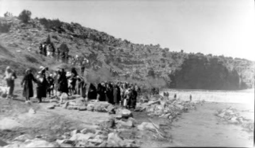
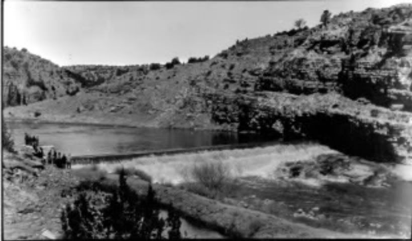
(Thanks to Georgia (Abercrombie) Santamaria for these two historic photos, taken by her grandfather James Abercrombie. Georgia found the glass-plate negatives for many of his photos in the attic of the old family hacienda and printed them in her darkroom)
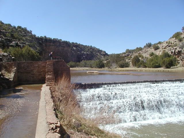
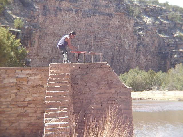
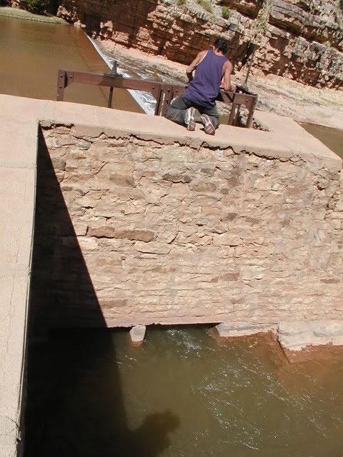
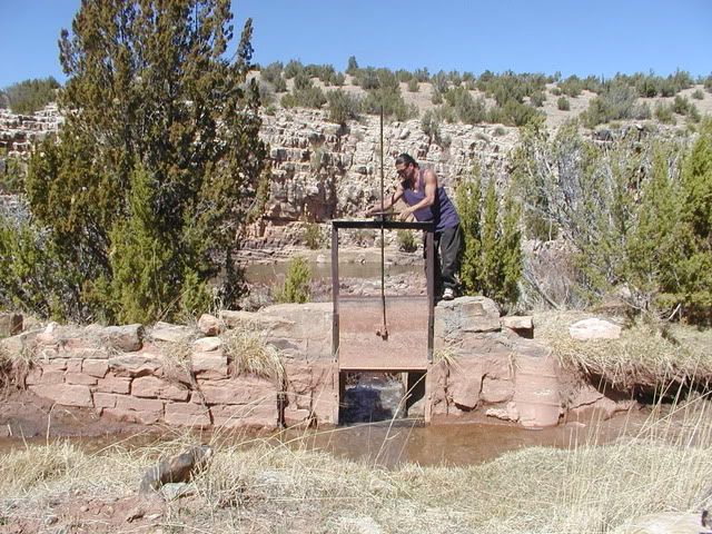
As we walk towards the dam we see the headgate structure:
That's my helper Sam up there, turning the big wheel that opens the headgates. I am pretty certain that much of the rock for this structure was quarried from the canyon wall seen behind him, which doesn't have the weathering the the undisturbed stone has. I was also told today by the majordomo of the lower end of the acequia that there had been a smaller diversion dam built of stone and sticks directly upstream of this one, but it is covered by the water, what's left of it. Apparently it was repeated damaged or destroyed by floods during the century prior to this new structure built in 1939. Floods of more than 10,000 cusecs (cubic feet per second) have passed this dam, without damage.
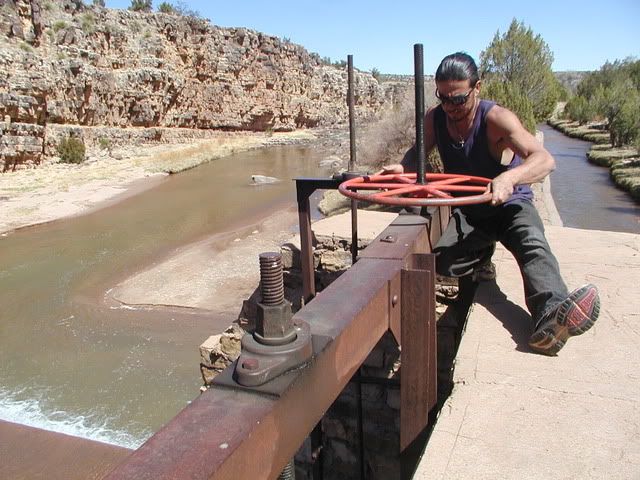
Which looks like this. There are two gates, but we are only opening one right now as we bring the system up to capacity slowly:

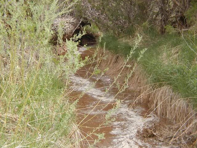
and the water starts flowing into the acequia:
This is one of many desagues along the acequia. Right now it is wide open as we use the flow of the water to flush out sand and gravel carried in from the river. In normal use it is closed down to a 2 inch slot that exits the sediment-bearing lower strata from the flow to the side and back to the river.
When water gets scarce, the desagues are closed so none of the water is wasted.
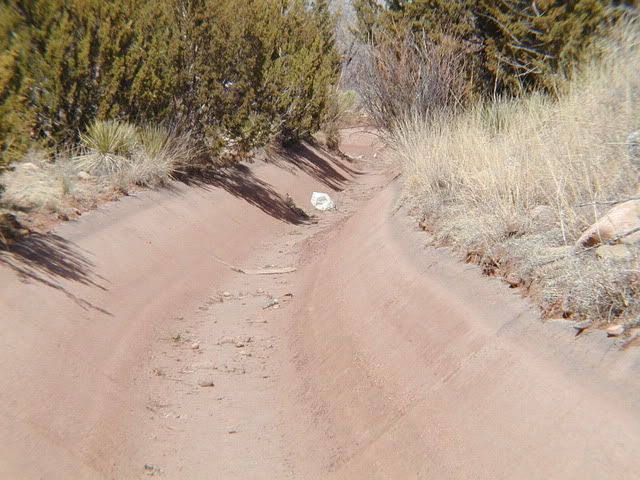
Near the dam, the sidewall of the canal is concrete, because it is so precariously perched above the river:
Further along, the majority of the canal passes through earthen channels, although there are areas where the pathway for the water is basically hacked out of the rock, and there is even a 700-foot stretch that is concrete-lined, where the canal again clings perilously close to a sharp drop-off that is a large gravel bank that erodes easily when too much water passes.
This concrete-lined section is the ultimate gauge of how much water to divert into the acequia; an overflow here would be disastrous.
The dimensions are 24 inches wide at the bottom and 84 inches (7 feet) at the top, and 30 inches deep, yielding a usable cross-section of ten square feet. A 4 fps flow through here will carry the 40 cusecs we divert.

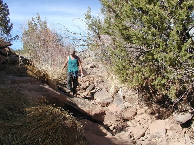
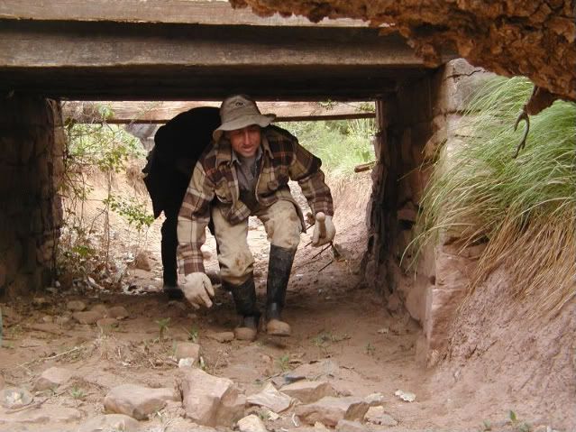
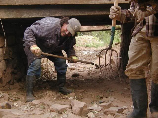
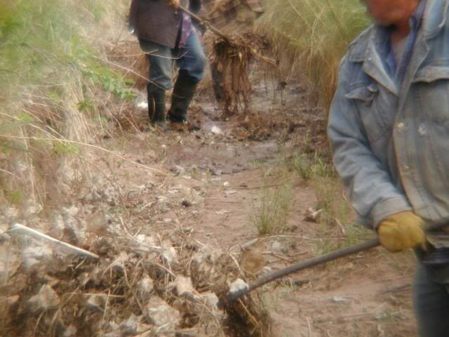
As the water is run down the channel for the first time in a season, a crew scurries ahead of it, forking out the plies of leaves, twigs and trash that the flow picks up and carries along, the final cleaning as the water is "walked" down the acequia.
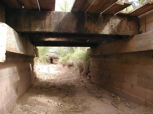
Here they are coming under my bridge with the water close on their heels.
As of tonight (Friday), the acequia is running at half flow as the majordomo of the bottom end of the ditch flushes and cleans the flow that just reached them late today after starting out 5 miles upstream yesterday. Once they are ready, later tomorrow, I'll open the other big gate at the dam and increase the flow, incrementally, to the maximum capacity in time for the "official" start of the irrigation season, on time this year for the first Sunday (12 noon) of the new Spring.
I hope you have enjoyed this glimpse of the inner workings of a tradition that has continued since 1835, the main artery of the life-blood of this old farming community. It is certainly an educational experience for me as I enter this new phase of my relationship with this unique place I have chosen to live in.
Thanks for reading.

