For the most part, you will be walking from your hotel to the Convention Center and almost every place downtown. I'll deal with buses and Light Rail in the next NN Prequel. I'm going to assume that most people will be driving from the airport to the convention (and back), or from the convention to various tourist locales. I'm going to use the Convention Center as nexus; adjust from your hotel as necessary.
The highways
The main N/S highway is Interstate 35, which runs from Laredo, TX to Duluth, MN. Around the Twin Cities, I-35 splits into two parallel roads, I-35W, the western branch, which goes through Minneapolis, and I-35E, which goes through St. Paul. They join up again to reform I-35. Interstate 35 (which also links to traffic reports)
You will need to get on I-35W SOUTH to go from downtown to the airport or the Mall of America.
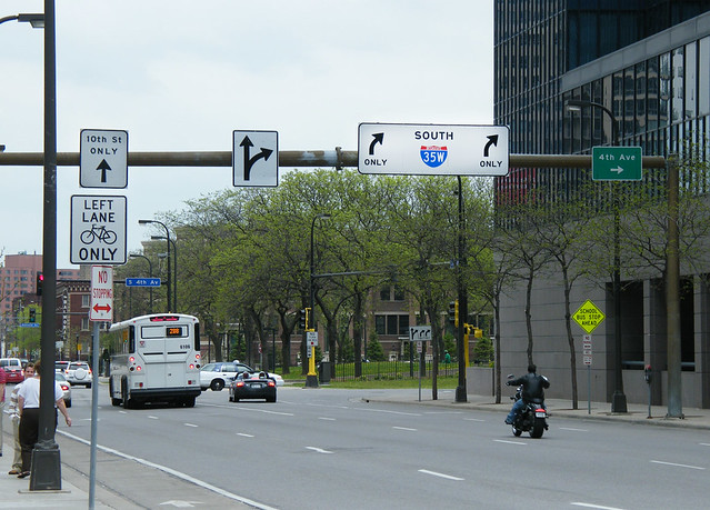
Entrance to i-35W from 10th St near Convention Center
The main E/W highway is Interstate 94. The Convention Center is a few yards away from I-94, though it's tricky to get on.
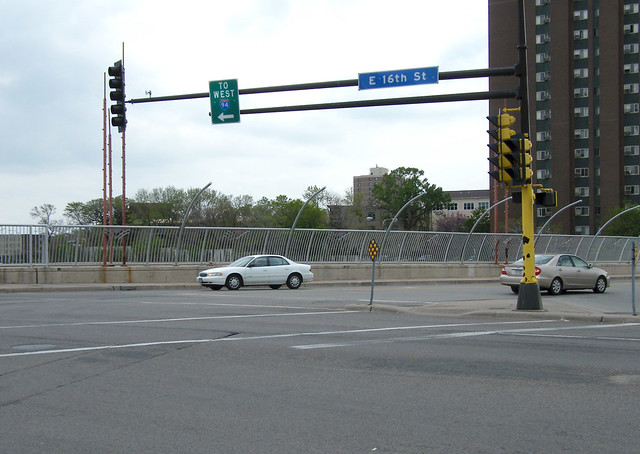
Start of entrance to I-94 WEST off 3rd Ave (directly east of the Convention Center and one block south).
Interstate 94
To get to St. Paul, you take I-94 EAST. This is only partially effective if you want to get to downtown St. Paul (for example, the Science Museum), but at least puts you in the general vicinity.
I-394 is a spur that starts in downtown Minneapolis and heads west.
The Twin Cities are ringed by I-494 and I-694. These are essentially the same road with different names given to the north arc (694) and the south arc (494, where the airport is).
You might think that I-94 would handle it's naming convention the same way that I-35 did: The west (Mpls) side would be one designation while the east (Stp) side would be another. But no. I-35W intersects both I-494 and I-694, as does I-35E. Go fig.
The easiest (but longest) way to get from the airport to Netroots Nation: Head out of the airport, taking the right branch to 494/5. Follow I-494 West to I-35W South. Keep going until you get to the downtown exits. The 11th St. exit winds up right next to the Hilton.
I shall leave a discussion of other major arteries to your mapping software.
The roads
The trick to driving around town in city traffic is knowing the one-way streets. Downtown is a series of one-way streets (going E/W) and one-way avenues (going N/S).
Detailed map of downtown including skyways and one-way streets:
Good map of downtown, with arrows for the one-way streets, showing how downtown painfully lurches from a grid loosely parallel to the Mississippi to an EW/NS grid.
Grant Street (where the Convention Center is) maps very roughly to 13th St. (13th St. is it's own road very briefly.) Franklin Ave. is 20th Street. Lake Street is 30th Street.
Nicollet Mall, (Zero Ave, see first prequel) is closed to most traffic from the river to Grant Street (ie the Convention Center). This is annoying as parking for the Millennium is only accessible from a street which is nominally closed to cars. Go there anyway.
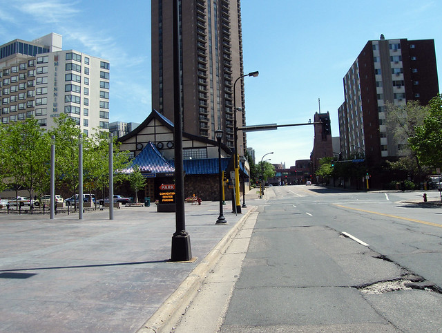
Grant Street looking east toward the Convention Center (visible in the background). Note Millennium Hotel on the left. The street in the foreground is Nicollet Ave. To the left, it's Nicollet Mall. Just to the right of the intersection on Nicollet is a bus stop.
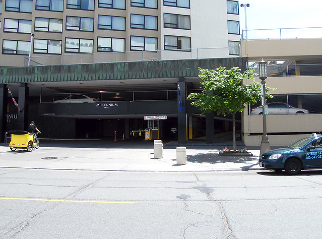
The entrance to the parking garage under the Millennium, accessible off Nicollet Mall. Note taxi at right and taxi bicyclist at left.
West of the Convention Center, one block West of Nicollet, is LaSalle Ave, which is a one-way heading South. LaSalle magically becomes Blaisdell at Franklin Ave, and continues as a one-way until 40th.
East of the Convention Center, Park Ave is a one-way headed North and Portland Ave. is a one-way headed South. Both terminate (as a one-way) at 40th.
To get to the University, go down (south) to 4th Street, turn right (east). Go past the deflated Metrodome. Either go straight to University or get off at the Cedar Ave. exit to go to Cedar-Riverside.
Okay! Fire up your GPS and explore! Next up: Public Transportation.
