Radar shows that tropical storm Irene is rapidly intensifying, threatening to become a hurricane before it strikes Puerto Rico. Radar sequences show Irene rapidly improving its organization and forming an eye as its rains and 50 miles per hour winds are battering St. Croix in the Virgin Islands. Irene is on track to make a direct hit on Puerto Rico.
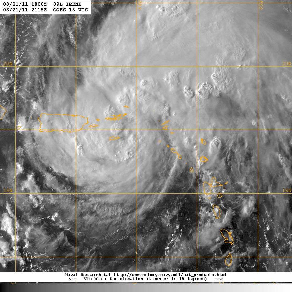
Now that Irene is forming a circular eye, it will be able to intensify rapidly. Dry air and disorganization has been overcome as Irene passes over 84 - 87 degrees Fahrenheit water
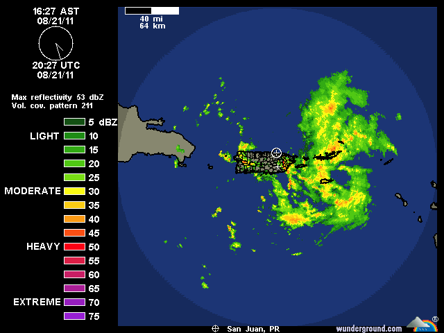
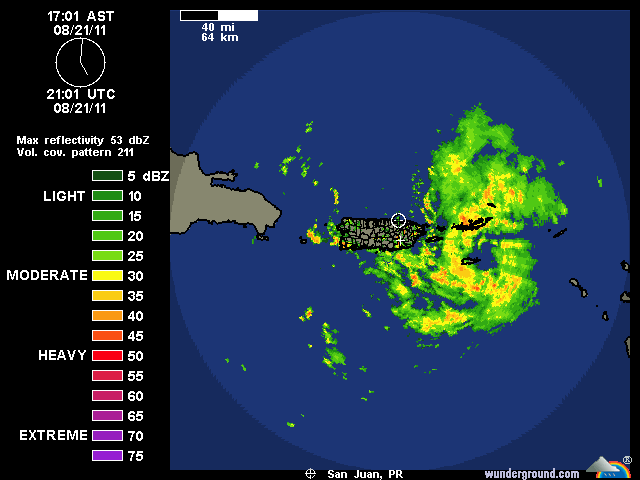
In just half an hour, at 5pm, radar shows that Irene's developing eye had become more circular and tighter while the gap in the eyewall on its eastern side had closed dramatically.
Previous National Hurricane Center (NHC) forecasts which predicted that Irene would go south of Puerto Rico have been corrected and updated at 5pm EDT for a direct hit. This is a dangerous shift in the forecast track not only for Puerto Rico, but also for the Bahamas and the southeastern United States. Because the present track has no direct interaction with Cuba and a more glancing passage over of the island Hispanola, Irene is likely to become stronger than previously forecast. Less land interaction and more time over the very warm waters around the Bahama islands favor a stronger and more dangerous hurricane as it approaches the coast of Florida and South Carolina.
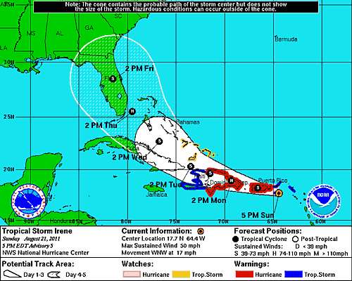
Irene is a large storm, so hitting Puerto Rico will likely have a small effect on its intensity. Hispanola, which is a large, high island could sap Irene's strength if there's a direct hit and the track passes over the high mountains. However, the new track forecast would have Irene glance the north coast of Hispanola, then pass over open water towards the Bahamas and Florida.
Irene has the potential of becoming a major hurricane that strikes the United States somewhere from Florida to the Carolinas. The HWRF model, which correctly forecast the northward shift in the track towards Puerto Rico, is forecasting Irene to be a major hurricane approaching the Charleston, South Carolina coast on Friday afternoon. Obviously, the error bars for such a model are huge 120 hours out. However, this image shows what could happen anywhere from the Florida Keys to Cape Hatteras.

