Hunting Island State Park, SC - a disappearing beach.
The Daily Bucket is a place where we post and exchange our observations about the natural happenings we see. Birds, blooms, bugs and more - each note is a record that we can refer to in the future as we try to understand the patterns that are quietly unwinding around us.
December 2012

Hunting Island State Park is located on the coast of South Carolina north of Hilton Head and east of Beaufort and the Marine boot camp at Parris Island. My advice is to totally skip the mess called Hilton Head and focus on other places in the Low Country. The Penn Center is a good place to check out the history of the Gullah people. It's right off US 21 on St Helena Island between Beaufort and Hunting Island. Gullah Grub is highly recommended for traditional food but if the lady is not there and serving on front porch, try Steamers back in town or the Shrimp Shack down the road. These places all serve tasty local seafood.
Promo from the state park website --
Hunting Island is South Carolina’s single most popular state park, attracting more than a million visitors a year, as well as a vast array of land and marine wildlife. Five miles of pristine South Carolina beaches, thousands of acres of marsh and maritime forest, a saltwater lagoon and ocean inlet are all part of the park’s natural allure.
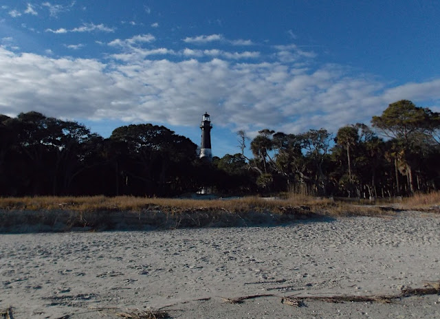
Of all the lighthouses in South Carolina, the Hunting Island Lighthouse is the only one in the state that is publicly accessible.
The lighthouse was closed for interior painting when we were there so we didn't get to climb 130' for the great view. It was built in 1859, reconstructed in 1875 after intentional destruction during the Civil War and moved in 1889 due to erosion. Outbuildings such as the keeper's cottage have been rebuilt/restored. The lighthouse and buildings will likely be moved again someday.
More below the turbulent orange surf but watch your footing please. The sand is shifting.
From Wiki --
Since 1980, Hunting Island has suffered major beach erosion as a result of heavy tides from the confluence of the Atlantic Ocean and Saint Helena Sound, and is expected to shrink in size by ten per cent over the next forty years. . . . . The majority of the park's cabins have been vacated in recent years due to high beach erosion and have since been condemned.
Erosion has been estimated at 15-20 feet per year in the last century. 50' was lost during 2004 hurricane season. When we visited, Sandy had recently passed along the coast and the beach was washed clean all the way up to the woods. This beach has been renourished several times over the last few decades but it's going bye-bye.
This website has pictures and articles.. Looks like the webmaster has given up adding to site after losing their cottage.
We were late for turtle nesting season. Early October was prime time for hatching. There was an amazing 118 nests this year but I wonder what effect erosion has on the mama loggerheads. Caretakers & monitors have learned that the sand pumped in for beach nourishment was too heavy and compacted for nesting. Trapping blowing sand is better but will never be enough.
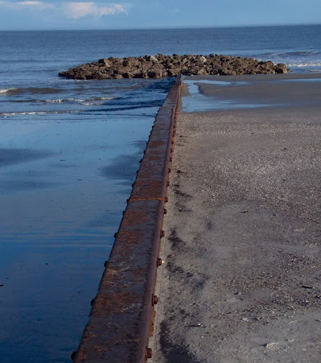
We got a tour and discussion of the beach with Ranger Amanda, marine scientist and educator. Being the quietest time of the year, there was only the 3 of us so we got to ask a lot of questions. Groins were constructed starting in the 60s. Our ranger was unsure of the benefit; what sand builds up on one side washes out from the other. She also told us of the strong currents offshore and we talked of the effects and dangers. Just now I read of a Marine that drowned in September shortly after boot camp graduation.
The one remaining cabin is located by the lighthouse and goes for $210 a night. It's extremely private after the park closes, not so much during the day. The old CCC-built cottages farther south have washed away and we weren't able to go down there to see. While there is an extensive network of narrow one-way roads thru the beach side of the park, the cabin road is closed. We saw maybe a dozen people while we were there; I can't imagine the daily 1000s throughout the summer.
Photos!
This is the bridge onto Hunting Island with a very narrow drawbridge and roadway. We had to stop for a DOT crew picking up trash.

A view from the boardwalk overlooking the marsh on west side of island.
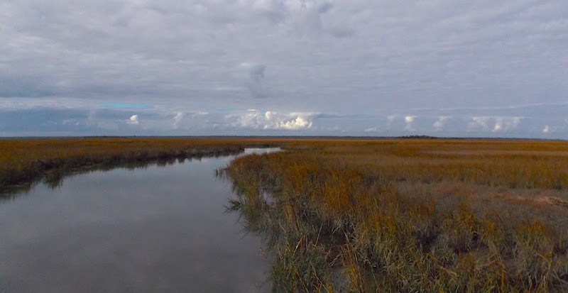
Raccoon tracks thru the mud at low tide.

The Lighthouse - note the small remaining dunes half washed away.
Beach view looking north. I asked about the flatness of the beach and Ranger Amanda said that was caused by the erosion and which led to more rapid erosion.

One of the groins - the drop off on the north side (left) was 4-6 feet.
Farther up the beach from the lighthouse.

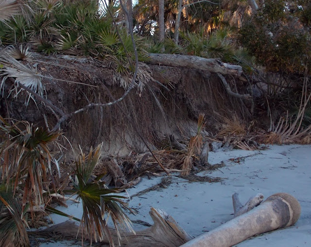
Where the woods used to start. The flatness extends out a ways and then drops off sharply as it nears the continental shelf. Barnacles now populate the submerged trees.
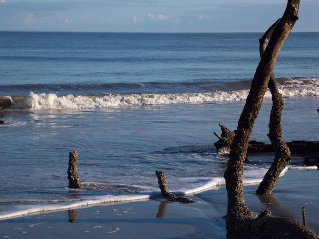
Where the edge of the woods is now. Note the palm in the fore view that has lost its rootball after rolling around in the heavy storm surf and high tide. Palms, palmettos, live oaks, sweet gum and pine dominate the woods.
Tree pushed over with root sticking up.
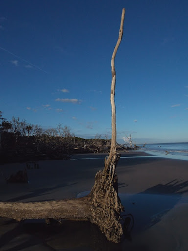
Dead pine - soon to fall.

Ann taking a picture of tree roots. This tree fell back, some fall forward. Some recent falls still had leaves on them.

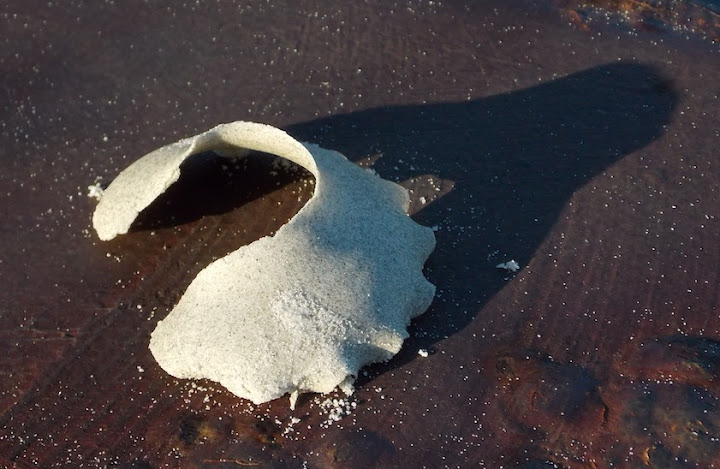
Help me out please. I forget what the ranger called the mollusk that made this but I remember the protective leathery egg cone is made of muscus and sand that will dry out and crumble.
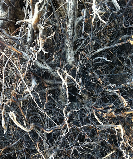
Mess of tree roots.
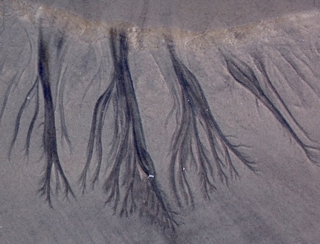
Patterns in the sand. Looks like a puddle washed away the sand but left the underlying silt that filters out of the wood soil. My guess is that the beach sand has darkened considerably as the sea eats more land.
Bonus irony picture - early morning at the Savannah National Wildlife Refuge down by Georgia border. The smoke was from either the pulp mill or sugarcane processors. Just south of those was a huge inland port for container ships at Port Wentworth, Georgia. I'd never seen so many trucks coming and going.

So there's a couple days on our trip along the Georgia/South Carolina coastline. We saw other places that were impacted by storms, historical storms, but the erosion on this barrier island was caused more by prevailing currents. The village of St. Marys on the Georgia/Florida border sure looked like it had major rebuilding after a storm. Every time we saw a new school in some small town along the coast we half-thought that was a benefit from destructive storms. Anyways - thanks for coming by and please leave your observations and reflections of the world around you. And if you have any examples of beaches and erosion, you know where to post them.

