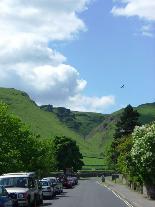
There are many beautiful things to delight the tourist in the Peak District National Park, and the little town of Castleton in the High Peak area contains more than its fair share of them. Here we see a photograph taken on the approach to Winnats Pass, an impressive geological feature located to the west and north of the town. The name of the Pass is thought to be a local corruption of the words 'wind gates'. It is one of the most spectacular limestone formations in Derbyshire. Local legend has it that it is haunted by the ghosts of a young Scots couple - as covered in the Derby News of April, 1788 - or by those of the miners who so horribly murdered of them for the money they carried and their horses.
Late in the Carboniferous Period, the partial melting of the Gwondwana ice-sheet caused this area of Derbyshire and Yorkshire to rise. Consequently, the channel which had been cut through a limestone reef, a feature caused by the growth of huge amounts of coral in the period 280 - 300 million years BCE, was exposed and further eroded. This same elevation of the land caused shallow sea areas to form, which in turn, gave rise to conditions ideal for the laying down of coal measures. Originally, it is thought the Pass had been formed when the roof of a huge undersea cavern had collapsed, when the seas had receeded and the roof was no longer partially supported by the sea water; however, this theory has now been discounted. This reef forms part of the edge of a limestone massif known as the White Peak, and is exposed just before it is overlaid by the nearby heavy gritstones and shales which form the area known as the Dark Peak.
The road through this spectacular feature now forms the principal link between Castleton, the historic Roman spa town of Buxton, Derbyshire (Aquae Arnemetiae) and the great conurbation of Manchester, following the collapse of the A625 Sheffield to Manchester road around the base of the nearby Mam Tor (see previous diary). The Mediaeval road into Castleton, through the Pass, had first been 'metalled' during WW2, to help deal with the increased traffic between the steel town of Sheffield, and the massive industrial complex and inland port of Manchester.
The parking area for the famous Speedwell Cavern, an old lead mine, complete with an underground canal used by the miners, is at the foot of the Pass on the left. From here, the road rises very steeply, twisting and turning, with a gradient of 1 in 5. The top of the Pass is reached at 1,400ft, a rise of 550ft in 1/2 mile!
The rugged walls of the Pass are riddled with caves. The south-facing wall gets a lot of sun, and consequently, the soil cover is relatively thin; these dry conditions allow Wild Thyme (Thymus serpyllum), Fairy Flax (Linum cartarticum) and Bird's-foot Trefoil (Lotus corniculatus) to flourish. On the north-facing wall, the opposite applies. Cool and damp, the soil supports strong colonies of herbs such as Dog's Mercury (Mercuraialis perennis), Red Campion (Silene dioica) and the rare Jacob's Ladder (Polemonium caeruleum). Sure-footed sheep breeds such as the Scottish Blackface crop the vegetation of the Pass with relish.
This steep climb means that 'buses and vehicles over 7.5 tones are banned from Winnats Pass. It is such a steep gradient that the rugged walls of the Pass have looked down on many professional and amateur cycle races over the years. The 'Tour of The Peak' traverses the route each Autumn, and the 'Tour of Britain' used Winnats Pass on several occasions.
This special place is yet another candidate for a lifetime 'bucket list'!
http://peakcavern.co.uk/
http://peoplesmosquito.org.uk
http://shortfinals.wordpress.org

