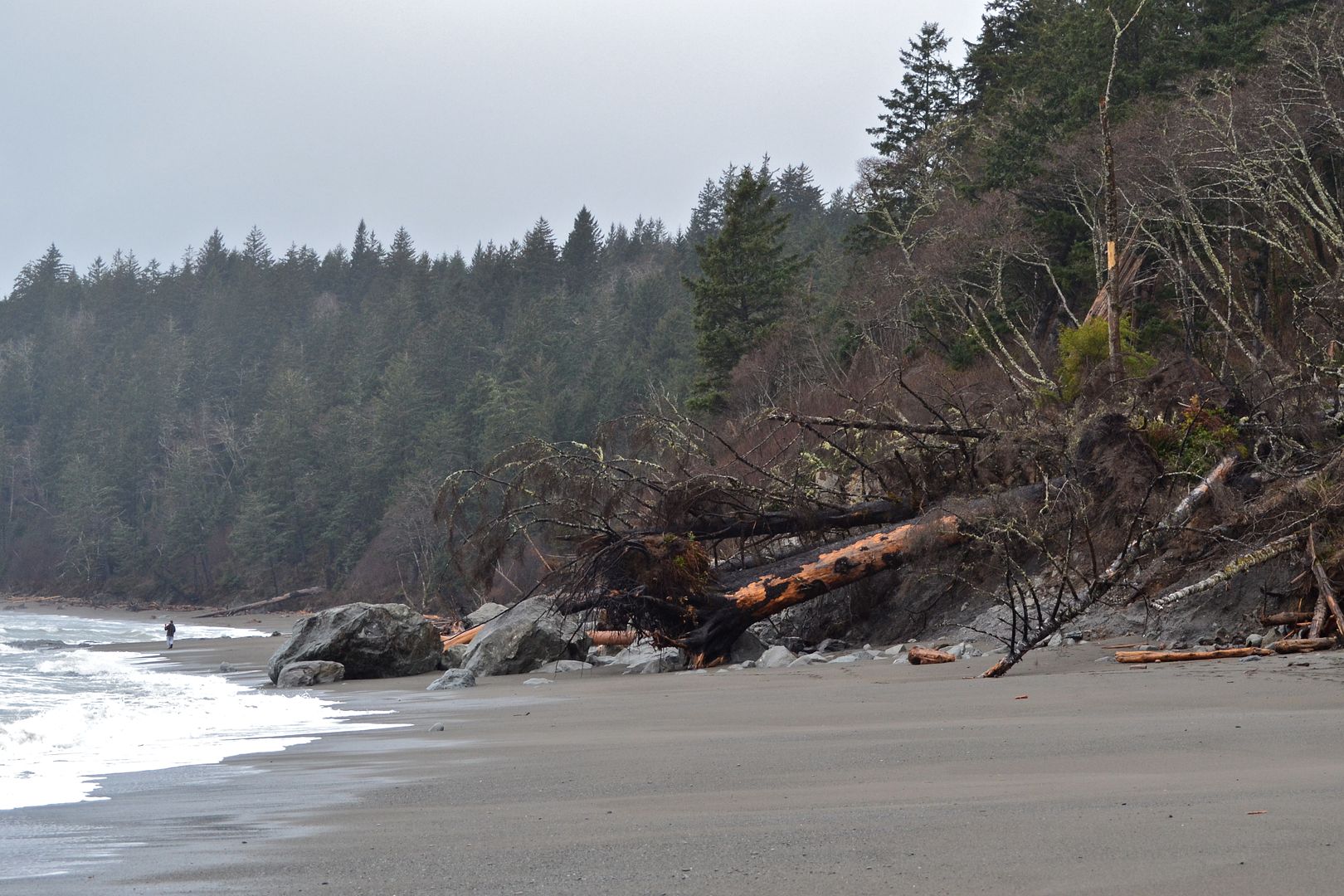
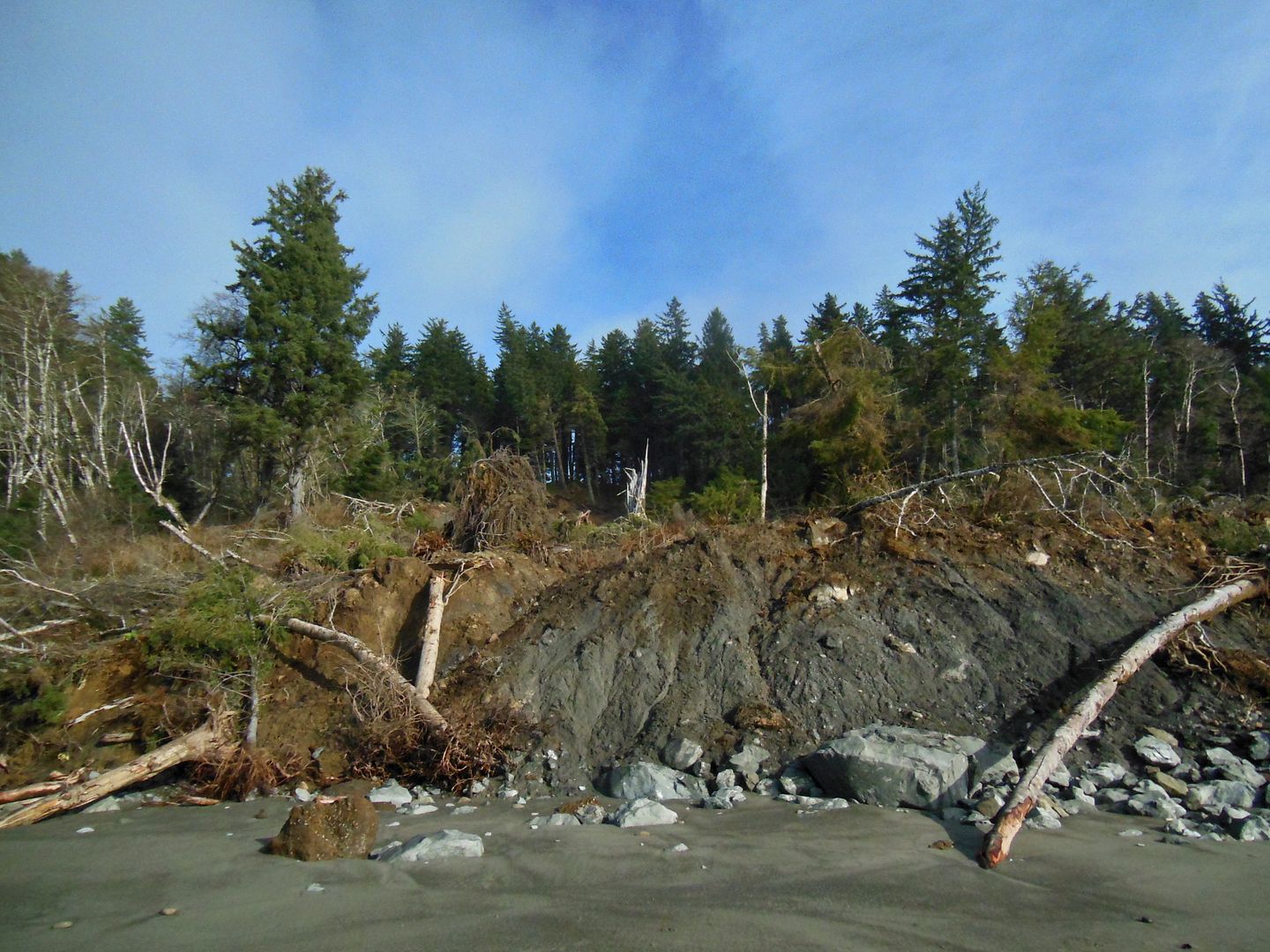
The beaches of the Olympic Peninsula aren’t thrashed only by the force of waves from the ocean. They are also buried under slumping hillsides from above. When I visit the beaches each year I see changes from both directions. This winter I came across a new landslide on Second Beach: a big chunk of hillside is now collapsed onto the beach (see Mr O for scale in the photo above).
Landslides in the wilderness aren’t generally dangerous to people unless you happen to be out there and underneath at that moment. They are horrifically destructive to life and property in developed areas (a kossack many of us birders knew died tragically and too young that way in Alaska last year). In winter especially we hear about houses and roads giving way, usually because of unstable ground saturated by rain, liquefying and pouring downhill. You may know of some in your area. After a slide, heavy machinery cleans it up, clearing away debris so the area, road or railroad tracks can be used again. In the wilderness nature works on landslides instead.
|
The Daily Bucket is a regular feature of the Backyard Science group. It is a place to note any observations you have made of the world around you. Rain, sun, wind...insects, birds, flowers...meteorites, rocks...seasonal changes...all are worthy additions to the bucket. Please let us know what is going on around you in a comment. Include, as close as is comfortable for you, where you are located. Each note is a record that we can refer to in the future as we try to understand the patterns that are quietly unwinding around us.
|
Two years ago I happened upon a big landslide on Third Beach that was just days old, based on its features (I Bucketed about it here). I’ve been going back each year since then to see how this part of the beach has fared, expecting signs of the landslide to wash away. To my surprise, the hillside is still sliding.
Follow me through my documentation to see what I’ve learned about landslides onto a beach like this.
Two years ago the new landslide looked like this: a mass of sediment with rocks at the toe end and a lot of trees pulled down, one big Sitka spruce extending out to the edge of the water at this 3 foot tide.
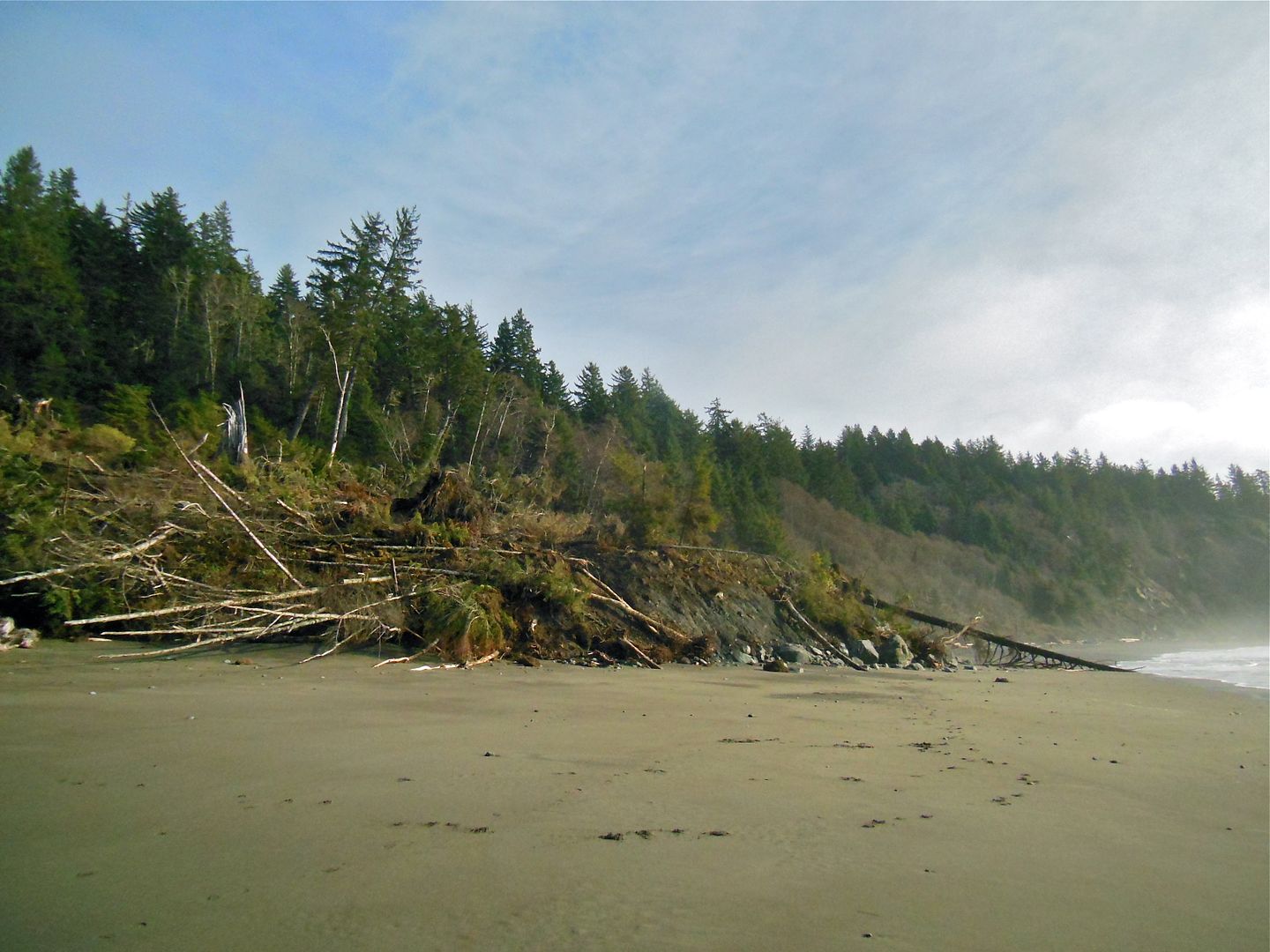 Landslide on 3rd Beach, winter ‘13/’14
Last year it was raining so I didn’t take many photos. But you can see the big boulders appear further out from the hillside. This is partly an illusion: the tide is a foot higher, so the waves are washing up farther. I think it’s safe to assume the giant boulders weren’t washed around once they rolled onto the beach in the slide so we can use them as a marker. The uprooted trees are a different story. Big surf carries trees away. The trees here are all different so the hillside slid again at least once during the year. However the original and later sediment has washed away from behind those boulders revealing more rocks landward.
 Landslide on 3rd Beach, winter ‘14/’15
This year the boulders are in the same position, with different trees draped over them. More hillside sliding down. I can’t be sure since the photos are not taken from exactly the same position but it appears the angle of the sediment slope is about the same in all three years. Angle of repose?
 Landslide on 3rd Beach, winter ‘15/’16
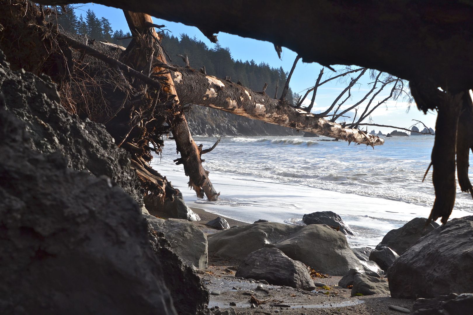
Let’s look at the landslide from the other direction.
Two years ago it’s mostly fresh sediment with boulders peeking out at the end.
 2 years ago: 12/26/13 @ 1pm, tide 3 feet
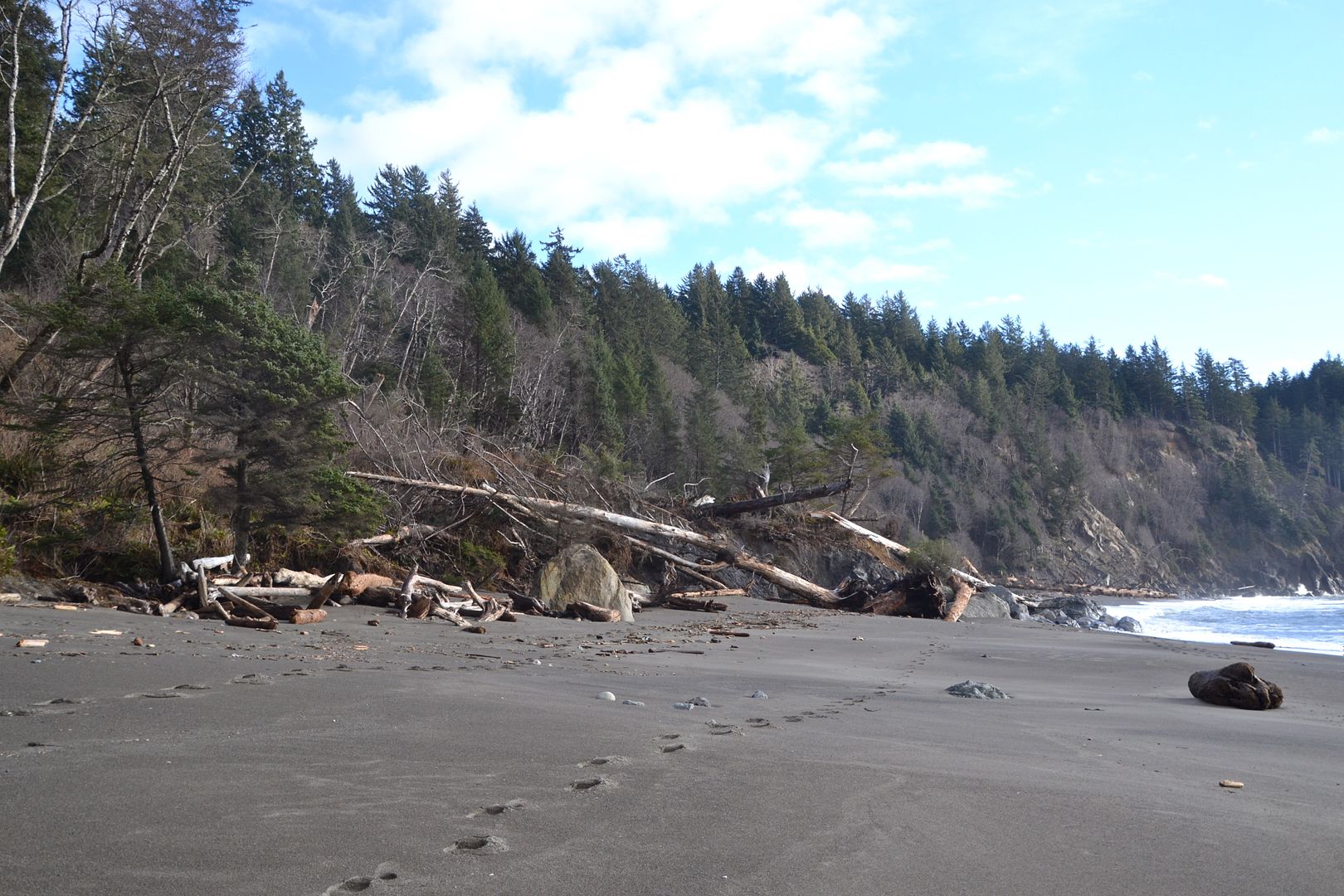
A year ago much of the sediment has washed away behind the boulders. The tide is halfway up; a normal high tide would wash into the dirt pile.
 Last winter: 1/17/15 @ 3pm, tide 4 feet
Note the leafless alders tipped sideways, still embedded in the sediment….they have deeper roots than the conifers and fall over less easily. Trees grow vertically, no matter what the angle of a slope so we know the ground they were growing in has moved recently (a top of a living alder would change direction to grow straight up if it has the time during growing season).
 1/17/15. Closer view.
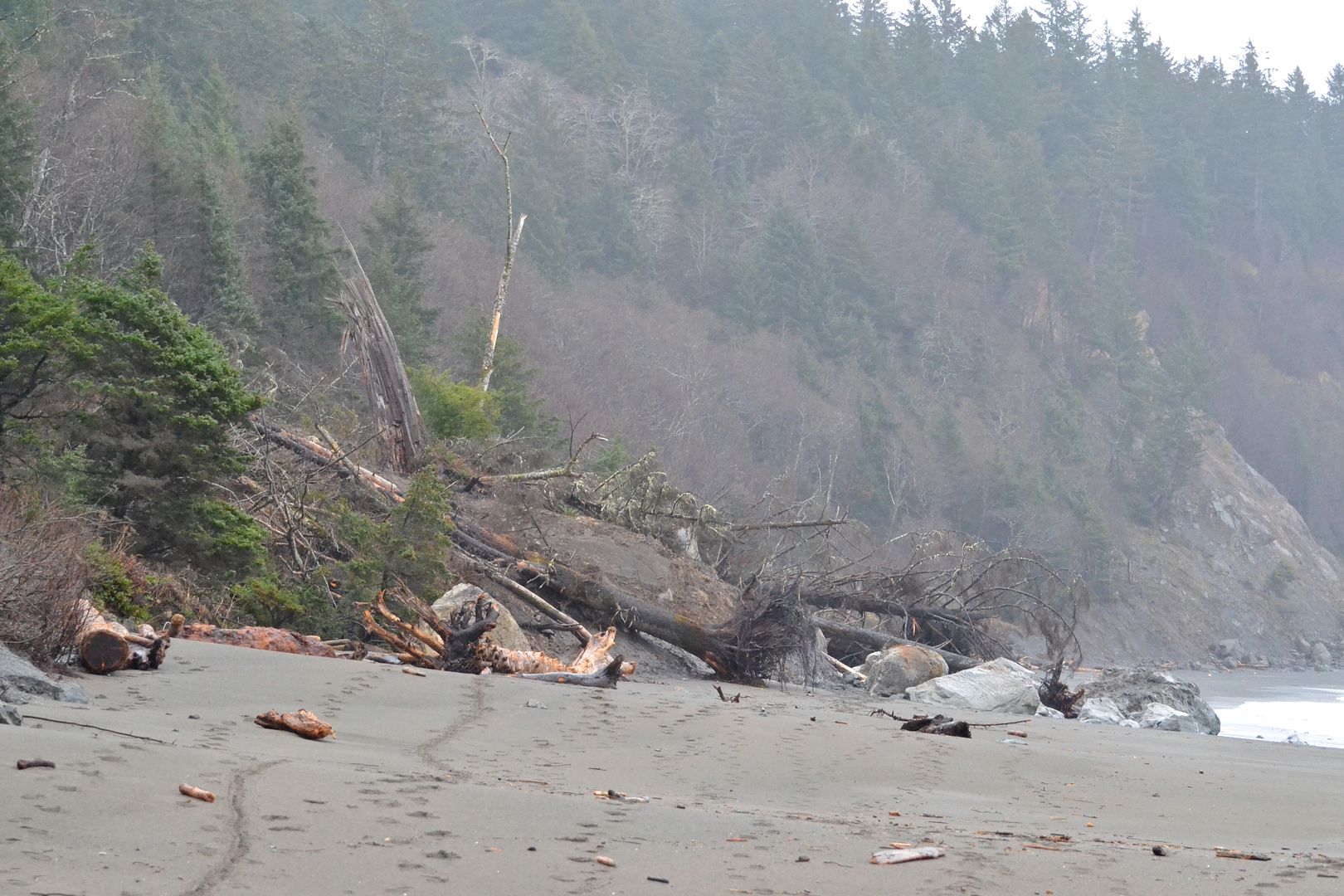
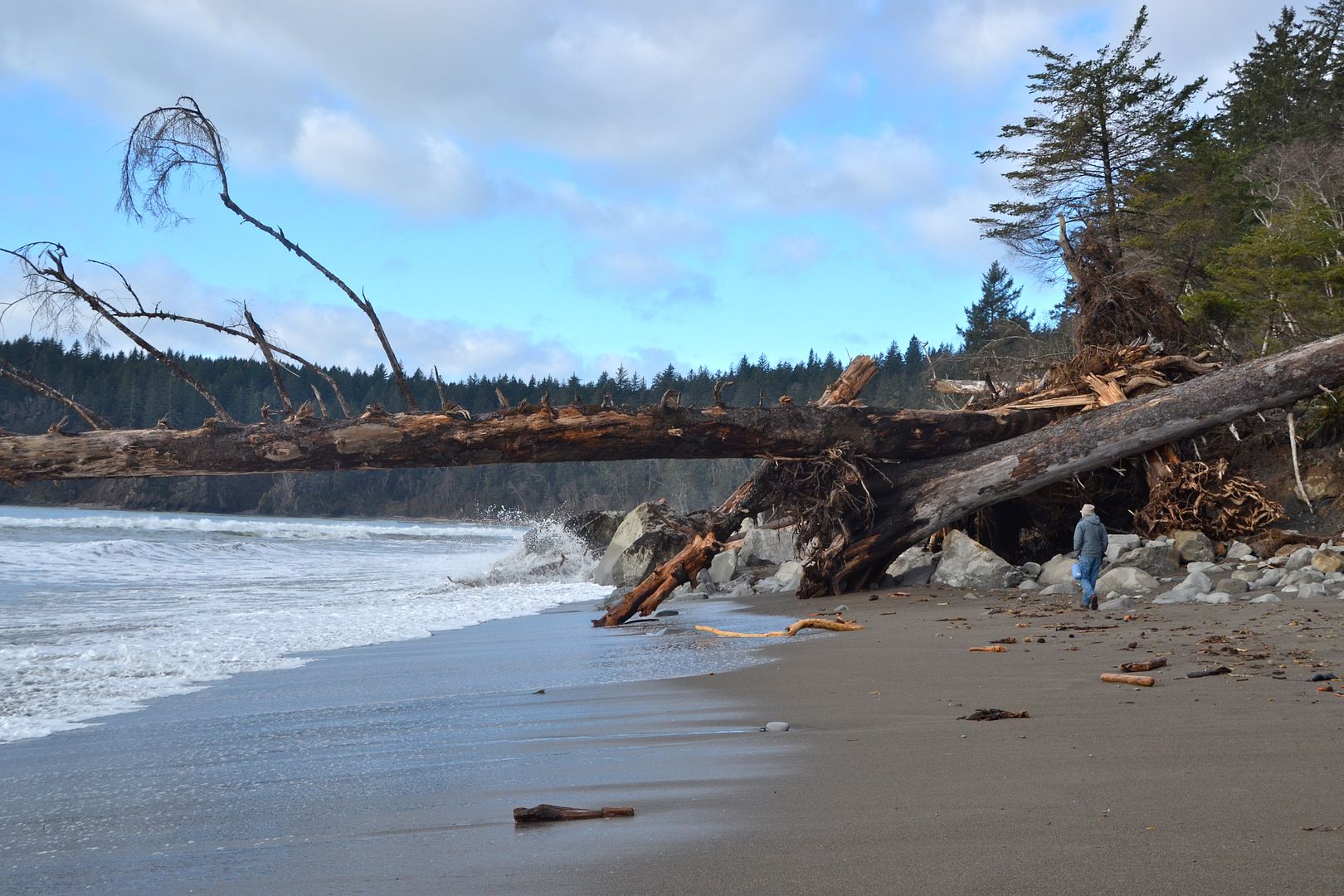
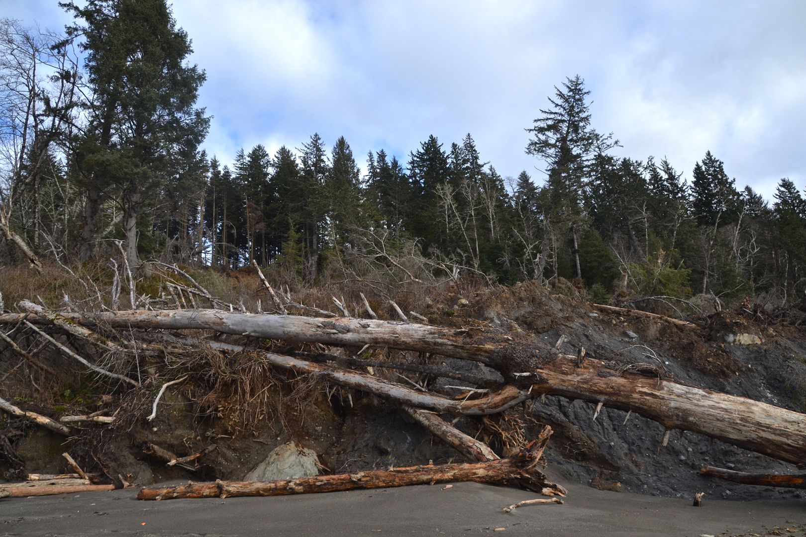
This year more trees have come down the slope and it appears more small boulders are uncovered from the sediment. Or perhaps more have rolled down in the later slides?
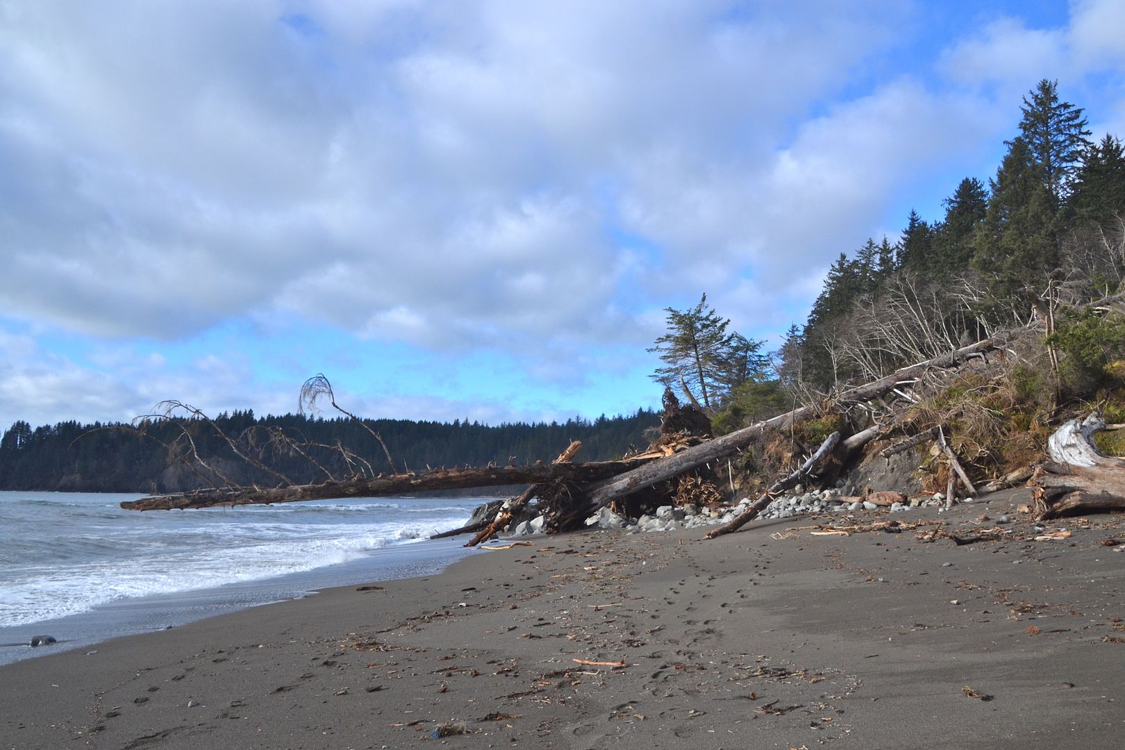 This winter: 12/30/15 @ tide 5 feet
 This winter, closer view. The downed conifers are spruces.
This is fresh rough sediment below the fallen trees, unscoured as yet by waves. Since there was a huge storm a few weeks before our visit with 35 foot waves and extra high tides, I’m thinking this mass has moved down since then.
One more view comparison.
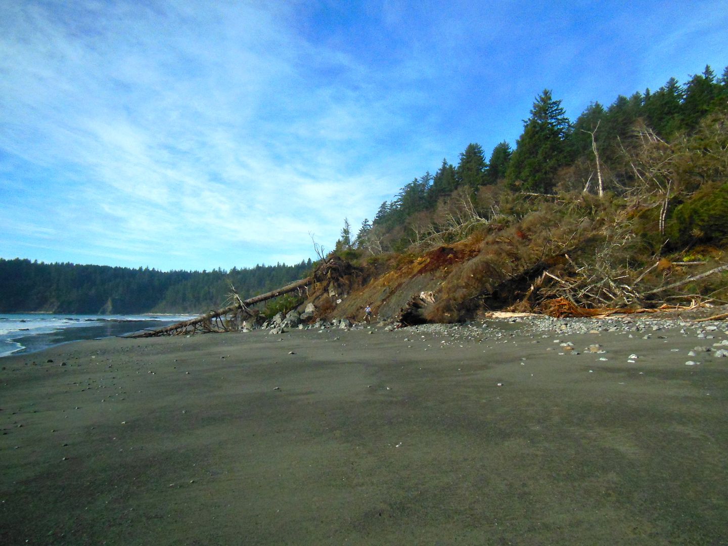
If we look uphill, 2 years ago the top of the slide is not as far up toward the ridge as it is now. Some of the conifers on the slope there are gone now. Interestingly, two tall conifers remain on either side of the slide (the one on the right is tilted right). They’ll be markers next year.
 2 years ago. More light brown topsoil has slid down than in the slides since then.
 This year. Mostly subsoil. Few trees remaining up on the ridge.
My conclusions are that given continuing unstable conditions, the slope will continue to break away, carrying whatever is on or in the ground. The slide action is in winter, most likely because the ground becomes saturated by seasonal rainfall, which is prodigious here in rainforest country. Waves and high tides carry away whatever is loose enough in the pile: sediment and trees. The rocks remain. It doesn’t look like there’s much more hillside here, so next year may not be much different? We shall see. I’ll also be paying attention to the new slide on 2nd beach.
The wide sandy beaches we enjoy so much exist only because the geology landward is so easily eroded. The headlands that extend out into the ocean on each end are composed of much harder rock. The Olympic peninsula is composed entirely of a variety of rock formations that were packed onto the North American continent as the oceanic plate carrying them collided with it just offshore (I should really be using the present tense — this is ongoing). We can think of it as a succession of bands scraped off and pushed up as the oceanic plate dives below the continent. It’s a torturously destructive process, twisting, compressing, and tilting the bands into weird shapes neither vertical nor horizontal (WDNR has a detailed description of the coastline geology here, general description of Olympic peninsula dynamic geology here). Along the coast there’s a general alternation of weak and resistant rock zones, with the weak ones being a mix of rocks (”melange”) overlain by Ice Age unconsolidated sediments...easily infiltrated by water and eroded. It will continue to erode, changing the outline of the coastline over the next centuries, leaving more resistant rock as seastacks off shore. Rising sea levels will hasten that process. Earthquakes and tsunamis as well.
In populated areas like the Puget Sound basin where Ice Age glaciers deposited huge quantities of unconsolidated sediment, landslides are a serious risk to life and property, especially during the winter wet season. Improper land use exacerbates landslide risk as the Oso slide showed. If you’re curious about coastal stability in western Washington, here’s a good site with keyed maps showing where the risks are.
Have you ever seen any landslides? or other catastrophic ground movement?
oooOOOooo
As alway, all nature observations are welcome in the comments below. Tell us what you’re seeing in your own natural neighborhood.
| "SPOTLIGHT ON GREEN NEWS & VIEWS" IS POSTED EVERY SATURDAY AT 5:00 PM PACIFIC TIME AND WEDNESDAY AT 3:30 ON THE DAILY KOS FRONT PAGE. IT'S A GREAT WAY TO CATCH UP ON DIARIES YOU MIGHT HAVE MISSED. BE SURE TO RECOMMEND AND COMMENT IN THE DIARY. |

