The wildfire currently raging in Alberta, causing the evacuation of 90,000 people from Fort McMurray, was recently reported to cover 161,000 hectares (1,610 km2). To put this in context of historical wildfires in Alberta, the map above was made from the database provided by Alberta Agriculture and Forestry:
Spatial Wildfire Data
That database contains perimeter information for 25,738 wildfires in the province from 1931-2015, with areas ranging from very small fires to a massive fire covering over a million hectares in 1950 (at the left of the map above). The latter is known as the Chinchaga fire, the largest North American wildfire on record.
Just looking at the wildfires with areas greater than 50,000 ha, with the year of the fires annotated, gives this map:
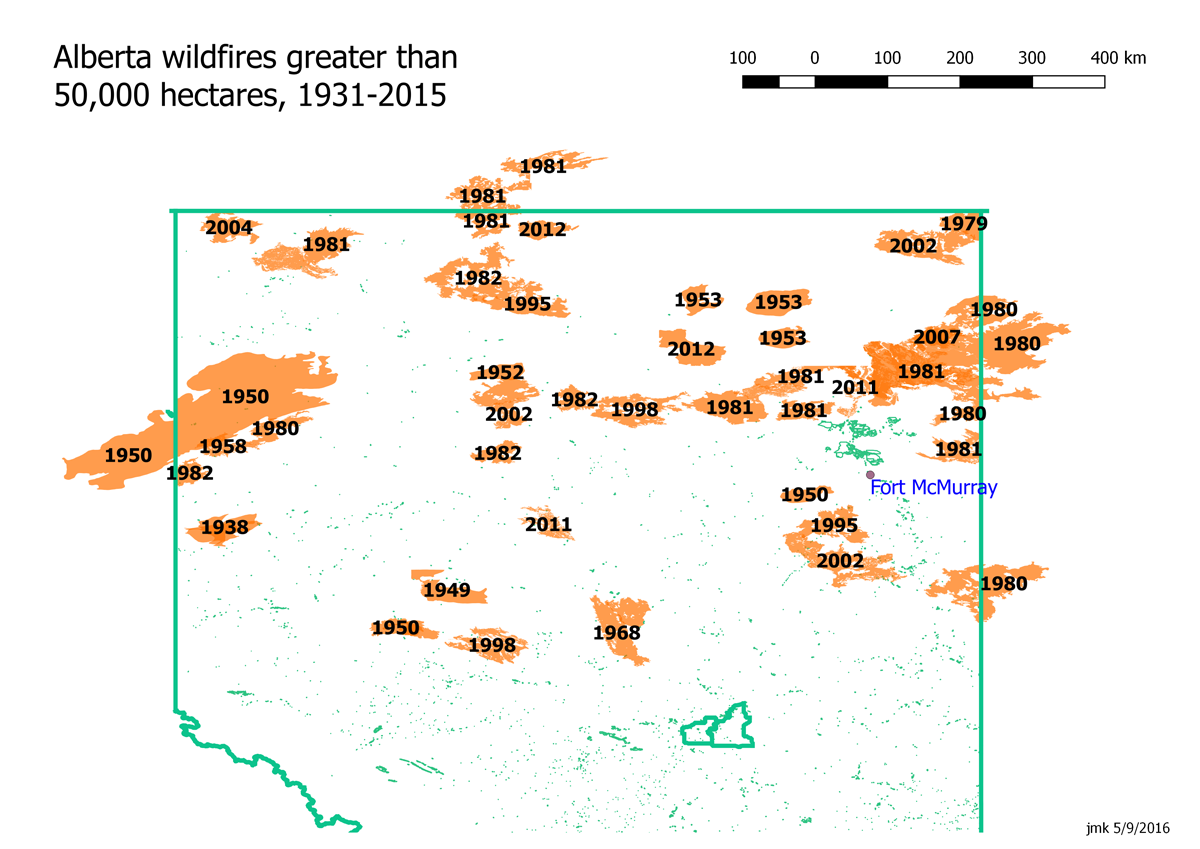
So while several large fires have been relatively near Fort McMurray over that time period, there were none that involved the town itself.
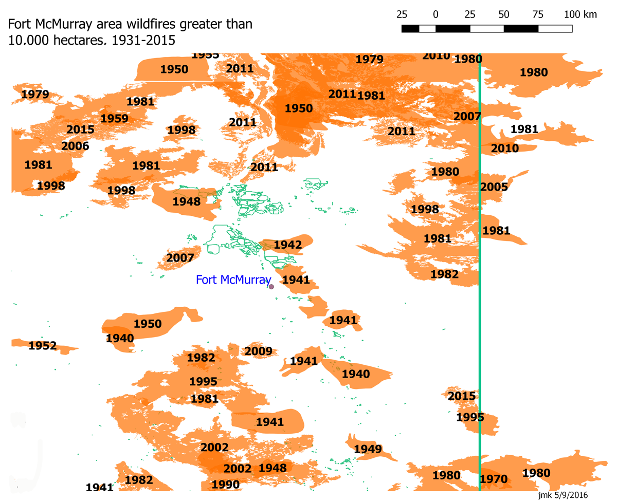
A closer view of the Fort McMurray area, with fires greater than 10,000 ha annotated:
A bar chart over time shows the sporadic nature of the wildfires:
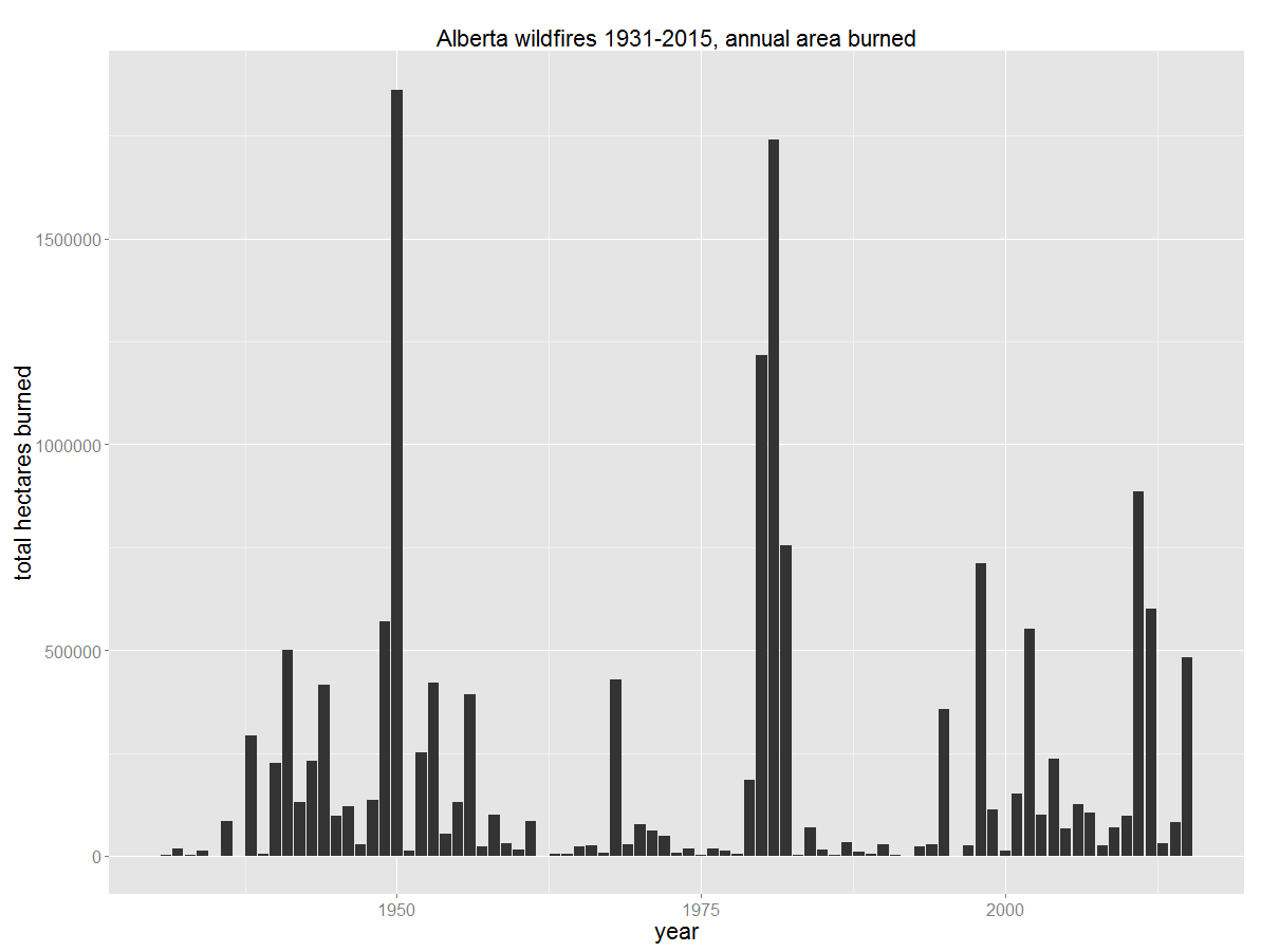
Clearly, wildfires are a recurring danger in the region. Neighboring Saskatchewan boasts this hockey team:


