Yesterday, I went to Valley of the Gods in Bears Ears National Monument, located in Southeastern Utah. It is located in San Juan County, UT—I posted a diary about the area around Bluff, Utah two weeks ago. Valley of the Gods is located a bit further west than the area that diary focused on, though still (just less than) 20 miles from Bluff. Valley of the Gods, or ‘VotG’ going forward, has been a named destination for many years. However, prior to being protected by inclusion in the newly established Bears Ears National Monument—it was completely unprotected by any Federal designation. Thankfully, by being included in Bears Ears this gorgeous valley is now protected from development. Fwiw, there are no gas wells in VotG, although the entire area around it that is not within Bears Ears is chocked full of gas and/or oil extraction wells. And to be clear, when an area is designated a National Monument, all current leases, be they acreage for cattle grazing or mining/extraction operations—remain. What becoming a National Monument means is that no further leases will be issued (among other things), not that any current lease is cancelled. This is an important point, as often the hue & cry about federal designations contain some measure of ‘But what about all the untapped resources?’. This is misleading, as there have been leases granted for decades here, so if any extraction company was interested, they had decades to purchase an extraction permit & lease land to do it on. That window has closed, but not without years to pursue the ‘resources’ previously.
It is also misleading in another fashion as well. I saw a quote from a Native American Tribal Leader who was discussing Bears Ears that sums it up well—and I sincerely apologize for not knowing the original speaker’s name:
“The Earth is not a resource, it is THE source”
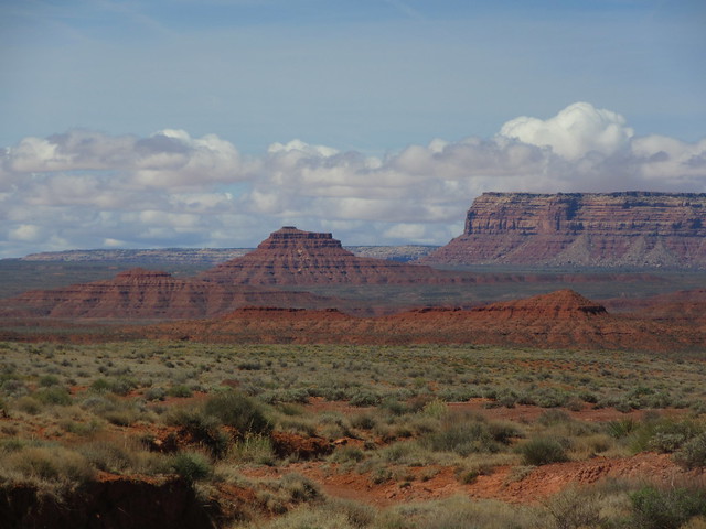
I promised many photos, so let’s get started. First a map of Utah. Bears Ears is in southeast Utah-it, in places along its southern border, defines the northern border of the Navajo Nation. Bears Ears is a vast, 1.3 million acre swath that roughly sits between the Colorado River, the San Juan River, and the towns of Bluff, Blanding, Monticello, and Moab.
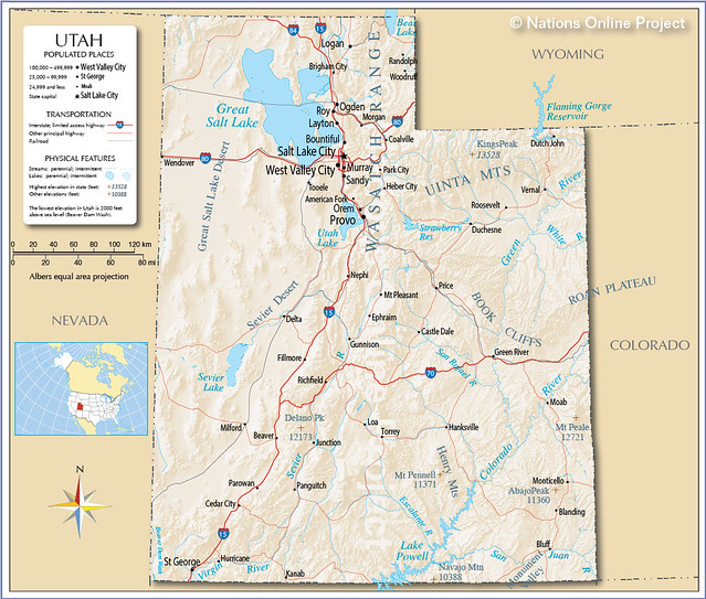 The Beehive State
VotG is closest to the ‘outpost’ of Mexican Hat, Utah—a place so small is isn’t on that map. Mexican Hat is named for a sombrero-like, balanced-rock formation, and has a population of ...31. It is ~150 miles from my hut near Durango, CO, perfect for a quick day’s adventure although a lifetime could be spent exploring nearby. I wanted to get a early start so I prepped the evening before, including checking the weather several times. This is crucial for traveling dirt roads in the desert, especially in the Spring, as the roads become impassible when wet. Not treacherous, impassible. No precipitation was forecast. I awoke during the night to discover it was drizzling. ?? Eh, well, I went back to sleep but when I awoke, the ground around my hut was moist at most, so...still good to go. When leaving Durango towards the west, one goes over the La Plata Mountains, and although it is not labeled a “Pass” it is nonetheless a higher elevation than town. And much to my dismay, here is what I found—
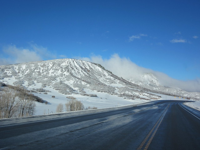 Oh no
Oh no
 Usually a cause for joy, snow is. Not today, I want dry today.
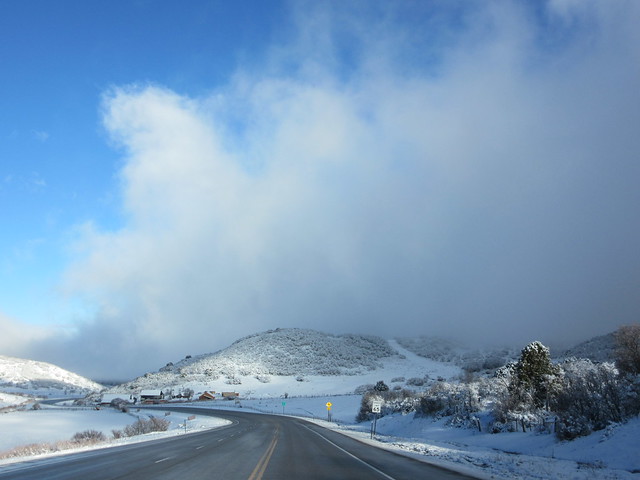
Luckily as I drove west, the drier it got. Mostly. The roads were slightly damp, and the dirt/mud alongside looked quite damp. As I approached VotG, the sun & time had dried things considerably.
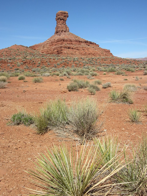
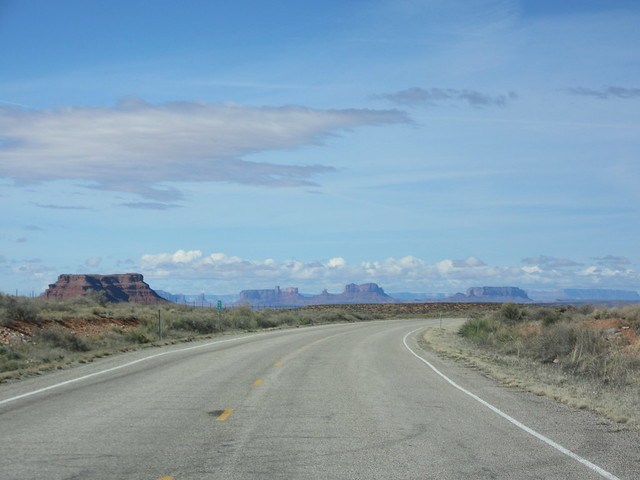 Oh hey—rocks & stuff!
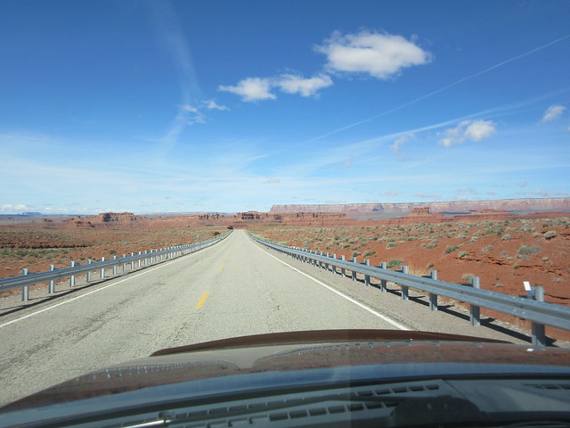 Unusual—guard rails. We’ll want those later (but there won’t be any...)
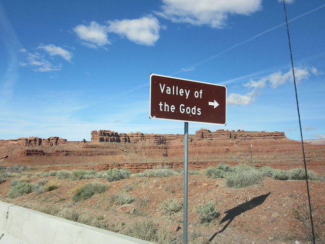
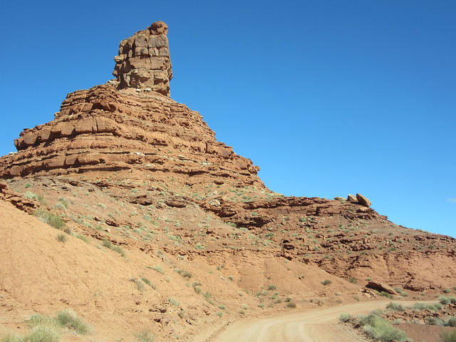
When approaching a commercial venture in some town or another, there are often many signs for many miles advertising said venture. No so with VotG—here is the only sign. Don’t miss it, because there is no ‘Grand Entrance’, no friendly Park Ranger in a booth, only this sign.
 Yay! Made it!
I stopped as soon as I turned off State Hwy 163, so as to show you the entrance:
 It’s free because you own this! And yes, there is a tiny sign just past the cattle guard. It says, in effect, “Don’t be a moron, you’re out in the middle of nowhere”...
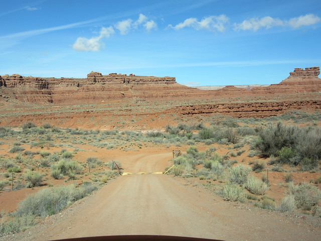
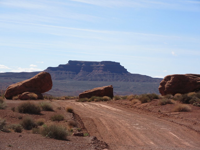
You can’t quite see it, but only ~150 yards from this spot there is a wash ahead. A wet wash or dry wash? The difference will make or break our day. Please be dry.
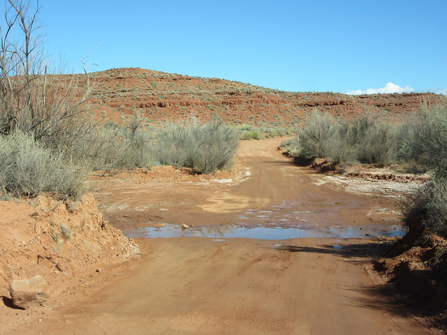 D’oh!
D’oh!
A wash in desert is nothing to fool with—they are straight up dangerous! Without warning, they can become a raging torrent within seconds. The storm may not even have passed overhead & maybe it didn’t rain on you, but 10 miles away it rained...and here comes the water down the wash! You won’t hear it, not until it is way too late. It can be deep enough to wash you & your entire campsite waaay down-wash. Bad. No camping in washes, derp, and check before you even drive through! I stopped the truck to check it out, wanting to investigate the bottom for solidness & not deep, wet, soft sand. It may not look like much—but upon seeing a wash for the first time, one that is wet? You better check it out because you’ll wait for someone else to pull you out should you get stuck. And it won’t be AAA, since there is no cell phone coverage here. I do carry—at all times, all year round, a tow strap. Gotta have one. I’ve pulled a dozen folks out of the snow with it, luckily or wisely never needing for my own self.
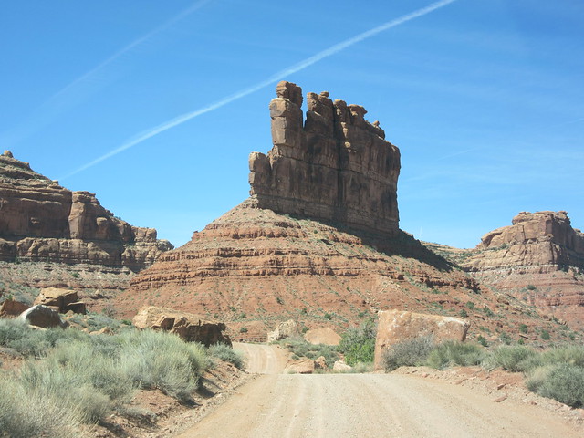
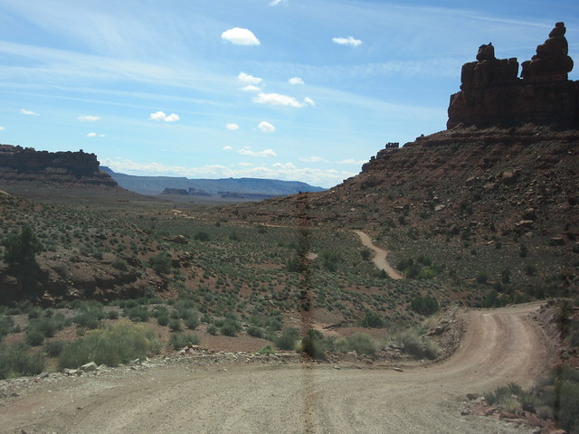
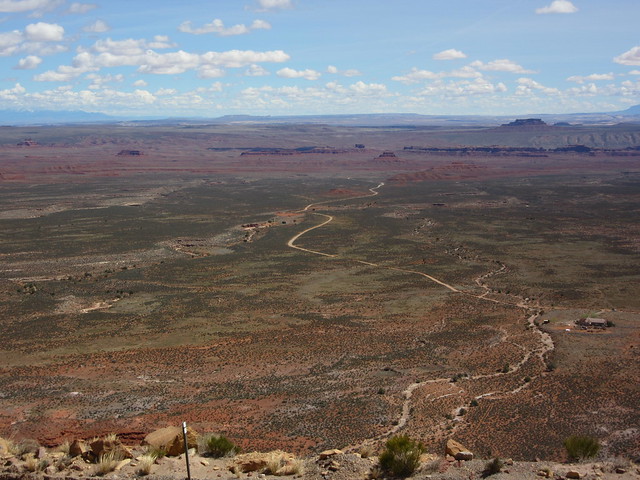
Valley of the Gods is accessed by a 17 mile drive on a dirt road. As you can see below, it is not quite a loop.
 map credit: BluffUtah.org—a very worthwhile website
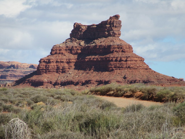
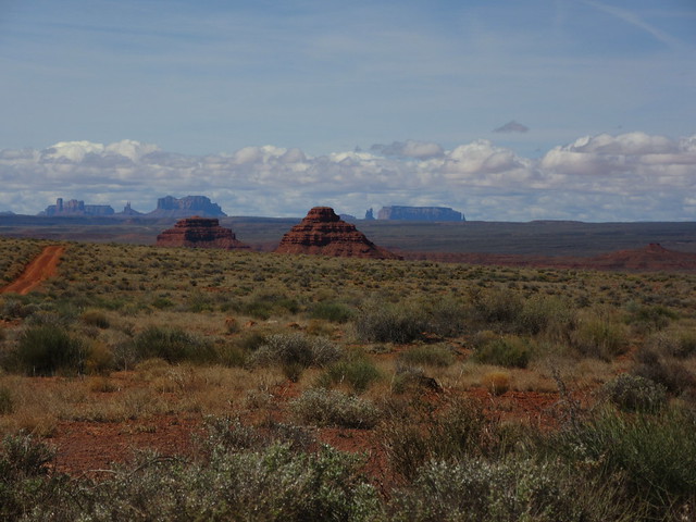
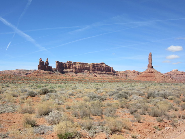
One drives along across the desert floor, and gazes slack-jawed up at the abrupt sandstone formations—buttes, monoliths, mesas, towers, mushroom rocks and sweeping desert views. It is similar to Monument Valley in that way—but it is less famous & a much smaller area and thus far less used. I saw perhaps 20 vehicles in VotG all day! I did see maybe 7-10 RV-type campers though, and except navigating the washes with a trailer—it is an awesomely gorgeous place to camp. Incredible, incredible views with few if any other people after dusk!
 Whoa—that was quick! This is within the first mile...
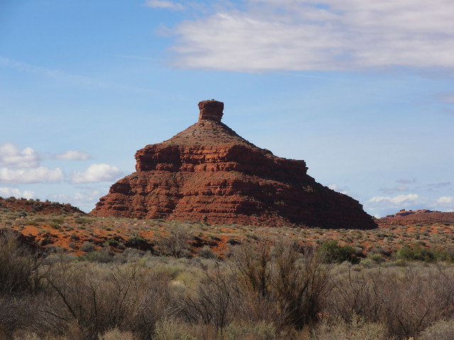
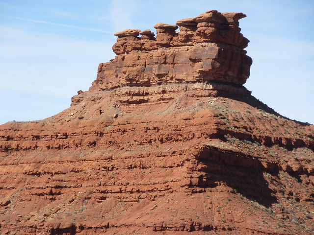
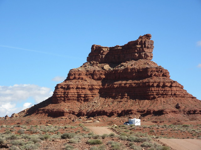
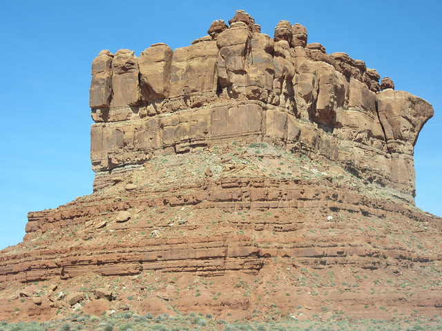
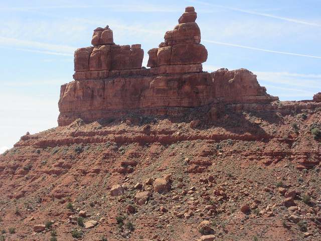
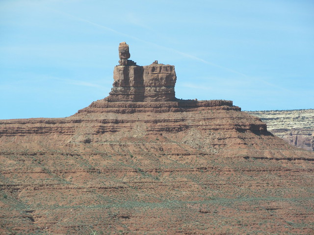
The first named butte you come to is Seven Sailors Butte. But these names are only ‘what they’re known as’, not any official name. Call them as you see ‘em!
 Seven Sailors Butte. I even see the boat, man.
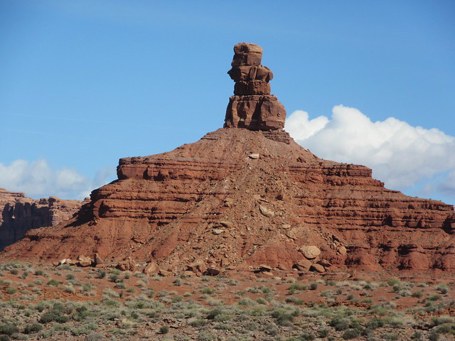
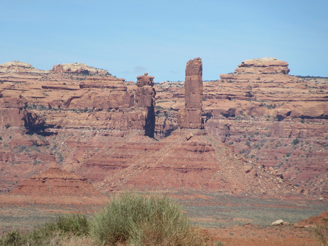
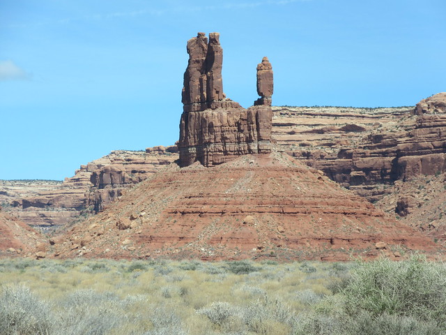
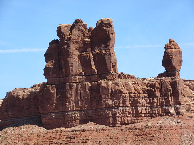
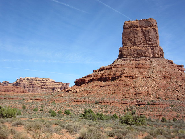
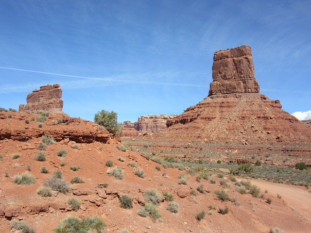
Barely past Seven Sailors, two prominent features come into view-a monolith and a tower:
 Rooster Butte on L, Setting Hen (aka Hen Setting on a Basket) on R
The drive gets you closer as you wend your way along the road…wait—look back, it Seven Sailors again!
Turn your head back again--
 The Rooster & Hen
Annnd back again!
 Zoomed in on those handsome Sailors
 Getting closer to the Hen
 And the Rooster
Oh—it’s pretty no matter which direction one looks!
 ooohhhh
I pulled over to let a camper/RV pass. The road is wide enough for two small cars to pass—not a truck & a RV. The ~30’ camper gives scale to the Setting Hen:
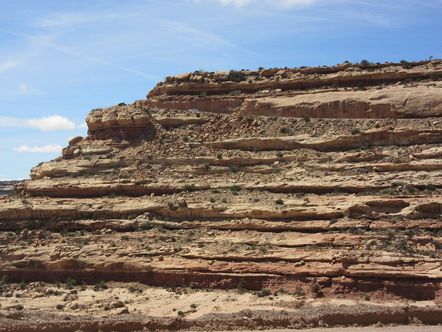
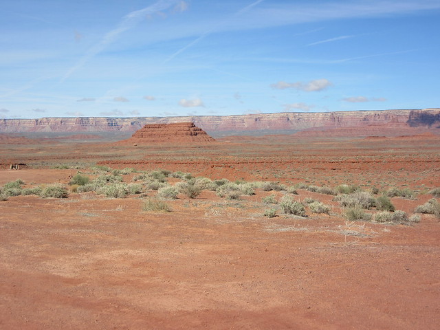 Desert floor, abrupt mesa to the west—Cedar Mesa
 Ever-changing colors through-out the day
 Bigger than my truck. I wonder if they made a sound when the fell off The Rooster...
 Sage, rabbit brush, the ubiquitous yucca, and the Rooster
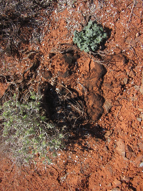 Cyanobacteria & lichens covered in red dust—between the 2 green plants. This is proto-soil, and I usually see it on a rock surface. I was surprised to see it on the sandy red desert floor, but then, I’m no geologist...
I decided to take a walk around The Rooster & Setting Hen. The is a small ridge that connects the two:
 Rooster Butte
 and The Setting Hen
And then looking perpendicular to the two formations:
 Wow—this is why I came here!
 Ooooooooh
Driving on…
 Seven Sailors again--notice white speck, left of center. That’s a camper with a view!
But really, if you want to see camping done right:
 yer doin it right!
 Wait—2 pics previous the Sailors were red! Ah, the sun moved just enough to change the color.
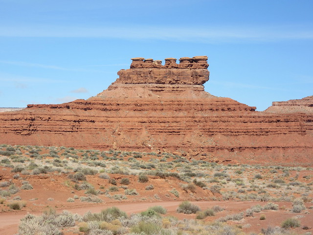
Soon enough, my mind was well into ‘The Land Time Forgot’, hence, I forgot to note which buttes these were. Franklin & Battleship? I dunno. Guess along with me!
 Naming rights: apparently, free
 The top of some butte or another. I apologize. Nice though...
 There’s one I know—‘Lady in the Bathtub’ on the right
 See...she’s in a tub. Her head is on the right, her upended legs are to the left. That’s my story and I’m sticking to it.
 oh my
oh my
 Hmm. Less Lady-like up close
 Battleship Butte? Franklin?
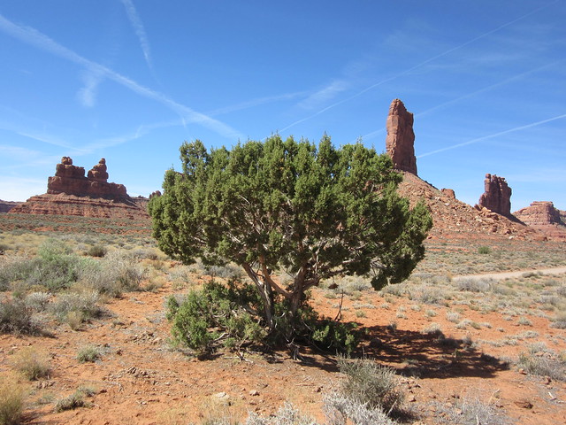 Not so many trees in the desert. This is a cedar (actually a juniper, but don’t tell the locals) that is 100’s & 100’s of years old. Things grow s l o w l y in the desert.
Usually, trees look like this. This tree is probably an order of magnitude older:
 An old timer
See the formation in the distance in the first photo of the cedar? Pretty big. Let’s see how wide that knife edge is:
 Wider than your house
Continuing along…
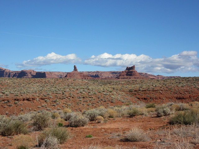
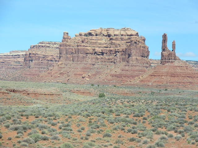
 Could be Castle Butte on the right...and a fair representational view of the second half of the drive.
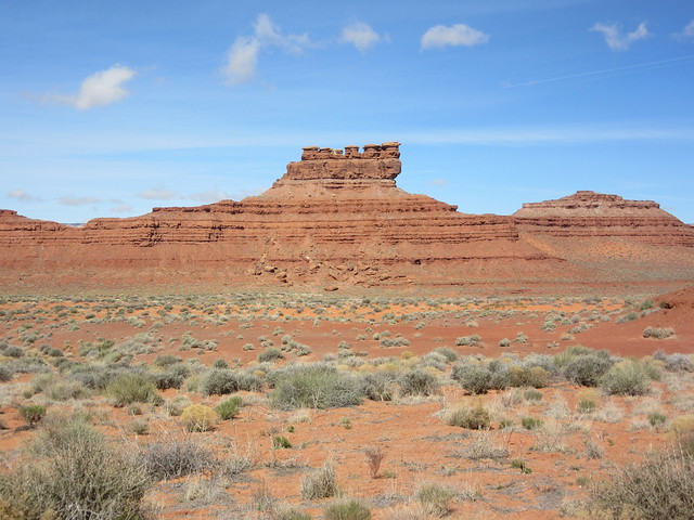
Or...maybe this is Castle Butte. If you look a little left of center, you maybe, might, possibly see a white van. Notice the second butte to the left—the van is right in front of it. :D
 Yes, there’s a white van in this picture
Here, let me zoom in. Way in.
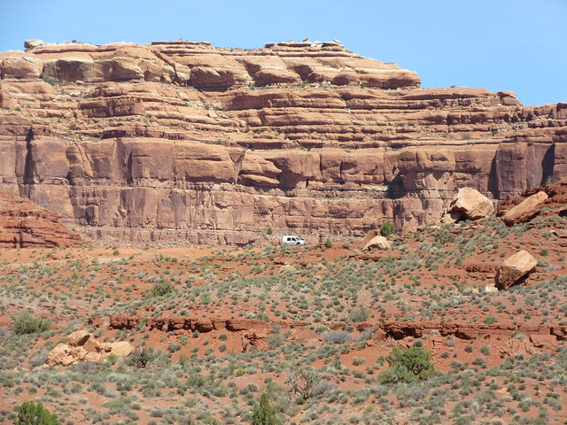 Puts the scale into perspective
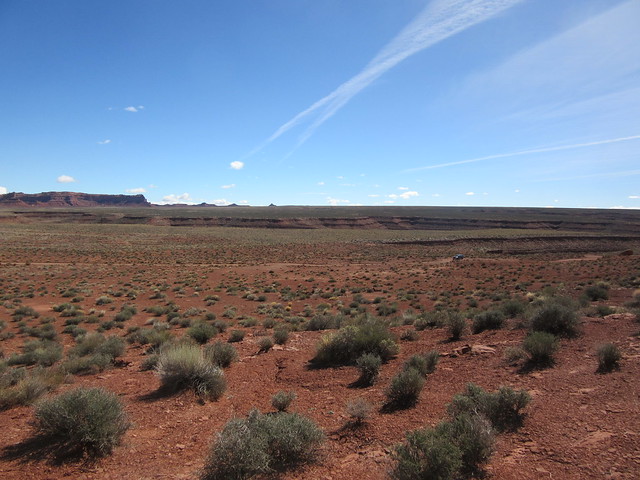
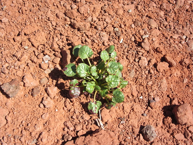
It really is Spring in the desert at 4000’...maybe not the height of Spring just yet, but soon. Maybe 2-3 more weeks—then it starts getting HOT. The desert is fairly green, as you can see. You can also see that “green” is relative. Part of the beauty of places such as this is that...while impressive when looked at from a distance, one must get closer to see Spring. Let’s look at Spring, shall we?
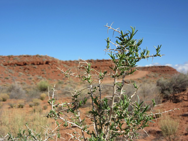 Leafing out. Most but not all desert plants have some protection from grazers. As you might guess, these leaves would be painful to get to...
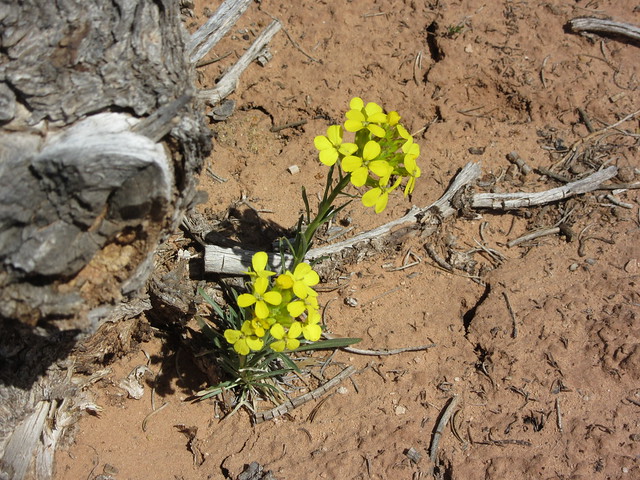
Desert Wildflowers!
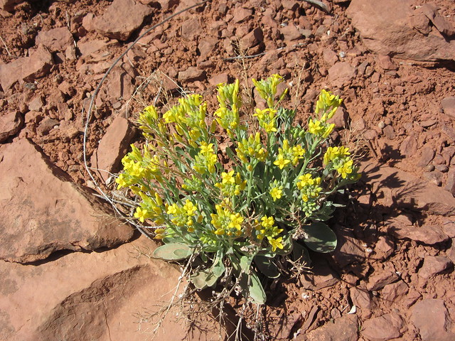
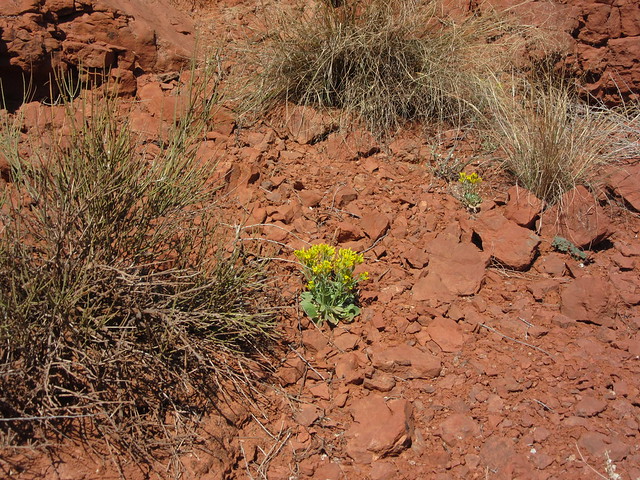 So small! Not bad for growing in sandstone though.
 Everything is greening up!
Even succulents!
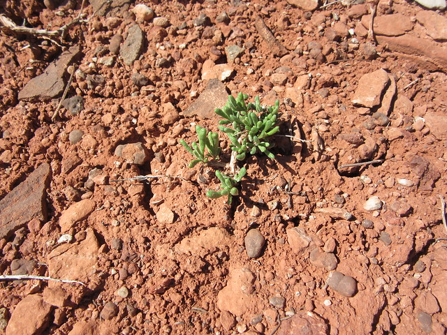 Behold zee leeetle babee succulent
 The desert is green, yes?
 I think I had a salad at that new hipster restaurant that had some of this in it. (definitely not true)
 From 50’ away, this looks dead. From 3 feet away, well...
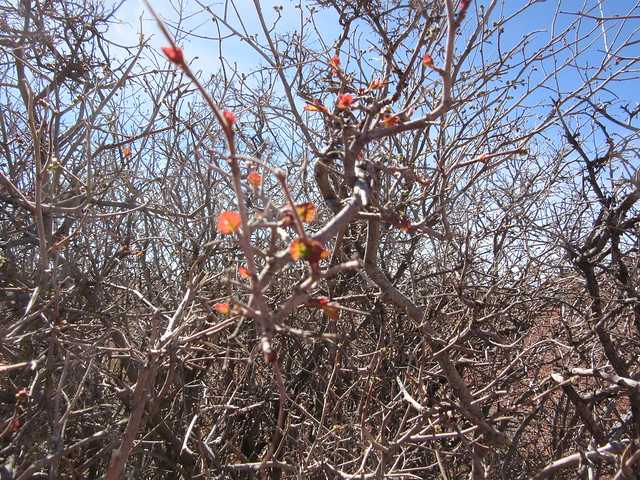
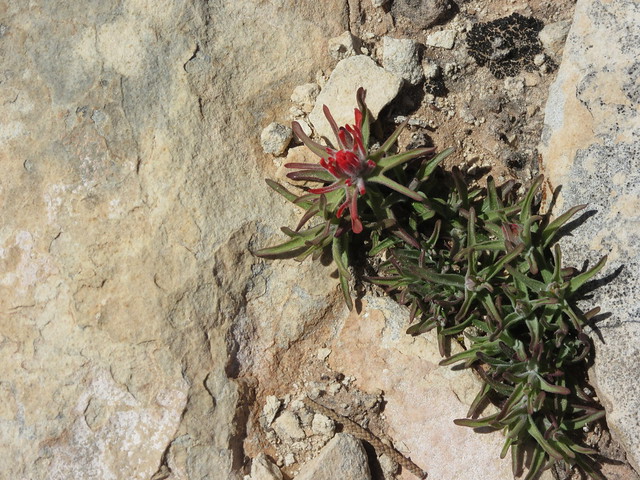
Holey smokes, Fella—who knew there were so many flowers in the desert? Well, you do now. Even the Indian Paintbrush has begun to bloom.
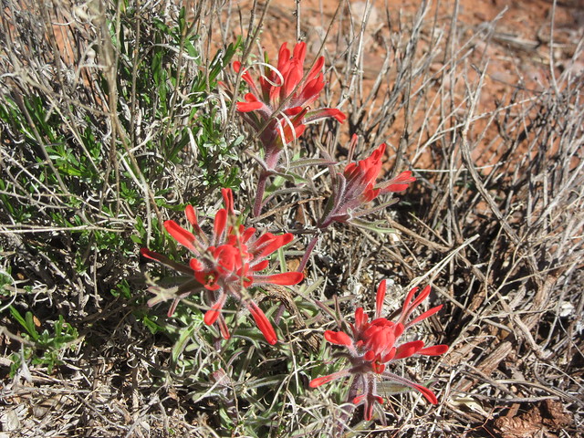 Indian Paintbrush is very common across the Southwest. It’s blooms last for months, even in the desert sun, although the red leaves/blooms do fold inward when very cold at night….or very hot during the mid-day.
One can’t very well have a photo diary of the desert without a cactus pic, right?
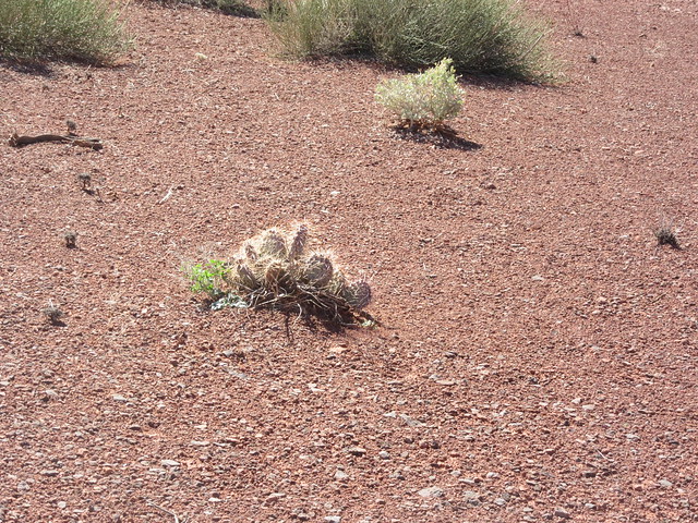 Right!
Close by, it is lush by desert standards:
 A very old cedar snuggling with lushness...
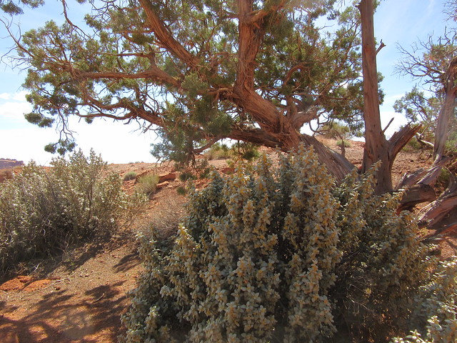
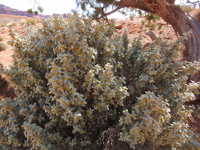 No idea what this plant is, but it looks so plush I wanted to touch it. But touching things in the desert is a bad idea. They can poke, sting, or itch like a mofo later.
My trusty hiking buddies—OF COURSE they came along! We’re a pack, we do everything we can together—especially if it involves hiking or truck rides!
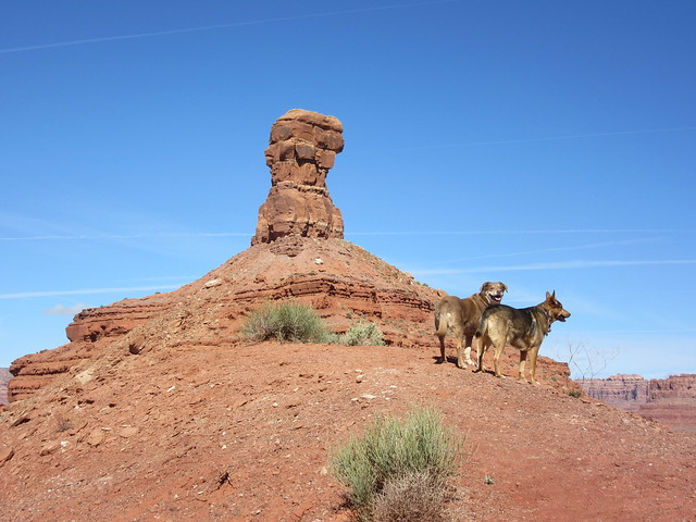 Fletcher, left & lil Chris on the right
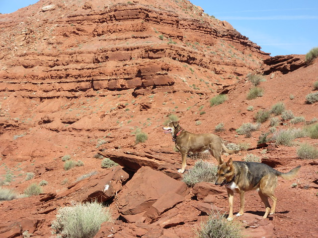 Fletch lookin regal, lil Chris couldn’t stay posed one second longer..
 My boy, just happy to be here
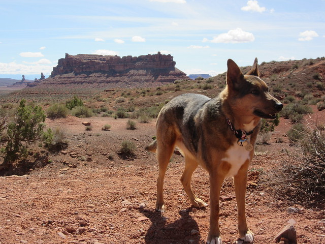 Aww lil Chrissy! Lookin cute, girl!
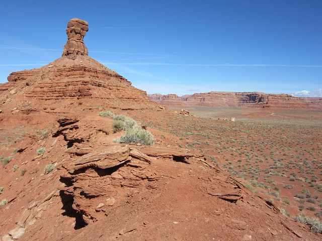
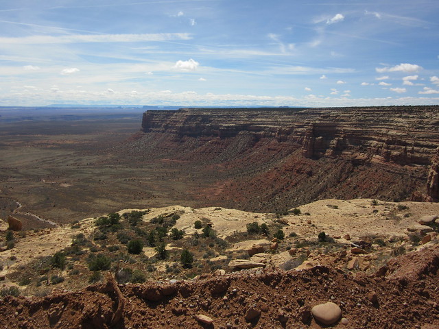
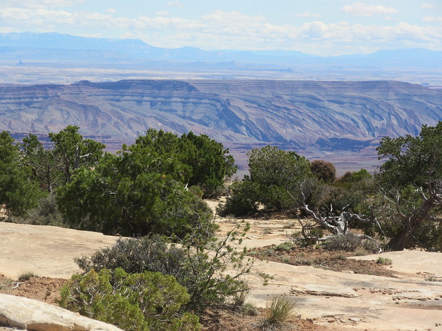
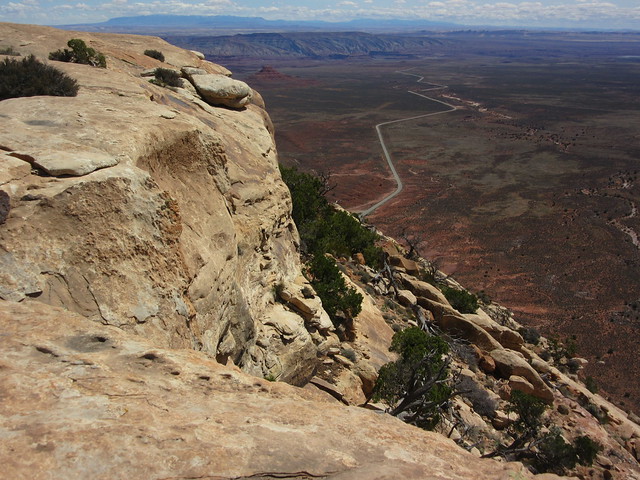
BONUS! As I neared the north end of the drive, I decided to go up the Moki Dugway. A wise choice. Moki Dugway is on County Road 261, and it is how one climbs up Cedar Ridge in a vehicle. Honestly—it was as cool as VotG, although perhaps not as ...natural. Built in 1958 (by Texas Zinc, a mining company, to transport uranium ore from the "Happy Jack" mine in Fry Canyon to the processing mill in Mexican Hat. See? They’ve been extracting stuff here for a long time.) it climbs nearly 1500 feet up Cedar Ridge in only 3 miles, hugging the mesa face. Moki is believed to be a bastardization of the word “moqui”, what the Spanish explorers back in the 1500’s called the Native Puebloans they came across. And a “dugway” is simply how they refer to what has been dug away from the cliff or mesa face—a dugway. Go figure. So...not only is the dugway an impressive sight in it’s own right—but, MAN—the views from towards the top are incredible. At the top of the dugway, there is a road to Muley Point—an area with truly eye-popping, jaw-dropping views AND many, many Native American petroglyphs. The road in is about 12 miles—one way, too far to allow the time needed to explore something so picture-worthy and historically significant. Next time: Muley Point. But this time, let’s check out the Moki Dugway!
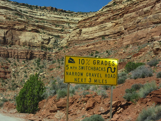 Not kidding—that looks...UP! ...5 mph!
 Yes, it’s dirt. No, there are no guard rails. Yes, there are hellacious switchbacks.
Oh! Look at...why...YOU GO GIRL!
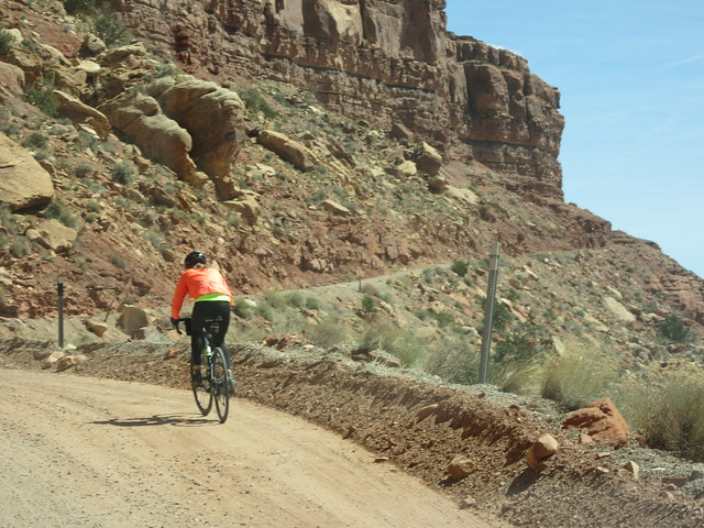 GO! GO! GO! ::: shakes cowbell :::
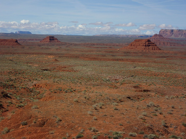
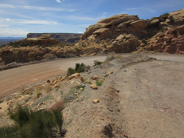
The view gets better and better as you climb. Seriously—
And to the east…
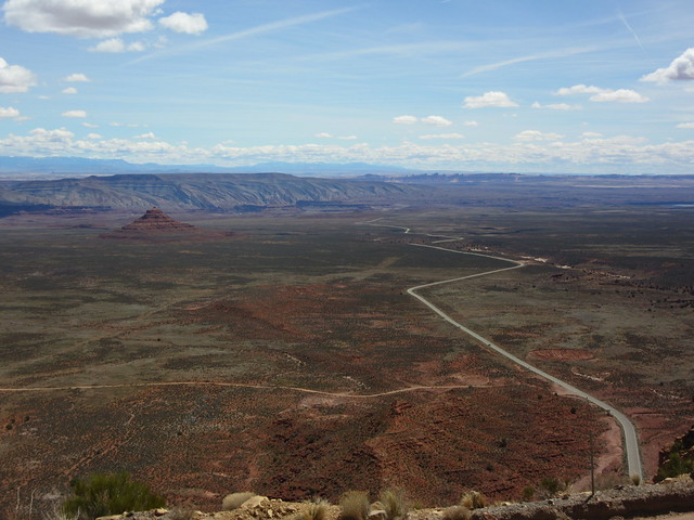 That’s CR 261, headed to Mexican Hat that looks paved, and the road through VotG going left/east from it.
 If you look near the top & left-ish, you’ll see a car. Perspective, right?
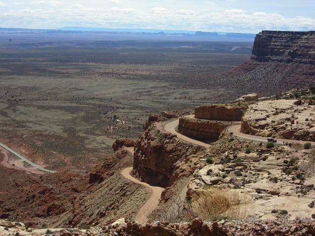 Oh my—now THAT’S a road!
And near the top, I saw a heart-warming sight. Freeway Blogger would be proud of this, here near the Navajo Nation:
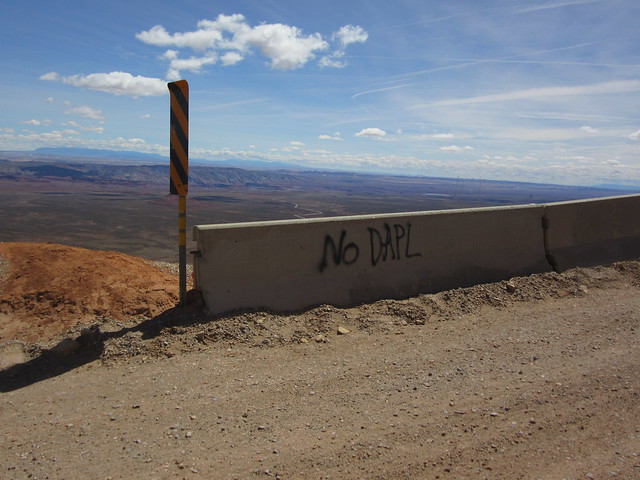 Suck it, Tillerson!
But seriously though—the views up there!
 On top, a massive rock with ancient pines
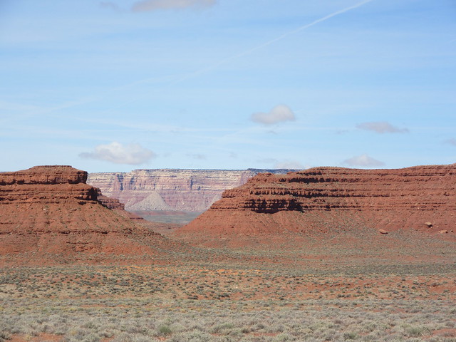
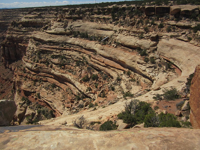
 Yeow. That’s Comb Ridge in the mid-ground. Butler Wash, where we went 2 weeks ago, is ‘just on the other side’—a 40 mile drive from where I’m standing. At least 40 miles...
 Even at nearly 5000 feet elevation, on a rock, in the desert, an Indian Paintbrush fights to live. If it can get another foot taller...it’ll have a spectacular view...
 Like this...
 And this… grow little Paintbrush, it’ll be worth it!
When researching The Moki Dugway, I came across this—a 3 minute Go-Pro video of driving up the dugway. Impressive—but consider yourself warned! Vertigo alert! Vertigo Alert! Very, uh, groovy soundtrack too…
And from a TV show, “Hell Roads”. I found this one interesting—but Moki is NOT the word for dead people in any language!
Alrighty, I’ve burned up enough of Kos’es pixels. I promised many pictures of Valley of the Gods—I hope you’ll agree, I came through.
I want to remind you—You Own This. We own Bears Ears. We own the Moki Dugway—all of this; it’s our heritage and our birthright as Americans! Please help #Protect Bears Ears! Please, please contact your Congressional Representative and Secretary Zinke, and tell them:
Protect Bears Ears!
Thank you!
 Wouldn’t you want your grandkids to experience this?
Peace.


