Bird life varies dramatically with habitat as we know. One of the things I really enjoy about birding at aquatic sites is how different habitats can be over short distances. Depth, water movement and substrate vary considerably along the coast where I frequently birdwatch, and that affects what foods are available, hence the bird life. It’s been a long term puzzle for me to sort out why birds prefer one bay over another even when I can’t really perceive what factors are significant. Having two different habitats right next to each other makes a good side by side comparison. Since the location and general weather conditions are exactly the same, it must be the aquatic conditions that birds use to choose one or the other. If they do.

One such spot I visit now and then is a tombolo, which is a narrow strip of sand connecting two larger land masses, in this case a small spit to the island. The tombolo happens to be owned by our county Land Bank, so it’s publicly accessible for me to wander and birdwatch.
This tombolo is made of sand deposited there by a northward flowing current. The whole spit was formed that way over thousands of years. Inside the spit is a shallow quiet bay while outside is a deep channel with swift currents. The tombolo separates them, and it’s easy to observe what birds are in each habitat. I’ll be sharing pictures and my observations over the past couple of months. Perhaps in future I’ll do another edition of Dawn Chorus looking at summer/fall life there.
This is what the tombolo looks like, standing on the road, which pretty much covers its whole width. On this day in February there’s a moderately high tide on a fairly calm day. Not much wind. I can tell that by how flat the channel is on the right. The bay, on the left, is even more calm.
 Medium high tide
While some birds come and go over the seasons a few are reliably to be seen at the tombolo year round. There are always several Great Blue Herons either foraging or meditating on the bay side. Eagles find prey on both sides of the tombolo. The vegetation there is brown in winter, typical salt marsh plants like pickleweed and salt grass.
 Pair of Bald Eagles
 Great Blue Heron
In addition to herons, I can expect to see lots of ducks from the tombolo in winter. There are generally more to see in the bay than in the channel, closer to shore. For the most part the ducks in the bay are dabblers, but occasionally buffleheads or goldeneyes paddle around in there. The most abundant ducks are pintails, mallards and green-winged teal, with fewer numbers of wigeons, mergansers, scaup, shovelers and others.
 Flock of pintails on the wing, gulls floating further off.
 Sleeping ducks
Pintails are a favorite of mine. Common but so elegant and graceful — never commonplace.
 hen pintail
|
 drake pintail
|
More ducks —
 Common goldeneyes
 Northern shovelers
At low tide muddy flats emerge which are attractive to a variety of birds.
 Ducks and shorebirds on the mud
Green-winged teal prefer shallow water, even wet mud, straining the surface for seeds and tiny arthropods.
 drake GW teal
Their crouched, scooping, sieving style of feeding is so distinctive I can tell who they are even without seeing their features. But that green is spectacular in both the drakes, and the hens more subtly. This short video I took shows their foraging style.
Low tide is appealing to shorebirds too. In that same pool that day were about a dozen Least Sandpipers picking at tiny arthropods. It’s intriguing to me how two different kinds of birds can feed on similar prey but with completely different methods, determined by the kind of mouth they have. Teals have sieves, shorebirds have chopsticks. The video below is the sandpiper counterpart to the teal video, taken the same day.
 Least sandpipers
Whereas the ducks are around all winter, the shorebirds are here only in passing, mostly in fall and spring. Besides the peeps, yellowlegs are common visitors.
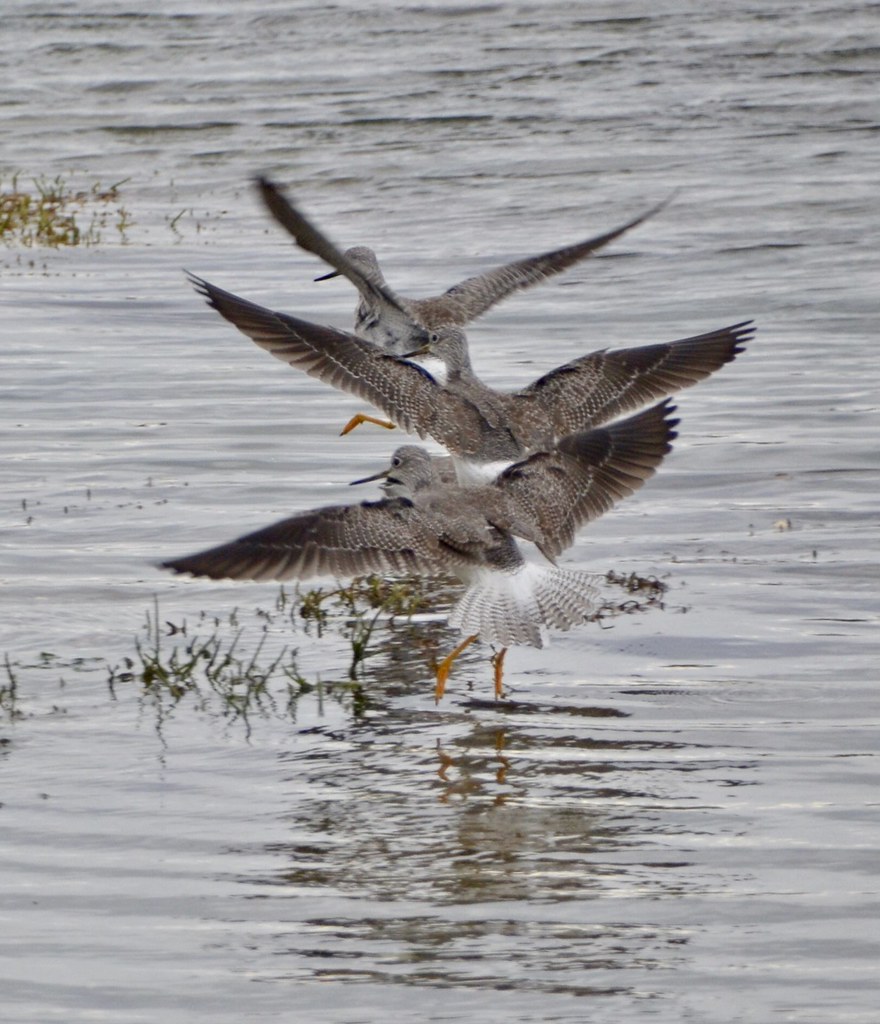 Greater yellowlegs
Gulls go for the clams buried near the surface of the mud. At this time of year it’s mostly Glaucous-winged gulls busy foraging in the bay. They have molted into their breeding plumage now, brilliant white heads. GW gulls are huge birds — see how small the teal are in comparison!
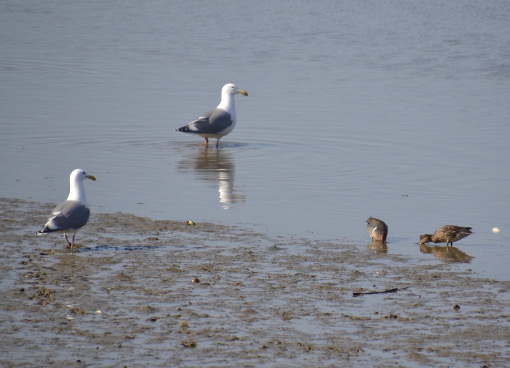
Gulls use the road to break clamshells. They get so skilled at the technique they know exactly how high a given type of clam needs to be dropped. Too high and another gull will snag it before the dropper can descend to the road, too low and the clam won’t break. They don’t often need more than one try. The road edge is lined with clamshell fragments from decades of this and during a low tide the road is like a lunch counter of gulls eating clams. Walkers and bicyclists have to dodge them, and cars drive slowly.
If you compare this day’s scene to the road view above in February when the tide was high you can see how much more activity there is when the tide exposes food for birds. The behavior of marine birds varies dramatically with tide level. Low tide = woohoo!
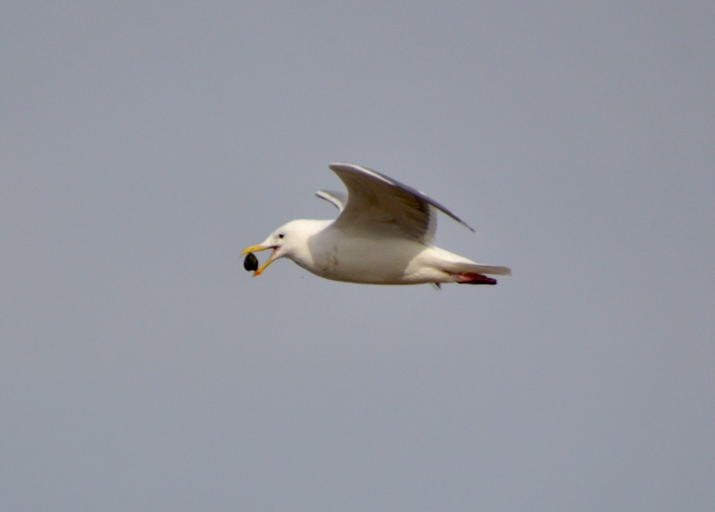 A Littleneck clam has been pulled from the mud,
 gets dropped on the road,
 and pieces of clam meat extracted from the broken shells.
The beach on the channel side of the tombolo doesn’t have nearly as much bird activity, even at low tide. For one thing, the beach sediment is cobbles and rocks where few clams or worms live and for another, the strong tidal current washes particulates and tiny living things along the shoreline, not much accumulating there. We have few sandy beaches.
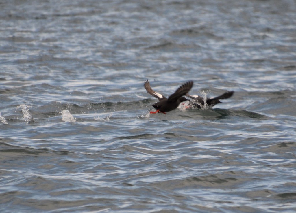
Oystercatchers do find limpets and snails to pry off boulders.
 Pair of oystercatchers giving another what for
Where food is to be found is offshore in the subtidal waters of the channel. Birds aren’t as easy to see out there but they are abundant. Buffleheads, goldeneyes and harlequin ducks hunt the nearer, shallower water while alcids, scoters, loons, grebes and cormorants are farther out.
 Buffleheads in the channel
 Harlequin ducks with a gull loitering nearby
Most of the deepwater diving birds are beyond where I can get pictures from shore even with my zoom, but here are a few:
 Rhinoceros auklets are in breeding plumage now
 So are Pigeon guillemots
 Rednecked grebes aren’t entirely yet
Inside the tombolo the bay used to have far more birds. Historical accounts by early settlers of the 19th c and middens left by indigenous Straits Salish Indians tell a different story than what we see today. The bay was mostly eelgrass meadow from shore to shore with abundant fish, crabs and shellfish. Many more birds, feeding on them. Research studies (summary here hws.ekosystem.us/...) of the bay today indicate 90% of the eelgrass is gone, and there are few fish except around the dock pilings of the marinas. The bay is shallower, warmer and less well-oxygenated.
What happened? About a century ago the tombolo was built up so a permanent road connected the spit to the rest of the island. Below the road bed, the naturally deposited layer of sand tops out at about 4 feet above mean low water. A tombolo of that height would be overtopped by half the incoming high tides. In other words, installing the road has closed off the bottom of the bay from tidal circulation, allowing sediment to build up inside and starving the bay of oxygenated plankton-rich water. Runoff from residences, businesses, and agriculture has also polluted the bay with organic compounds and heavy metals, toxic to marine life.
Without the raised tombolo, we’d be looking at an eelgrass bed here, with more birds and fish. A proposal is being considered to breach the tombolo and install a bridge instead, bringing back some of the original circulation. A tidal current regularly flowing through the bay would help flush out toxic substances and bring in fruitful water that would support a healthier ecosystem.

That would take money. But sea level rise caused by ongoing and accelerating climate change may do the work for us. I took a picture of the tombolo during a King Tide in February, when astronomical conditions raised the tide higher than usual. You can see how close the water is to the road. With sea level predicted to rise another 2 feet by 2050 and 8 feet by the end of the century (www.wacoastalnetwork.com/...), the tombolo will be overtopped regularly. The county will be faced with a decision no matter what, since folks who live on the spit will expect road access to the world.
 King Tide, 9 feet. February 19, 2019
It would be great to see the tombolo “alive” again, a dynamic natural structure of sediment that alternately protects the bay and allows fresh seawater inside to support an eelgrass ecosystem. I may be alive to see that, one way or another. In the meantime there are birds to observe making use of the resources that do exist, on both sides of the tombolo.


