I am an immigrant and I would like to write about and show you something of the first part of this nation that I came to truly love. The first part of my title references the Woody Guthrie song and emphasizes that this nation belongs to us all. A nation is a society, a group of people. But it is also a physical, geographic entity. And this was the first place where the geography of these United States really touched me, where I really felt at home. I would like to encourage others, especially those from ‘red’ parts of the country to write about the land that they love as well. I am biologist and this diary is biologically oriented but I would love to hear about anyone's love for part of this country.
This is a photo diary. The photos were all originally slides which were scanned. Age has been kinder to some than others.
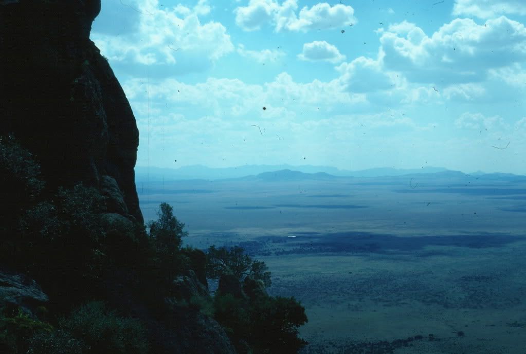
Almost 20 years ago, in the spring of 1989 I entered the area under consideration for the first time. I was driving down to start the field work for grad school. Earlier in the day I had got my car stuck in some sand and I was (I thought) late. I left interstate 10 at the ‘town’ of Road Forks just east of the NM/AZ state line and proceeded to go south and west on US highway 80. Passing through Granite Gap, a rocky pass in long, low Peloncillo Mountains, I was startled by a stunning vista. A vast valley stretched out below and before me with a large mountain range appearing to burst straight out of the ground on the far side. It looked, to my eastern eyes, to be completely devoid of human presence, grey brown lowlands running away from for miles and miles until interrupted by the dark green sides of the mountains.
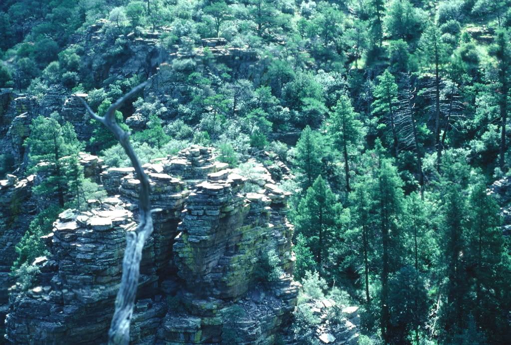
This was my first introduction to the Chiricahuas, the largest of the ‘sky-islands’, the mountain ranges that are scattered across southeastern Arizona and southwestern New Mexico. Here is a picture, from the Gray Ranch in far southwest of New Mexico that will give you some idea of what I saw.
This is also a point to make a statement and perhaps an apology to New Mexicans. The region I discuss stretches across both Arizona and New Mexico but most people just talk about ‘southeastern Arizona’. There are a couple of reasons for this. One is relative size; a lot more of the region is in Arizona than in New Mexico. The other is accessibility. The New Mexico portion is further from major population and transportation centers, most of it is privately owned, and the publicly owned parts generally have poor road access. However I don’t wish to slight New Mexico, a state I love dearly.
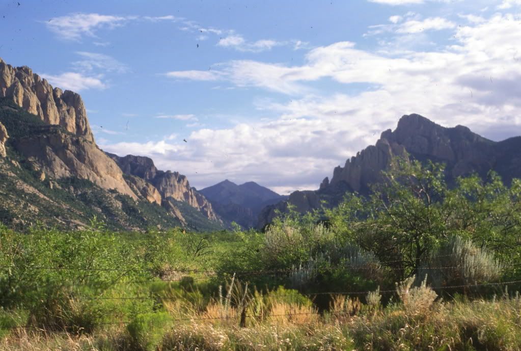
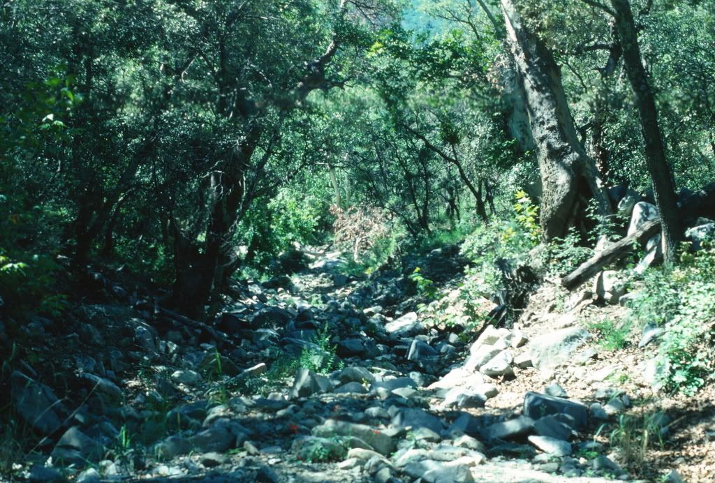
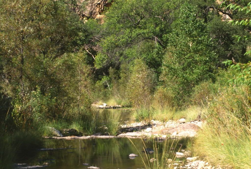
As I got closer I saw this, the entrance to Cave Creek Canyon. In minutes I was entering a subtropical paradise. Below I will show you a few sites from my time there. I hope these elderly scanned slides won’t horrify too many of you.
Why Sky Islands? The topography of the area is known as Basin and Range, something that is found widely in the west in the regions west of the continental divide but east of the Sierra Nevada and Cascades. Isolated mountain ranges exist as islands in a sea of lowlands. Over geological time erosion has removed a lot of soil/gravel/rocks from the mountains and they have washed down into the valleys. The valleys fill up because they are too dry for permanent water to carry material further downstream. So you end up with broad flat valleys with the upper parts of the original mountains rising quite abruptly out of them (the valleys). The mountains are islands because many of the species living on them need the cooler, moister environment provided by the higher elevation in order to survive. The surrounding desert is a hostile sea that they can only cross with great difficulty
 f at all.
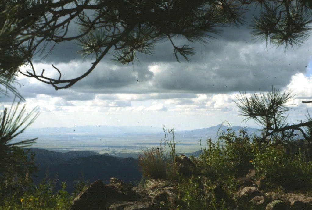
This picture gives you an idea of the large scale topography. It was taken from the central ridge of the Chiricahuas and looks out over Sulfur Springs Valley to the west.
Why is This Area so Great? What is special about this region? It is one of the most biologically diverse regions of the United States with many plant and animal species.
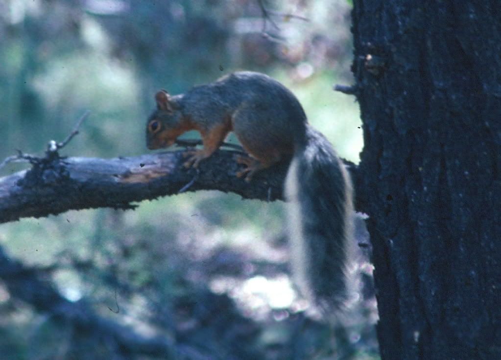
This is an Apache Fox Squirrel, found nowhere else in the US other than in the Chiricahuas.
The region has a fascinating culture history and vibrant cultural present.
This is the bar in Rodeo, New Mexico. A century ago it had over 10,000 people. Southeast Arizona is the home of Tombstone and the shoot out at the OK corral. It was the home of Cochise and Geronimo.
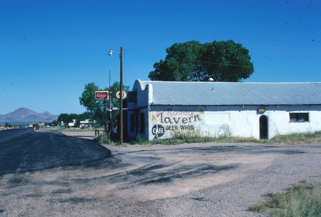
Now Rodeo probably has only a few hundred people. But it has an art gallery. And dozens of scientists spend time in the bar every year. A high proportion of the surrounding population in artists, retired scientists and people who just want to live there.
It has a varied but not extreme climate with dramatic summer weather
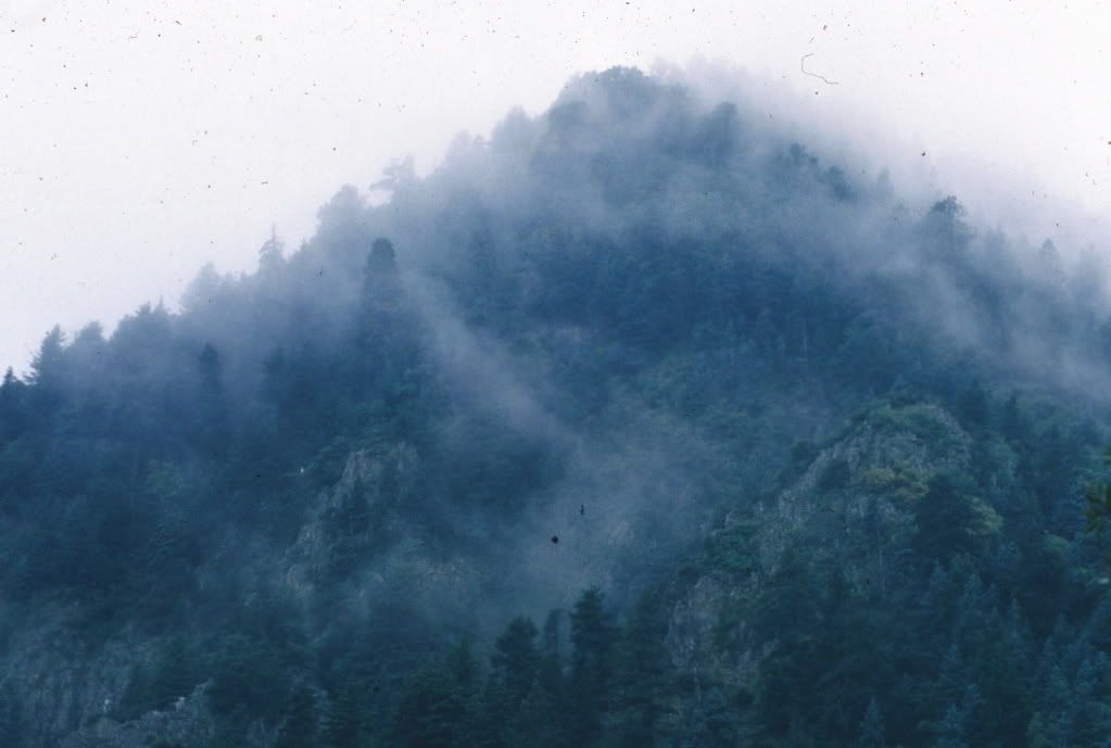
Here is fog rolling down the mountains
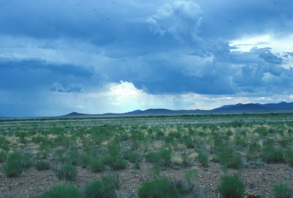
And here is a thunderstorm building up over the desert.
Some Places
For this diary I am going to concentrate on lower and middle elevation locations, particularly those with water. Otherwise the diary would be huger than huge.
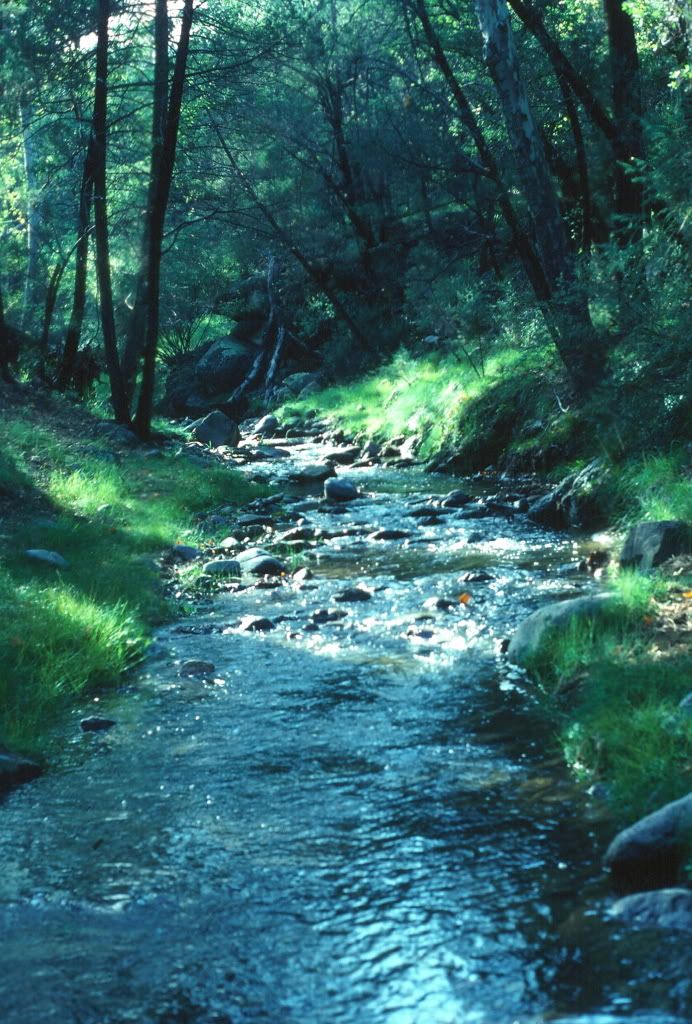
Along the middle fork of Cave Creek in the Chiricahuas. Trogons live along the south fork but I have heard them in this area as well.
Upper Ramsey Canyon in the Huachuca Mountains, a similar mountain range further to the west, near the city of Sierra Vista. The lower part of this canyon is owned by the Nature Conservancy and is a popular birdwatching destination.
Madera Canyon in the Santa Rita Mountains. This is not a good picture. I don’t know why I don’t have a better one. You shouldn’t hold that against it. It is a fine place with lots of hummingbirds. It is possible to see Trogons there. It is the closest and most convenient place to Tucson to experience a sky island with a lot of Mexican species.
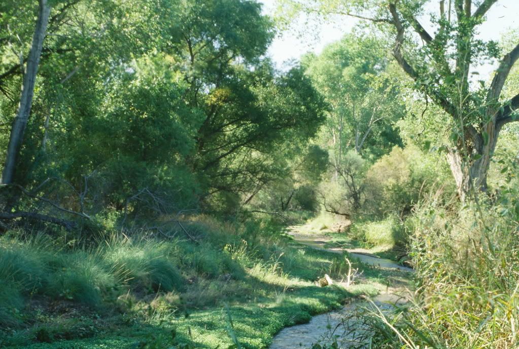
The Sonoita Creek Sanctuary near Patagonia. Another long time Nature Conservancy location. Outside of the mountains but with permanent water – home to Gray Hawks among other things.
The Pajarite mountains run along the Mexican border west of Nogales. Unlike the other ranges they are low and without a strong central ridge. They have a lot of unique plant and animal species that barely get over the Mexican border.
This is Sycamore Canyon in the Pajaritos – unlike most other places in the region the creek here runs down to Mexico (only a few miles from where this photo was taken) rather than north to the Gila River. This is a famous place for Trogons, Becards, Vine Snakes, and several plant species that just creep across the border.
Some Critters All taken in Cave Creek Canyon unless otherwise noted.
Here are my only two bird pictures.
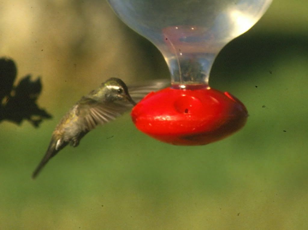
A blue-throated hummingbird – one of the two largest species in the US – an example of a ‘Mexican’ species.
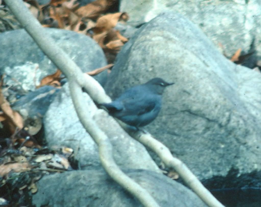
A dipper (sorry for the poor quality) – unlike the hummingbird the dipper is at the extreme south of its range.
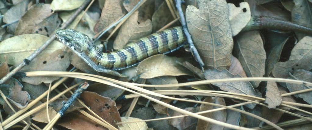
Alligator lizard
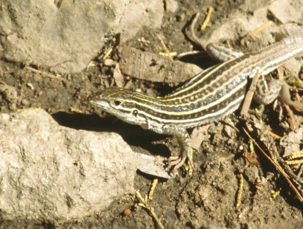
Whiptail Lizard – a member of an all female species. No males required!
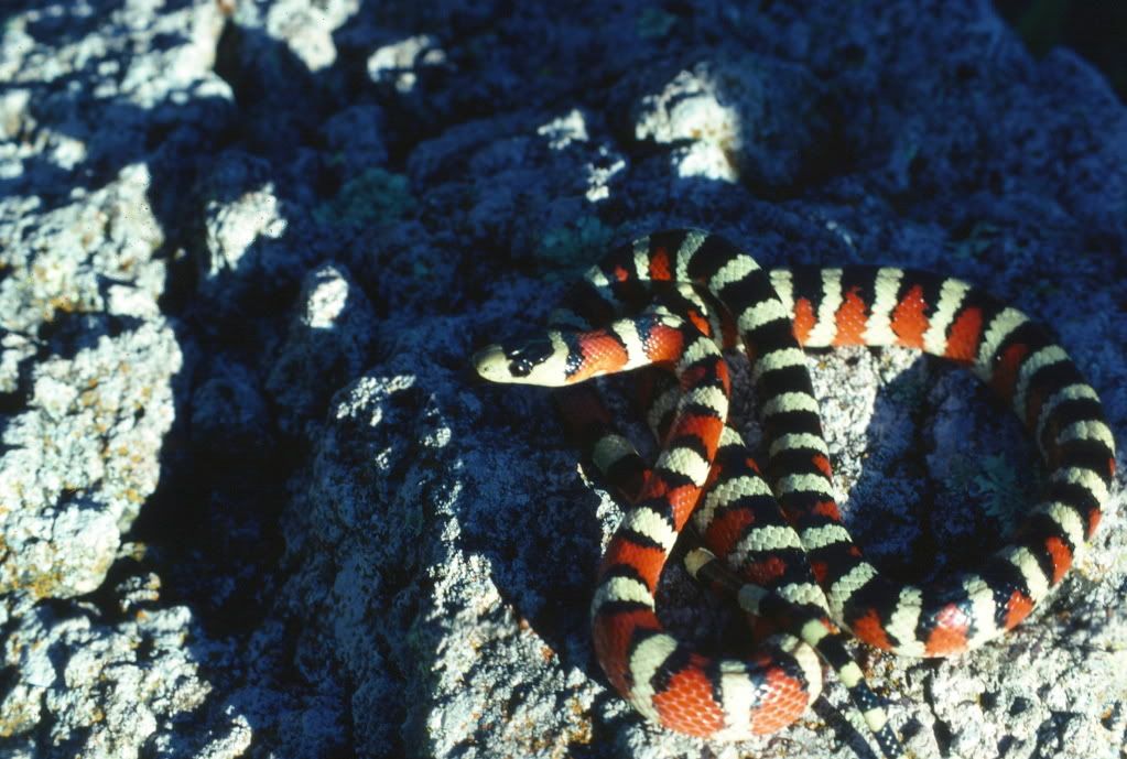
Arizona Mountain King Snake (only posed picture in diary)
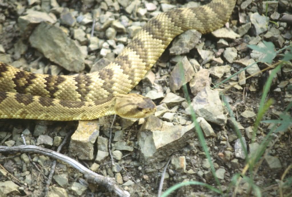
Blacktail Rattlesnake
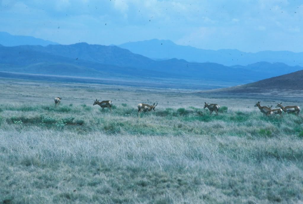
Pronghorn southeast of the Chiricahuas along the road to Douglas, Arizona
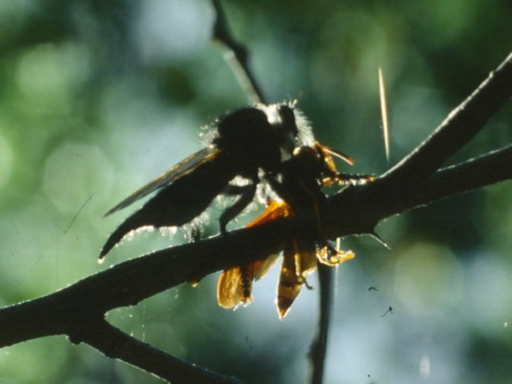
Robber Fly with prey
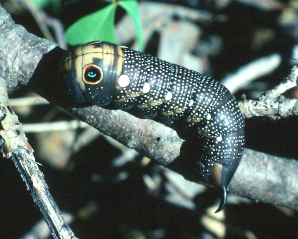
Really wild caterpillar in the Huachucas
Perils to the Biodiversity.
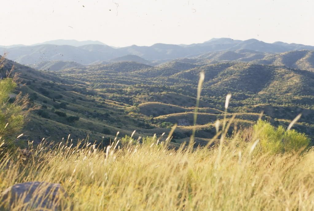
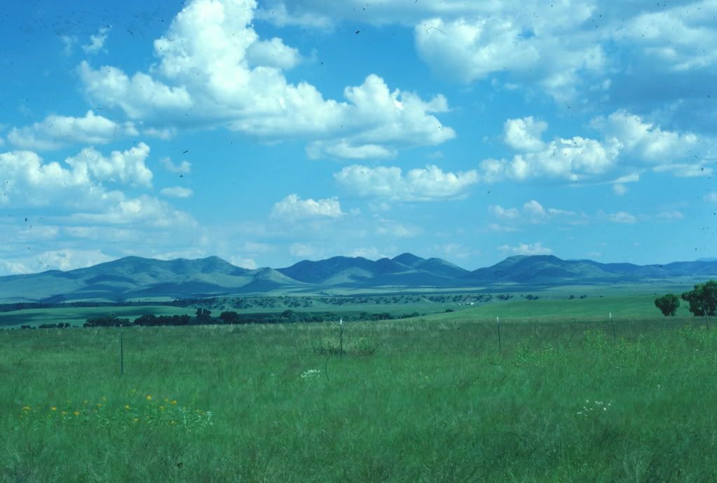
Desertification – Most of the low elevation areas once looked something like the San Rafael Valley, shown here in late August and the height of the monsoon season. Now many areas look like the storm shot near the top of the diary. Overgrazing and over consumption of water has led to many areas transforming from a grassland to a desert.
The Border – During my time in the region the border fence was a few strands of barbed wire and it was a fairly low key area. Since that time illegal trafficking in both humans and drugs has dramatically increased as have enforcement efforts. I don’t want to think about the effect this has had on the isolated canyons along the border which are used by many rare plants and animals.
Global Warming – the animals and plants on the sky islands are, in many cases, trapped on them. As the climate warms they have nowhere to go but up. So their habitats will shrink and the species restricted to the highest, coolest, and dampest areas will see their habitats vanish forever.
That's All Folks
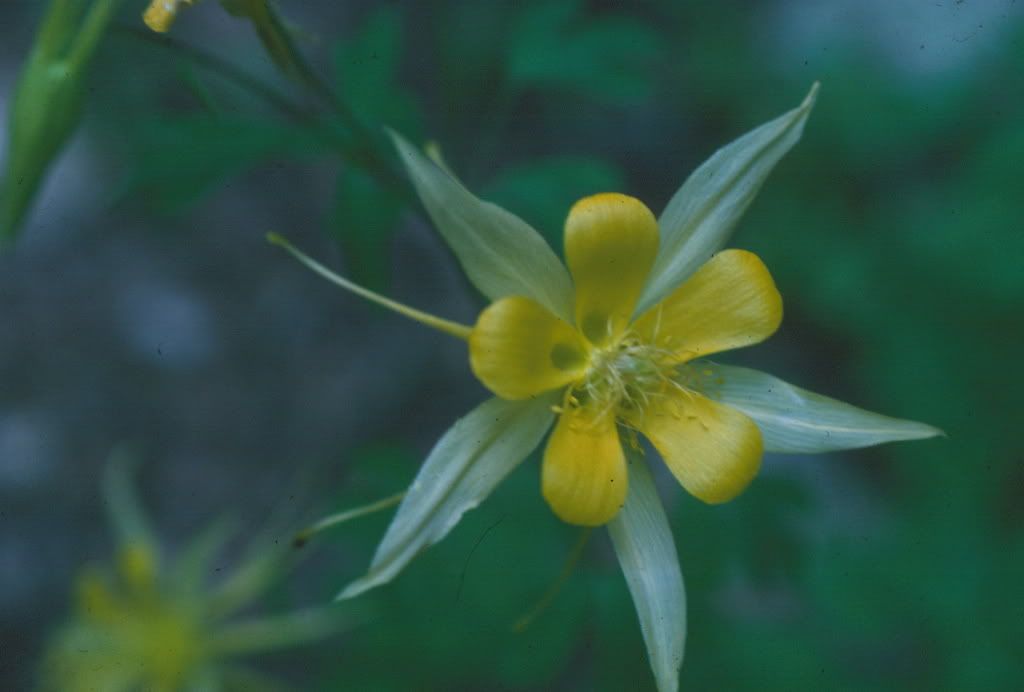

A nice columbine and a friendly ringtail in the rafters to bid you goodnight.
