This summer, I visited the Mono Lake area. My last visit to this jewel of the Sierra Nevada Mountains was many years ago – I won’t wait that long again.
One of the highlights of our trip was a visit to Mono County Park. At the end of a boardwalk to the shore of the lake, we were treated to the sight of thousands of Wilson’s Phalaropes just off shore. Every few minutes, as a raft of these tiny birds floated towards the shore on the gently rocking surface of the lake, a huge flock would take wing, zoom around in crazy formations for a few minutes, and then settle back to the surface of the lake to start the cycle over again.
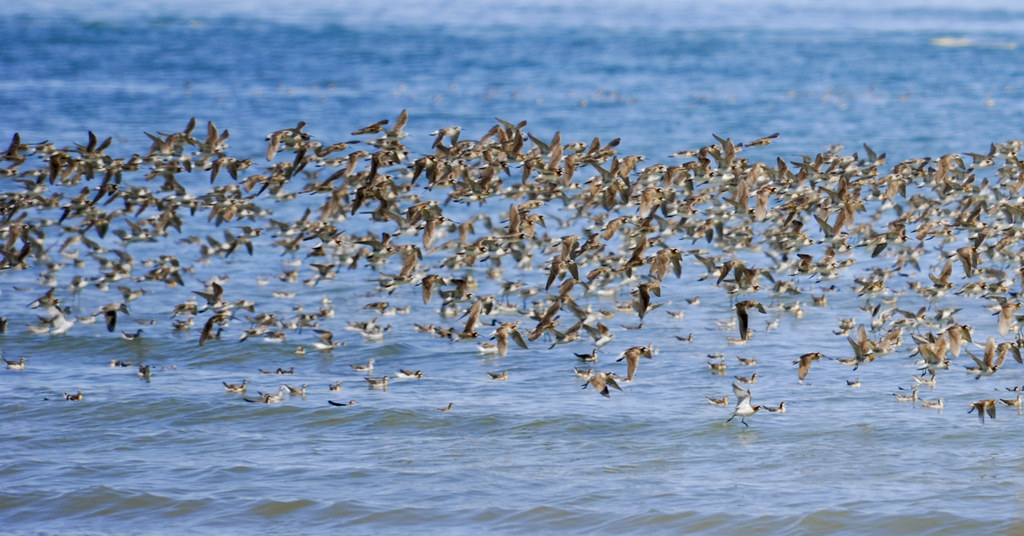
Mono Lake is a critical stop for Wilson's Phalaropes on their fall journey to South America – 80,000-125,000 of these lovely little birds spend several weeks in July and August at Mono Lake fattening up for their upcoming non-stop journey to Ecuador. Pretty damn cool I’d say.
And to think that we almost lost it all...
Many of you, I’m sure, have seen the classic movie Chinatown. The plot of that movie was based loosely on California’s water wars of the 1930s and 1940s. Mono Lake was also a pawn in the game played by Los Angeles, which gobbled up as much water as it could to make sure that the water it needed to fuel its growth would be available.
Mono Lake is an alkaline lake located east of the Sierra Nevada Mountains. It sits in the Mono Basin, which was formed on the western edge of the Great Basin (my summary in this diary is based on the information available on the Mono Lake Committee website - there’s lots of good stuff there if you have some time to explore). The lake is set in a volcanic landscape with the steep eastern scarp of the Sierra Nevada Mountains as a backdrop. It has has no outlets but runoff from several small streams replenish it. The evaporation rate of the lake is about 45 inches per year so it takes a fair bit of run-off to keep the level of the lake stable (annual precipitation at lake level is less than 5 inches).
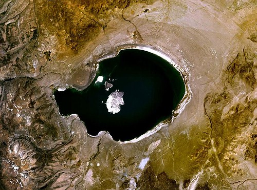
Satellite image of Mono Lake showing Negit Island (small dark island) and Paoha Island (large light island).
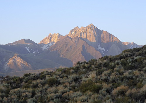
A view of the Sierra Nevada Mountains from the Mono Lake area.
Beginning in 1941, the Los Angeles Department of Water and Power began diverting most of the water from the streams that flow into Mono Lake (Rush, Lee Vining, Parker, and Walker Creeks). By 1982, the level of the lake had dropped approximately 45 feet, the volume of water in the lake was halved, and the salinity had increased from ~51 grams/liter to ~99 grams/liter.
As you can imagine, these changes in lake level and chemistry had dramatic impacts on the ecology of the lake. The populations of brine flies and brine shrimp, the only creatures that live in the lake, declined with the increased salinity. The flies and shrimp provide the food needed by the Phalaropes to fatten up for their journey south and by the birds that nest in the region, including California Gulls and Eared Grebes. What’s more, the dropping water level exposed a land bridge from the north shore to Negit Island so that predators like coyotes and foxes could raid the nests of these birds. Other small islands also became vulnerable to predators during nesting season.
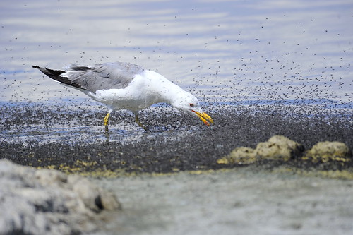
California Gull vacuuming up brine flies along the shoreline of Mono Lake.
Things were looking pretty grim for Mono Lake and the wildlife that depended on it for survival.
Fortunately, David Gaines, a teaching assistant at Stanford University, became the force behind preserving and restoring the Mono Basin ecosystem. In 1974, David and a group of students applied for and earned a grant to conduct the first comprehensive study of Mono Lake (see their study here). That study was the catalyst for raising awareness of the dire situation facing Mono Lake. In 1978, David Gaines and a few others founded the Mono Lake Committee (a project of the Santa Monica Audubon Society), with the goal of protecting and restoring the Mono Basin ecosystem. They enlisted the support of the Sierra Club, Friends of the Earth, the Natural Resources Defense Council, and the National Audubon Society, and California Trout to preserve the lake. The MLC took the lead on a three-pronged approach – legal, legislative, and educational.
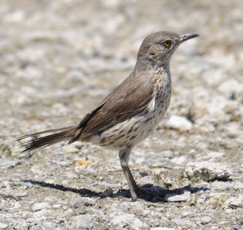
Sage Thrasher at the South Tufa area.
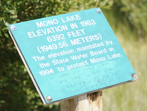
Over the next decade and a half, the Mono Lake Committee worked tirelessly and tenaciously to achieve their goal. Finally, in 1994, the California State Water Resources Control Board issued a landmark decision that amended the Los Angeles Department of Water and Power license to divert water from the Mono Basin. The bottom line is that the decision calls for a lake level of 6392 feet above sea level, the level of the lake in 1963, or about 20 feet higher than the level in 1982. It’ll take a few years for the lake to reach that level but it’s good to know that the lake will be preserved for the critters who depend on it, and for those of us who need these places to restore our spirits. Just look what a group of committed people were able to achieve against enormous odds – pretty damn cool I’d say.
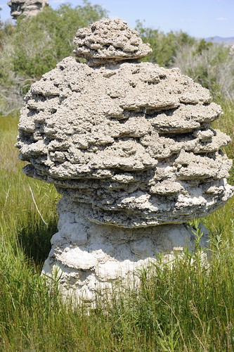
This tufa, formed as a reaction between the alkaline lake water and fresh water upwelling in subsurface springs, will be submerged again once the lake reaches its mandated level.
(For those of you who are interested in the timeline of legal decisions of the restoration agreement, start here).
A few more Mono/Eastern Sierra Birds to close things out.
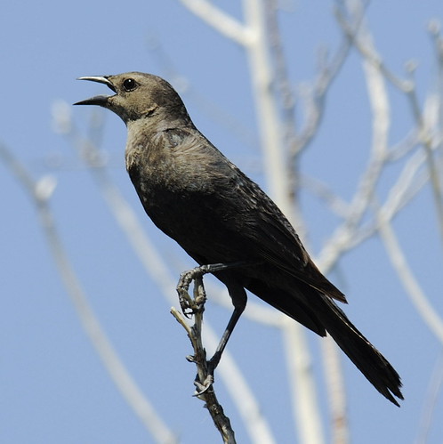
Brewer's Blackbird
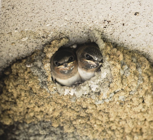
Cliff Swallow nest under the eave of the visitors' center.
