10-Mile Underwater Plume of Oil Off Louisiana from BP Oil Spill
by Julia Bodeeb -- May 15, 2010
Huge Underwater Plume of Oil
The New York Times reports that scientists have now identified a large underwater plume of oil in the depths of the Gulf of Mexico. One plume is described as "10 miles long, 3 miles wide, and 300 feet thick."
The oil plumes are destroying oxygen levels in the water of the Gulf of Mexico. This causes the death of wildlife. To the birds and fish in the Gulf Coast this spill is not "tiny" as BP claims, it is life threatening.
Dr. Samantha Joye, of the University of Georgia, tells the NY Times that "oxygen has already dropped 30 % near some of the plumes in the month that the broken oil well had been flowing...This could draw the oxygen down to very low levels that are dangerous to animals in a couple of months."
Dang those Silly Scientists, always discovering stuff; and taking measurements and so forth.
Scientists: Underwater plume of oil headed out to sea
by Rick Jarvis, USA Today -- 05/17/2010
In the first on-site measurements of the oil spreading below the surface, researchers found the plume of crude stretches 15 to 20 miles southwest from the site of the damaged wellhead and is about 5 miles wide, said Vernon Asper, a University of Southern Mississippi marine scientist leading the research.
The plume is compact, much thicker than the lighter remnants reaching the surface and suspended in about 3,000 feet of ocean, he said. A deepwater current is dragging it out to sea. The underwater oil cloud is not connected to the surface slick — now the size of Delaware and Rhode Island combined.
"This [underwater] plume is some of the heavier products of the oil that won't reach the surface," Asper said in a radio-telephone interview from aboard the R/V Pelican, a 116-foot research ship at the site of the spill. "We think this oil is going to stay down there. It doesn't look like it's coming to the surface."
Here is what "Delaware- and Rhode Island-sized Plumes" might look like in the deep waters of the Gulf of Mexico.
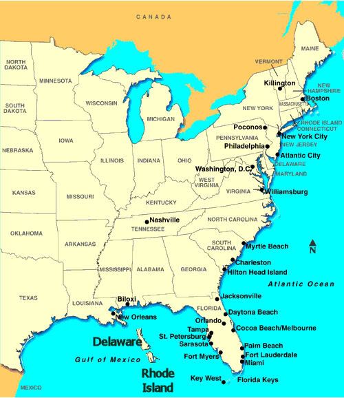
Image link
And here is what those Deep-Water Horizontal Currents looked like, as of 05/17/2010, with a 0-hour Forecast (ie. Real Time).
Light Blue indicates a Horizontal Current, at depth of 1000 Meters, is between 0.3 and 0.4 Meters/Second.
3000 feet is the depth where the massive underwater plume was found. (which is approx 1000 Meters used in the map)

Link to run the Forecast at that Depth.
Image link
Here is that same Deep-Water Horizontal Current map, with those massive underwater plume superimposed.
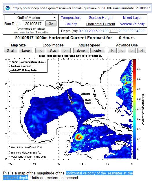
Image link
Of course the exact location of these state-size plumes wasn't stated --
So those overlays may not be reaching precisely those deep currents, just yet, like those University eggheads claim.
Then again, they [Rhodie & Deli] may be about to find "their ticket" out to sea ... and into that Great Ocean Conveyance, aka the Great Gulf Stream.
Isn't Geography fun?
Note: Map overlays may not be to exact scale. Diagrams are for illustrative purposes only. Much like the Animations we're allowed to see on our Commerically-paid-for TVee.

