Anybody who is paying the slightest bit of attention knows that Arctic summer sea ice is melting at a record pacebecause of warming of the atmosphere and the ocean. If you understand the idea of feedbacks, then you realize that increased summer ice melt leads to further ice melt because the earths albedo is reduced. Less ice means less solar radiation reflected back into space which, in turn, means further warming and even more melting of the ice.
Global warming's effect on Arctic sea ice is also conditioned by atmospheric circulation, which can drive warmer winds and ocean currents into the Arctic Ocean. A recent paper published in Geophysical Research Letters, (abstract here and full article here-subscription required) suggests that since 2001 a significant change has taken place in atmospheric circulation patterns during the Arctic freezing season, which helps account for unusually high arctic surface air temperatures and increased sea-ice melt during the following summer.
[For an introduction to Arctic climatology and meteorology follow this link.]
[To see a good Arctic map, click here]. (Notice that you can get weather reports for specific places on the map by clicking on the yellow dots.)
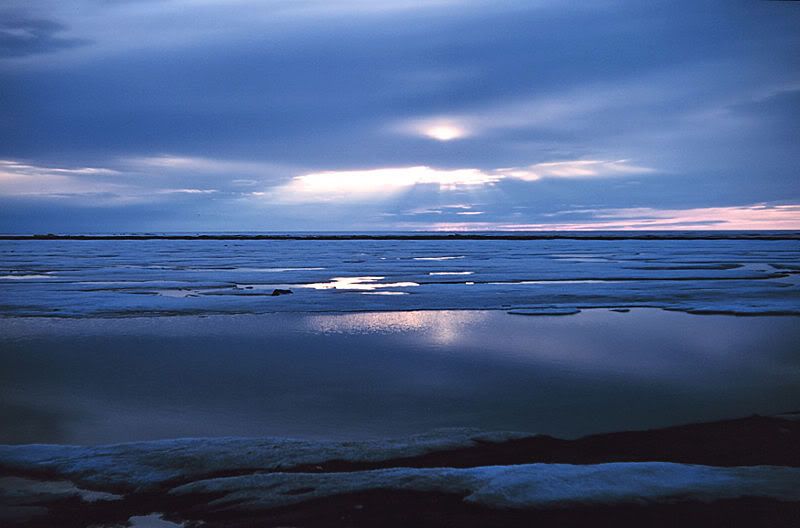
Image right: NOAA photo of Arctic sea ice from spring 1950.
In their study Recent radical shifts of atmospheric circulations and rapid changes in Arctic climate system: the authors write:
[2] The Arctic climate system change has conspicuously switched onto a fast track since the beginning of the 21st century. In particular, an extreme sea-ice coverage loss occurred in summer 2007 [e.g., Comiso et al., 2008]. Although these changes have been largely attributed to the greenhouse-gas-emissions-induced radiative forcing, the atmospheric circulation is the route by which global-warming-forcing exerts dynamic effects by driving sea-ice motions and exports, ocean currents and heat transport. The atmospheric circulation also determines formation and distribution of cloudiness as well as critically modulating surface radiative heat budgets. Accordingly, substantial Arctic climate system changes have been tightly associated, under conditions of global warming forcing, with the positively-polarized trend of the atmospheric circulation leading pattern, the Arctic/North Atlantic Oscillation (AO/NAO) [e.g., Rigor et al., 2002; Zhang et al., 2003].
[3] However, the AO/NAO has gone to neutral in the latest decade, clearly shifting away from the fast track of the changes, and unexpected from previous studies and global-warming-forced climate simulations [e.g., Thompson and Wallace, 1998; Osborn, 2004]. The driving role of the AO/NAO trend in underlying cryospheric, hydrospheric, and terrestrial subsystem changes has been substantially weakened [e.g., Maslanik et al., 2007]. Therefore, the rapid climate change signature in atmospheric circulations and its connection to other subsystem changes remain unclear.
What this means is that the AO/NAO pattern is no longer driving atmospheric circulation in the Arctic. The researchers use a complex statistical model to show that the AO/NAO has been replaced by a different atmospheric circulation pattern that they call the Arctic Rapid change Pattern (ARP). In their study, they examined overlapping 5 year windows beginning with the winter of 1986-87 and continuing up through 2007.
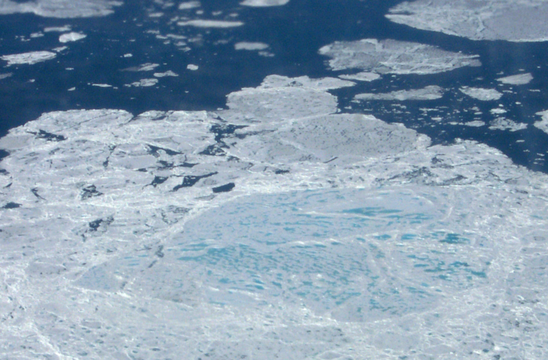
Image below left: NASA photo of Arctic sea ice from June 2000.
Examining each time window, we found AO/NAO robustly represented the predominant variance (>20%) of atmospheric circulation variability; its tri-polar spatial pattern was retained until the early 21st century (Figure 1b). However, this persistence ended in 2001/02-2005/06. The previous tri-polar AO/NAO was transformed into a totally different dipole structure between the Eurasian Arctic coast and North Pacific. We propose that this new atmospheric circulation leading pattern – the Arctic Rapid change Pattern (ARP) – represents an unprecedented climate change signature, and plays a decisive role in driving recent rapid Arctic climate change.
In other words, in the last 5 years, a pattern with two focal points has replaced the previous three-focal-point pattern. According to an article from Der Spiegel about the study:
Winter in the Arctic has long been determined by what researchers refer to as a "tri-polar" pattern. The interaction among the Icelandic Low, the Azores High and the subtropical high in the Pacific led to primarily east-west winds, a pattern which effectively blocked warmer air from moving northward into the Arctic region. [emphasis--JR]
But since the beginning of the decade, the patterns have changed. Now, a "dipolar" (bipolar) pattern has developed in which a high pressure system over Canada and a low pressure system over Siberia have the say. The result has been that Artic (sic) winds now blow north-south, meaning that warmer air from the south has no problem making its way into the Arctic region. [emphasis--JR] "It's like a short-circuit," says Rüdiger Gerdes, a scientist at the Alfred Webener Institute for Polar and Marine Research and one of the five authors of the study.
It's important to understand that we are talking about a phenomenon that occurs during the Arctic freezing season. This is significant for the following summers sea-ice melt:
Results also suggest that the recent central Arctic warm anomaly in the freezing season is mainly attributable to enhanced heat transport associated with the ARP negative phase. The warmed atmosphere and accordingly thinned sea-ice would enhance the following melting season ice-albedo feedback.
According to the researchers, "The SAT [Surface Air Temperature] anomaly reached 12.0°C in the 2005/06 winter relative to the 1958-97 average."
This heightened temperature anomaly during the Arctic freezing season has continued according to the National Snow and Ice Data Center.
Air temperatures over the Arctic Ocean stayed warm through November, partly because of continued ocean-to-atmosphere heat transfer. However, some of the warmest anomalies were located well north of the open water areas seen in September. This regional pattern of warming points to the strong role of atmospheric circulation, pumping warm air into the region from the south. [emphasis--JR]
From 2001-2006 the ARP was in a negative phase with relatively high pressure over Siberia. In 2006-2007 it abruptly turned positive, which contributed to the record sea-ice melt of 2007. The authors of the study explain:
18] Starting in summer 2006, ARP quickly transitioned to the positive phase that persisted until summer 2007 (Figure 4a).[figure not included--JR]] While a surface heat surplus is continually maintained by enhanced atmospheric and oceanic heat transport from the North Pacific, the changed wind patterns pushed sea-ice back to the previously-warmed and ice-reduced North Atlantic side (Figure 4c). [figure not included--JR] The warmed ocean, increased solar radiation absorption in summer, and enhanced ice-albedo feedback due to previously-increased North Atlantic warm air and water intrusion and previously-reduced sea-ice cover maintained a persistent negative sea-ice anomaly over the North Atlantic Arctic (Figure 4c). [figure not included--JR] The reversed wind pattern also increased perennial-ice loss through Fram Strait. Simultaneously, the wind-stress-forced sea-ice redistribution favoured to empty the North Pacific Arctic. The positive-ARP-steered clear sky intensified surface solar radiation and albedo-feedback by the increased open ocean, and, in turn, contributed to vanishing sea ice cover over the North Pacific Arctic, which has been manifested by the weather forecast product and ice mass balance buoy [Perovich et al., 2008]. Taken together, the extreme loss of sea-ice area occurred.
The differences between sea-ice melt in 2006 when the ARP was in negative phase and the record-setting year of 2007 when it was in positive phase can be seen in the images below:
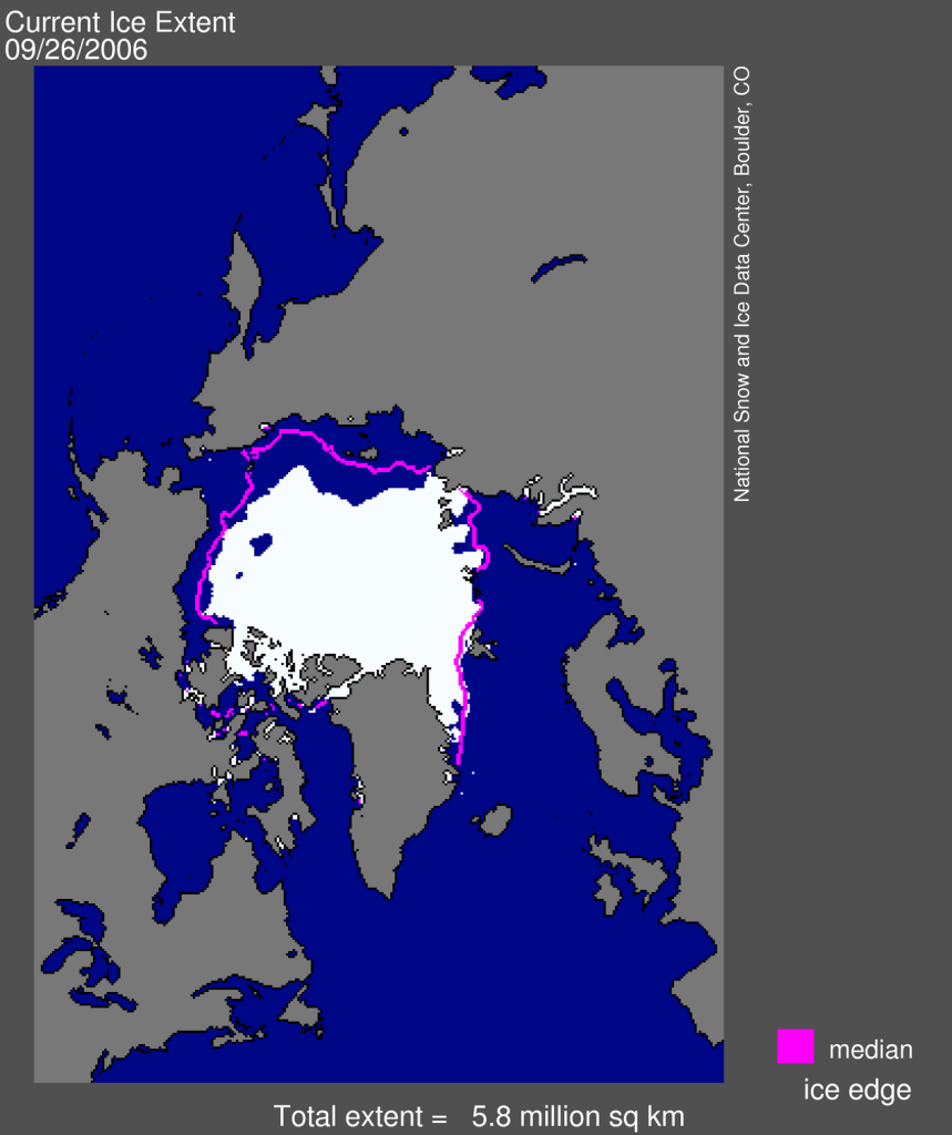
Image: NSIDC
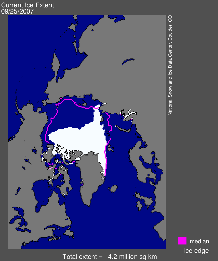
Image: NSIDC
The decline of the AO/NAO and the rise or the ARP help to explain the increased melt rate of Arctic sea ice, but just how significant is the increase? According to James Overland from the Pacific Marine Environmental Laboratory in Seattle:
Even if the Arctic circulation were to return to normal and would switch to the "dipolar" pattern just once in a decade, the situation would look grim, he said. "Each time we would see a loss of so much ice that it would be impossible to return to the initial state." [emphasis--JR]
In other words, we have probably reached a tipping point from which there is now no turning back.
Gerdes and his co-authors fear that the changes in the Arctic could mean that a "new era of global-warming-forced climate change" has begun. [emphasis--JR] The volume of greenhouse gas emissions like CO2 and methane into the Earth's atmosphere could have resulted in a permanent change in the global climate system.
If such is indeed the case, this will simply be one more instance in which Jim Hansen's predictions have proven correct.
"In the case of Arctic Sea ice, we have already reached the point of no return," [emphasis--JR] says the prominent American climate researcher James Hansen, director of the Goddard Institute for Space Studies at NASA.
Hey there in Poznan. Are you listening? Then stop your bickering and give us some real solutions.
Related Posts:
Final Wilkins Ice-Sheet Breakup Looms
Changes Taking Place in Arctic Sea-Ice Growth and Melt Cycles
From North to South, the Whole Damn World is Melting
When Ice Shelves Collapse: A Brief Tutorial
UPDATE: Bridge to Wilkins Ice Shelf Faces Imminent Collapse
Crossposted at Climaticide Chronicles
