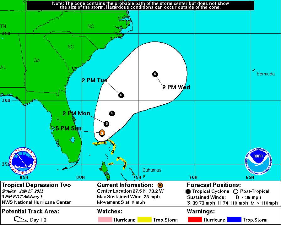
TD2, the second Atlantic tropical depression of the year and the first affecting the United States was located by an Air Force reconnaissance plane 100 miles north of the northwestern Bahama islands. The National Hurricane Center reports wind speeds of 44 knots were measured - normally strong enough to indicate a 35 knot tropical storm - but the NHC determined winds were 30 knots because convection was weak near the center of the storm. Models forecast slow movement and slow strengthening over the next day so the only immediate effects to land will be increasing surf on beaches from the Bahamas to Florida.
Recent NHC RGB satellite imagery shows increasing convection near the center of the depression. Low clouds in yellow, high clouds in white
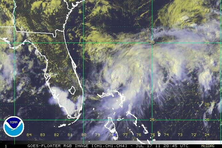
Wind shear has been dropping over the past 24 hours and organization and wind flow at high levels out of the depression has been improving rapidly over the past 6 hours. Dry continental air encroaching on the northwest side of the depression will tend to impede development otherwise favored by warm sea surface temperatures and favorable winds aloft.
Dry air to the northwest (in brown & black) will tend to inhibit development.

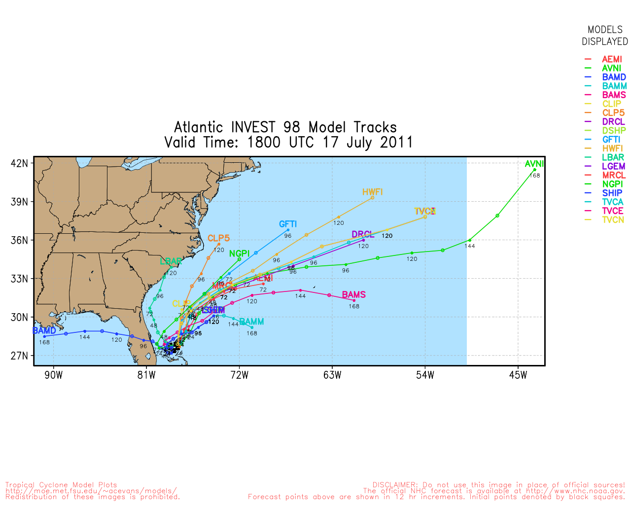
None of the NHC's models predict the depression will strengthen to a hurricane, but several forecast it will become a strong tropical storm.
Track models show some divergence but the consensus is for the depression to begin moving north northeast in about 24 hours in the general direction of Bermuda. The NHC's forecast is consistent with the general consensus of the models.
I am hoping for some moderate surf in North Carolina in a few days. Because this is a developing system, the uncertainties in forecasts are high. At this time it appears like a tropical storm will develop within 12 hours, but it won't be a problem anyone but people in small craft.