Busy times. Today I was runninng around from place to place - trying to chase the shadow of my no-show architect, checking on pricing on roof waterproofing, hunting for parts for a 30 year old Swedish welder, etc, all the while looking uncomfortably at the sulfuric blue mist that's back in town. Levels at the meter near my land were only about 100 µg/m³, so even if I had been doing more than surveying, it probably wouldn't have caused serious symptoms; today I only got a minor but persistant headache that I haven't had since the Mist left (connected to the SOx or just random? I have no way to know). Levels are far worse in other parts of the country. But I'm still hoping this Blue isn't going to go back to being a daily event of varying intensities higher than this.
On the other side of the world, however, there's fresh volcanic activities having a more profound, immediate effect on people's daily lives, and there could be more to come.
Join us below the fold.
Let's start on the other side of the world: the Ecuador / Colombia border:
(Credit: Noticias)
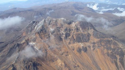
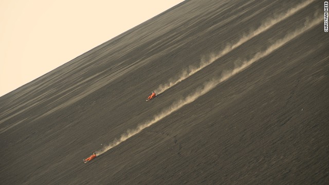
Colombia has ordered the evacuation of 12000 indigenous people living in the shadow of the Chiles and Cerro Negro volcanoes. There is considered to be a high likelihood of eruption in the coming days to weeks after a magnitude 5.8 earthquake and numerous smaller quakes occurred within the system. The fact that the volcano is a big unknown, having no known eruptions in the past 10.000 years, doesn't make it any easier to predict; it's a very different beast from the other Cerro Negro volcano, which is found in Nicaragua and is a popular site for volcano boarding:
(Credit: CNN)
(Yes, that's apparently a real thing)
Elsewhere, there's been lot of ado about new activity in Japan's Ioyama, not to be confused with the recently-deadly Ontake. The big concerns about Ioyama is that it's only 40 miles from a nuclear power plant. That said, it's important to keep in perspective, the new activity there is still very minimal and there are no signs of an imminent eruption at all, let alone an eruption of such a size that it could disrupt operations at a plant so far away.
Yes, both of them are showing earthquake activity, especially Cerro Negro. One of Cerro Negro's was extremely powerful for a volcanic quake (assuming it was volcanic and not seismic). But there's nothing else on the planet right now comes close to the frequency of powerful quakes in Bárðarbunga's caldera:
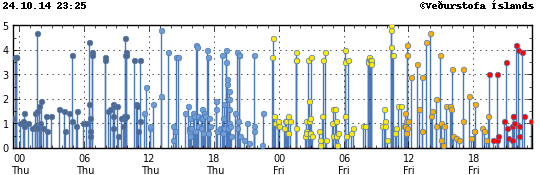
What the bloody heck, Bárðarbunga? For comparison, here's the same time 2, 4, and 6 days ago:
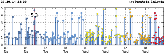
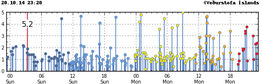
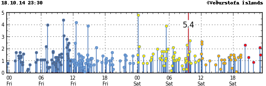
Anyone else noticing a trend here? Bueller? Bueller?
In the past two days there's been an incredible 72 quakes over magnitude 3. Tremor, however, isn't showing an eruption in Bárðarbunga's caldera at this time. She's just really, really "quakey".
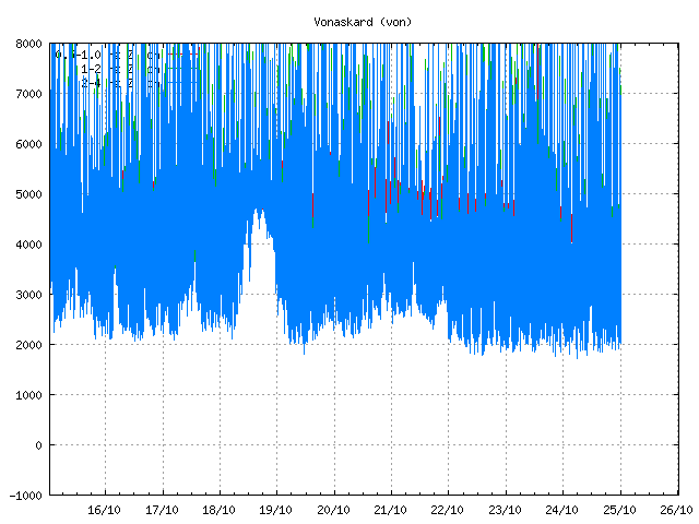
The most recent risk assessment suggests that a jökulhlaup from Bárðarbunga could approach 25 thousand cubic meters per second. To say that this would take out the current bridge, designed to withstand a mere 3,000 cubic meters per second, is an understatement. The researchers and journalists at Holuhraun are only half an hour at flood speed from the glacier's edge.
The eruption over Holuhraun - which many people are now wanting to call "Nornahraun" (Witch's Lava) after the Nornahár (Pele's Hair) it's produced - continues with similar intensity. Let's look at the map:
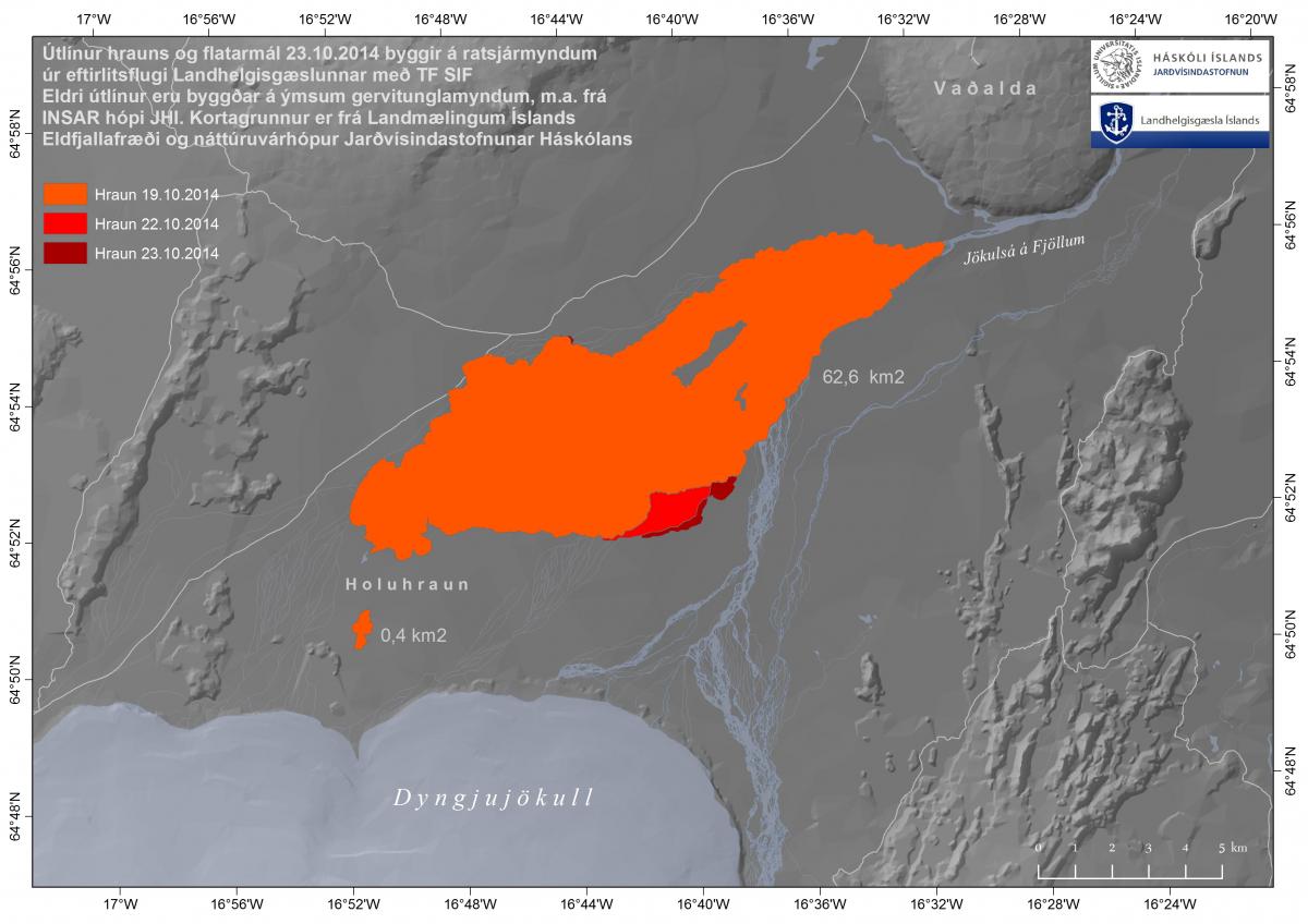
(Credit: Jarðvísindastofnun)
If the eruption is continuing at similar intensity, then why is the daily expansion lower? Because instead of forming a narrow, focused a river of lava as we saw in the early days, it's spreading out extensively over itself like a long firey delta:
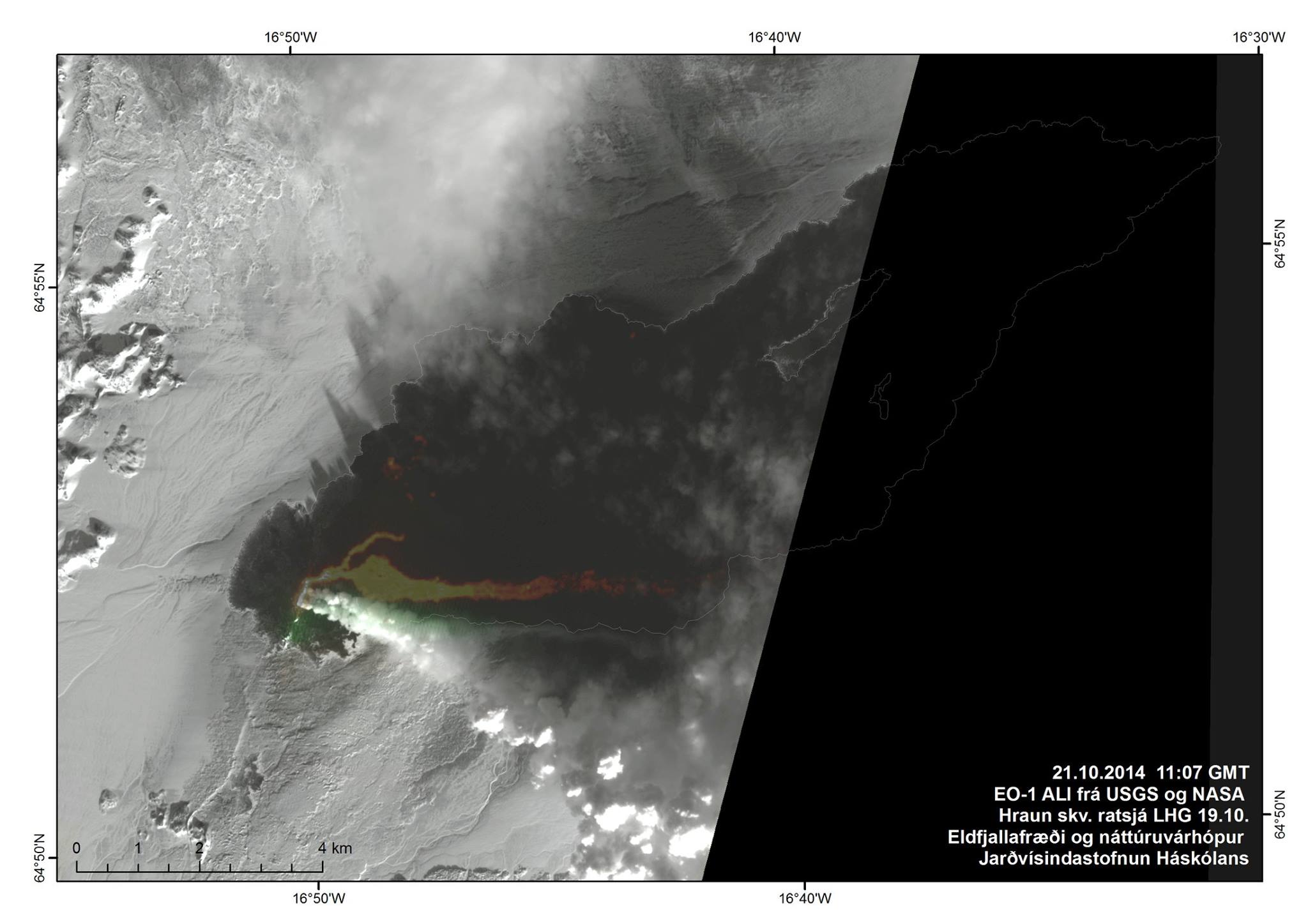
(Credit: NASA / USGS)
Where is all of this lava originating? A new study suggests that, contrary to some alternative theories that have become more popular as of late, only deep mantle plumes could explain the formation of large igneous provinces like Iceland.
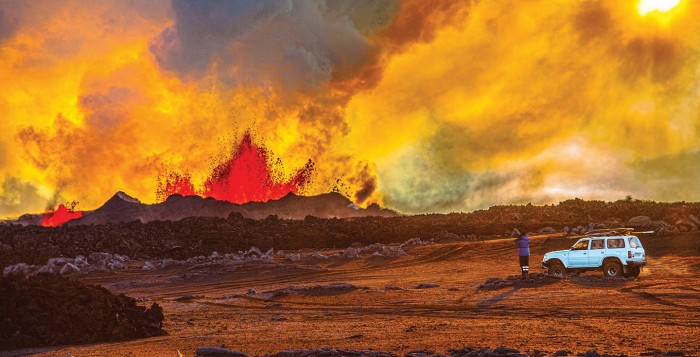
Tour companies keep trying to find clever ways to get people up close to the eruption. Arctictrucks Experience is taking advantage of the fact that the closed zone size is much smaller in the direction of the glacier, and so takes people up to camp on the rim of the glacier overlooking the eruption:
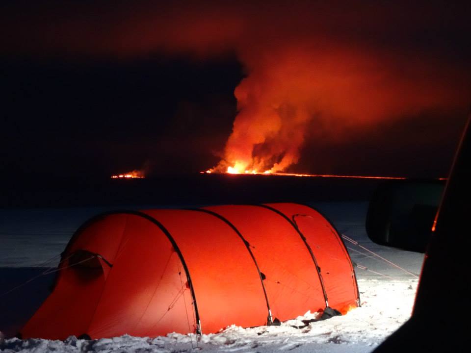
(Credit: Arctictrucks Experience)
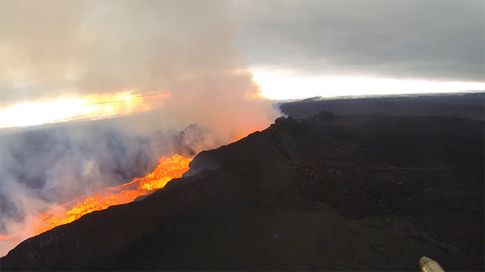
Let's check out some more pictures from others while we're at it, plus a couple videos:
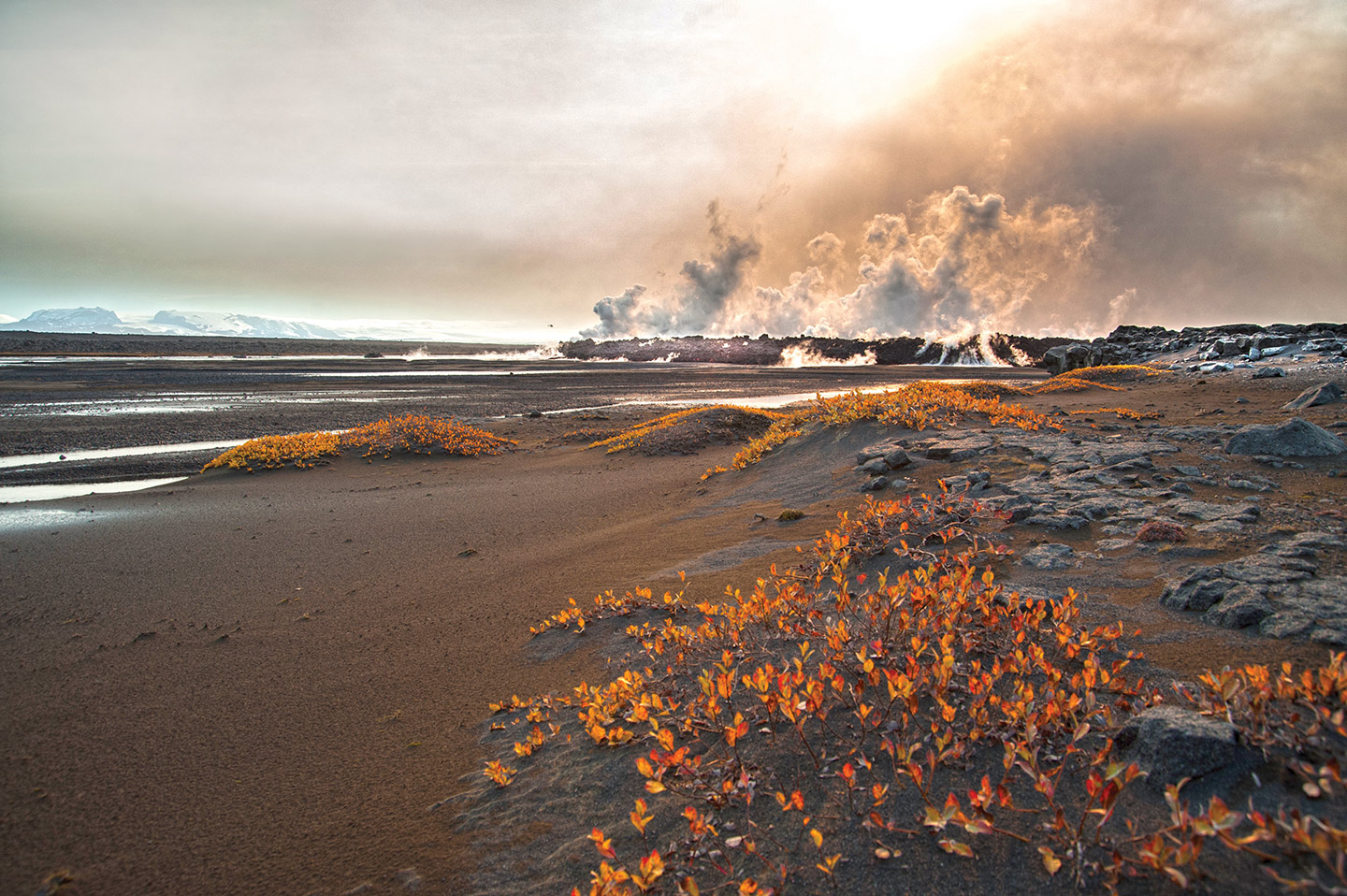
(Credit: MVT Times)
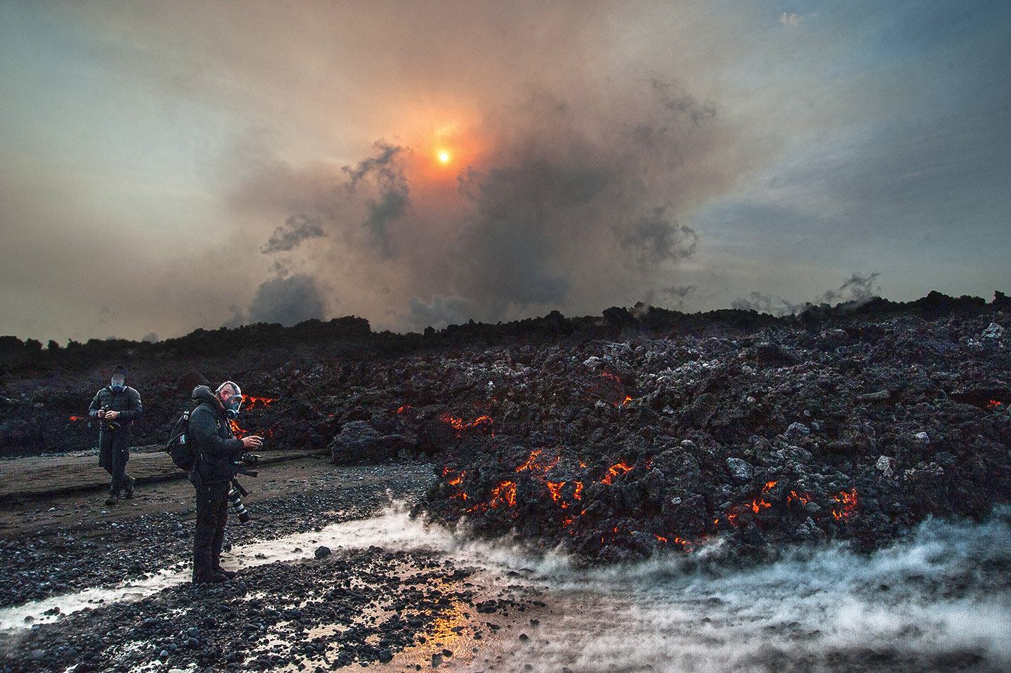
(Credit: MVT Times)
(Credit: MVT Times)
(Credit: Gísli Gíslason)
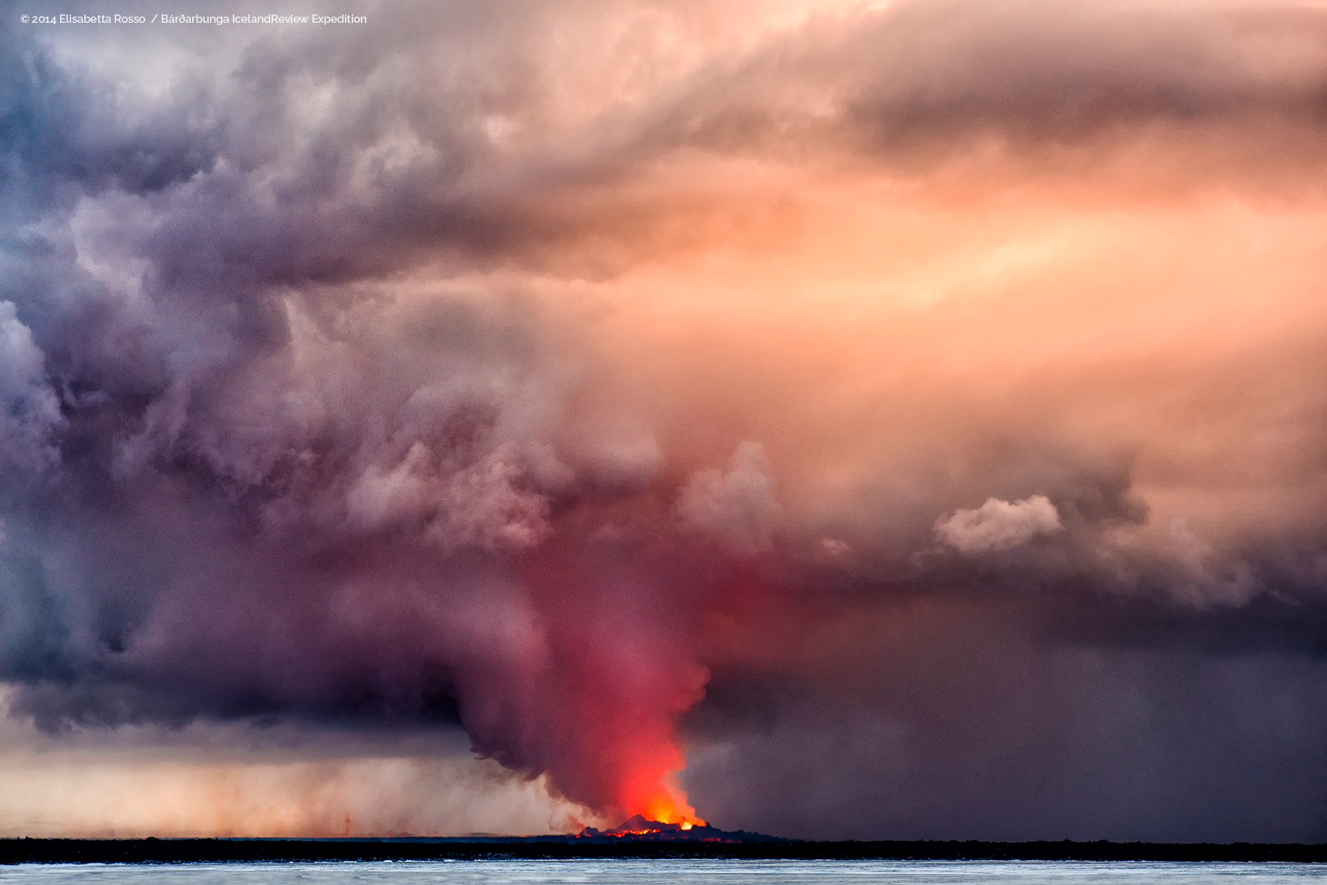
(Credit: Elisabetta Rosso)
Update, 2:07:: No article tonight.
