Yesterday, Sigmundur Davíð, head of one our conservative parties and current Prime Minister and Minister of Justice, flew over the eruption on Holuhraun. As a professional courtesy, the volcano did not cause any mishaps for his flight. Rather, the trip was uneventful and was used as an opportunity to update him on the status of the eruption and preparations that the Coast Guard and public protection services have been taking.
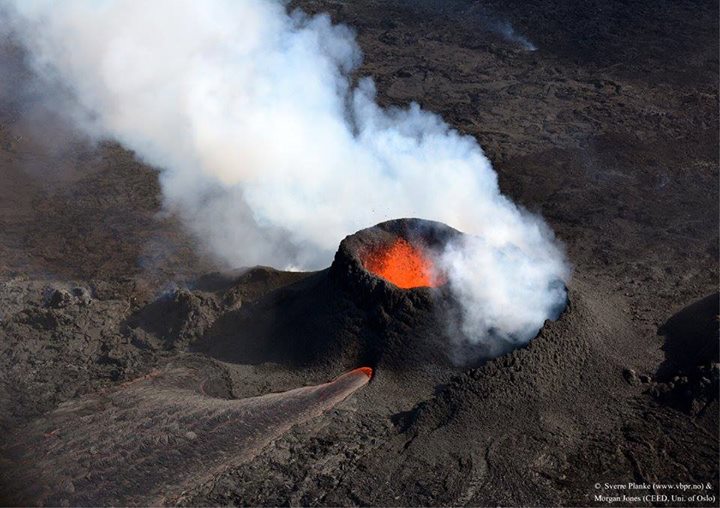
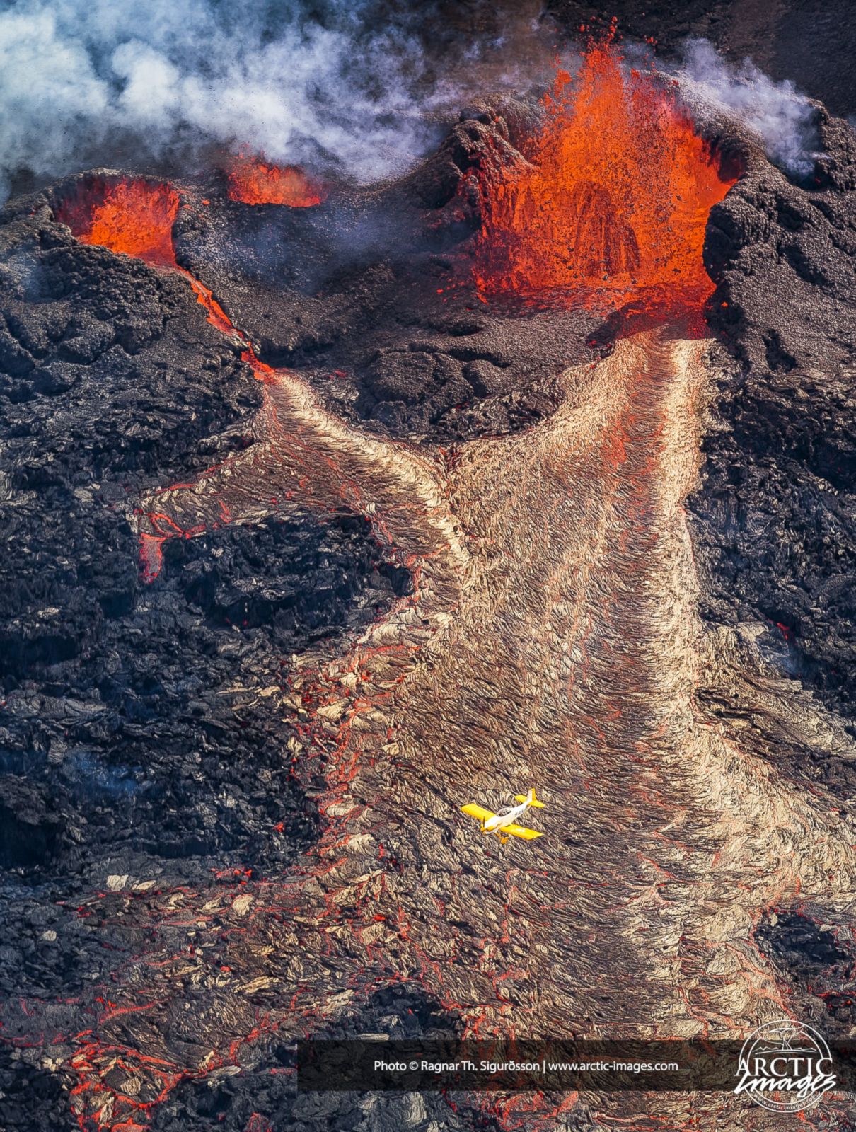
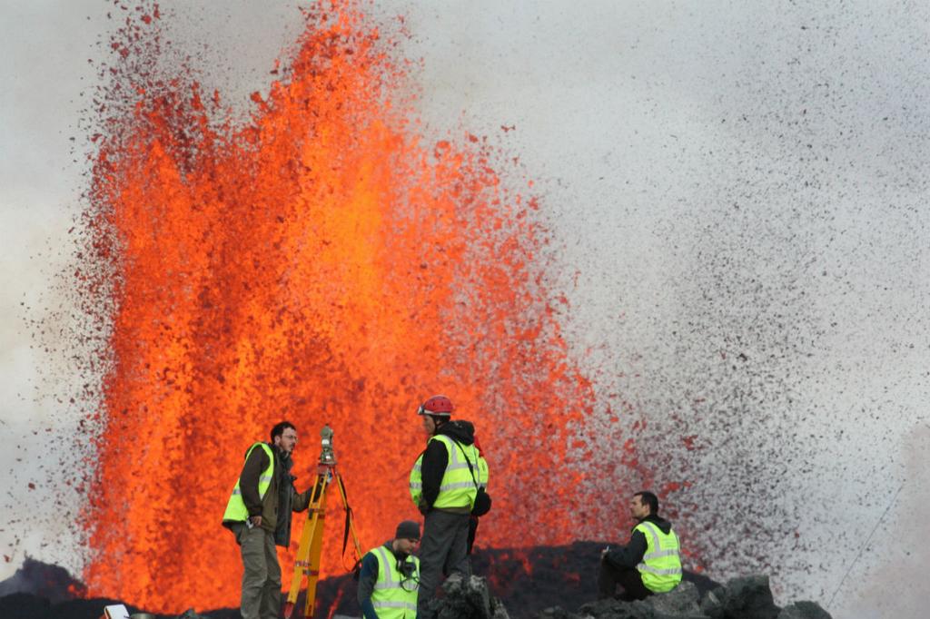
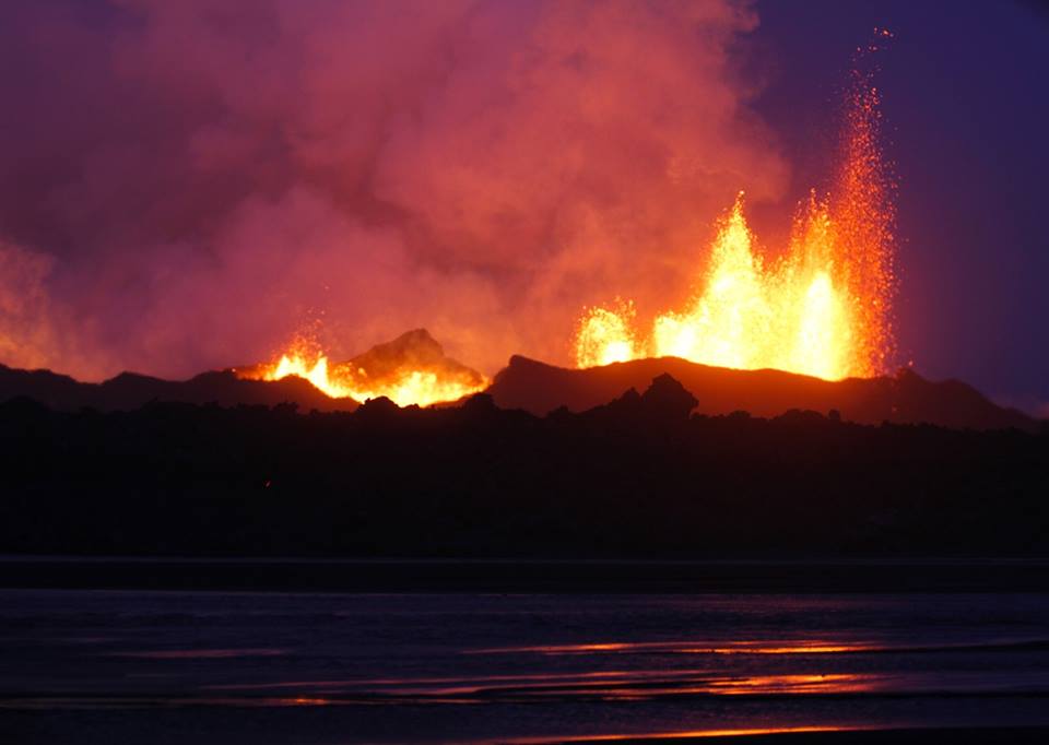
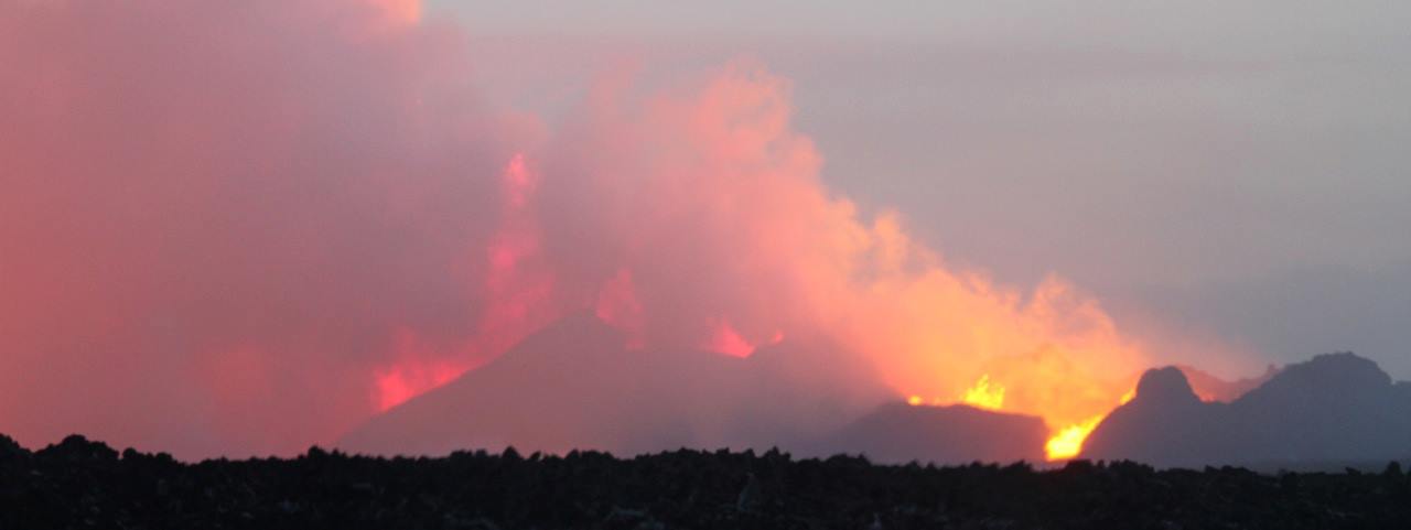
Onto Holuhraun, fresh lava poured continuously, nearly 200 cubic meters per second running across 25 square kilometers toward a pinch in the Jökulsár á Fjöllum. The volumetric flow of the lava is faster that of the river itself - a literal river of fire across the surface.
But while that's where the activity near the surface has been, what's going on under the surface to the south-southwest is what has people even more concerned. And some of the more careful observers the other day might have gotten an extra worry... that of sudden rapid motion on the part of Grímsfjall.
But is all as it seems? Join us for an I'm-Sorry-I-Was-Too-Tired-To-Finish-My-Update-The-Other-Night edition of Eldfjallavakt!
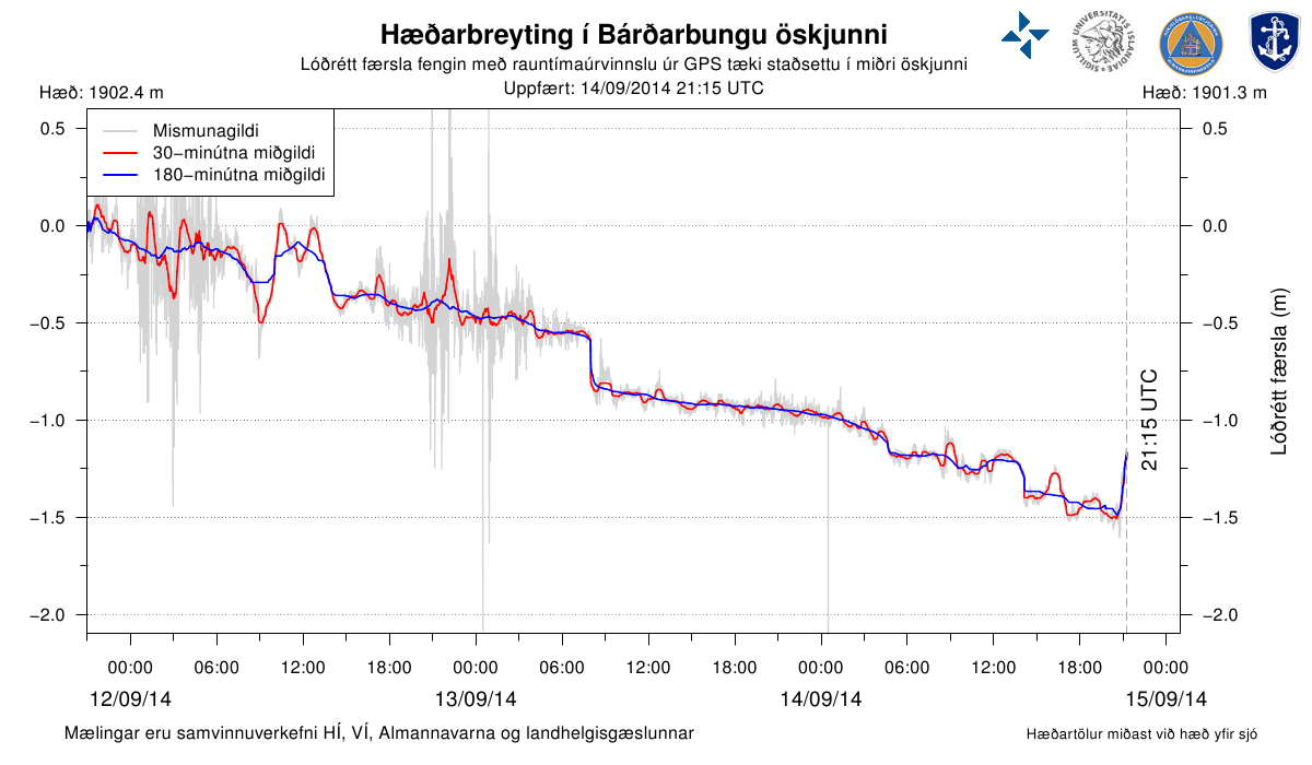
Perhaps you were watching the GPS meters. Or perhaps you read it on a blog. Either way, you might have heard some concerning news: Grímsfjall is moving rapidly up and to the north.
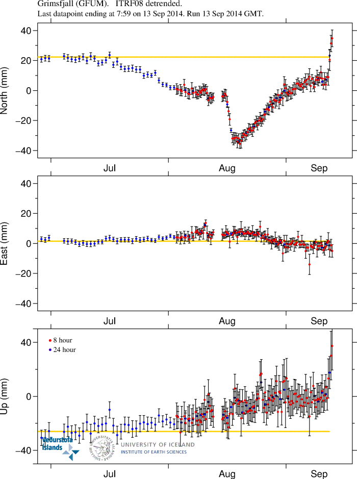
Danger Will Robinson, right? That's a pretty tremendous spike, and naturally people got worried.
But all is not as it seems.
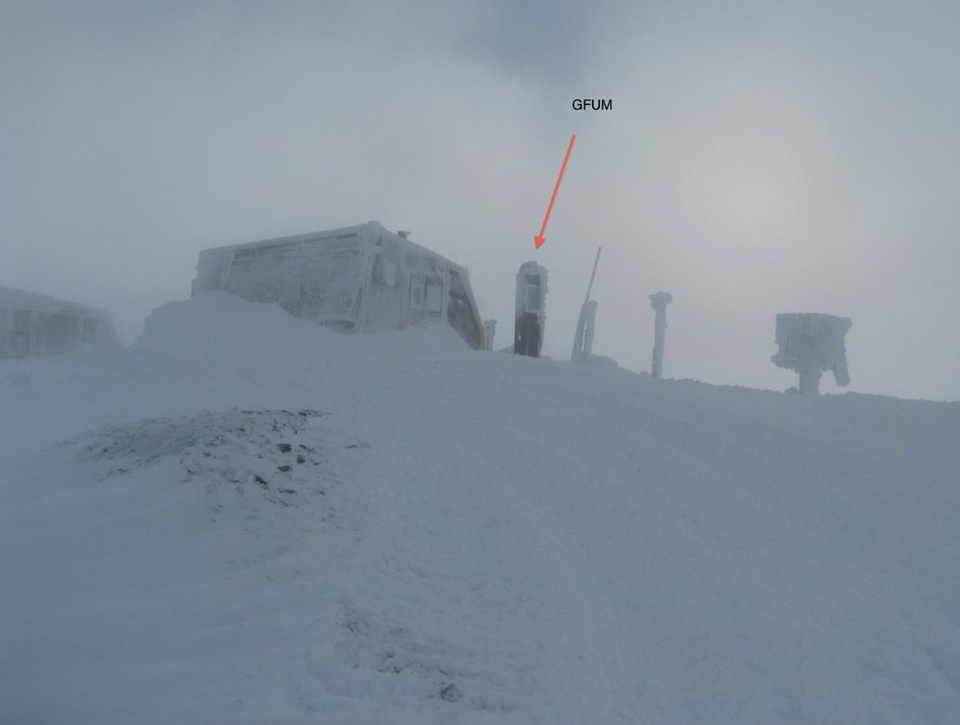
According to Jarðvísindastofnun Háskólans, there was an ice storm that coincided with the measurements and iced over their antenna. This resulted in heavily inflated, artificial movement in the system. Here's what the station looks like after such ice storms:
No sudden movement in Grímsfjall. Just one thing among several we have to be thankful for today.
Here's another: declines in pollution rates. The multi-day pollution event in Austfirðir that reached nearly 4000 µg/m³ has finally subsided and people can breathe fresh air.
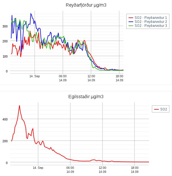
Many people in town had initially thought they were getting sick before realizing the cause (one of the cell phone carriers didn't send out the warning SMS messages). Now they at least have some time before the next event.
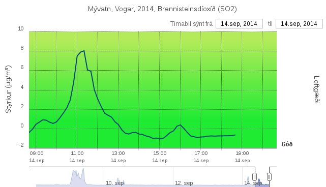
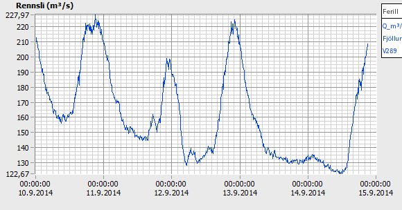
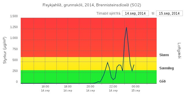
There were predictions today that the northern part of the country would experience their own pollution event, but thusfar the meters at Mývatn have not detected it:
There's even good news about the lava eruption itself. The lava field has advanced only 50-100 meters in the direction of pinching off the Jökulsár á Fjöllum at Vaðalda. After registering rather little flow yesterday, the flow meter at Upptyppingar is nearing normal for this time of year:
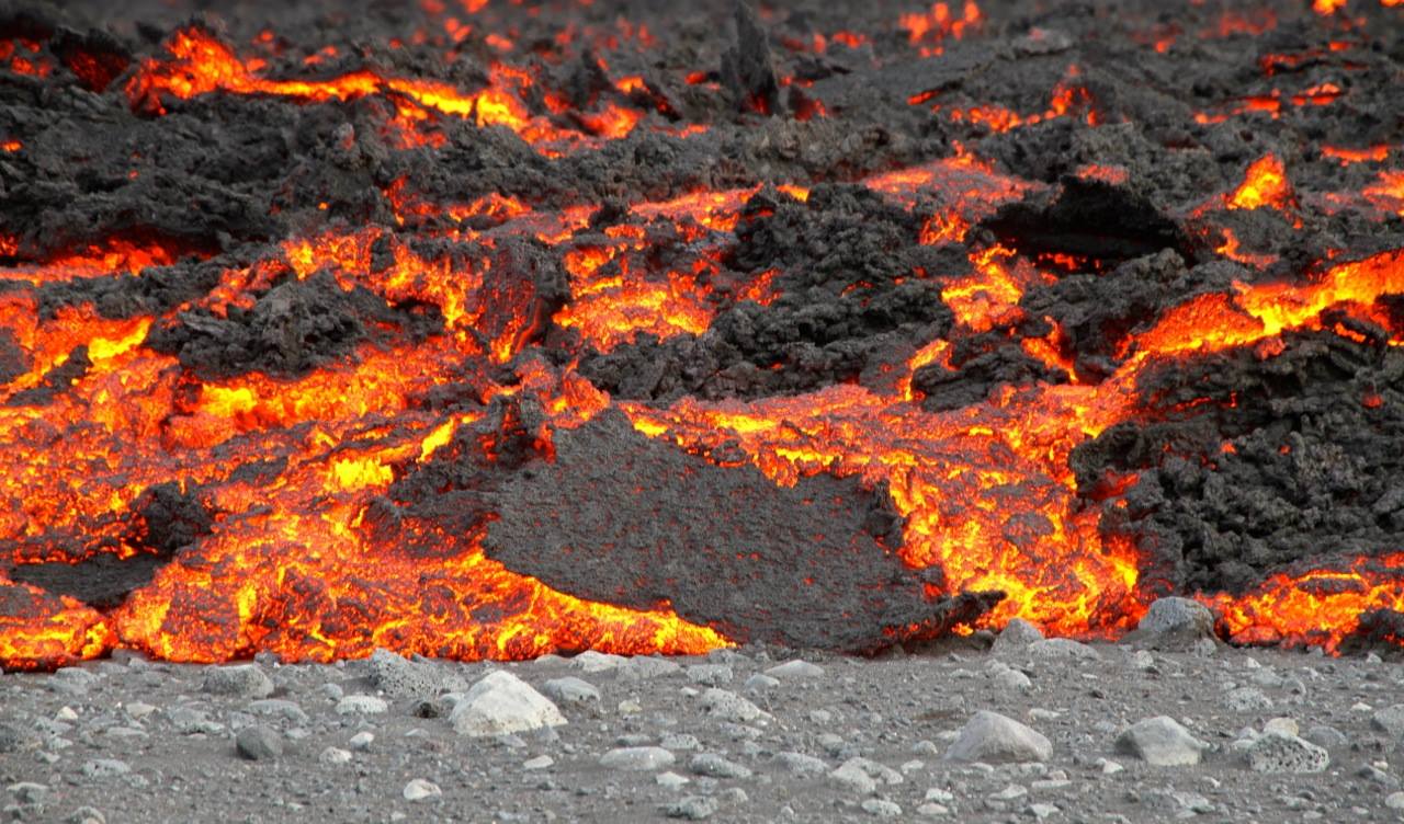
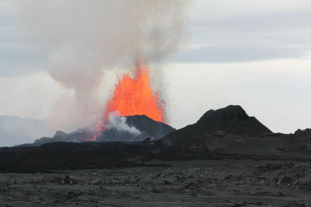
Instead of advancing forward, the 1175°C, honey-textured lava is diverting into a number of lateral flows to both the east and the west of the main flow. The largest of these had reached 300 meters wide and 2 kilometers long yesterday.
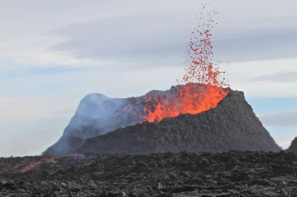
In addition to the change in flow patterns, there appears to be a reduction in flow rates from the fissure. One of the fissures (Suðri) has ceased fountaining entirely and is now a lake of lava. Some scientists have been jokingly suggesting that it should be renamed "Heiturpottur", or "Hottub".
But is this reduction a good thing? Because one scientist has been arguing that the vast majority of the magma moving is at present not accounted for.
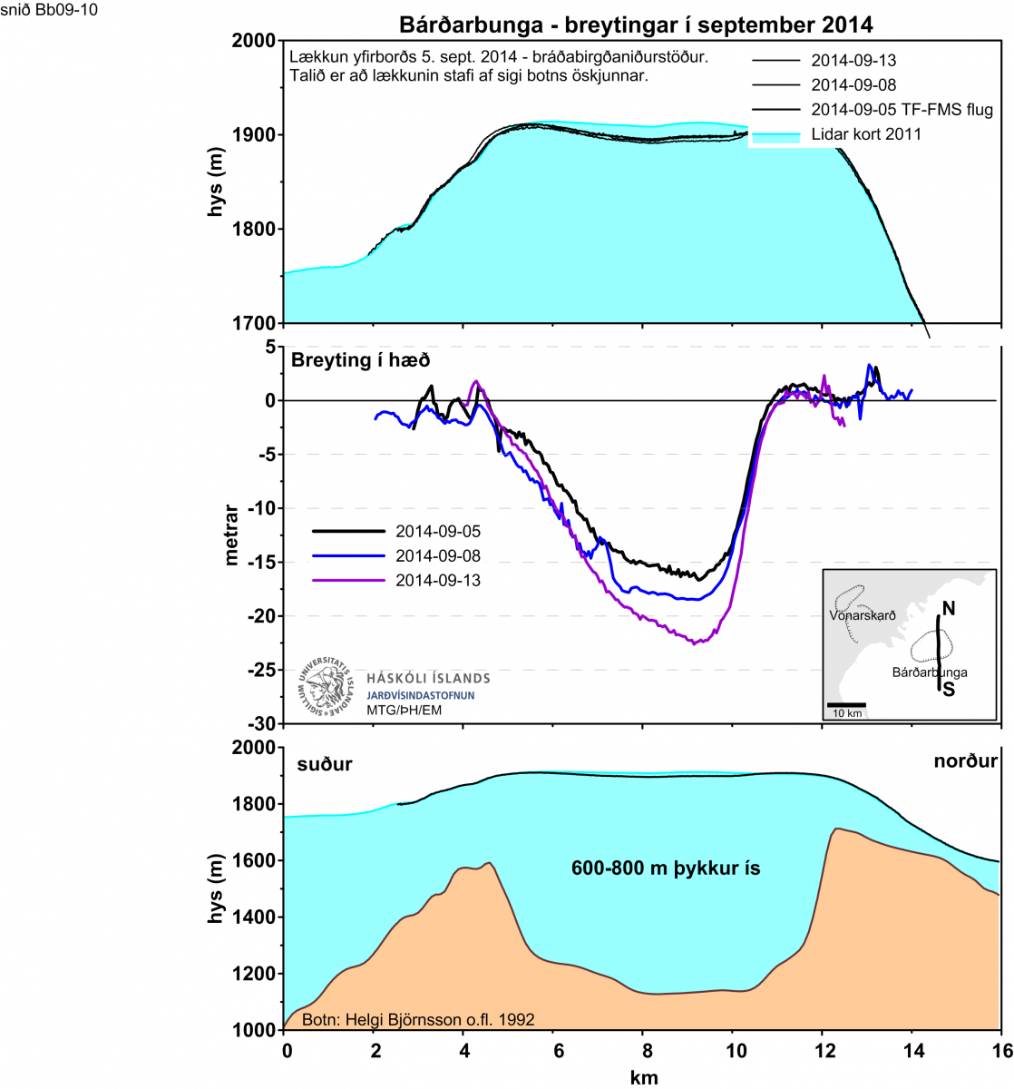
As we know, the top is caving in on Bárðarbunga.
And the whole system keeps undergoing spikes in tremor, which is very disconcerting.

Precisely what is going on underground is not sure, but a common presumtion is that the collapse is taking up the space lost by magma at some depth moving out onto Holuhraun.
Enter volcanologist Haraldur Sigurðsson. He estimates that the volume of rock that's subsiding in Bárðarbunga's 130 square kilometer caldera is moving at a volumetric rate of 50 to 100 million cubic meters per day.
If the rock is moving at that rate, then where is the 50 to 100 million cubic meters of magma that the rock is displacing, given that that's a daily quantity far larger than the total amount erupted thusfar? Haraldur thinks it's going towards expanding the dike. He, however, offers no clarification as to where he thinks it's expanding or any further justification along the lines of seismic or GPS data.
It is just a further point underscoring how little we actually know about what is going on within the volcanic systems in the area.
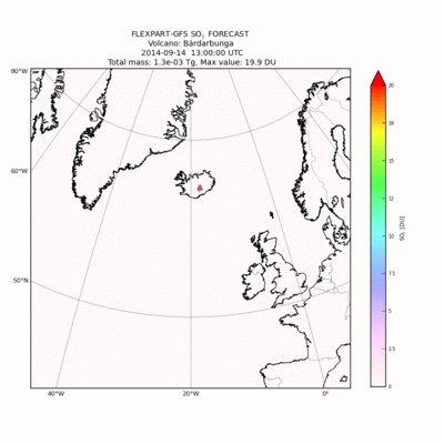
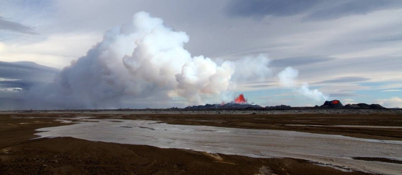
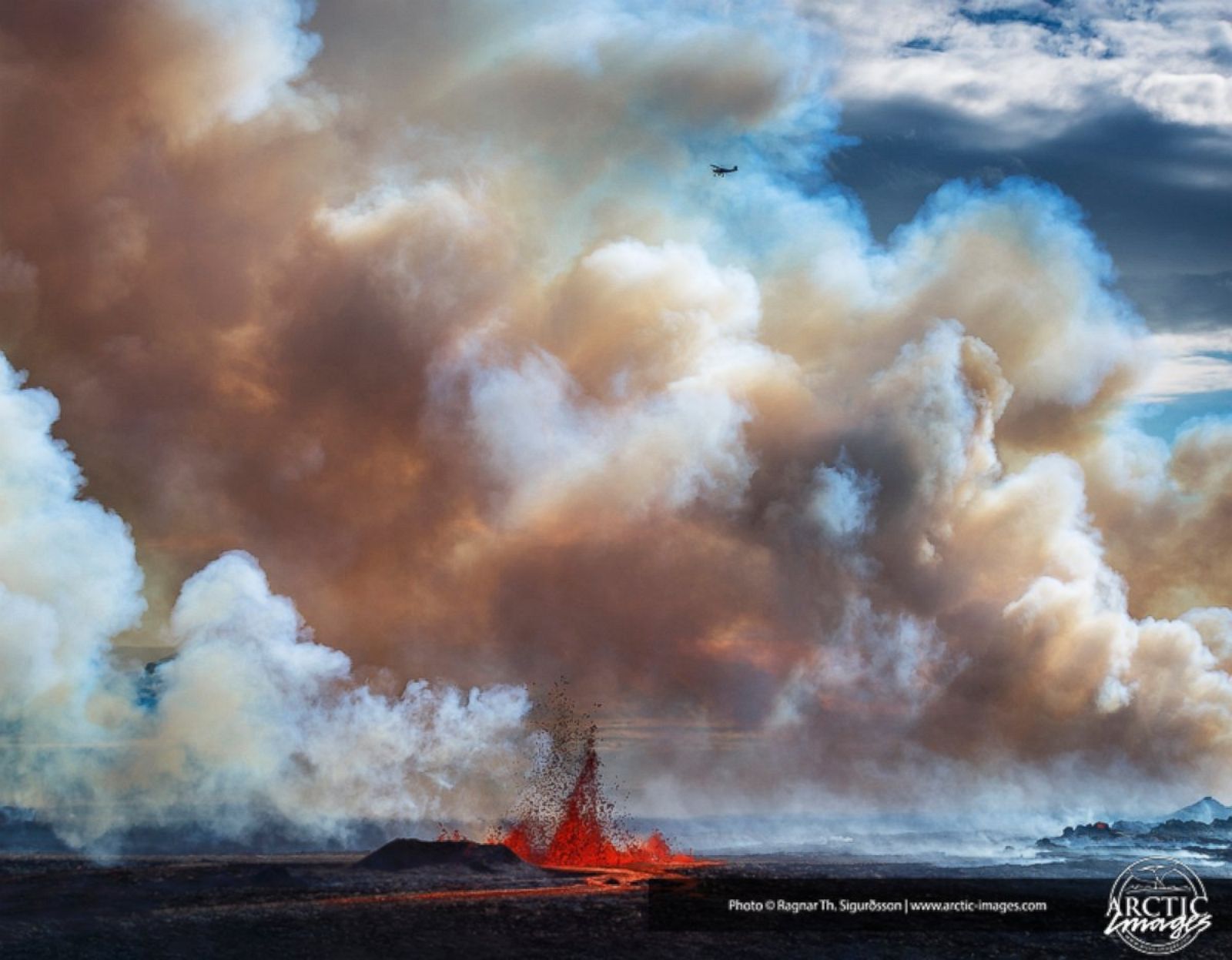
At least we know one thing now: how much gas is being emitted. The other day we got the first official estimates of 750 kg/s sulfur dioxide, or about 65 thousand tonnes per day. By comparison, this rate is about 8-16 times higher than the emission rate of Kilauea. To help visualize it, 750kg/s works out to 2000 cubic meters of SO2 emitted per second, or a Hindenburg's worth every minute and a half.
Yesterday I provided the SO2 emission rates to the VAST team, and they have now incorporated them into their latest FLEXPART run. Since the levels are somewhat higher than they were assuming, the model shows heavier pollution now.
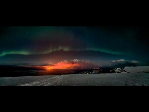
Okay, that's all for now! Sorry for the delays again on the interview, but I still have not yet gotten a response on permission to post the video, and of course I'm not going to do that without permission. So instead, here's a drone video of the lava flow from yesterday:
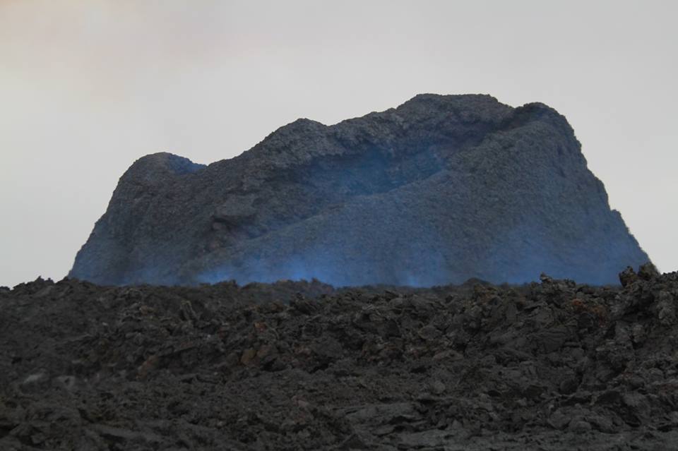
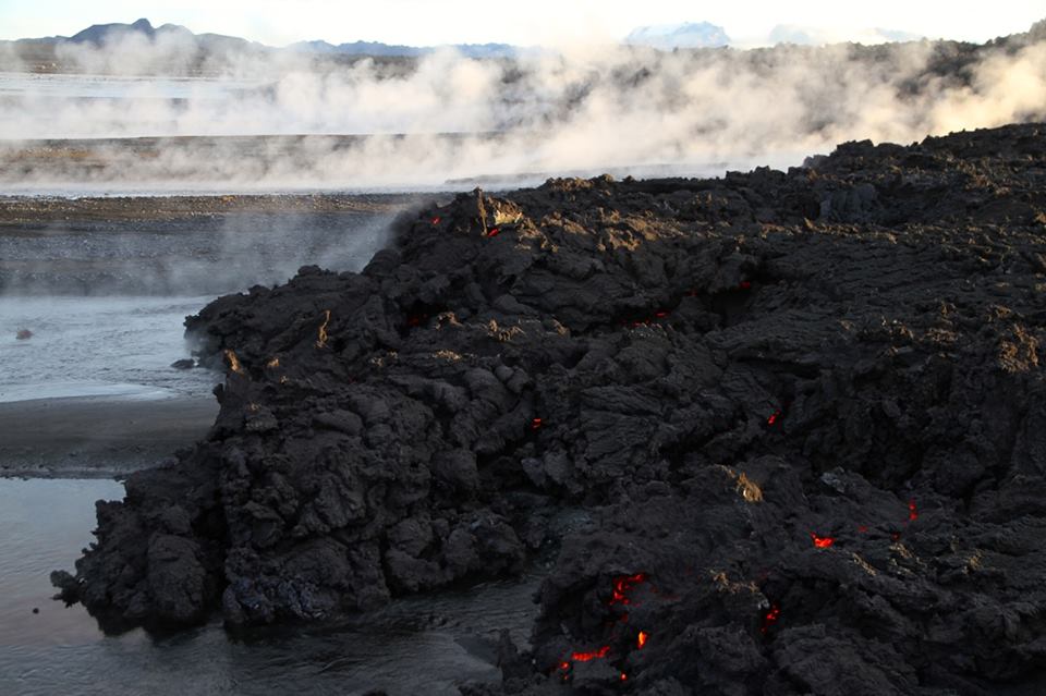
And pictures:

Update, 00:35: Ugh, spoke too soon about the north not getting the predicted SO2 blast - they're getting nailed by it now. Could be worse, though.
... though I probably shouldn't say things like "could be worse" on an event that's still ongoing....
