Orcas Island, San Juan Islands
Salish Sea, Washington State
Ms. K. and I were treated to a couple of days in January at Deer Harbor Resort on Orcas Island by my brother who belongs to a timeshare condo group. It wasn’t as though it was an exotic vacation as it was less than 25 miles from home as the crow flies. However, after an hour’s drive south along the coast and another hour’s ferry ride through scenic islands, we could have been a thousand miles away. And we really lucked out on the weather for mid January - mostly sunny, temps in the 40s with just a bit of rain at night.
|
THE DAILY BUCKET IS A NATURE REFUGE. WE AMICABLY DISCUSS ANIMALS, WEATHER, CLIMATE, WATER AND PLANTS AND NOTE LIFE’S PATTERNS.
WE INVITE YOU TO NOTE WHAT YOU ARE SEEING AROUND YOU AND SHARE YOUR OBSERVATIONS AND COMMENTS BELOW. EACH NOTE IS A RECORD THAT WE CAN REFER TO IN THE FUTURE AS WE TRY TO UNDERSTAND THEIR PHENOLOGICAL PATTERNS THAT ARE QUIETLY UNWINDING AROUND US.
TO HAVE THE DAILY BUCKET IN YOUR ACTIVITY STREAM, GO TO BACKYARD SCIENCE AND CLICK ON FOLLOW.
THE DAILY BUCKET IS A NATURE REFUGE. WE AMICABLY DISCUSS ANIMALS, WEATHER, CLIMATE, WATER AND PLANTS AND NOTE LIFE’S PATTERNS.
|
The San Juan Islands are an archipelago that lies between the north western coasts of WA state and Vancouver Island within the Salish Sea. Orcas Island is the horseshoe shaped one in the upper center of the map. You can see part of Vancouver Island with Victoria in the lower left side. Bellingham and Bellingham Bay where we live are on the upper right. The ferry ride took us past Lopez Island where Ocean Diver keeps us up to date on the goings-on along her beaches, bays and ponds. Lopez is just below Orcas.
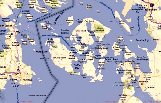 The San Juan Islands, set in the Salish Sea
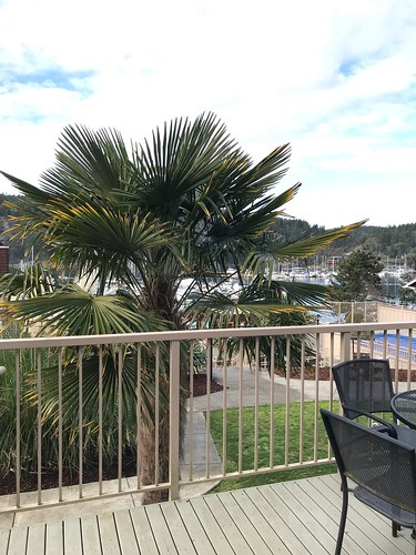
The view from our deck:
January being the off season we felt that we had the island to ourselves except for a few locals who were all friendly. That was good for us as we have a long history on this island, having starting coming there with the family each summer through the 1970s and into the 1990s. Then in the mid 1990s and into the 2000s, we came by boat and moored at various marinas in the islands, including right here at Deer Harbor.
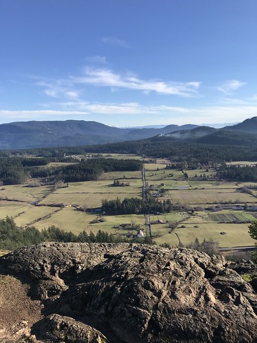
I took a hike up Turtle Back Mountain, largest hill on the west side of the island at 1,110 feet, to take a few photos of the surrounding territory. The photo at the top is from this vantage point.
Below is a video of the wide panorama to be seen from Turtleback. The video starts looking south east, down Puget Sound toward Seattle. Were it not hazy, you could see Mt. Rainier. Moving to the southwest is the Strait of Juan De Fuca with fog (the white strip) and the Olympic Peninsula with the Olympic Mountains in the background. Moving on to the west is West Sound in the foreground, across San Juan Channel is San Juan Island and behind that is Vancouver island and Victoria BC.
Below is a photo looking, across Orcas to the east showing the interior of the island and Crow Valley farms. Mt. Constitution is in the distance. Shortly I’ll show some views from atop that big hill. Fortunately we were able to drive up it.
 Crow Valley Farms, Looking east across the Island
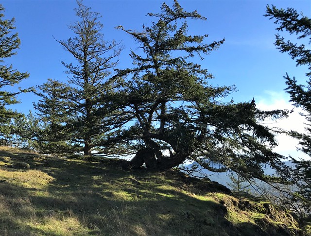
Now for some trees. There are several species of trees on Turtleback that I particularly like:
 Shore Pine (Pinus contorta)
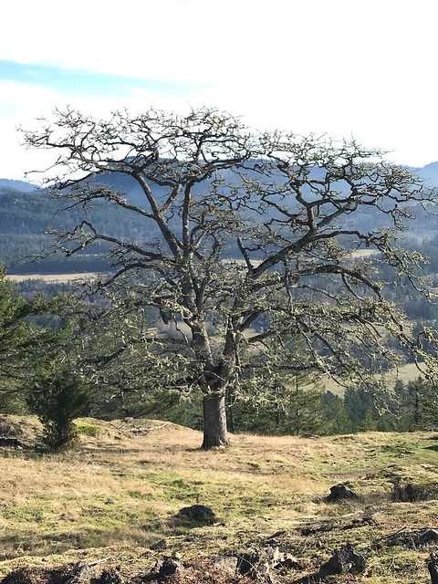 Garry Oak (Quercus garryana — aka Oregon Oak)
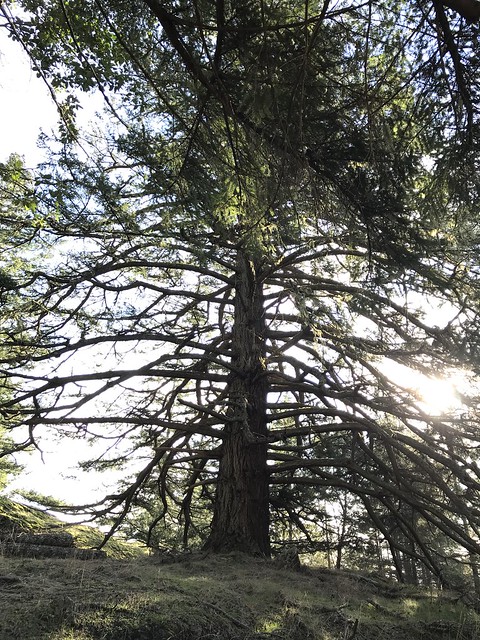 Western Hemlock (Tsuga heterophylla)
More trees: Back at Deer Harbor the Madronas ( aka Madrone, Arbutus) were beautiful as the sun came out and lit up their red and yellow peeling bark.
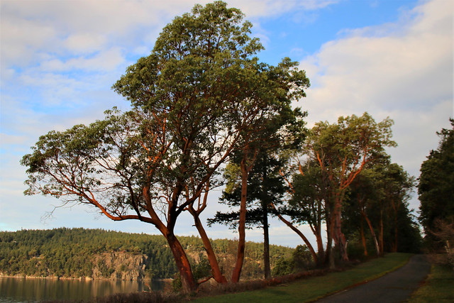 A row of Madronas (Arbutus menziesii) along the Deer Harbor Path (aka Madrone, Arbutus)
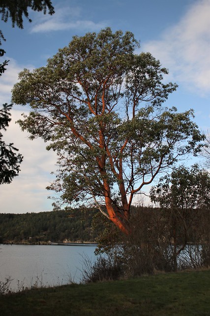 Madrona along Deer Harbor
To get a good look at what was on the other side of the island we drove to the east side and up Mt. Constitution. This is the highest point in the San Juan Islands group reaching 2,409 feet and is part of Moran State Park. The views here are even more breathtaking than those from Turtleback. The photo below shows the water of Bellingham Bay in the foreground with Bellingham, the city on its shores. Behind are the cascade mountains with Mt. Baker overseeing it all.
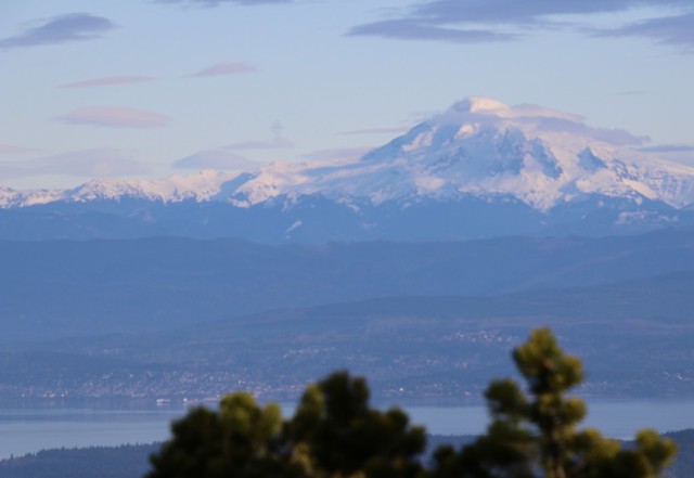 View across Bellingham Bay to to Bellingham and Mt. Baker
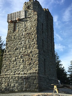 CCCs Tower atop Mt. Constitution
To position us at home relative to up here, we are able see this tower on Mt. Constitution from our living room. The stone tower was constructed in 1936 by the Civilian Conservation Corps.
The following video starts from Canadian Lowlands and moves down the cascades toward Puget Sound.
From this vantage point we can look to the north into the lower mainland of British Columbia and see the Cascade Range coming down across the border. Looking to the East we are perched above Rosario Strait and Lummi Island. Looking further across is Bellingham Bay and Bellingham with Mt. Baker looming above it all. Then moving south we look down to Puget Sound again. The sound you hear in the video is the wind howling and it was frigid, (for us anyway).
Following are some other scenes from around the island. Some are from this trip and a couple are from previous trips to provide a bit more local color.
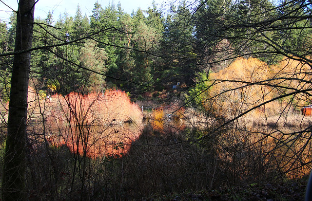 January Willow reflections in an island pond
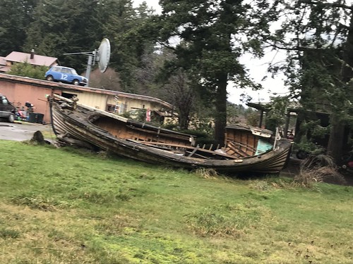 Everyone here has a boat and this is not an unusual scene
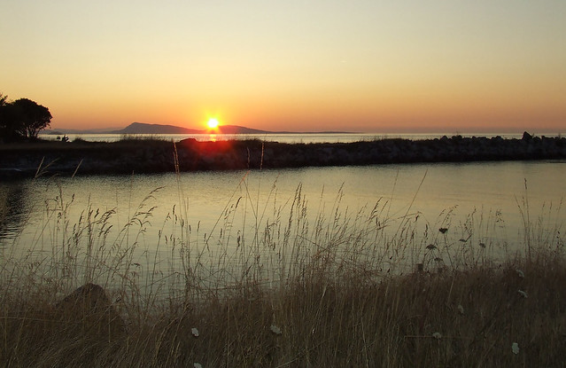 An August Sunset over Sucia Island from the North end of Orcas Island
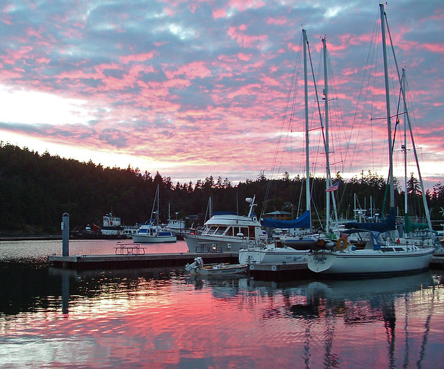 A July sunset over Deer Harbor Marina
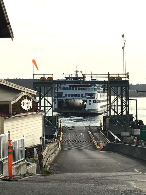 The Ferry Takes us Back to real life
"SPOTLIGHT ON GREEN NEWS & VIEWS" IS POSTED EVERY SATURDAY AT 3:00 PM PACIFIC TIME ON THE DAILY KOS FRONT PAGE. IT'S A GREAT WAY TO CATCH UP ON DIARIES YOU MIGHT HAVE MISSED. BE SURE TO RECOMMEND AND COMMENT IN THE DIARY.
What are you seeing in your backyard and around your town? Please share it with us in our Daily Bucket.