|
The Daily Bucket is a nature refuge.
We amicably discuss animals, weather, climate, soil, plants, waters and note life’s patterns.
We invite you to note what you are seeing around you in your own part of the world, and to share your observations in the comments below.
|
.
It’s been 40 years since Mt St Helens blew up. For those of us who lived in the Pacific Northwest at the time, that’s a day we remember, and we can answer the question:
Where were you at 8:32 a.m. on Sunday, May 18, 1980?
I was living in south Snohomish county, about 150 miles north of the volcano. That morning, I was outside the house, it being a nice day, jiggling my restless two-month-old new baby while my 2-year old toddler slept inside. It was a quiet Sunday morning, and then I heard — no, more like felt — a very deep boom. I thought maybe somebody was firing off some explosive in the area. Granted, there had been news reports of geologic activity at St Helens during the preceding couple of months: earthquake swarms, steam and ash ejections, and a big bulge on the north side, alarming enough for Gov Dixie Lee Ray to declare the mountain off limits. But Mount St Helens — or Lawetlat'la, the Smoking Mountain as the local Cowlitz people directly to the west call it — hadn’t erupted for over a century, and previous eruptions had hundreds or thousands of years between significant explosions. At the time I heard the boom, quite honestly I didn’t even make the connection. But by afternoon I was hearing news reports what was happening — aha! Remember, this was in the era before the internet, and news didn’t travel very fast.
Meanwhile, down in Oregon, Mr O was sitting on his boat in the St Helens marina (the town on the Columbia River that is named for the view of the mountain). He and I didn’t actually meet until 2006, so I heard his account of the eruption many years after the event. He didn’t hear a boom, even though he was much closer to the mountain it being only 40 miles to the northeast, because the mountain exploded to the north. But he saw the whole sky lift straight up like a gigantic grey wall. This composite photo from that day gives a sense of what that must have looked like.
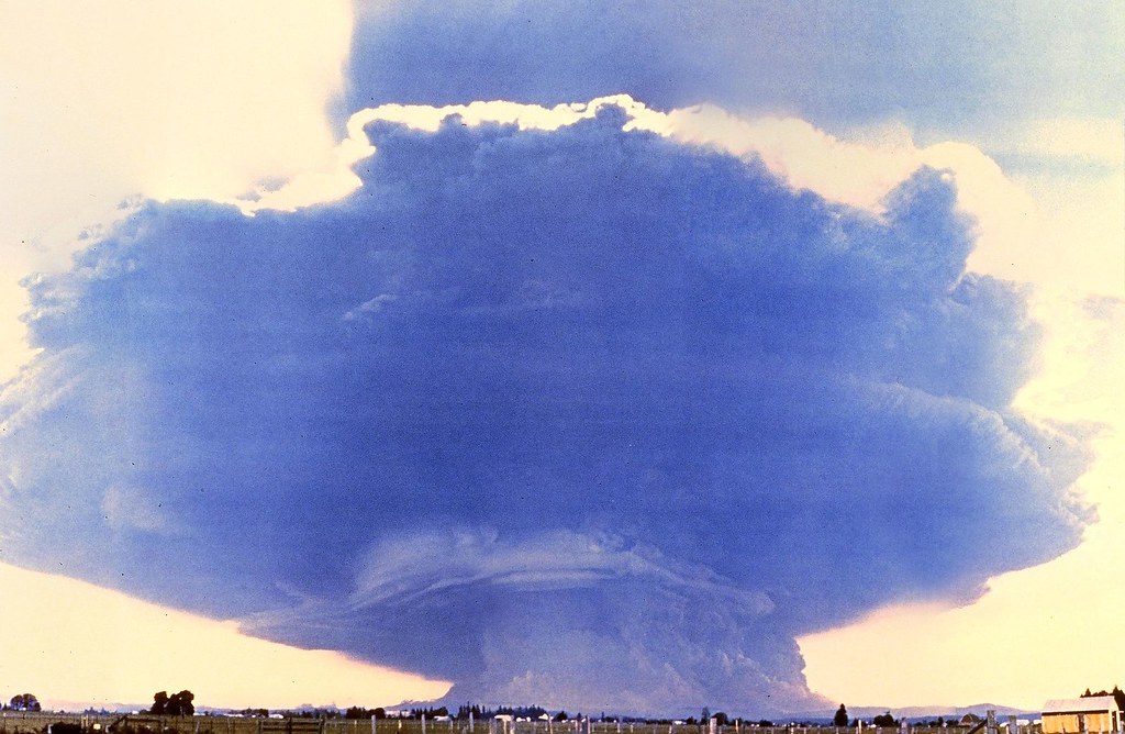 Composite of 20 photos by Rocky Kolberg, taken from Toledo, Washington 35 miles west of Mt St Helens, on May 18, 1980. Creative Commons.
The photo is titled Mt St Helens Mushroom Cloud, which is not an inappropriate reference to the size of the explosion, equivalent to 1600 Hiroshima size atomic bombs.
Mr O relates that when the marina manager saw the thick layer of volcanic ash that settled onto the boats some days later, he thought to do a good deed and hosed off the boat decks. Problem was, the ash soup washed down into the bilges, and everyone was digging that wet fine-grained silt out of their boats for months and years!
Another story. The folks who were in this plane know exactly what they were doing at 8:32am on May 18, 1980:
Overhead, Keith and Dorothy Stoffel were making an aerial survey of the volcano when they noticed a landslide on the lip of the summit's crater, USGS reported. Within seconds, the whole north face of the mountain was on the move. Just as they passed around to the east side of the mountain, the north face collapsed, releasing superheated gases and trapped magma in a massive lateral explosion. Keith put the plane into a steep dive to gain the speed to outrun the cloud of incandescent gas; Dorothy continued to photograph the eruption through the rear windows of the plane as they made their escape.
- from the Live Science article Mount St. Helens Eruption: Facts & Information
The Live Science article has many more facts about the volume and speed of the ash cloud, its height miles up into the atmosphere, the hot pyroclastic flows and muddy lahars overloading river channels, the millions of trees snapped off, the sterilized ground, superheated steam, and so on. The numbers are hard to take in, since we don’t have many cataclysms like that to compare to.
There are many videos about the St Helens eruption. This 6½-minute one has nice footage from that day and maps. I also like how it mentions the death of countless millions of wildlife creatures, which most reports overlook.
🦌
You can visit Mount St Helens, either driving to a lookout, hiking onto its slopes, or climbing up to the edge of the crater (although the Windy Ridge access road is currently Covid-19 closed). Back in 2001, I participated in a couple of hikes to the mountain. The first an overnighter from Spirit Lake to Smith Creek down in the woods to the east of Helens.
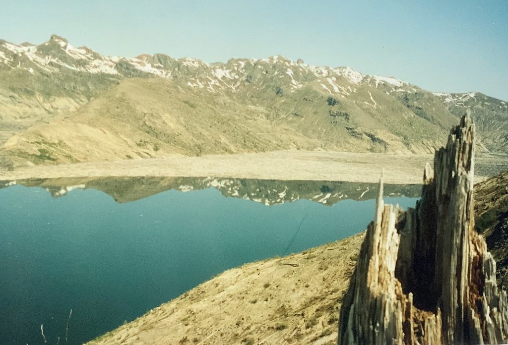 Spirit Lake still has gazillions of dead trees floating in it. The lake bed itself is much higher up, filled with exploded mountain and some human remains as well as Harry Truman’s cats and countless aquatic wildlife.
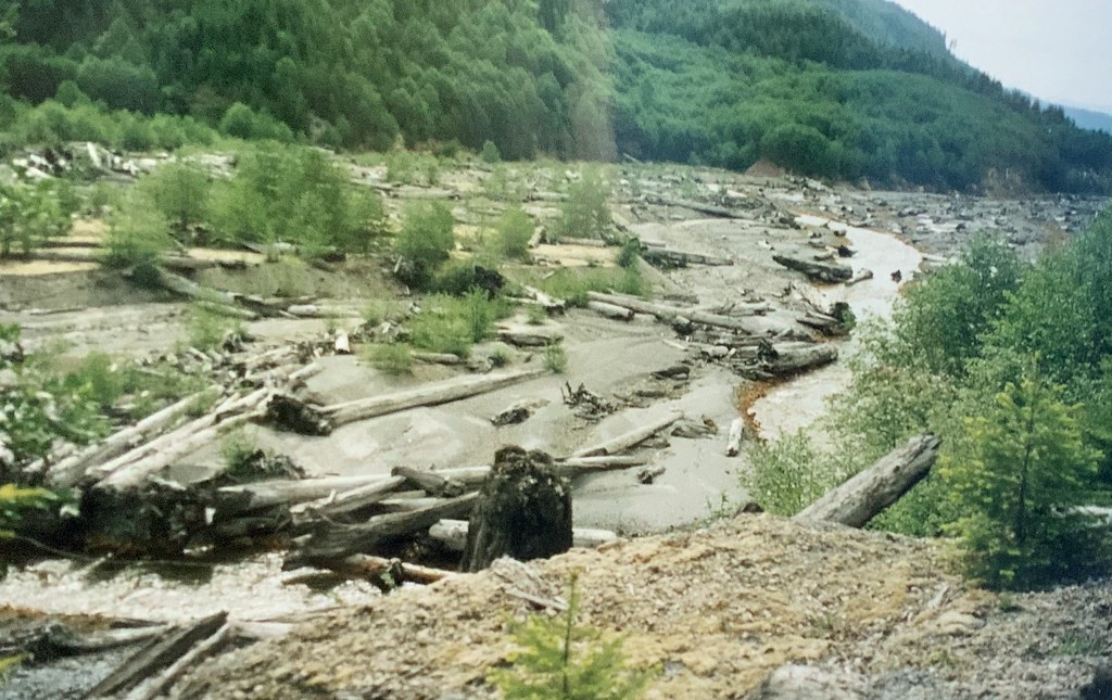 Smith creek drainage debris
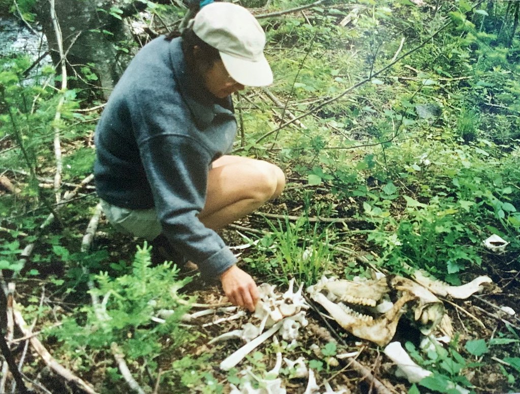 Elk bones in the woods
A month later I joined a smaller group to hike the Loowit Trail, which goes all the way around the peak of Helens above the treeline. This was my last backpacking trip, as my degenerative spinal condition makes carrying heavy things and being on my feet all day impossible now. It’s considered a difficult hike due to steep grades, loose terrain, poorly marked sections, several miles through an old bouldery lava field and 10 miles across the blast zone where there’s no water or camping allowed. It has spectacular vistas the whole way around though, and well worth the effort. We started on the northeast side, from the Windy Ridge parking area, and hiked counterclockwise. It was a weird experience to gradually transition from the desolate moonscape of the Pumice plain blast zone around to the lava fields of older eruptions, and thence to the lush alpine slopes on the south side virtually untouched by the explosion. Then coming back around to the Windy Ridge access trail, the barren landscape of lahars and ash fall reminded us just how recently the mountain had erupted.
My pictures from those trips are film prints, using an instamatic camera. Not great quality, but hey it’s history.
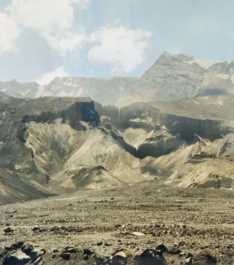 Loowit falls, above the Pumice plain.
 That’s a 1200’ drop into the Toutle River valley on the right, and even with a traverse across the slope it’s a 20% grade. Brutal down and up. Plus wading across the Toutle. Luckily in July it wasn’t deep.
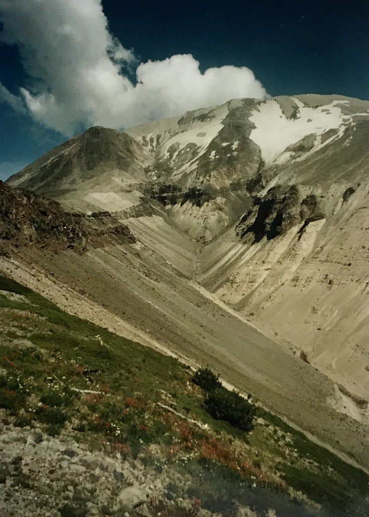
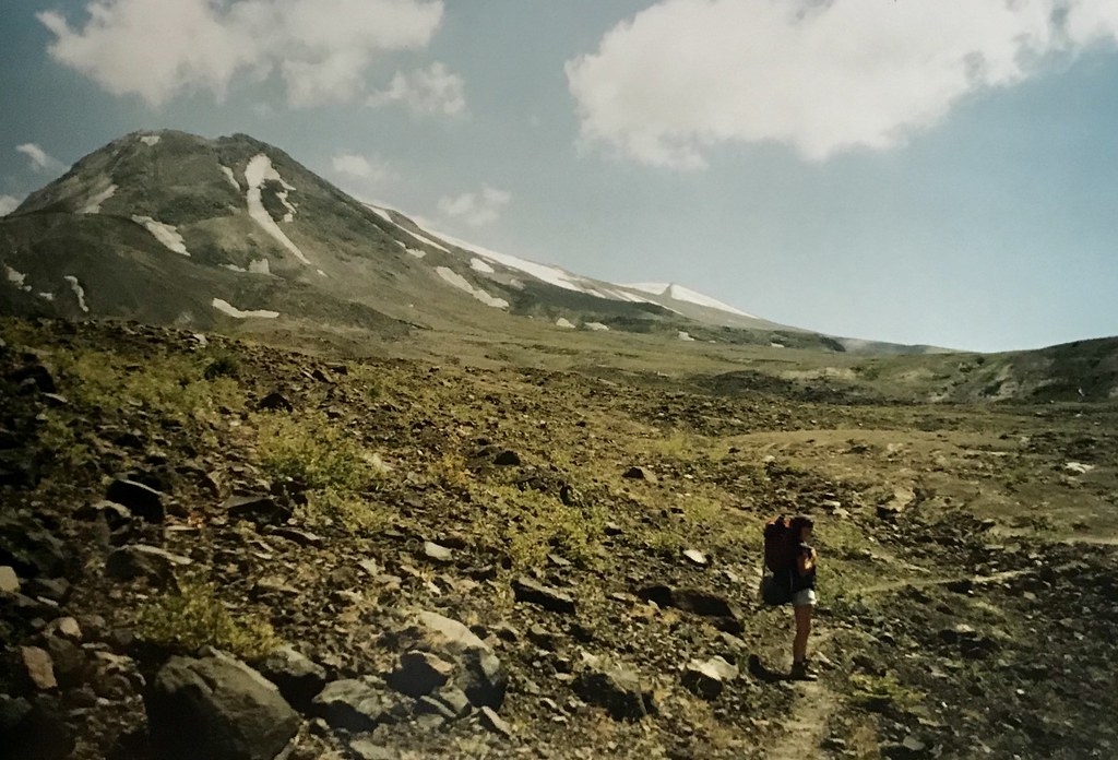
 Wildflowers had colonized ash fall slopes not in the direct blast zone. Even the Pumice plain has new growth now, amazing how quickly life returns.
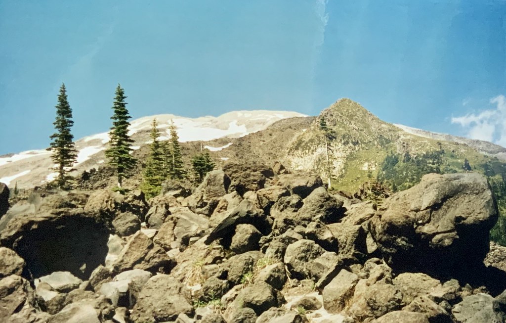 Lava field from an earlier eruption thousands of years ago. “Trail” very poorly marked, I just followed the person in front of me and tried not to turn my ankles.
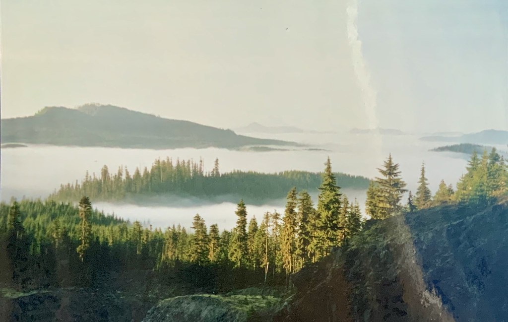 Lush view southward, fog in lowlands, mountain peaks above. Mt Hood is in the far distance, center.
The trail’s name comes from a Northwest Indian legend, part of which is below, describing the origin of the several volcanic mountains in that area:
 pre-eruption
Because Loowit was beautiful her mountain (St. Helens) was a symmetrical cone, dazzling white. Wyeast's mountain (Mount Hood) still lifts his head in pride. Klickitat , for all his rough ways, had a tender heart. As Mount Adams, he bends his head in sorrow, weeping to see the beautiful maiden Loowit wrapped in snow.
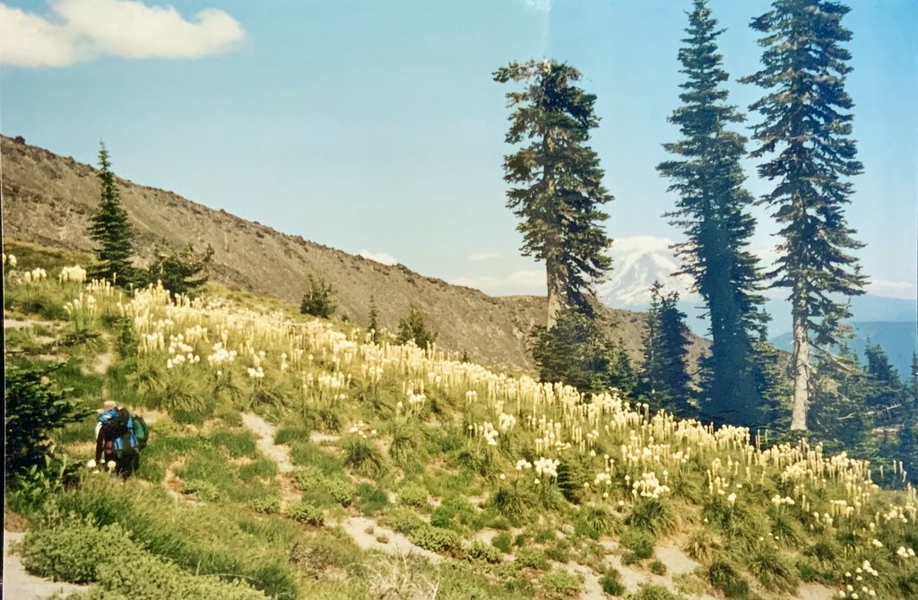 Bear grass fields just above the treeline. Mt Adams in the distance to the east.
 Still snow on Helens in July, even though it lost 1300 feet of elevation on May 18, 1980. Witnessing volcanic explosion, or its aftermath, is a good opportunity to experience a little humility.
Mount St Helens is a reminder that cataclysms can be sudden as well as the more gradual kind, like anthropogenic climate change. Nature does recover eventually from catastrophes, in some new form. Human lives (and civilizations) are considerably more fragile, something we’d be wise to remember.
🌲
Cloudy unsettled weather but warming up here in the Pacific Northwest.
What’s up in nature in your area today?
🌱
|
"SPOTLIGHT ON GREEN NEWS & VIEWS"
EVERY SATURDAY AT 3:00 PM PACIFIC TIME ON THE DAILY KOS FRONT PAGE.
IT'S A GREAT WAY TO CATCH UP ON DIARIES YOU MIGHT HAVE MISSED. BE SURE TO RECOMMEND AND COMMENT IN THE DIARY.
|

