The Dike Trail along the Columbia River in Washougal, Washington, has several information signs explaining the American Indian history of the area. At the time of first European exploration in the area, this area along the Columbia River was in the homelands of the Chinook-speaking Multnomah, Wasco, and Wishram Indians.
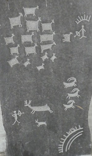 Shown above is a replica of some of the ancient rock art found along the Columbia River.
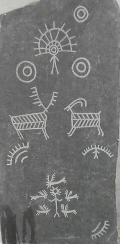 More rock art.
According to one of the information signs along the Dike Trail:
“For thousands of years before the arrival of the Corps of Discovery, the Columbia River was a travel corridor between the Pacific Coast and the Great Basin.”
In his chapter in Lewis and Clark Through Indian Eyes, Sioux writer Vine Deloria, Jr. describes the Corpse of Discovery this way:
“The expedition actually seems to have been a tedious march from one place to another made known to them by Indians and French traders, with an occasional incident to testify to the strangeness of the eland and the unique challenges that the West presented.”
According to Vine Deloria:
“A good portion of the trip while moving through wild and unoccupied country did not involve discovery of the West but merely followed paths already well established.”
In the Columbia Plateau region, the Columbia River was a well-established superhighway for the numerous Indian nations in the area. The American Corps of Discovery, commonly called the Lewis and Clark Expedition, in their 1805 journey to the Pacific and their 1806 return to the United States followed this well-known trail in rather crude dugout canoes.
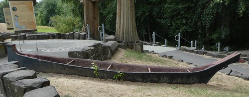
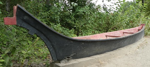 Shown above is a Chinook-style river canoe.
 Another Chinook-style river canoe.
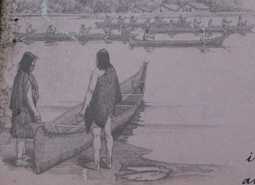 This drawing shows both the Indian canoes with their high bows and the crude American dugouts.
Trade
The Columbia River, like other large rivers, was a transportation corridor facilitating trade between the Indian nations on the Pacific Coast with those in the Plateau, Great Basin, and Plains areas. With regard to the Columbia River’s role in trade, one of the information signs reports:
“Long before the arrival of Euro-Americans (in ships from the Pacific and on foot from the interior), the Indians of this region developed an extensive network of trade, with the Columbia River at its heart. By foot and by canoe, Coastal and Cascades peoples traveled back and forth between the interior and the Pacific Coast. Interior goods, such as beargrass (for baskets and mats), obsidian, and buffalo hides flowed downriver, while shells, wapato, smoked seafood, and other coast items moved upstream.”
Archaeologist James Keyser, in his book Indian Rock Art of the Columbia Plateau, writes:
“Trade was a key element of the Columbia Plateau economy, it served both to bring items not obtainable locally and also to redistribute food products to area of seasonal scarcity.”
Trade requires communication and the people living along the Columbia River were multilingual. Writing about the Wasco, Wishram, and Cascades in a chapter in the Handbook of North American Indians, David French and Kathrine French report:
“Multilingualism has long been a characteristic of these peoples, largely because they functioned in the region as traders and hosts to visitors.”
The Indian people living in the Washougal area at the beginning of the nineteenth century were well aware of American and European trade goods and had already incorporated many of these items—fishhooks, guns, manufactured woolen blankets, metal knives, beads—into their cultures. According to one of the information signs:
“For many years before the arrival of the Corps of Discovery, exploring ships from Europe and the United States had been visiting the Columbia estuary. By the time Lewis and Clark arrived, European and United States material culture had become well-integrated into the Native American lifestyle of this region.”
Subsistence
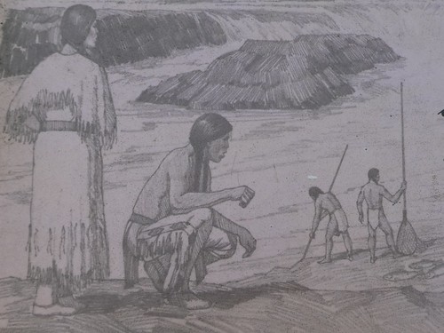
Fishing was important to the Indian peoples living along the Columbia River. one of the primary food resources of this area was a group of anadromous fish, the salmon (Onchorhyncus). Along the Columbia River there was a spring Chinook (Onchorhyncus tschawytscha) run from March to May, a summer Chinook run in June, and a fall Chinook run in August and September. There was a Coho salmon (Onchorhyncus kisutch) in the fall and a Sockeye salmon (Onchorhyncus nerkai) in June.
According to one of the information signs along the Dike Trail:
“The Columbia River was once the site of the biggest salmon runs in North America, and hosted large populations of trout, sucker, eel, and smelt.”

Salmon were a staple food. During the spring and fall salmon runs, fish were caught in great numbers and dried. It is estimated that the aboriginal salmon harvest along the Columbia River was about 18 million pounds. Among the Indians along the Columbia River, it is estimated that salmon provided at least 40 percent of their total calories. The salmon were speared, netted, gorge-hooked, or trapped.
Plant foods, particularly wapato and camas, were also staple foods.The root crops, such as camas, provided a major source of carbohydrates for their diet. Root crops were often dug in May and June, before the plants had fully matured. At this time, the roots were still soft and juicy.
In noting the use of root plants among the Indian tribes along the Columbia River – Wasco, Wishram, Cascades – anthropologists David French and Katherine French, in their chapter in the Handbook of North American Indians, report:
“Wild root foods were so abundantly available in season that they can be thought of as if they were crops ready to be harvested.”
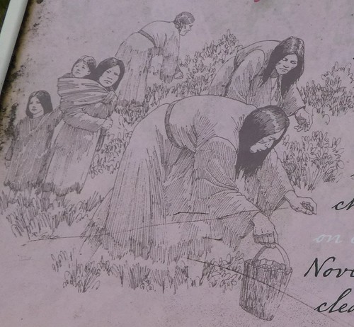 Gathering wild plants is shown above.
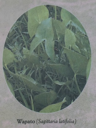
The wapato roots are similar to the Irish potato and the Corps of Discovery stocked up on wapato for their return trip.
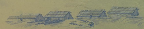
Villages
North American was not a wilderness, but a contentment which was settled by hundreds of Indian nations. The area along the Columbia River had bountiful resources and was densely populated by the time the Corps of Discovery traveled it. According to one of the information signs:
“As the Corps of Discovery traveled down the lower Columbia River, they entered one of the most densely settled regions of North America. Native American villages appeared near every stream confluence, slough, and river mouth. Residents—interested in trading or just curious about the outsiders—visited their camps almost every evening.”
Typically, the villages would have populations ranging from as few as 50 people to as many as 700 people. There were a few large villages with populations of 200 or more. The population and composition of villages was flexible. Individuals were not bound to a village and were able to move freely to another village when it suited them.
The houses of the Cottonwood Beach area, according to the observers from the Corps of Discovery, included both circular pit houses with conical roofs and large multi-family longhouses.
The earthlodge or circular pit house was constructed around which a pit about 6-7 feet deep and about 13 feet in diameter which was covered with poles, grass, and dirt.
Disease
Europeans brought with them many new diseases which impacted American Indian populations. In many cases, the European diseases, such as smallpox, reach Indian communities before the Europeans. According to one of the information signs:
“One devastating impact of increased contact with Euro-American explorers and traders was the introduction of diseases. By the time of the Corp of Discovery’s visit, at least two major epidemics had swept through the area, and Lewis and Clark noted smallpox scars on individuals who had survived a 1770s epidemic. The particularly high population densities of the lower Columbia that so impressed the Corps of Discovery were, in fact, much reduced from their historic peaks.”
Dams
The Columbia River today is not the river that the Corps of Discovery experienced, nor the river which provided fish for the numerous Indian nations that lived along its banks. Today it is not really a river, but a series of reservoirs created by the eleven dams that span its main channel. The waterfalls, rapids, and large fish runs are now gone. Instead of Indian canoes, barges, pushed or pull by diesel-powered tugboats rather than canoe paddles, now haul goods up and down the river.
Indians 101
Twice each week—on Tuesdays and Thursdays—this series presents American Indian topics. More from this series:
Indians 101: Columbia River Beadwork (Photo Diary)
Indians 101: Klikitat Baskets (Photo Diary)
Indians 101: Plateau Containers in the Maryhill Museum (Photo Diary)
Indians 101: Plateau Indian Basket Hats and Trinket Baskets (Photo Diary)
Indians 101: Celilo Falls
Indians 101: The Plateau Indian Longhouse (museum tour)
Indians 101: Columbia River canoes (photo diary)
Indians 101: Plateau Horse Regalia (Photo Diary)