Here are some files of use to those monitoring the election in Cuyahoga County (Cleveland) Ohio:
Google Earth zipped-KML file of polling places
Adobe PDF listing of polling places
Zipped Garmin GPS gdb file of polling places
More...
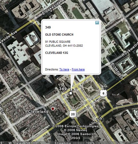
Opening the KML file should start up Google Earth with placemarks for all of the 574 polling places in the county. Clicking on any of the placemarks gives the address of the polling place and the precincts voting there. The latitude and longitude of each placemark are from the Google Maps geolocator service, based on the address of the polling place.
The PDF file indexes all the polling places according to precinct. There are 1,434 precincts for the upcoming election.
The Garmin gdb file has waypoints for all the 574 polling places, for use with GPS navigation software.
