Following is a link to a
Google Earth kml file showing the locations of all the polling places in Franklin County, Ohio. The polling places are color-coded according to the level of provisional ballots: red for more than 15% provisionals, yellow for more than 10% and green for less than 10%. Clicking on a placemark gives the info for that polling place:
Franklin County Ohio provisionals (32kB zipped Google Earth kml file)
Screenshots:
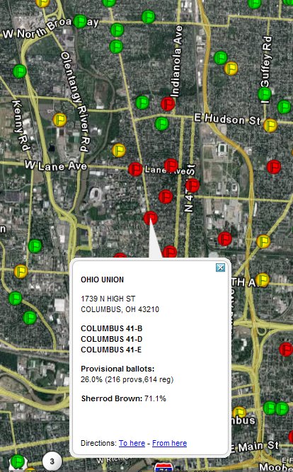
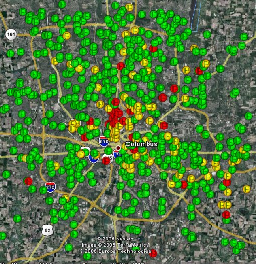
Basically, students and blacks had the highest level of provisional ballots. The main concentration is in the Ohio State University district.
Overall in the county the provisional ballots are about 5.7% of the total. The provisional rate in established Republican suburbs was very low. The rate in campus precincts averaged over 20%. The rate in non-campus, mobile, renter areas averaged about 10%, as did the largely black polling places on the east side.
None of the 20,679 provisional ballots have been counted to date. According to Ohio law, none can be counted until 11 days after the election, Nov. 18. Since this falls on the date of the OSU-Michigan football matchup, the Board of Elections has decided to wait one more day, Nov. 19, to begin counting.
