Here are the latest data from the National Snow and Ice Data Center (NSIDC). For the second time this year, the refreeze rate has stalled. This first happened in December 2008 for about a week. Now, once again, the refreezing rate has gone flat bringing 2008-2009 refreezing to nearly the same point that it was on the same day (January 22) in 2006-2007, the year when the record for minimal extent was set. The most significant difference between 2006-2007 and this year, is that this year's ice has a lot more first- and second-year ice which is thinner, and therefore more likely to melt away quickly than older, thicker ice.
Now of course, none of this tells us what is going to happen over the next two months. The refreeze rate may continue downward and pass below the 2006-2007 level or it may swing back up again closer to the 1979-2000 average. But, if it continues to run parallel to or sink below the 2006-2007 average it is difficult to see how we will not have a record sea-ice melt this summer, even if the National Weather Service's prediction of weak la Niña conditions through early summer hold true.
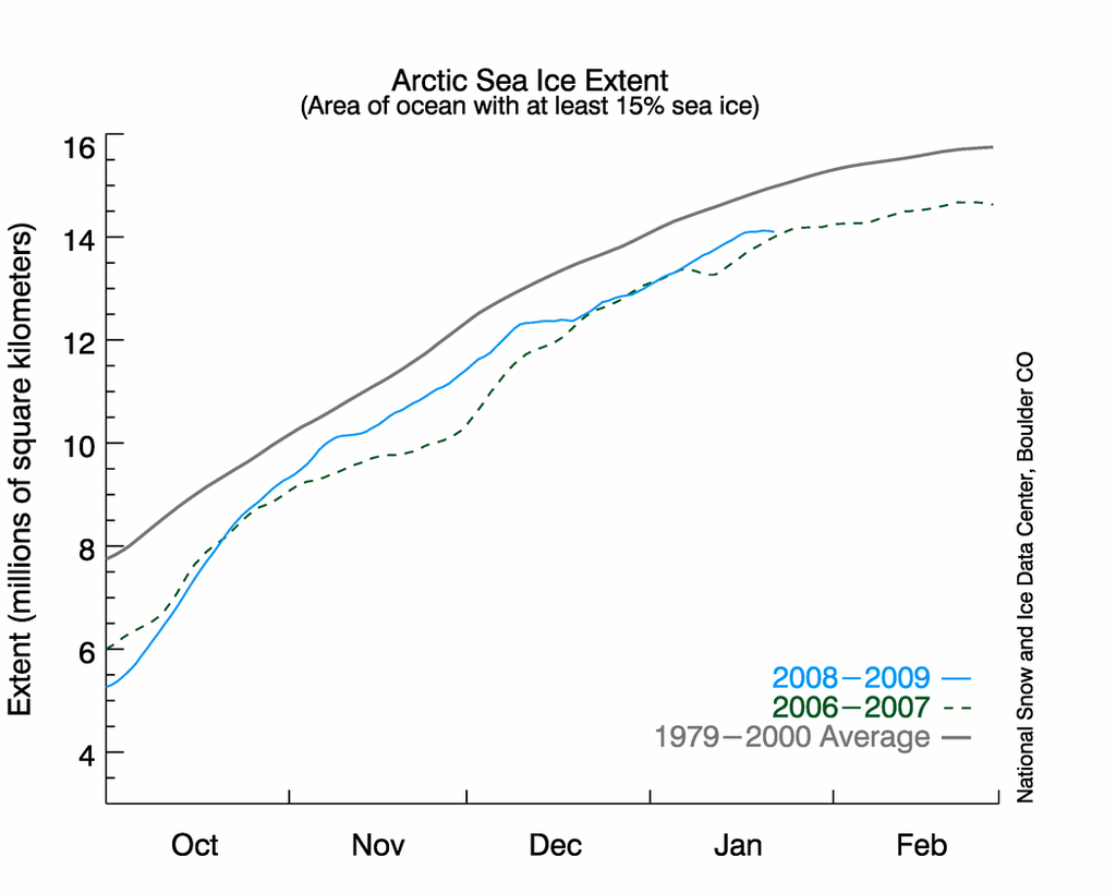
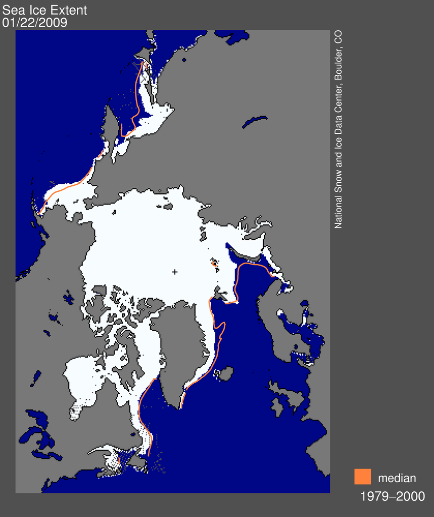
Graph and Map are from National Snow and Ice Data Center For larger images click here and here.
Crossposted at Climaticide Chronicles
