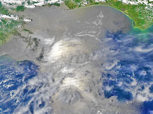
The extent of BP's oil slick in the Gulf of Mexico is far worse than anything we have seen so far, and we have seen a lot.
Folks, I hate to say it, but this doesn't get any better. Below the jump is a color-enhanced satellite photograph showing just how much of the Gulf Coast is now inundated with oil. We are talking about the entire coastline from central Louisiana all the way to the Florida panhandle.
Source: "Gulf Oil Disaster Looks 'Very Scary,' Says Astronaut
This picture doesn't even show the oil that:
(a) is entrained in the Gulf Loop and headed toward Florida, Cuba, and beyond, and
(b) is below the surface.
That's the thing about this "spill" too... we've never had an oil spill of this nature where so much of it is below the surface of the water and invisible to satellites and the naked eye. It's safe to assume that, given the heavy consistency of this oil and also BP's application of dispersants at the source (which is keeping oil from surfacing, but not from spilling out), there is far more oil beneath the surface than what we are already seeing.
This is a catastrophe.
Where is our President on this? What are any of us doing to fix this situation? This is horrifying.
Update: Some of you have pointed to the photo a few days ago showing a much smaller slick as evidence that this photo is misleading. I will simply show you to the original, non-enhanced photo so you can see for yourselves.
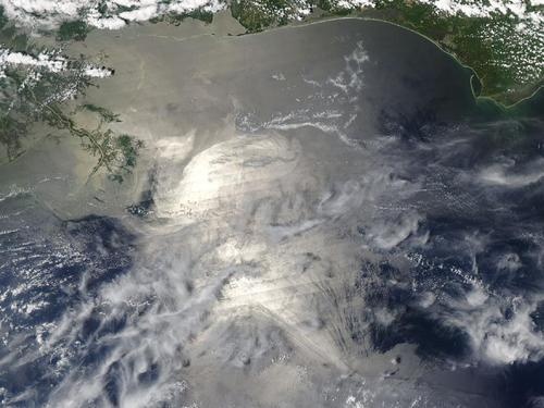
I'm no expert on these things - just trying to get the word out - so I don't know how to square the difference between this photo and the one shot several days back. I will say, though, that the May 17 photo would not explain how the Louisiana marshes have now been inundated with oil. I also don't know if there are differences in satellite technology that could account for the differences in photos.
