Thanks to a fortuitous tweet from @fbihop, I managed to make it to the redistricting meeting down at the Roundhouse. I got there just in time to hear Brian Sanderoff get into the meat and potatoes of what the population changes over the last decade look like. I find this particularly interesting because I was a Field Operation Supervisor for the census in 2009.
TL;DR is that rural areas shrank while the urban areas grew.
Update: Added maps of all 6 congressional district proposals as well as maps showing the population deviation for congress, state house, and state senate.
There was some talk about least change maps, though Sanderoff admitted he'd only bring them up as comic relief due to the absurdity of what they'd have to do to keep the status quo completely in tact. He presented six alternative maps for the congressional districts, and maps of the state house and senate district's current deviations. They're mostly shuffling borders around Torrence, Valencia, Bernalillo, and lower Santa Fe counties, though a few move Roosevelt and Cibola, and one even messes with Socorro. If there's interest I'll scan the rest.
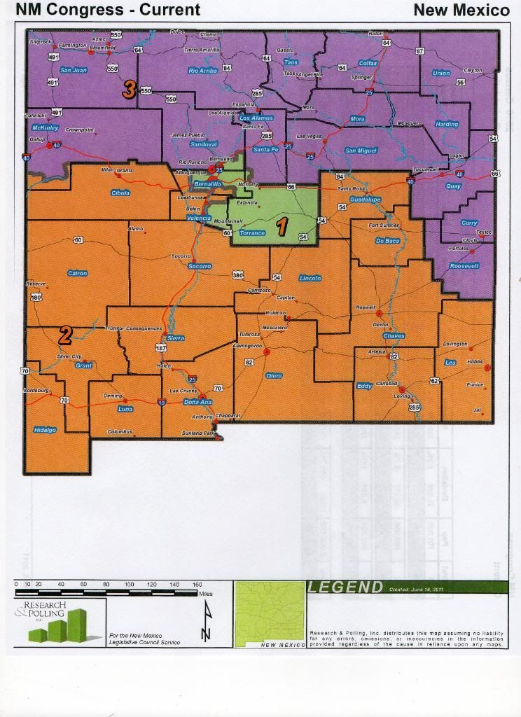
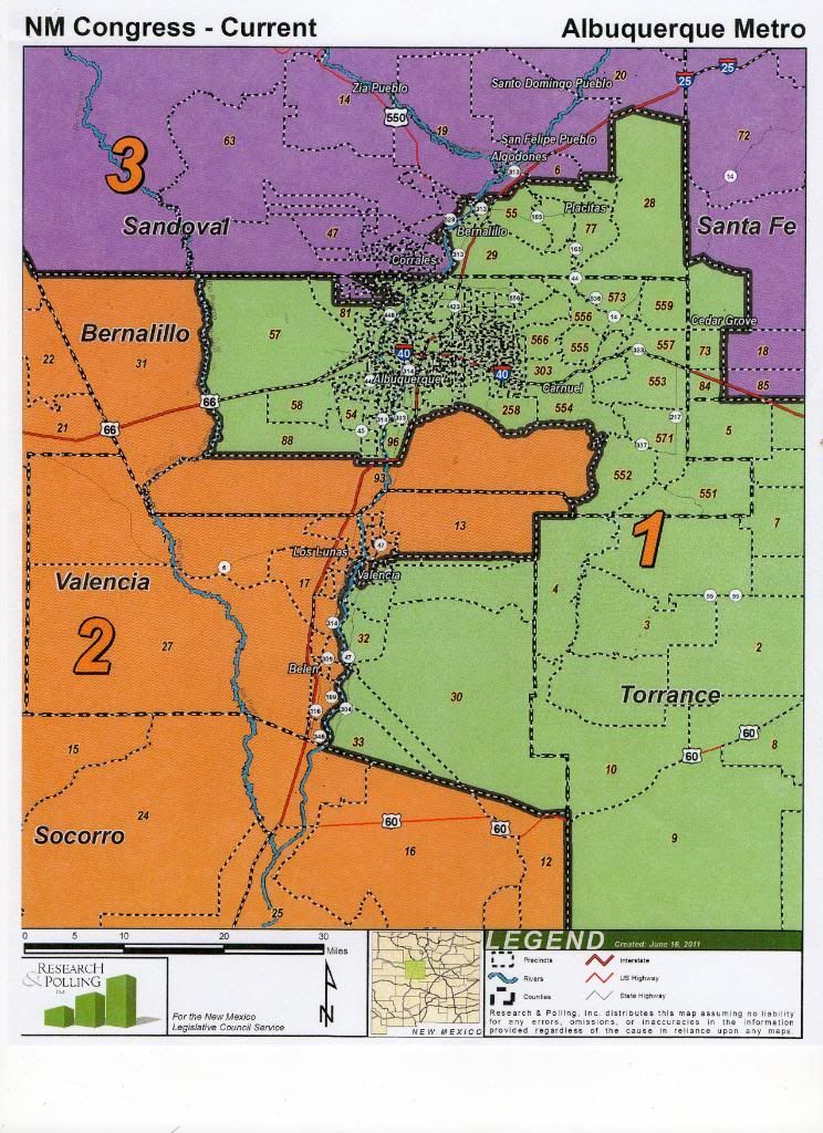
This is the current configuration of New Mexico's three congressional districts.
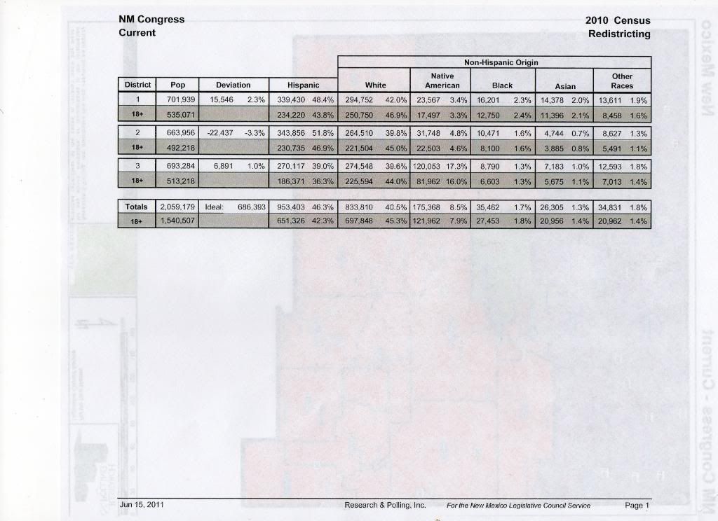
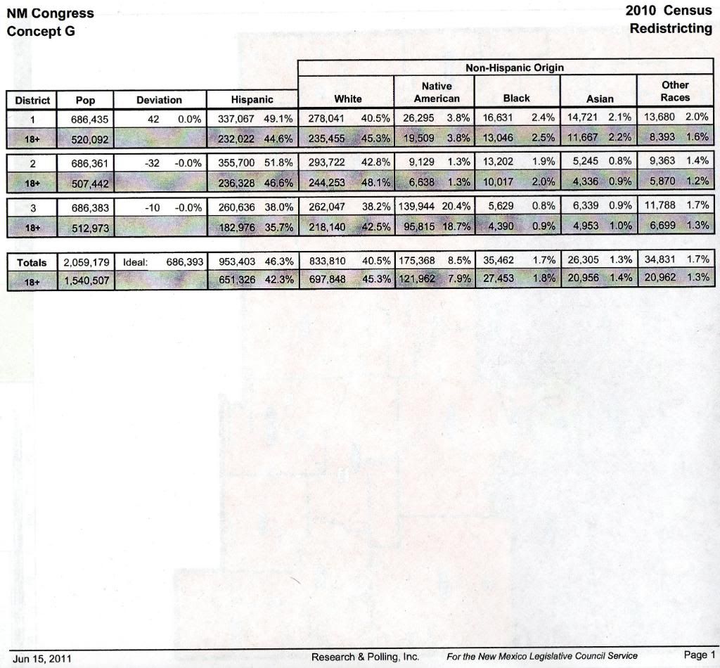
Along with some demographic data.
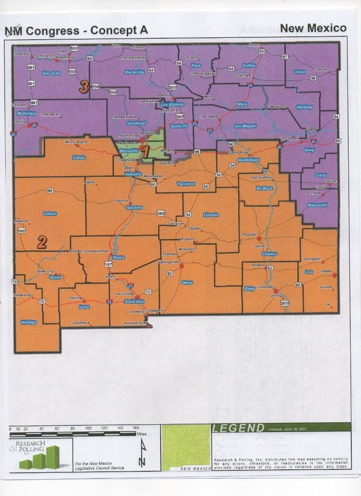
Now here are the overviews of the concepts for congressional districts. I've expanded on D and G because they're the most drastic changes.
Concept A
Concept B
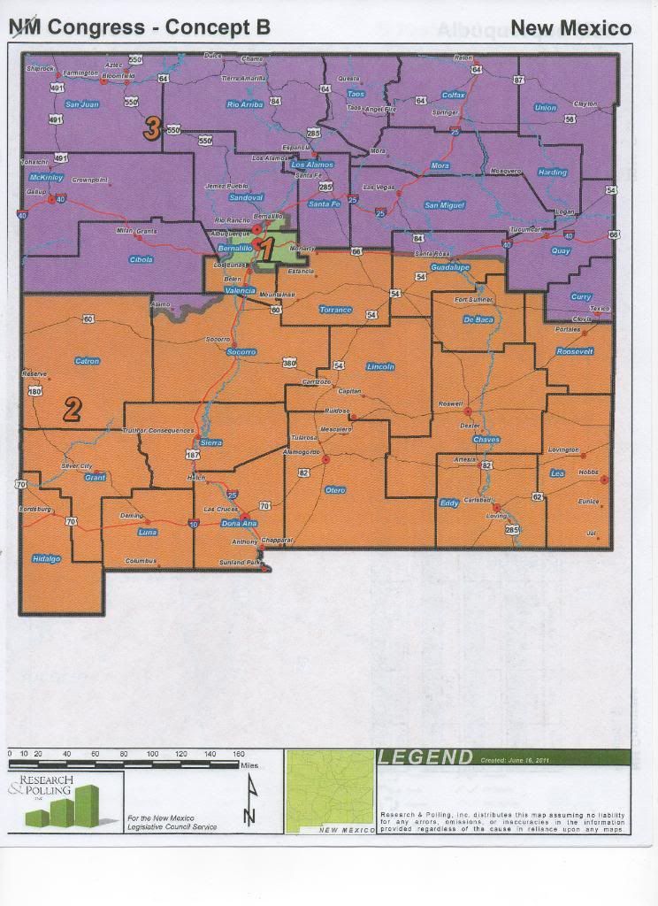
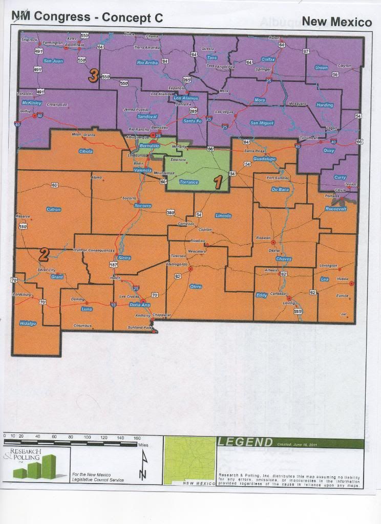
Concept C
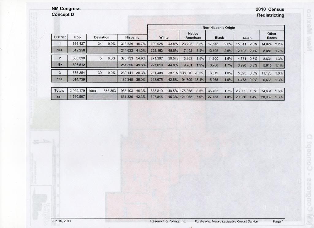
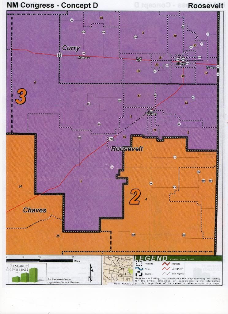
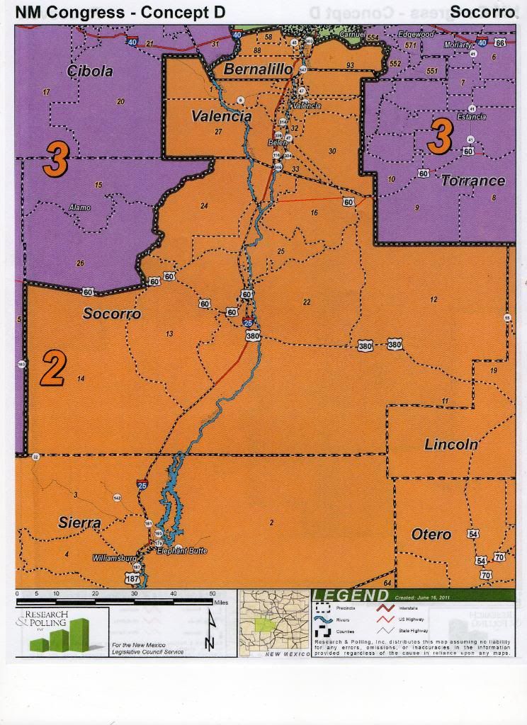
Concept D
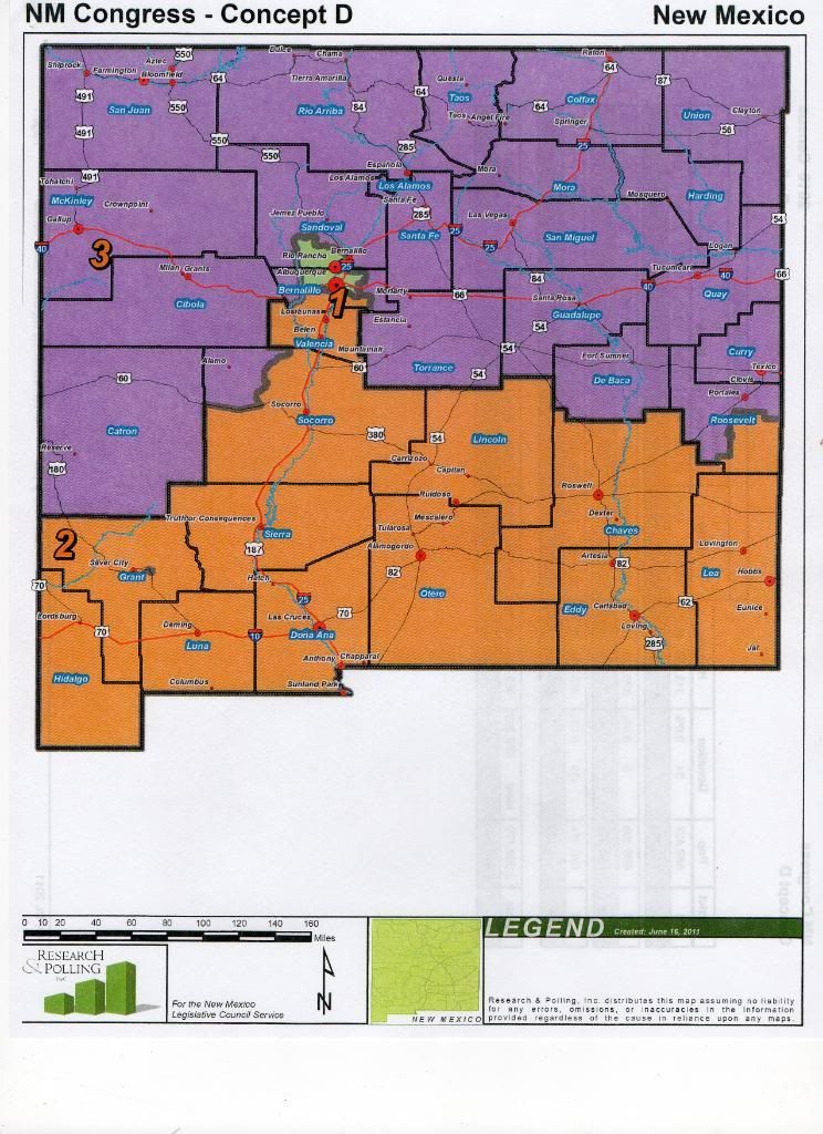
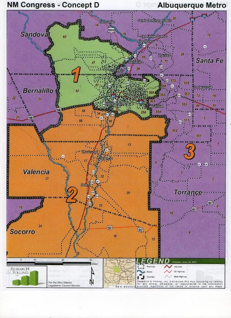
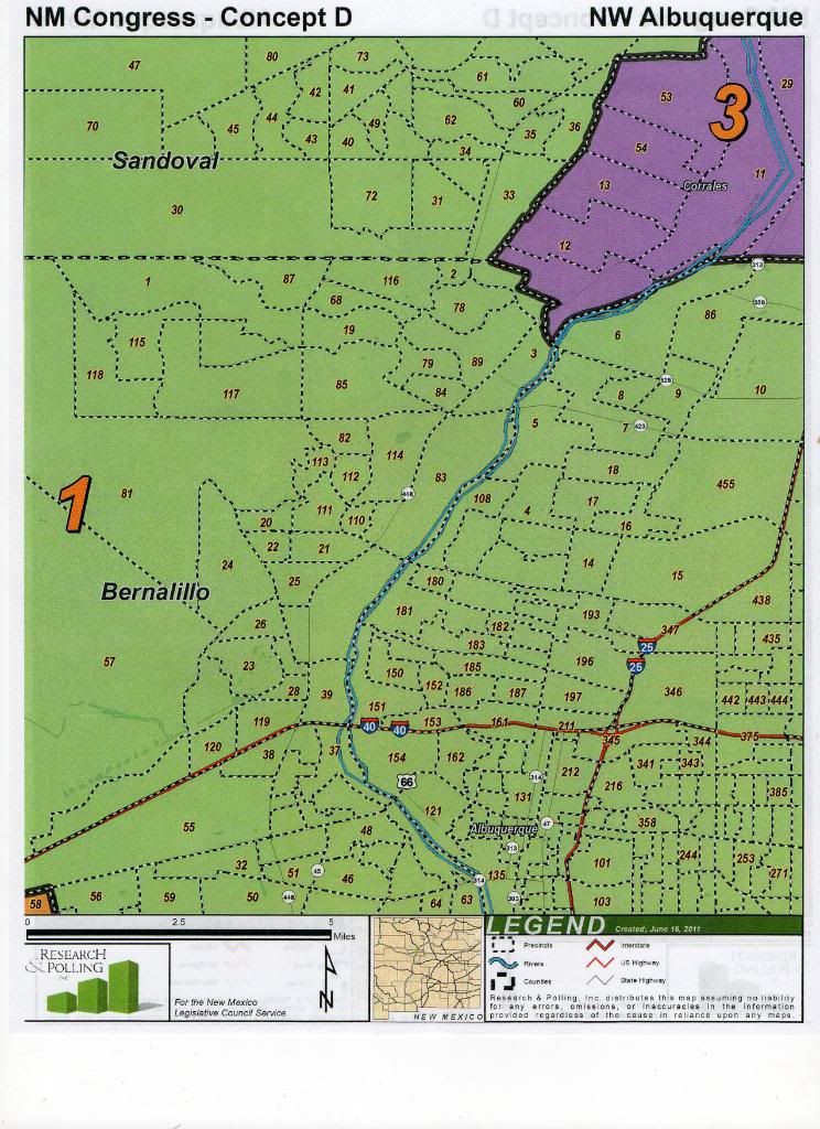
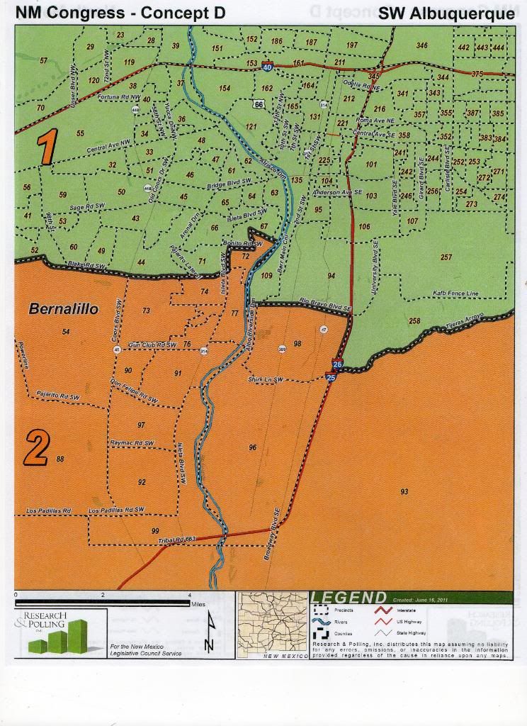
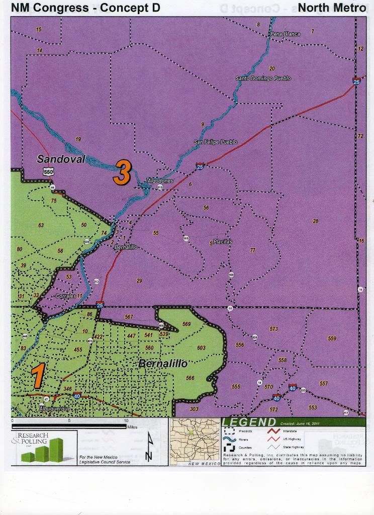
Sanderoff prefaced this one by reiterating that these were just "ideas" and "possibilities", I assume to console any Representatives genuinely freaked out by it. This one got an audible response, especially when people realized that Albuquerque's south valley goes to NM-2. The idea with this one is that it consolidated Rio Rancho and Albuquerque into an urban district, and makes up for the loss of Rio Rancho in NM-3 by having 3 absorb a good deal of the rural area from the edges of NM-2. I have a feeling this one isn't going to get through the leg.
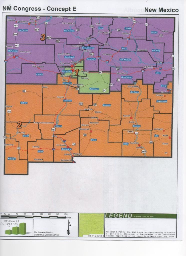
Concept E
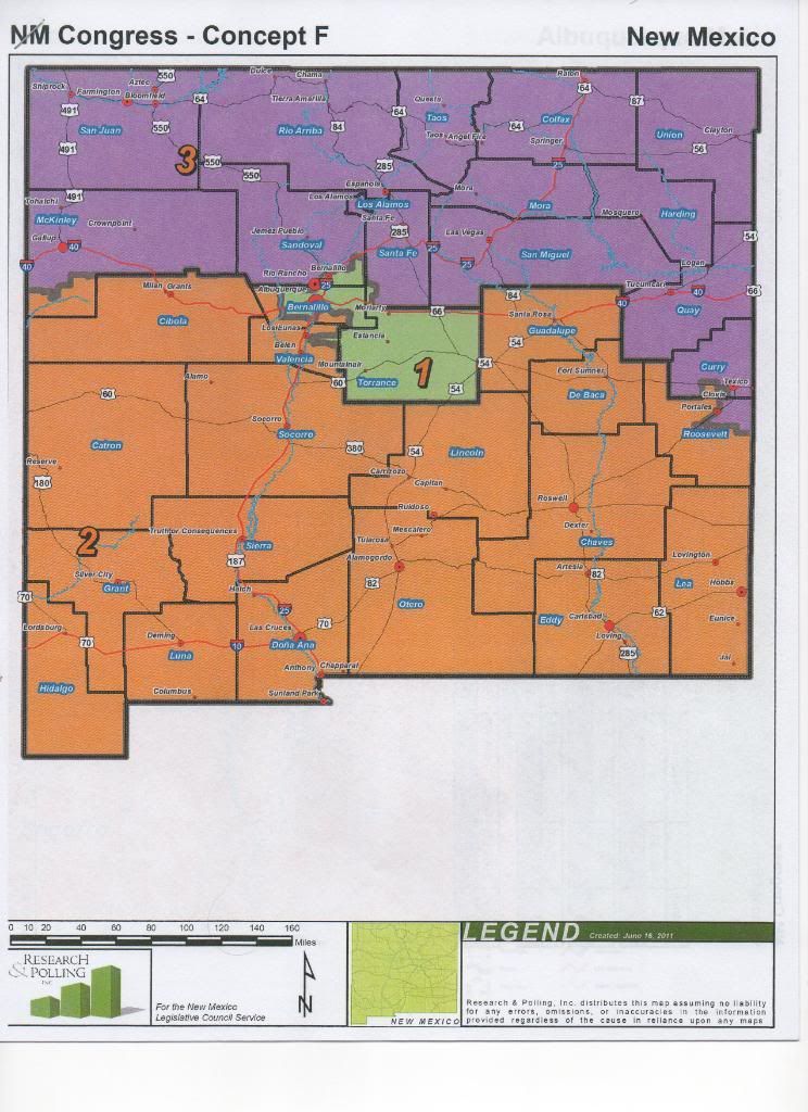
Concept F
Concept G
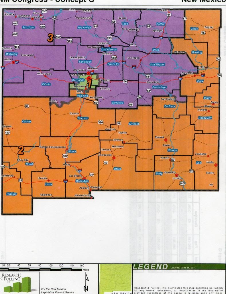
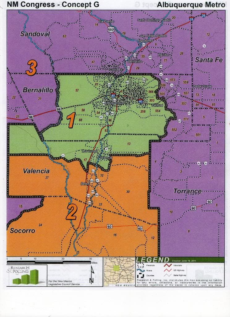
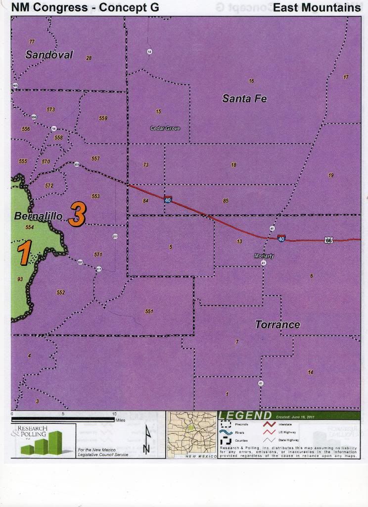
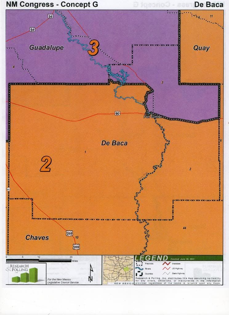
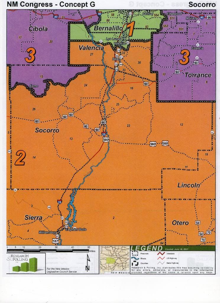
This one is about as visually dramatic, but I think the thinking behind it is a little more interesting. Instead of consolidating an urban district, this one takes into account the complaint that some folks in eastern NM have, which is that it's always subdivided, despite having very similar interests whether it's north east or south east. There is a lot of agriculture and ranching going on in that part of the state and I think it makes a certain amount of sense. It'll be interesting to see these ideas evolve through out the redistricting process. This one also accomplishes one of Sanderoff's stated goals, which is to consolidate Zuni pueblo.
Some of the other considerations mentioned during the meeting involved Isleta being a big reason that Valencia always seems to get carved up, and the trading of Edgewood, Rio Rancho, and Bernalillo around between districts.
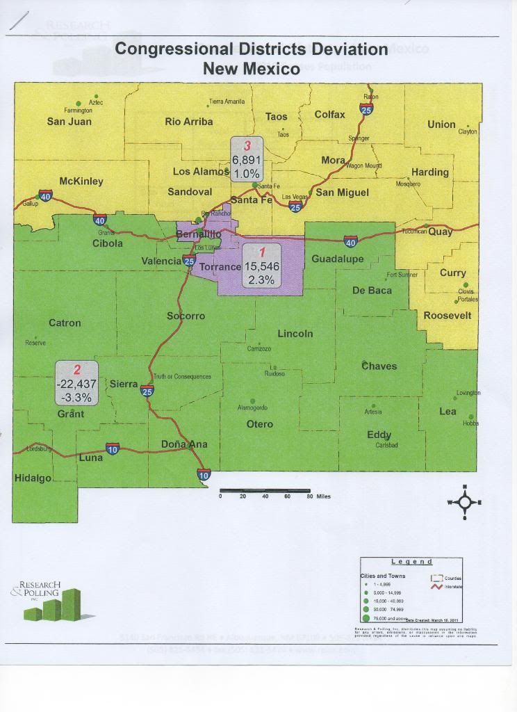
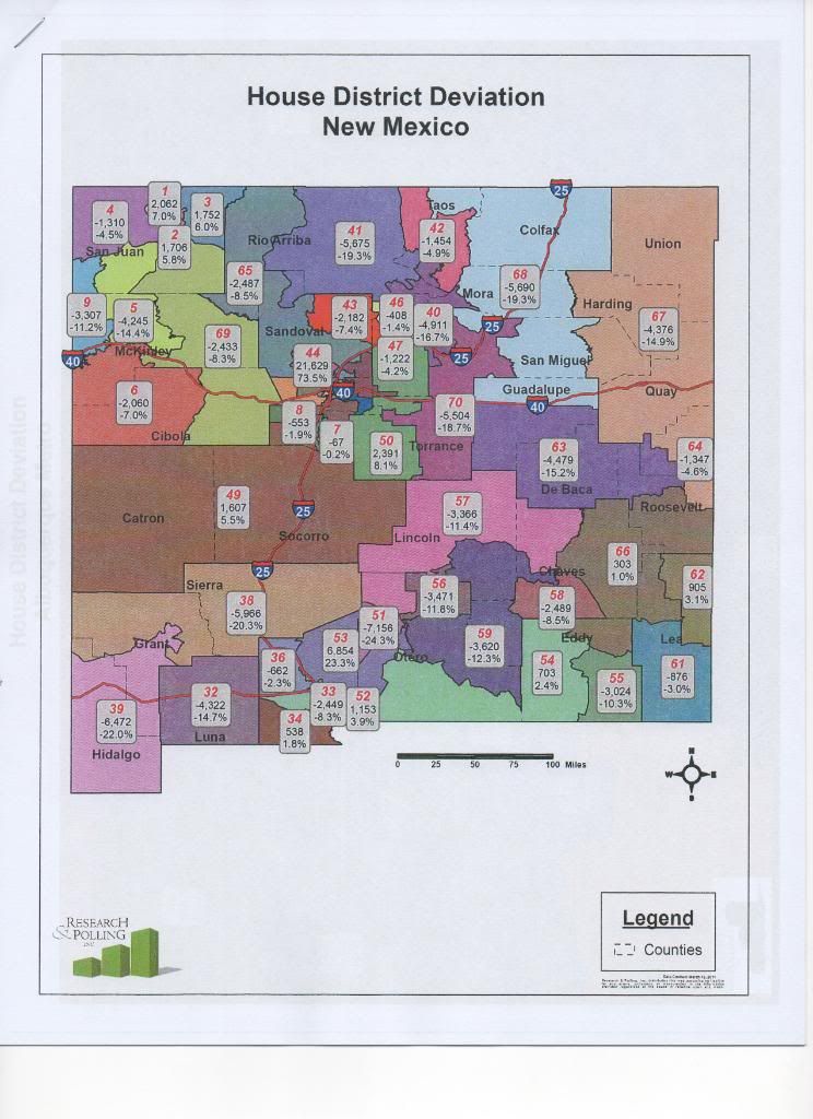
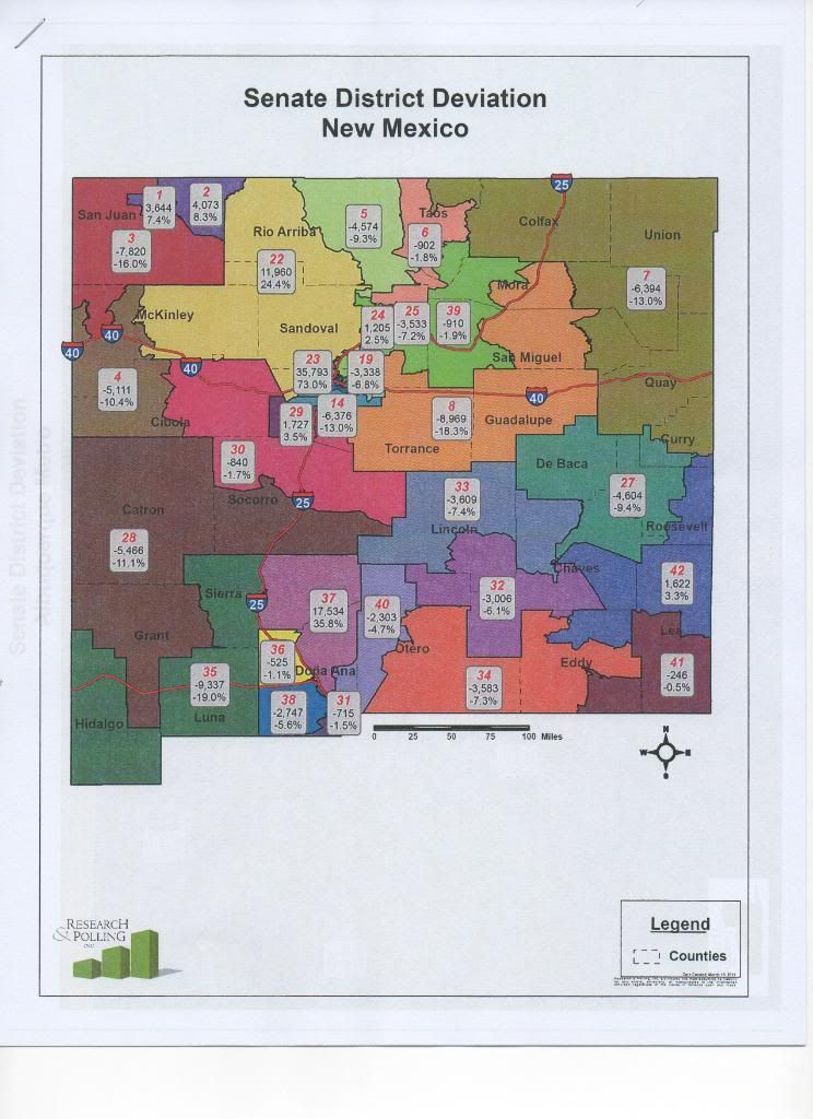
This is the population deviation map for the congressional districts, followed by the deviation maps for state house and senate as well.
Congressional District Deviation
State House Deviation
State Senate Deviation
There was a public comment portion that was relatively unremarkable, though a few people from Rio Ranch stood up and expressed a desire to have their city unified, and someone from Torrence county described the problems people in Torrence are having getting access to medical care because it sounds like they're supposed to go to Cruces (which is farther away) now instead of Albuquerque.
At one point a tea party guy stood up and complained about there not being enough flags in the Roundhouse, leading to one of the Reps later feeling it necessary to defend the legislatures patriotism and assure everyone that they're all, in fact, Americans. Looking forward to seeing how the rest of this process plays out.
