The canyon that isn't.
Bryce Canyon is not a "real" canyon. It is not carved by flowing water. Water is the active ingredient here, but in the form of "frost-wedging" and chemical weathering.
Small by comparison to other National Parks (checking in at just over 56 square miles), B
ryce Canyon National Park packs unique beauty and wonders into quite a tiny package. As a result of such a small coverage area, to most visitors,
Bryce Canyon N.P. is quite likely considered a "single feature park". However, if you get to digging into the nooks and crannies, you'll soon find it has much more to offer than just the wondrous Amphitheater, which is considered the main attraction of
Bryce Canyon N.P.

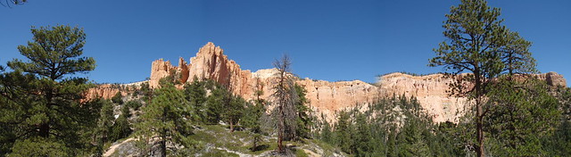
(Overlooking Bryce Canyon Amphitheater)
BRIEF HISTORY
A variety of cultures passed through, visited, and settled in the area now known as Bryce Canyon National Park.
[...]
A recent archaeological survey of Bryce Canyon National Park and the Paunsaugunt Plateau shows that people have been marveling at Bryce's hoodoos for at least 10,000 years. It is suspected that throughout history, just as today, most people were just passing through. Bryce Canyon winters are so harsh that even modern year-round habitation is difficult. Yet Paleoindians hunted huge mammals here at the end of the Ice Age. Pueblo peoples hunted game in the forests and meadows of the plateau. Paiutes frequented the plateau to harvest pine nuts and conduct broad scale rabbit hunts called rabbit drives.
[...]
The land was home to a variety of Native American settlers, and it wasn't until the late 18th Century that Mormon pioneers began settling in the area. One of the most well-known settlers was Ebenezer Bryce, from whom the park derived its name:
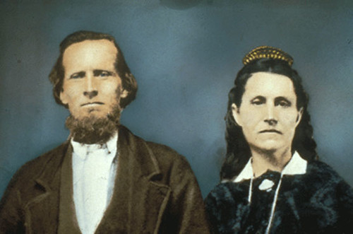
(Ebenezer Bryce and wife Mary Bryce, c/o NPS)
[...]
A group of families established the town of Clifton near the junction of the Paria River and Henrieville Creek, in 1874. Ebenezer Bryce and his family arrived in Clifton in 1875, but soon moved upstream to Henderson Valley (New Clifton). Ebenezer helped to complete a seven mile irrigation ditch from Paria Creek. Bryce built a road into the pink cliffs to make timber more accessible. People started to call the amphitheater where the road terminated, "Bryce's Canyon". Ebenezer Bryce and his family moved to Arizona in 1880, but the "Bryce's Canyon" name stuck.
[...]
It was in 1919 that "Bryce's Canyon" was brought to the attention of the US Congress, when a Utah Joint Memorial urged Congress to:
...set aside for the use and enjoyment of the people a suitable area embracing "Bryce's Canyon" as a national monument under the name: "Temple of the Gods National Monument."
Four years later, Congress responded by designating
Bryce Canyon National Monument on June 8, 1923. It wasn't until five years later in 1928 that it earned its status as
Bryce Canyon National Park.
GEOLOGY
As previously mentioned, Bryce Canyon is the canyon that isn't. It was not formed by a flowing river as is the case with the Grand Canyon. Rather, the brittle, weak limestone of the Claron Formation is worn away largely by ice (by way of "frost-wedging") and the falling of acidic rainwater.
For 200 days a year the temperature goes above and below freezing every day. During the day, melt water seeps into fractures only to freeze at night, expanding by 9%. Now as ice, it exerts a tremendous force (2,000-20,000 pounds per squarte inch). Over time this "frost-wedging" shatters and pries rock apart. In addition, rain water, which is naturally acidic, slowly dissolves the limestone, rounding off edges and washing away debris.
The result is a wondrous display of rock features. Chief among them is one of the biggest attractions or features of Bryce Canyon:
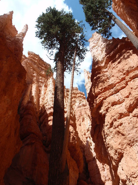
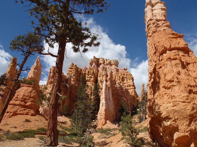
The Hoodoos
Hoodoos are tall skinny spires of rock that protrude from the bottom of arid basins and "broken" lands. Hoodoos are most commonly found in the High Plateaus region of the Colorado Plateau and in the Badlands regions of the Northern Great Plains. While hoodoos are scattered throughout these areas, nowhere in the world are they as abundant as in the northern section of Bryce Canyon National Park.
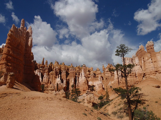
(Wall of hoodoos within Bryce Canyon Amphitheater)
Along with hoodoos are numerous Arches and Windows to be found throughout the park:
Windows or arches are natural holes that form along cracks and weak spots in thin walls of rock called "fins." By convention these holes must be at least 3 feet in diameter in two perpendicular directions to earn the name arch or window.
Perhaps the most popular example of these is a feature to be found toward the southern end of the park,
Natural Bridge.
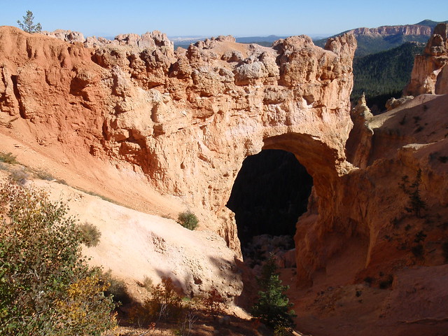
(Natural Bridge: Elevation 8,627 feet)
Yet another wonder resulting from the weathering and erosion of Bryce Canyon's limestone are the Walls and Narrows:
Walls or fins are narrow walls of rock, bound by joints or fractures on either side. As weathering and erosion open the cracks wider and wider they form narrows or slot canyons. The wall left standing in between two slot canyons is called a fin. As fins develop, differential erosion accentuates different rock hardness leaving them with a rugose appearance.
Fine examples of these can be found on the
Navajo Loop Trail, all along Wall Street. And, despite the off-putting name, this is one
Wall Street you're sure to fall in love with.
(View from within The Walls and Narrows)
ACTIVITIES
There are a number of ways to get to know the Bryce Canyon area. You can get involved with Ranger Programs at the park. You can find horseback adventures. You can find guided tours. And more.
I find myself a fan of strapping on my choice of footwear, and putting feet to earth. There are more than 60 miles of trails to be found at Bryce Canyon N.P, with the shortest being less than a mile and the longest being nearly 23 miles. They also range from short, easy, paved trails to long, strenuous, climbing footpaths.
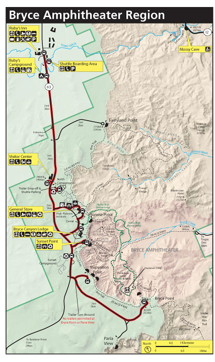
(Map of trails and attractions in The Amphitheater region)
If you're looking to get a crash-course experience this way in a one-day visit to Bryce Canyon, my suggestion for you is to head straight to the Amphitheater. But be forewarned: this is where the heavy traffic area obviously is, as it's the main attraction. An easy stroll can be done along the rim between Sunrise and Sunset Points.
If you are up for a moderately strenuous hike, start on the trail at Sunrise Point and dip down into the Amphitheater, connecting with Queens Garden Trail.
(View approaching Queens Garden)
Follow Queens Garden Trail on through to Navajo Loop Trail, taking the outer edge of the loop through Wall Street and on up to Sunset Point. Stroll back to Sunrise Point on an easy trail along the rim of the Amphitheater, soaking in the views and having fun identifying the route you took to get in and out of that wondrous beauty.
The route I just described above, while surely longer than that of the popular Navajo Loop Trail itself, will give you the widest range of features to take in along the way.
IMPORTANT: Just be sure to check for closures before heading out, as the Navajo Loop Trail portion is prone to numerous rockfalls (more than any other trail in the park) which can block access to various points along the trail.
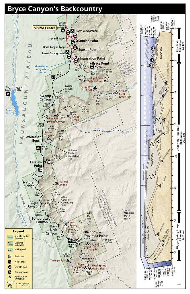
(Map of trails and attractions in the Bryce Canyon Backcountry region)
If you want to get a more secluded experience in the park (yes, you do!), I highly recommend making the trip to the southern (and less visited) end of the park for some lonesome backcountry hiking. Suggestion? Well, I'm a sucker for the Riggs Spring Loop Trail (starting at Rainbow Point and ending at Yovimpa Point, or vice-versa).

(Standing at the first lookout along Riggs Spring Loop, starting at Rainbow Point)
While a good portion of the trail could be done with an early start (going out and back), I would not recommend doing this strenuous hike all in one day. For myself, I find it far better to turn it into an overnighter, spending the night (or two!) in the seclusion of the back country woods...one with the beauty of the colors and formations surrounding you.
(Panoramic view of a lookout point approaching Corral Hollow)
There are four campsites along the trail, with one of them being a group site. My suggestion is to avoid the Riggs Spring site (which is right near the group site) and opt for an overnight stay at Corral Hollow instead. Wake up to the beauty that surrounds you before moving on to Yovimpa Pass and staying a second night, or vice-versa.
Final Facts
Night Sky:
Bryce Canyon National Park has a 7.4 limiting magnitude night sky! In most rural areas of the United States, 2,500 stars can be seen on a clear night. At Bryce Canyon, 7,500 stars can be seen twinkling in the void!
Pay close attention as you gaze up at the sky before falling asleep, and you might just see what seems like an equal number of shooting stars throughout the night sky!
Plants and Animals:
Because Bryce transcends 2000 feet (650 m) of elevation, the park exists in three distinct climatic zones: spruce/fir forest, Ponderosa Pine forest, and Pinyon Pine/juniper forest. This diversity of habitat provides for high biodiversity. Here at Bryce, you can enjoy over 100 species of birds, dozens of mammals, and more than a thousand plant species.
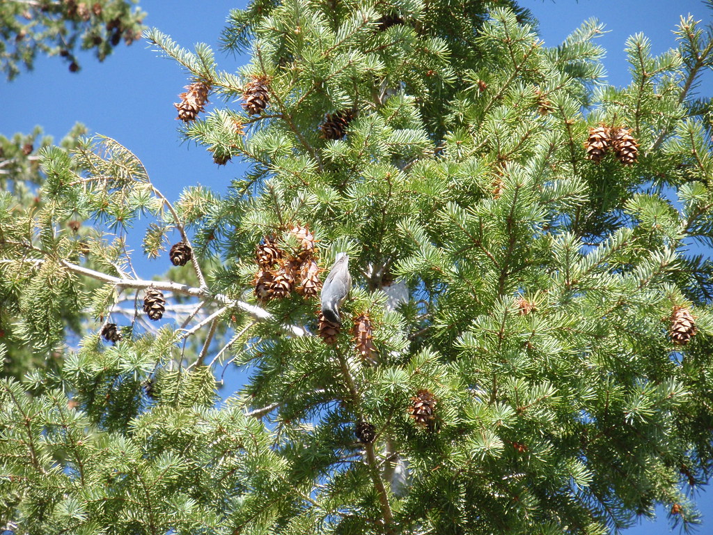
(Mountain Chickadee foraging in Bryce Canyon backcountry)
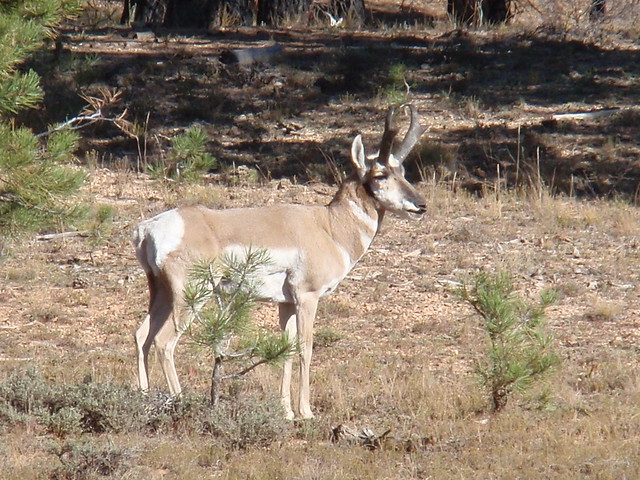
(Pronghorn, the last and only surviving member of family Antilocapridae)
As a parting tip: I've often found, as a repeat visitor, that the best viewing opportunities for Pronghorn have been just beyond the Visitor Center before reaching Sunrise and Sunset points. Around dusk and dawn, keep an eye out in the clearings on either side of the road. But be quick, or you might just miss them. Pronghorns are the fastest land mammal in the Western Hemisphere.
Good luck! And enjoy!
P.S. I'm certain I didn't quite do the park complete justice here. But I hope you've at least enjoyed this tour enough that it either brings back memories of visits past, or prompts the thought of visits in the future.
Bryce Canyon: the canyon that isn't. What a sight to behold.
Thanks for stopping by. Be sure to share your experiences in comments below.
This diary is part of the Park Avenue series on our National Parks. For past diaries, please visit us at the link just provided. We are looking for diary writers! If you are interested in contributing about your favorite National Park, Monument or other public land, please contact the group and we will work you in to the schedule. Thanks to SJerseyIndy for this week's diary!
