The court is not going to draw Tennessee's new map, as Republicans have total control. This map is intended as a neutral “baseline” to measure how much of an edge the Republicans can be expected to gain from their eventual map. Unsurprisingly, the Memphis district is deep blue, the Nashville district is light blue, and everything else is deep red.
The map:
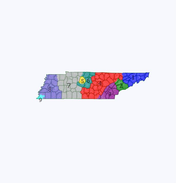
TN1: the northeast corner. R+24.5
TN2: the Knoxville area. R+18.2
TN3: Chattanooga and rural areas to the north and east. R+22.1
TN4: rural middle Tennessee. R+18.8
TN5: Nashville and a few close burbs. D+2.5
TN6: mostly Nashville burbs. R+19.0
TN7: mostly rural west Tennessee with a few Nashville exurbs. R+14.5
TN8: Memphis burbs and rural areas to the north and east. R+17.1
TN9: Memphis and a few burbs. D+21.8
The key issue: how much wiggle room do Republicans have to screw Jim Cooper? TN7 on this map is actually 47% Dem at the state level, so it probably would not be able to safely soak up too many Dem precincts. TN6 here is just 40% Dem at the state level, suggesting that it could trade a lot of territory with TN5.
Thoughts?
