Field volcanology research of active systems inherently has an element of danger to it. All due precautions are of course taken to prevent danger... nonetheless, it remains one of those sorts of jobs that make a person's mother worry herself sick. It takes a special kind of person to make a career out of walking into poisonous gases to collect a sample of hot flowing rock.
So when the entire area becomes closed even to scientists, you know it's a serious situation. But now it's been nearly half a day... and no obvious new disaster has happened. So what happened? And what's going to happen?
More Eldfjallavakt after the fold.
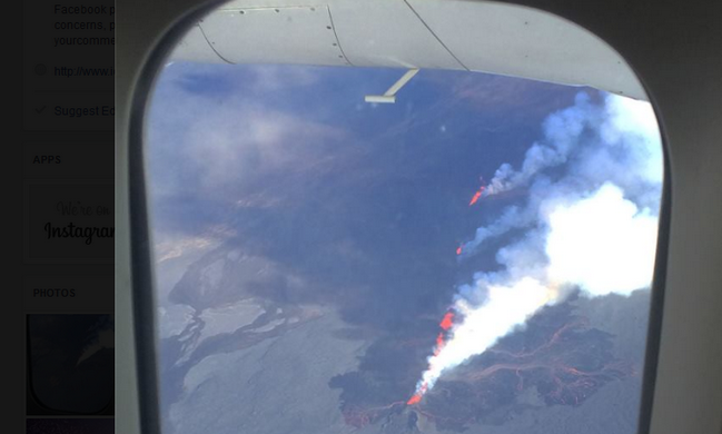
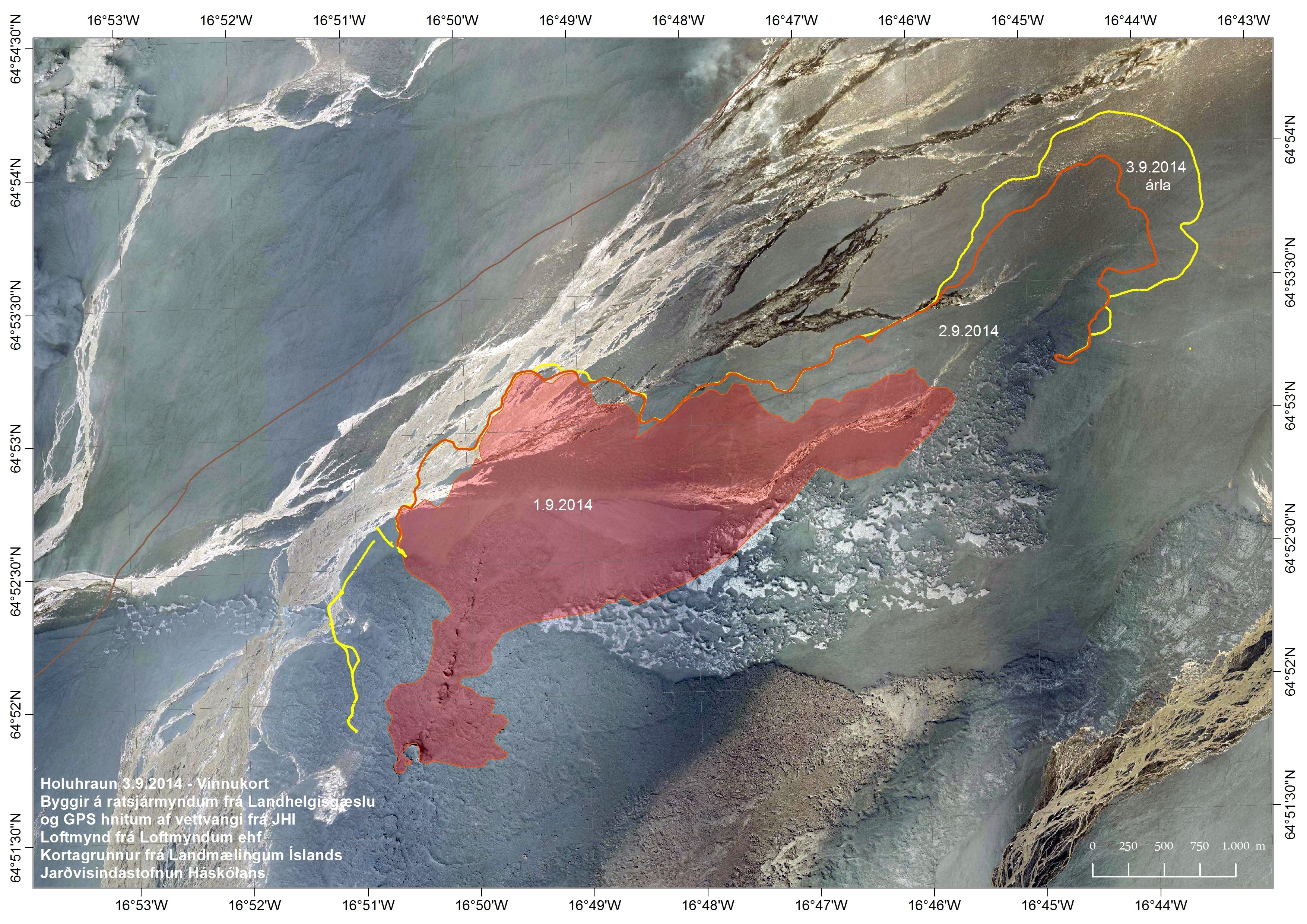
A quick background. A dike opened up reaching from Bárðarbunga (Iceland's largest volcano), under the glacier Dyngjujökull, out under the lava field Holuhraun, putting tension on Askja (a different dangerous volcano), before erupting onto Holuhraun. The dike is believed to be flowing not from any particular caldera, but from the far larger deep magma reservoirs. The new lava field (which researchers have taken to calling Þorbjargarhraun, to honor on-site researcher Þorbjörg Ágústsdóttir) is, as previously, flowing out 100-150 cubic meters per second, a total of 50-60 million cubic meters thusfar, and had reached 9.1 square kilometers in size as of 8:00 this evening.

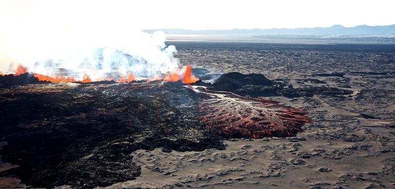
(Above: Þorbjörg standing in front of the lava flow named after her)
100-150 cubic meters per second is an awful lot. But it's not enough. The consensus is that magma is flowing into the dike faster than it's coming out, which is increasing pressure and spreading. And the consequences? Well, I'll let the videos speak for themselves:
The ground is coming apart at the seams, especially to the north (closer to Askja, increasing pressure on that system), and to the south (increasing the risk of a subglacial eruption and consequent jökulhlaup). it's also getting shallower over a large area. Beyond this, in the past day, a massive, deep, kilometer-wide rift valley has opened up underneath the glacier and up into the volcanic field, as you can see in these radar images:
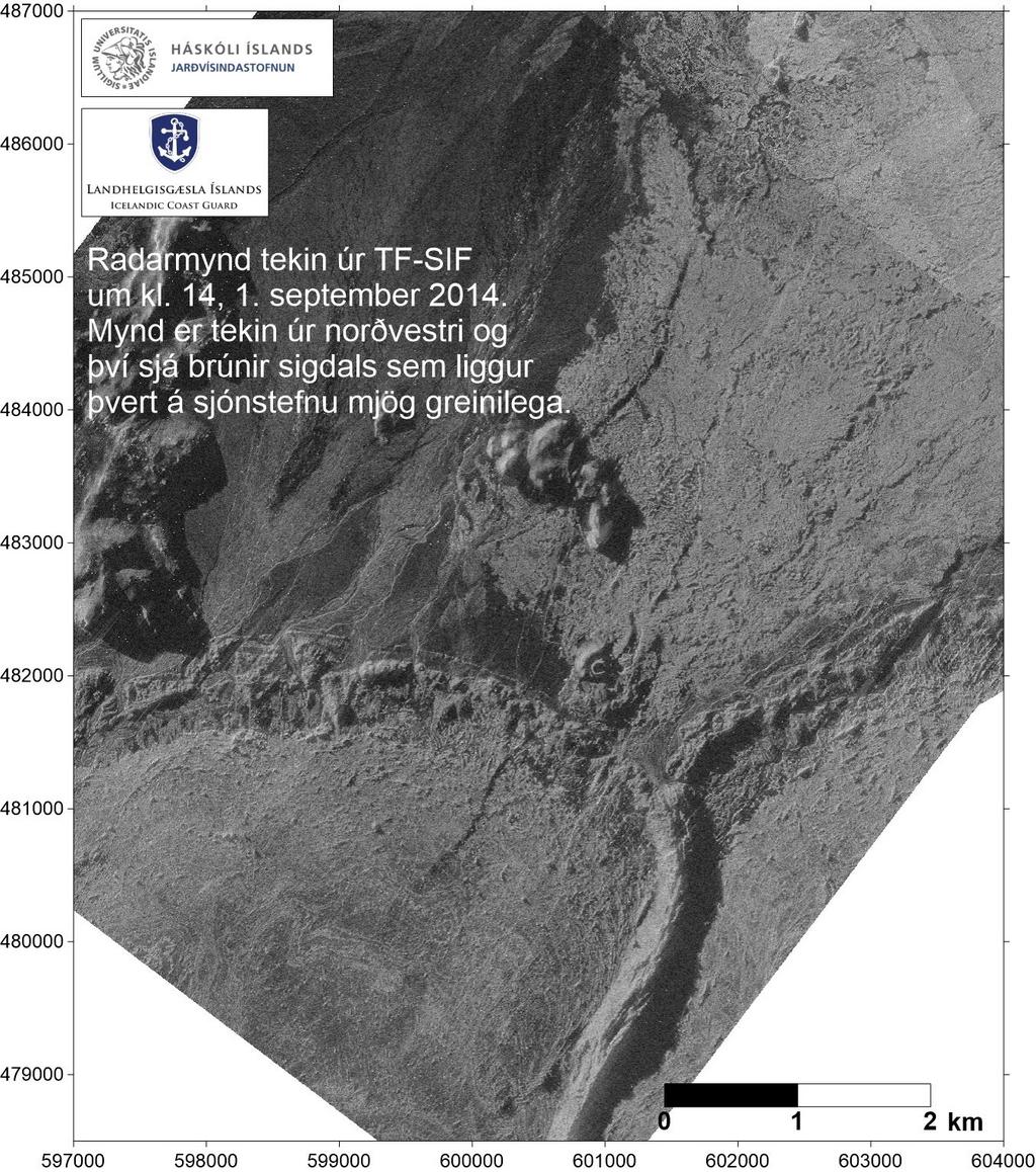
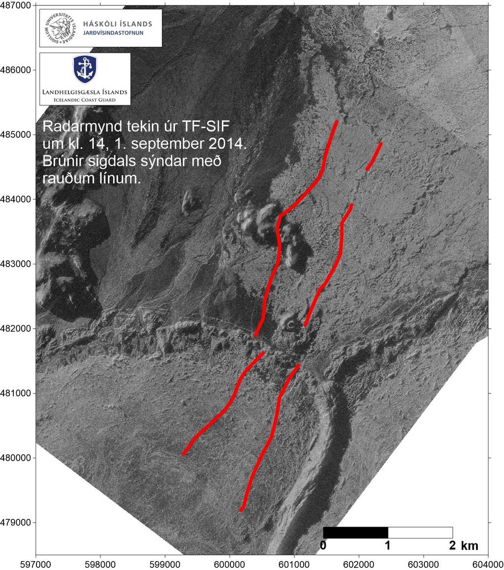
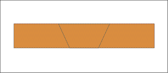
Now, does that mean a kilometer of spreading? No. Here's how such a valley floor (known as a "graben") drops out:
That said, how far it's dropped down is significant. While not known exactly, the valley is said to be very deep, enough for it to become visible all the way through the ice sheet. Combined with the the shallowing up of the dike, the increased pressure, and the increased rifting, and you have a dangerous situation.
But then the story got worse:
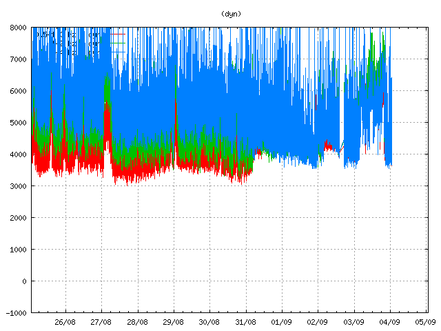
That's a nearby tremor graph. The spike is highly indicative of an eruptive event. As a result, the scientific team made the call to evacuate away from the site, out of fear of jökulhlaup. Subsequently, the area was officially closed to all persons, no exceptions for scientific research or the media as previously were in place.
Then, as the graph shows, the tremors died down. No floods have been registered. No further signs of eruption have yet been registered.
What's going on?
First off, it's not even clear where the tremor came from. Beyond that, it's not certain that it represents an actual eruption - for example, magma hitting groundwater can also create similar tremors. But something big happened somewhere.
When will scientists be allowed back to the scene? No word on that yet. Hopefully at some point tomorrow, once there's a better handle on the situation.
What's going to happen with the dike? Unfortunately so long as outflows do not match inflows, spreading is likely, which increases the risk of Jökulhlaup and increases the risk of explosive interaction with Askja.
Bárðarbunga's caldera again remains a big unknown.
Lava flows continue to experience periodic phreatic explosions, where the magma hits a body of water and flash boils it to steam. These are from small feeder streams of the Jökulsár á Fjöllum; however, the largest branch of the lava flow continues to advance on the main branch of the river, and is now only a few kilometers away.
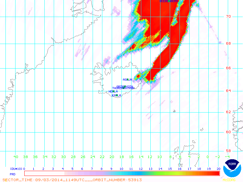
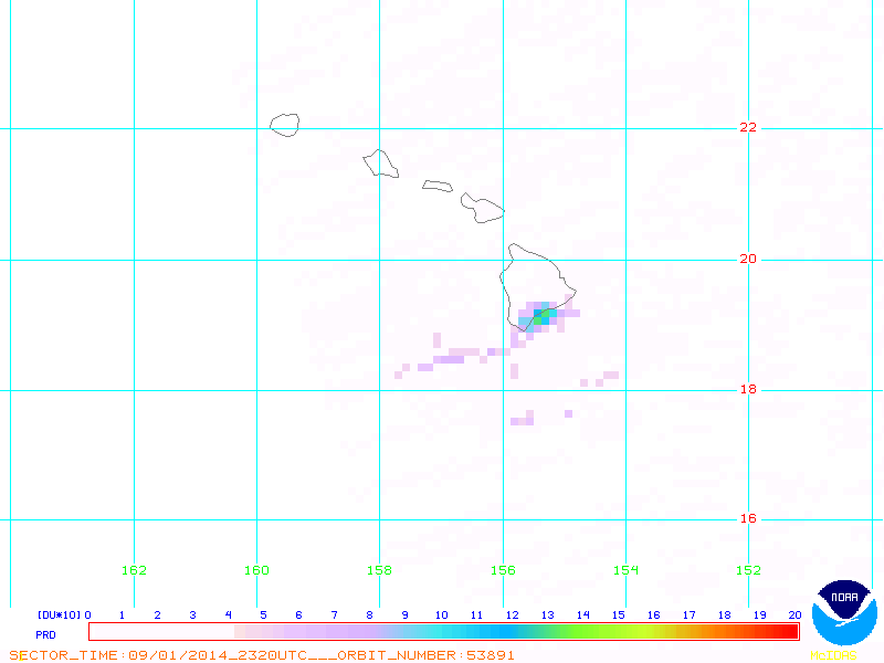
Sulfur dioxide emissions remain high. An early tweet from the University of Iceland stated roughly 20,000 tonnes per day, but the subsequent 2 september Met Office report stated that emission rates had gone up. Regardless of the exact figures, one can look at how much is entering the atmosphere from satellite views and compare that to other volcanoes. For example, here's a good satellite pass of the SO2 cloud over Iceland:
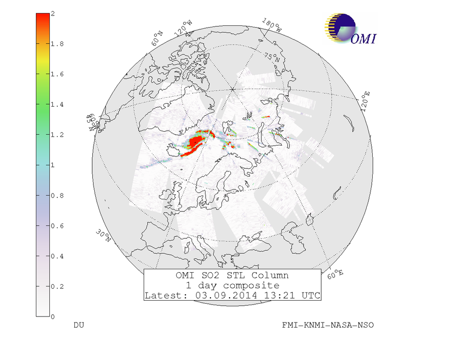
By comparison, here's a good satellite pass over Kilauea:
Here's a more "complete picture" view of the plume from the volcano, which by now is heading over Svalbard:
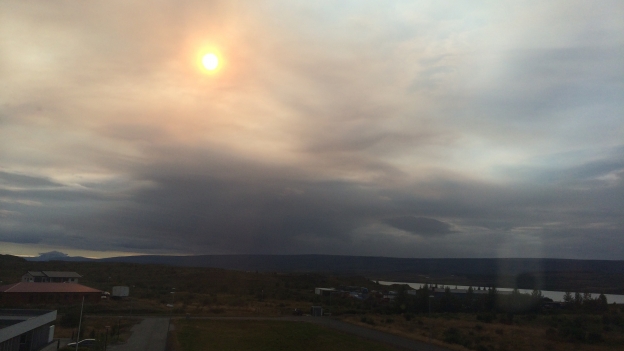
In Egilsstaðir (underneath the plume), many people have sent in pictures of the sun, which they said looked like sunset while it's still high in the sky:
It is, however, way too soon to say what the consequences from this will be, as it depends on how long the eruption goes on and how high SO2 levels remain throughout the eruptive period.
There remains no ash, so air travel remains safe.
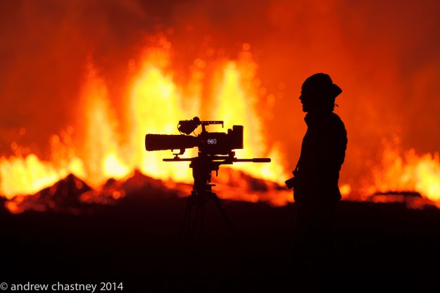
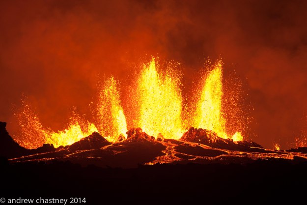
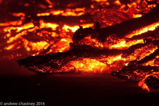
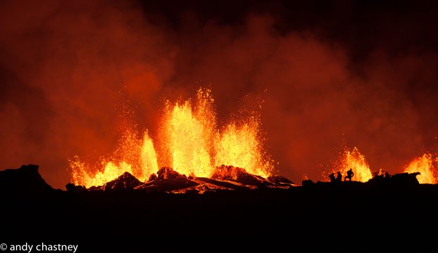
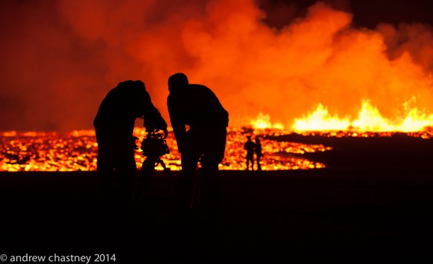
That's it for now! Eye candy time, this time courtesy of Andrew Chastney of the BBC. :)

Update, 10:15: Morning update. Were the tremors simply the result of increase in activity as the current site? Vulcanologist Ármann Höskuldsson suggests this possibility. The current eruption is reportedly among the most powerful its ever been, even though several craters are shut down.
The flow grew by 1.1 kilometer overnight, and it is expected to not be long before it reaches the main branch of the Jökulsár á Fjöllum.
Those tuning into the webcams may notice that you can't see a darn thing. What you're seeing is steam. It's currently raining and hailing on the site, and all of the water that hits the lava flows is flashing into steam, creating abundant fog. The weather is making an uncomfortable and dangerous situation all the worse for people returning. "I want to state something, that it's very uncomfortable to be travelling here," said reporter Rúnar Snær Reynisson. "One can expect the jeep to sink into the sand at any point in time - and it's not good to expect that when there's an eruption spewing poison gas and the wind direction can change. So I'm assuming that (photographer) Hjalti Stefánsson and I won't be stopping long here."
The public protective services has decided to allow scientists and the media back into the site; however, this was done with the reservation that they may have to on short notice re-evacuate the site.
Update, 12:30: Lava fountains are 120 to 130 meters high; activity has been consistently strong this morning, and there was a lot of flow last night, so now the field is believed to have grown to 11-12 square kilometers. Still no good explanation for the tremors the other day, but the best explanation thufar is groundwater interaction. Of course, added the vulcanologist being interviewed, "Presumably that's the reason. At least, we're hoping so."
There were four quakes of magnitude greater than 4 in a row this morning in Bárðarbunga's caldera, starting at 3:44.Two were 8-9 kilometers deep and two 4-6 kilometers deep.
There's a kilometer-long depression on the surface of Dyngjujökull. But it's not fully clear from press reports whether this is a new depression or the sigdalur / graben that we were previously reporting on.
Here's an awesome thermal image taken from NASA's MODIS satellite of the lava field. For perspective,here it is overlaid on a map with labels.
