Whenever the rate of significant quakes in Bárðarbunga's caldera seems like it couldn't get any higher... it does.
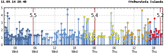
Tuesday evening:
9:43 PM: 3.9
9:44 PM: 4.3
10:10 PM: 3.6
Wednesday:
1:16 AM: 3.1
5:28 AM: 5.5
3:51 PM: 4.1
3:51 PM: 4.8 (14 seconds later)
7:07 PM: 3.5
9:41 PM: 3.1
9:42 PM: 3.2
9:42 PM: 3.5 (24 seconds later)
10:08 PM: 3.5
Thursday:
12:07 AM: 5.4
12:09 AM: 3.4
5:00 AM: 4.3
5:04 AM: 3.0
10:02 AM: 3.0
2:23 PM: 4.7
4:08 PM: 3.5
4:20 PM: 3.0
4:46 PM: 3.1
4:50 PM: 3.1
6:10 PM: 3.6
7:57 PM: 5.2
The Met Office uses a star for quakes greater than magnitude 3 to get your attention, because when one shows up in a volcano it often represent something significant going on that you should pay attention to.
Well, you've certainly gotten our attention.
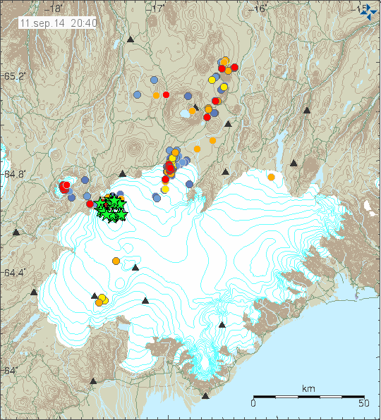
Let's zoom in on the situation in tonight's Eldfjallavakt.
Zoom.
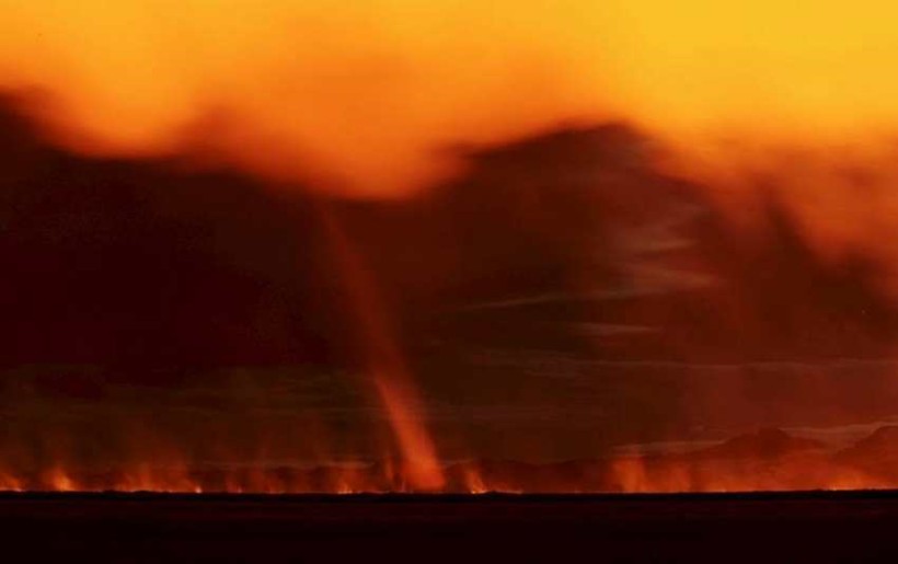
Here you can see why the Eastfjörds keep getting these high pollution blasts. The plume blows strongly eastward and breaks into strands. When these descend to surface level, you're pretty much breathing the eruption straight in.
Zoom.
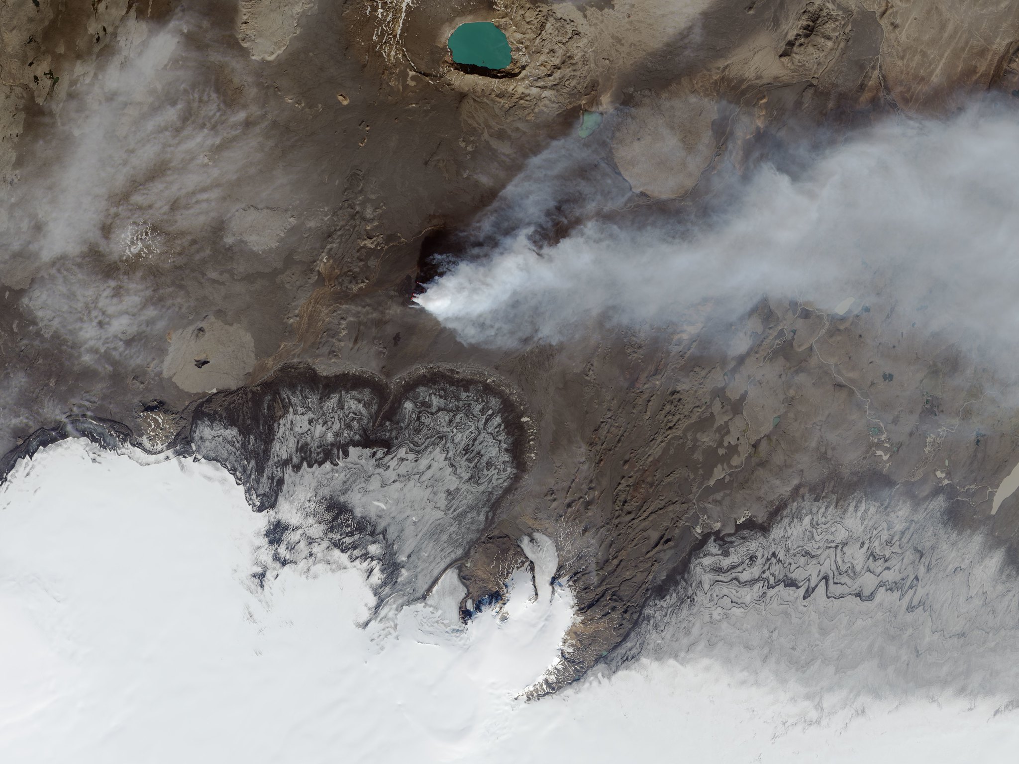
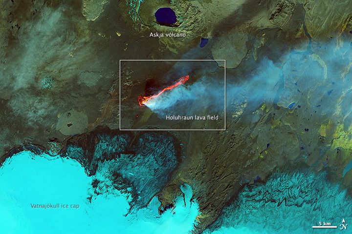
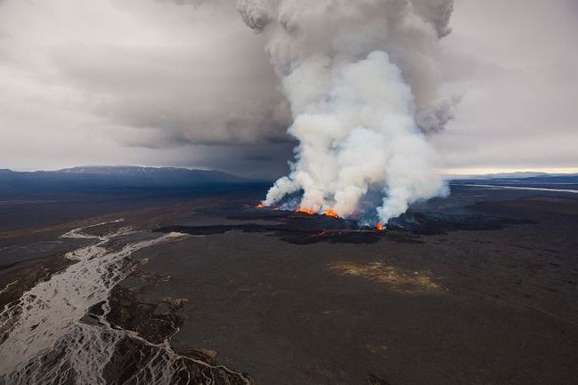
The plume stems up from the main fissure. The southern fissure is completely dead. The big green lake to the north is Askja's caldera, created in a massive caldera-forming eruption in 1875 which there is worry that Bárðarbunga may be preparing to emulate. The tan circle to the east-southeast is the hill Vaðalda which the lava will soon be running into.
Enhance.
Here we have an IR image composited in (several days out of date). Note the lava heading towards Vaðalda.
Zoom.
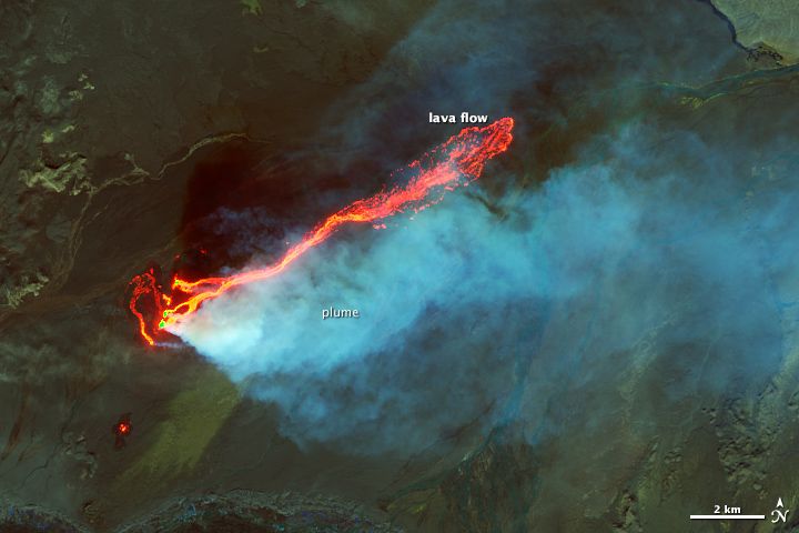
By and large, the lava thusfar has been only spreading out enough to keep its central channel flowing. It's only expected to spread out once it hits Vaðalda.
Map please.
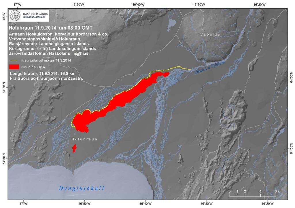
Here's the latest map. The red line is the flow as of the 7th of September; the yellow line is as of 8:00 this morning. The estimated time until the lava reaches Vaðalda is now only two days. The doomed waterfall Skínandi is right near where the Jökulsá runs into a narrow valley at the base of Vaðalda.
Ground level.
Indeed, the Jökulsár á Fjöllum is big. There's a reason that Dettifoss downstream is the most powerful waterfall in Europe. Nonetheless, 150 million cubic meters of rock and growing every day can dam up pretty much anything if conditions are right.
Now for something a bit different.
As mentioned, that's a lot of water, constantly renewed by fresh glacial melt. The amount of energy needed to heat up that much water by even, say, 2 degrees is pretty mind boggling - about 1.6 gigawatts.
Well, it might - and I stress might - finally be happening.
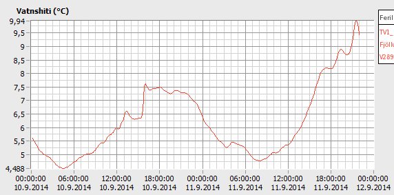
Every day all summer, the temperature of the river at Upptyppingar (just downstream from Vaðalda) has peaked at around 6:00. Here it peaked around 9:00, . In the past year the highest temperature recorded was 9.74°. Today it jumped up to 9.94°, over 2° hotter than yesterday (an unusually large daily variance). Weather, perhaps? The Grímsstaðir thermostat shows nothing unusual.
That said, before one can declare any kind of trend, we need more data. And regardless, the flow and temperature meters should start to get very interesting several days from now.
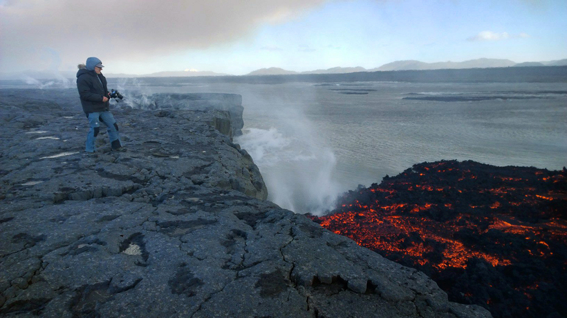
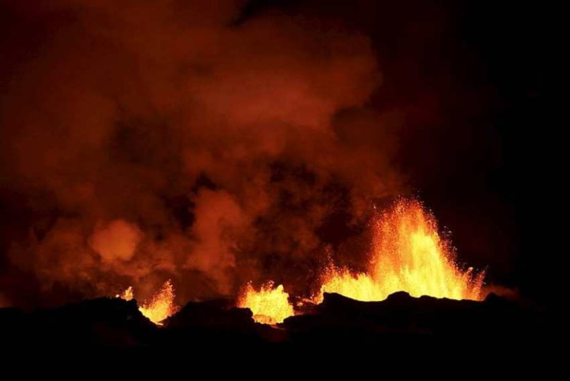
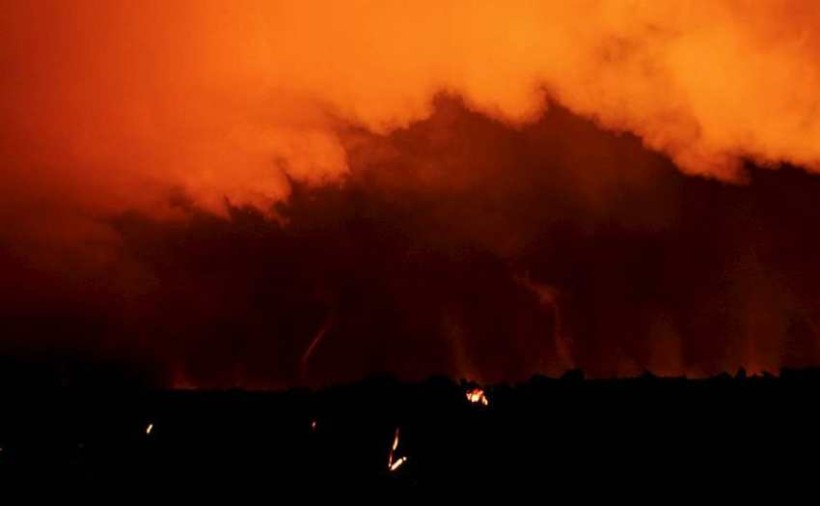
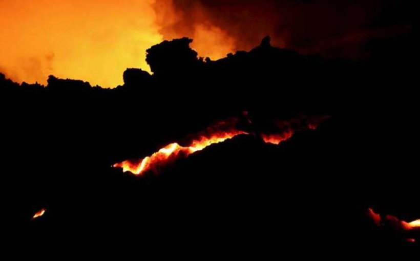
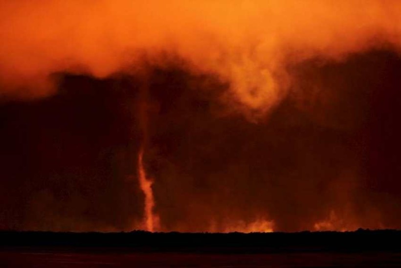
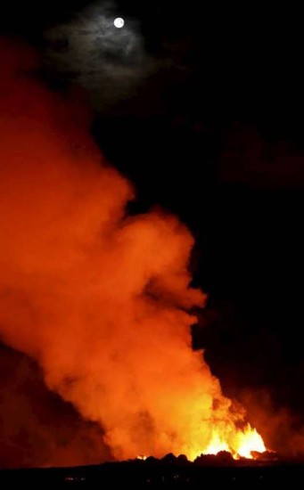
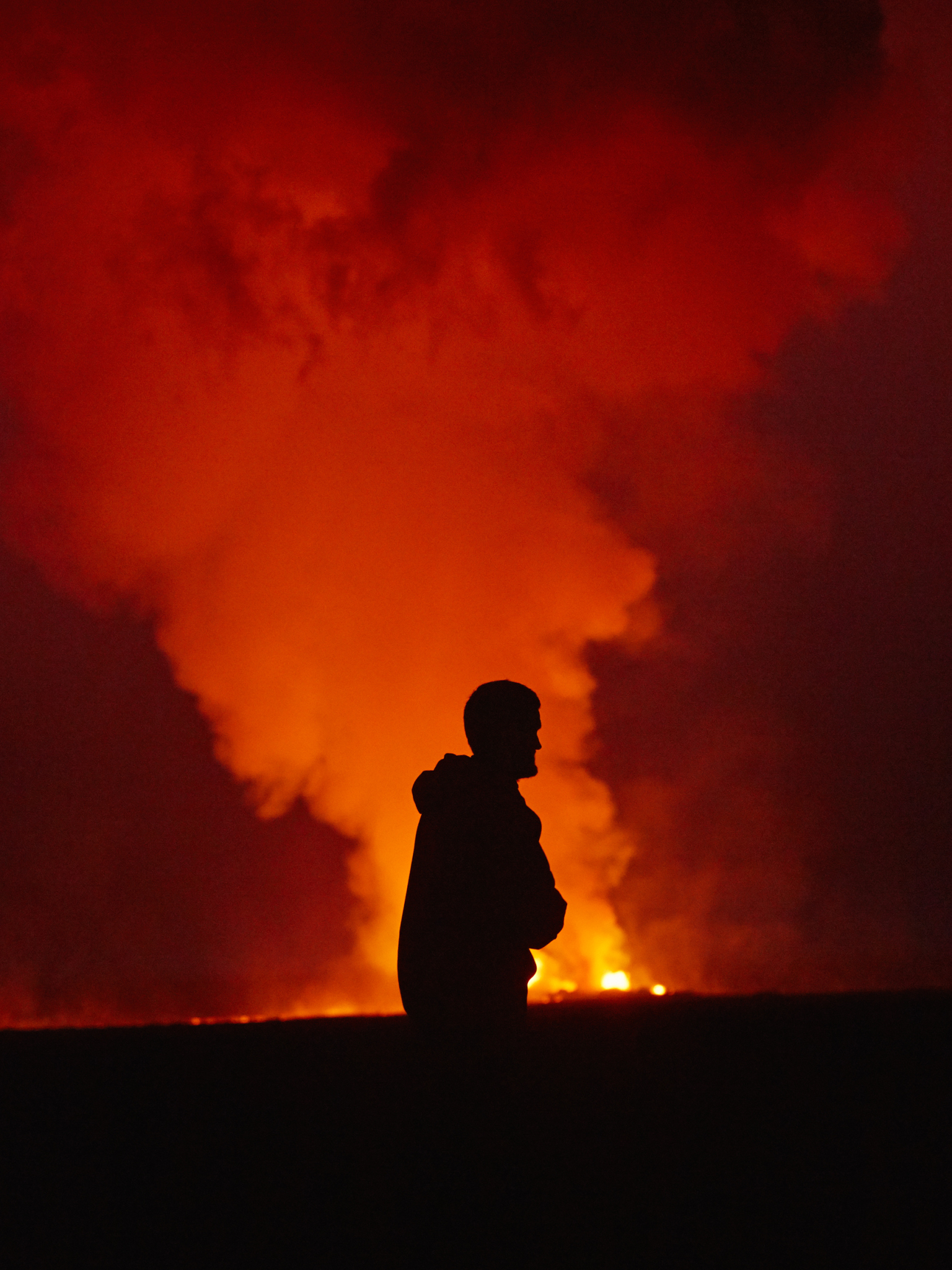
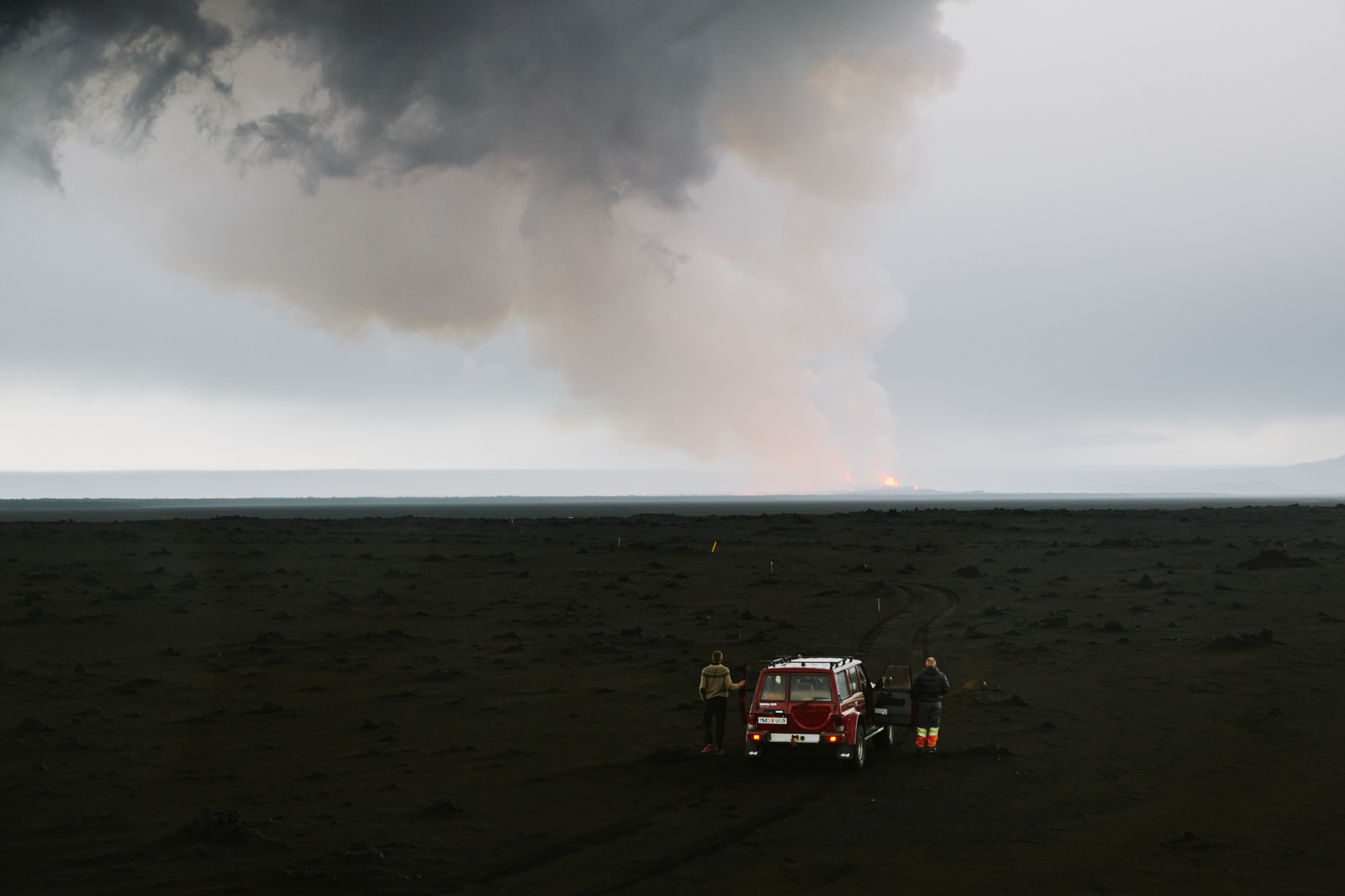
The whole field is still glowing, and the eruption continues full force.

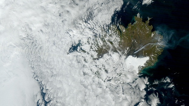
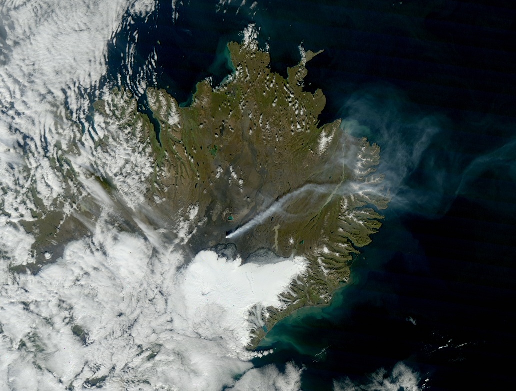
From water to air. Had we not seen such high levels yesterday, today's 558 µg/m3 SO2 in Egilsstaðir wouldn't look so tame. But it keeps coming and going in waves, with no end in sight. Gas masks and meters are sold out. The next shipment arrives on Monday. The company Dynjandi sells everything from shoes to kneepads, but every other call they've been getting is about gas masks.
I made a post on Facebook today offering my guest bedroom to anyone from the Eastfjörds who is having a problem with the air pollution.
The government has sent instructions to every house in Austfirðir on what to do when you see or hear about a gas cloud. The same info as they posted on the net - children and sensitive groups should be shut indoors with the windows closed and all air circulation systems shut off, healthy individuals should avoid heavy activity, etc.
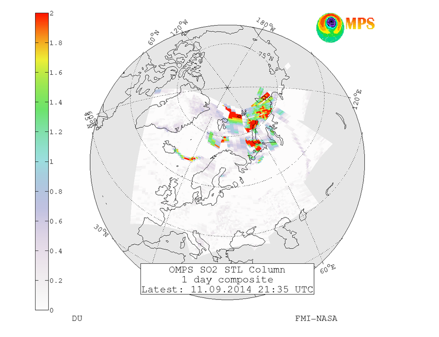
First Norway was complaining about the plume, now Sweden is. Sorry guys :(
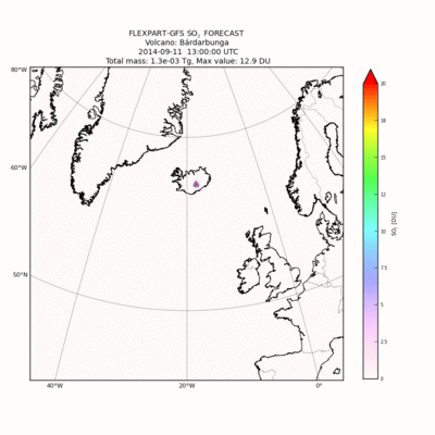
The gas over Sweden has since diluted. The arctic is looking pretty bad, though:
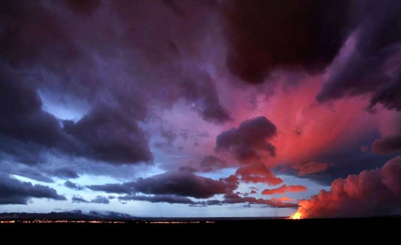
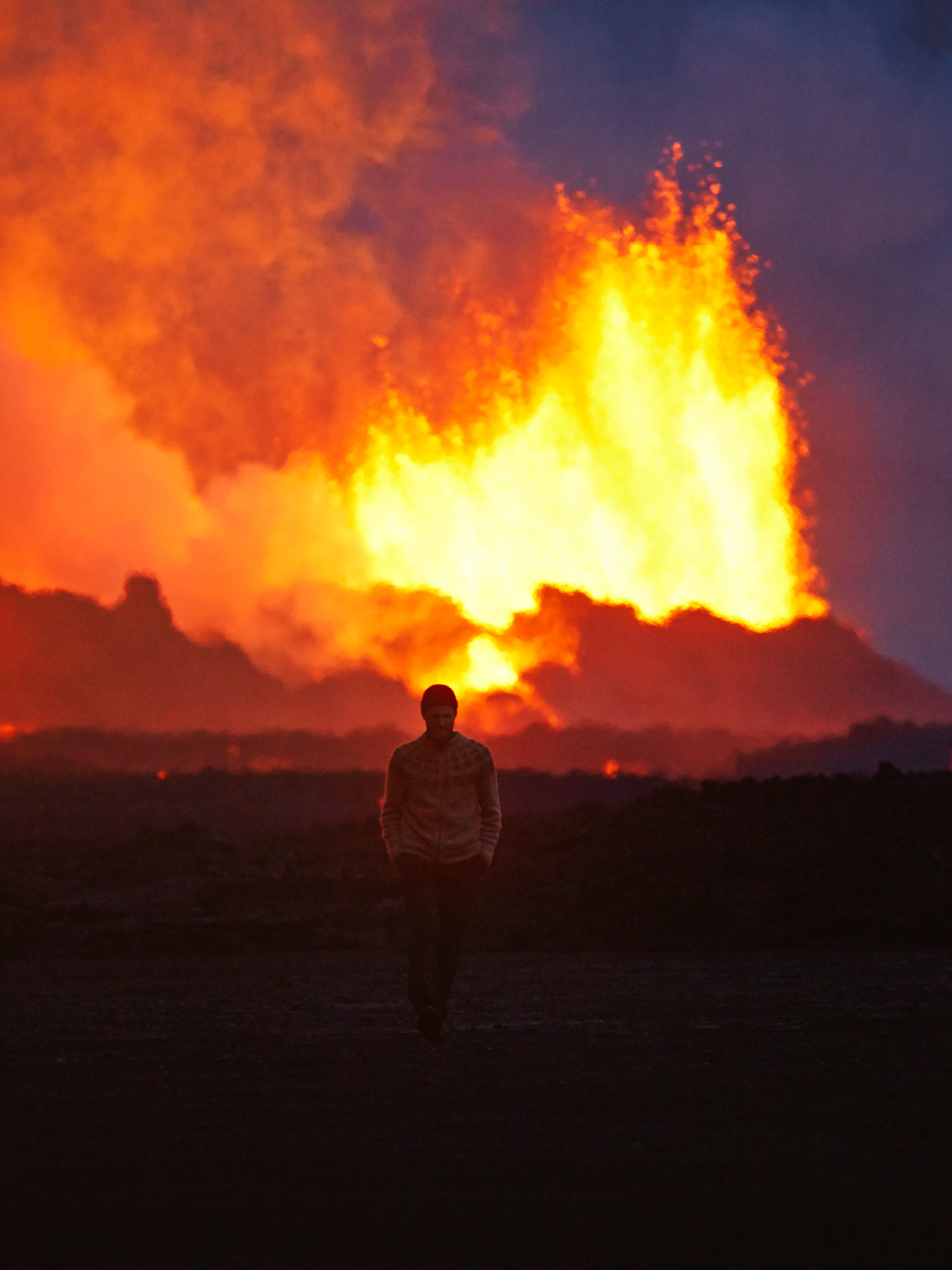
Now, a video and a whole slew of pictures courtesy of Morgunblaðið and Axel Sigurðsson. :)
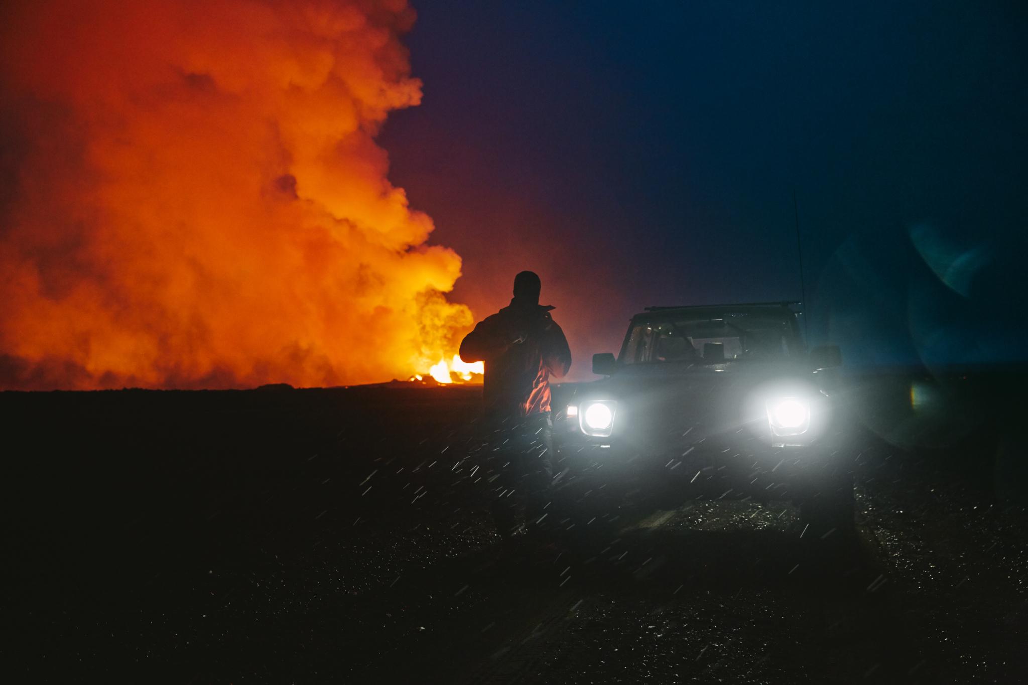

(Ed: Really, a satnav? "Turn. Left. At. Toxic Gas Plume. Then Straight. 400 Meters. To. Glowing River Of Lava.")
PLUS!
We've got a special feature today. Got a question about the eruption? One that a researcher might know the answer to? Well, unless something comes up, tomorrow morning I'm going to be interviewing one of the people who's been doing research on-site. :) So go right ahead and leave your questions in the comments section, if there's anything that's not already on my list of things to ask, and if I can fit it in, I'll ask her.
Update, 10:00: Just had a great interview with Þorbjörg Ágústsdóttir. I skipped over most of the questions related to the consequences of the plume because she had little data on it and it wasn't her field (if we don't get more info on that soon, I'll send some inquiries out to the people working on that). But I asked about pretty much everything else. I'm not sure how long it'll take me to clip the video this evening, and once I do I'll need to send it to her for approval, so it probably won't make tonight's article. But we'll see. :)
