The Daily Bucket is a place where we post and exchange our observations about what is happening in the natural world in our neighborhood. Bugs, buds, birds - each note is a record that we can refer to in the future as we try to understand the patterns that are quietly unwinding around us.
Washington County, Florida. February 11, 2012.
Saturday was breezy and chilly (the usual winter weather - cold in the shade, warm in the sun) but here in the heart of the Florida Panhandle, it was still a great day for wandering around the woods looking and learning and sharing. This plant hike was sponsored by The Florida Native Plant Society with indirect assistance by The Northwest Florida Water Management District (the District). We went here:

It's a special place and too often overlooked by those heading down to the craziness of the Gulf coast at Panama City. Some of the hikers came from there and the rest from Tallahassee 2 hours to the east or points between. We were blessed on this hike with a couple of botanists and/or naturalists and other knowledge people. A darn good mix - and with young and older. Pictures and descriptions below.
Here's part of the group standing on shore looking at the remnants of some little rare plant that had not come up this early in winter. I'm standing in what should have been a foot or 2 of water but because of the prolonged drought this sandhill lake was almost dry except for one puddle, possibly where the Florida Aquifer emerged.

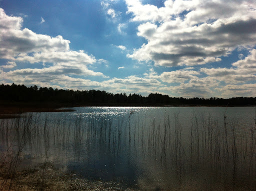
This is Rattlesnake Lake - also low but was fed by a steephead in addition to the aquifer so it looks much better. There were some interesting plants around the lake that came and went with the level of the lake. The shrubs farther up the shore were bigger while newer generations closer to the water were more likely to drown and die off. Other plants were adapted to periods underwater.
A sundew - maybe an inch across. This and another plant I didn't photograph gave a nice pink sheen to the white sand.

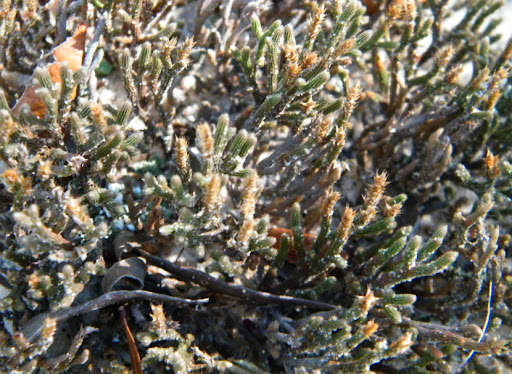
Spike Moss - this was farther up from the lake along the edge of the woods. Dries out in dry weather, resurrects in a rain.
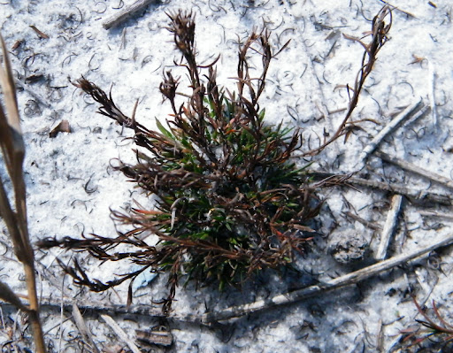
This moss that I didn't get the name of was down closer to the water. You can see how white the sand is. The sandhills in this region can be up to a 100' thick.
here's a good generalized description of the sandhills
Working our way up from the lake I spotted this Serviceberry, aka Juneberry. Apparently it's blooming early like so many other plants in this mild winter.

Working our way along a steephead that fed into one of the lakes, we found mountain laurel, blueberries, bays, yucca filamentosa and this wild olive just about ready to open.

I actually knew some plants but as I told the gentleman from Calhoun County see his herbarium - mostly just the ones that grow in my bit of woods and even then I get them wrong. You'll note I'm not even attempting the scientific names. He was very encouraging tho.
Woohoo! We're at one of the springs on Econfina Creek. This was actually behind the District maintenance yard, a good ways thankfully. I must give credit to the District for all they do in an difficult "environment" with a certain governor and the legislators wanting to dismantle the 5 water districts across the state because, you know, unrestrained growth is more important than drinking water. NOT!!! One of the guys hiking with us remembered back before the District bought these lands and how messed up it got what with the local rednecks (his words, his neck of the woods).

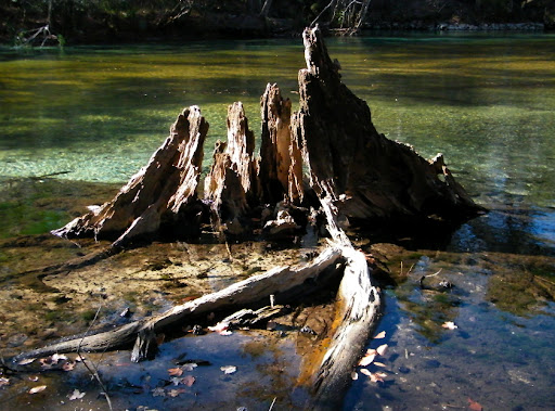

and that's a tiny little vent slipping out under the limerock.
One more link -- The Florida National Scenic Trail passes thru here too.
****
My very first DKos diary - and my apologies for whatever guidelines and rules I did not know about. Smile with me please. So, what's going on where you are?
Thu Feb 16, 2012 at 5:42 AM PT: Just to nail down a few facts about the lakes as my generalizations were a bit off, I received this:
The only factual thing I was not sure of was the observation regarding the lake levels. I thought that Rattlesnake Lake, the larger first lake we visited, had more water because it was lower in elevation and closer to the aquifer. It may be fed by seepage streams that help, but the steephead seepage stream we visited was at Whitewater Lake, which was smaller and dryer. An academic distinction that may or may not be correct. I would think that Leigh has the lake elevation data.
Thanks again, Fritz
What Fritz wrote sounds right. The hydrology of the lakes in this area is very complicated and not fully understood. Both of the lakes we saw, and several others, have steephead streams that feed water from the surficial aquifer into the lakes. I think Lisa K. was planning on taking us on a hike to the Rattlesnake steephead. The lakes also hold rainwater and surface water from runoff. Some lakes have a connection to the Floridan Aquifer though I think in most of those cases it's tenuous. So, the lakes don't all behave predictably or correspond to each other. Our elevation data may help. The LiDAR did not penetrate into water (it can but our specs didn't call for it) so if lake levels were high at the time of the flights then we're out of luck. I'll check by the end of the week and let you know (out of the office tomorrow). Now I'm curious!
As a side note, we have learned a good bit in the last year about the hydrology of this area because of the permit challenge to the new Bay County wellfield, just south of SR 20 to the west of where we were. The challengers were concerned that the sand hill lakes and other wetlands in Washington County, across SR 20, would be drawn down. They hired a lot of experts. The WMD, in turn, hired experts too. Waiting for the judge to decide. Leigh

