Last week I posted a Massachusetts Congressional Map that attempted to abide by three specific principles:
1. Maintain one majority-minority district while generally preserving the city of Boston (i.e. keeping Downtown and Beacon Hill in the Boston district)
2. Maintain two districts wholly west of highway 495.
3. Emphasize communities of interest above all else and keep town splitting to a minimum.
The first attempt looked like this!
Over the past few days a number of people have voiced criticisms over the map. I have since tried to reconcile these criticisms into a new map while still abiding by the original principles. The process has been somewhat arduous, but I think that I have succeeded in constructing a satisfactory map (with regards to the principles). If the process has taught me anything, it is that citizens are MORE THAN CAPABLE of drawing district maps. It has further solidified my belief that a community-based deliberating body should be responsible for the redistricting process, not conflict of interest politicians. Since that it is not yet the case, I urge you to participate in the process by drawing your own maps for the Redistricting Olympics! If we ever want citizen-based redistricting commissions, we must prove that we are indeed capable of such responsibility.
And so again, without further ado, I present to you the revised Massachusetts Congressional map:
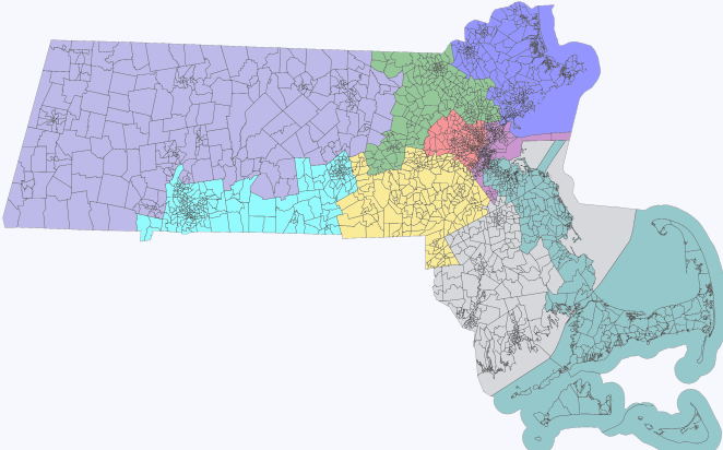
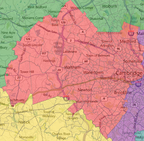
MA-01: Western MA
This sprawling Western MA district covers rural Western MA in its entirety. Pittsfield is this district's largest town with just under 45,000 people. From a community of interest perspective I think that this district does well. From a compactness perspective it is lacking. Shear size make it a tough district to serve.
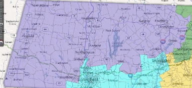
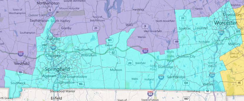
MA-02: Worcester/Springfield
Originally separated between two largely Western districts, user comments drove me to instead unite Springfield and Worcester into a largely urban district. It poses some problems for the smaller towns of Southwick, Oxford, Spencer, etc. which will be silenced by these two competing urban interests.
MA-03: Northern Middlesex County
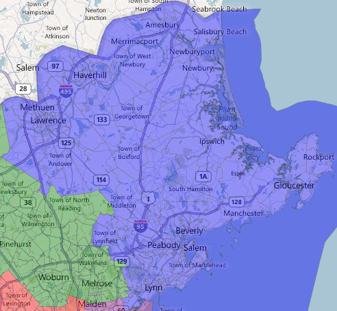
Unfortunately the creation of the Springfield/Worcester district had some reverberating consequences to this Lowell based district. A lot was lost in compactness and I am unsure if it is appropriate to include the area of Marlborough, Westborough, Northborough and Southborough. In order to get the population right I also had to make my first town separation. In the southeast corner, this district picks up precincts 1, 4, 9, 6, 7, 8, and 9 of Saugus. The others are included in the Essex County district.
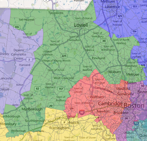
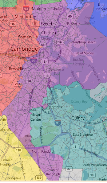
MA-04: Essex County
Almost every MA Congressional map will include an Essex County district. Unfortunately Essex County has about 15,000 too many people to be a district by itself. As a result, it lost the precincts of Saugus to the Northern Middlesex County district listed above.
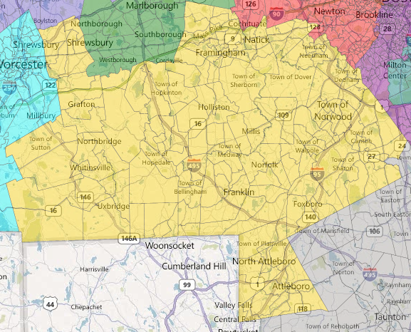
MA-05: Central MA
Loses Stoughton precinct 2 to the Fall River/ New Bedford district.
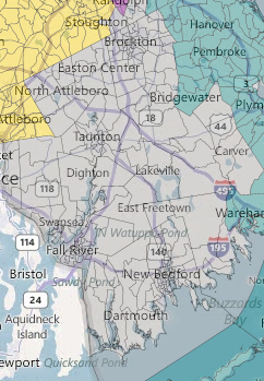
Fall River/New Bedford
Unites Fall River and New Bedford while seceding the town of Wareham.
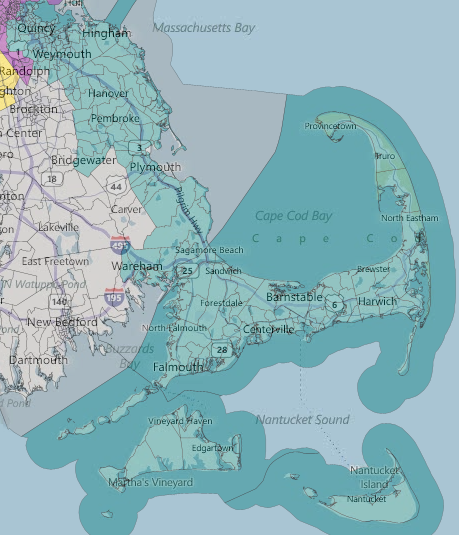
South Shore/Cape Cod
Nothing here changes too much. Pretty much the same as the current MA-10.
Metro West
Basically follows I-90 and the highway 2 until Wayland/Weston and Lexington respectively. Constitutes what I am considering Boston suburbs although differences arise the further out from the city. Splits the town of Needham by picking up precinct A.
Boston
Just barely a majority-minority with minority VAP of 50.9%. Loses several wards to the Metro West and Cape district, but if they were included the majority-minority status would not be maintained.
Comment and critique! Excited to continue the conversation!
