There are battles and skirmishes happening in Syria every day. These days the focus is on what is happening in Aleppo, but there are also some reports of skirmishes, hit and run attacks, and bombings in other places in Syria.
A lot of people are overwhelmed by the multitude of Arabic names that they hear and can easily be under the impression that most areas in Syria are experiencing fighting.
They aren’t.
The areas in Syria where fighting has happened, is happening, or under current circumstances could happen is actually only small part of the country’s total area.
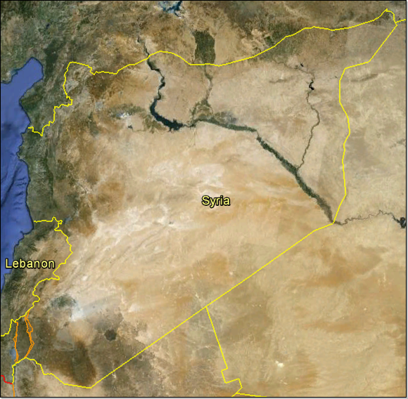
Syria has an area of 185,180 sq. km (71,498 sq. miles) which is about the same as that of the state of Washington. More than half of Syria is empty barren desert or lava fields and a good deal of the remainder is semi-desert.
- - - - - - - - - - - - - - - - - - - - -
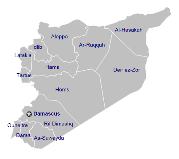
Syria is divided into 14 governorates.
- - - - - - - - - - - - - - - - - - - - -
The governorates are divided into districts.
- - - - - - - - - - - - - - - - - - - - -
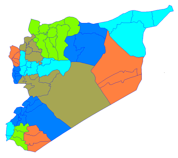
This map shows which parts of Syria (indicated in cream color) are empty barren desert or lava fields where, as a result, there is essentially no fighting.
The exceptions are the areas north of Metropolitan Damascus. Even though these areas (cream color with blue dots) are desert or semi-desert there are several small towns in them because the main highway between Damascus and Homs goes through this area and because irrigation has made some farming possible there in a few locations.
The banks of the Euphrates and the Khabur River in the Deir az-Zor Governorate are inhabited and farmed, and fighting has been reported in Deir az-Zor city and in a few other places along the Euphrates in the Deir az-Zor Governorate.
- - - - - - - - - - - - - - - - - - - - -

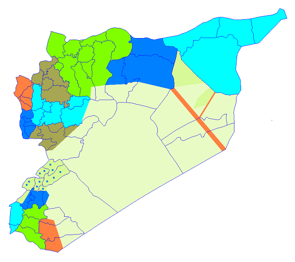
This map shows the parts of Syria (indicated in red) which currently have essentially no fighting in them because they are under the control of the Syrian Kurds (the areas in the north), or are the Alawite strongholds - the Latakia and Tartus Governorates (the areas in the northwest), or occupied by Israel (the area in the southwest).
The pink area is also quiet. It is mostly under the control of the Syrian Kurds but the government of Syria maintains a presence in Al-Hasakah city and the Al-Yarubiyah border crossing into Iraq
- - - - - - - - - - - - - - - - - - - - -
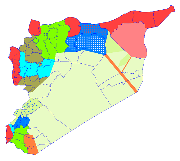
This map shows two more areas (indicated in blue with red dots and blue with white dots) which also currently have essentially no fighting happening in them.
These two areas are sparsely populated (with a majority of Arab Bedouins and a minority of Kurds), remote (northeast of the Euphrates which limits access), and under the control of the Syrian Government.
It is possible that the Syrian Kurds will want to take control of the northern area (indicated in blue with red dots) at some time in the future.
- - - - - - - - - - - - - - - - - - - - -
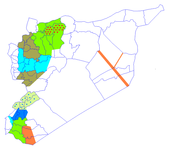
This map shows where essentially all of the skirmishes, battles and bombings have taken place, or under current conditions could take place, in Syria - areas which in total are only a fraction of Syria’s total area.
It is important to note that the areas with the red dots are heavily Kurdish and it seems that an effort is being made by the Kurds, the FSA, and the Syrian forces to avoid confrontations there.
Additionally, traffic between Aleppo and the Turkish-Syrian border to its north has to pass through these Kurdish areas or through the Kurdish controlled areas to their west.
- * - * - * - * - * -
More information about Syria can be found
here,
here,
here,
and here.
- * - * - * - * - * -
